October 18 Warming Up A Little Then The Next Storm Arrives Friday
October 18, 2023
Wednesday Morning Update
The good news is that as leaves are changing quickly, temperatures will be warming with sunshine for a few days. The bad news is that we have another storm that will affect part of the weekend with rain, but all of our weekend with a cool down.
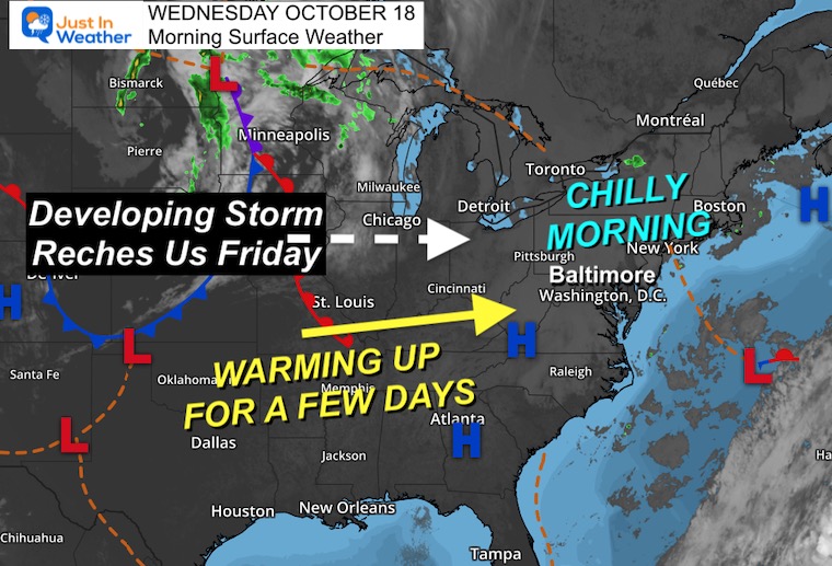
Morning Surface Weather
High Pressure and quiet weather dominate the Eastern US. Winds are light, which has allowed the chilly temps this morning.
Light winds and sunshine will help this afternoon feel comfortable.
The next storm is just starting to take shape to the west. This is part of a more complex event that will begin for us on Friday.
Ahead of that storm, there will be two days of warmer temps.
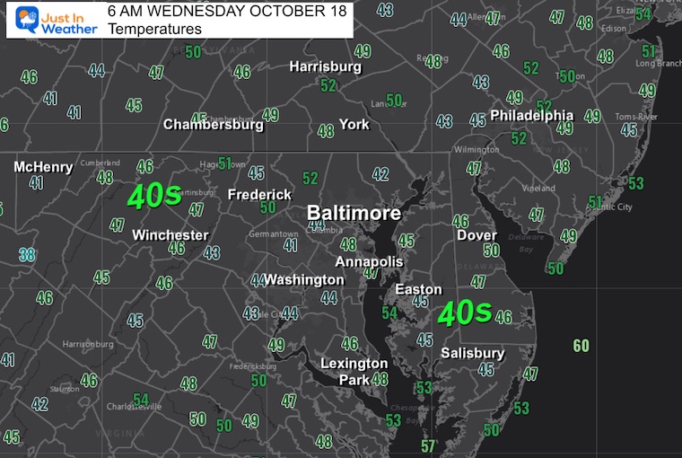
Morning Temperatures
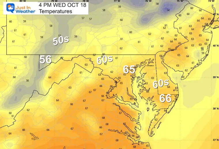
Afternoon Temperatures
Still below average, but starting to turn the corner. With light winds and sunshine it will feel like a nice Fall day.
CLIMATE DATA: Baltimore
TODAY October 18
Sunrise at 7:19 AM
Sunset at 6:24 PM
Normal Low in Baltimore: 46ºF
Record 30ºF in 1982
Normal High in Baltimore: 68ºF
Record 84ºF 1881; 2016
NEW REPORT
Winter Weather: Can Woolley Bear Caterpillar Stripes Really Foretell Snow?
New Reports:
Drought Report September 28
El Niño Advisory: First Look At NOAA’s Winter Outlook Expectations
Winter Outlook 2024 From Two Farmers Almanacs
Return to Cold and Snow
Subscribe for eMail Alerts
Weather posts straight to your inbox
Sign up and be the first to know!
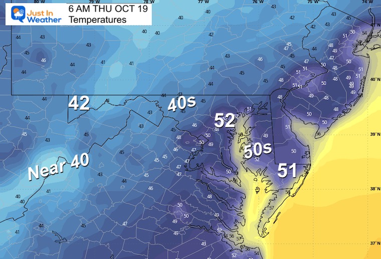
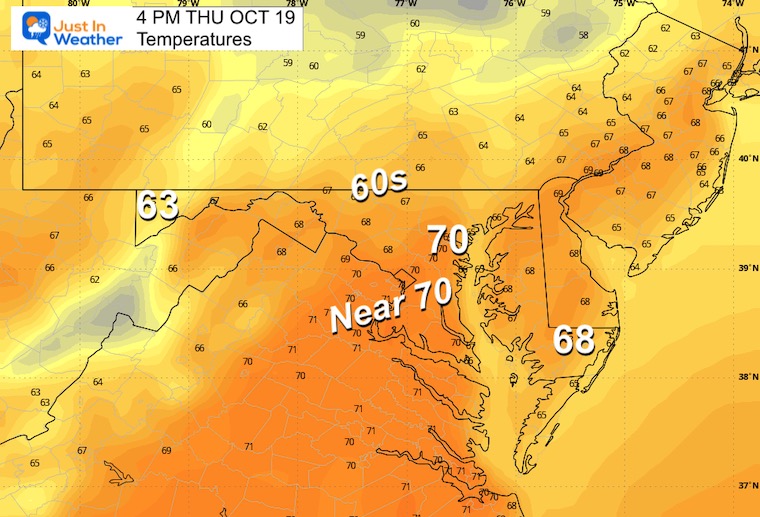
Temperatures Thursday
Sunshine and starting to warm a little.
Morning
Afternoon
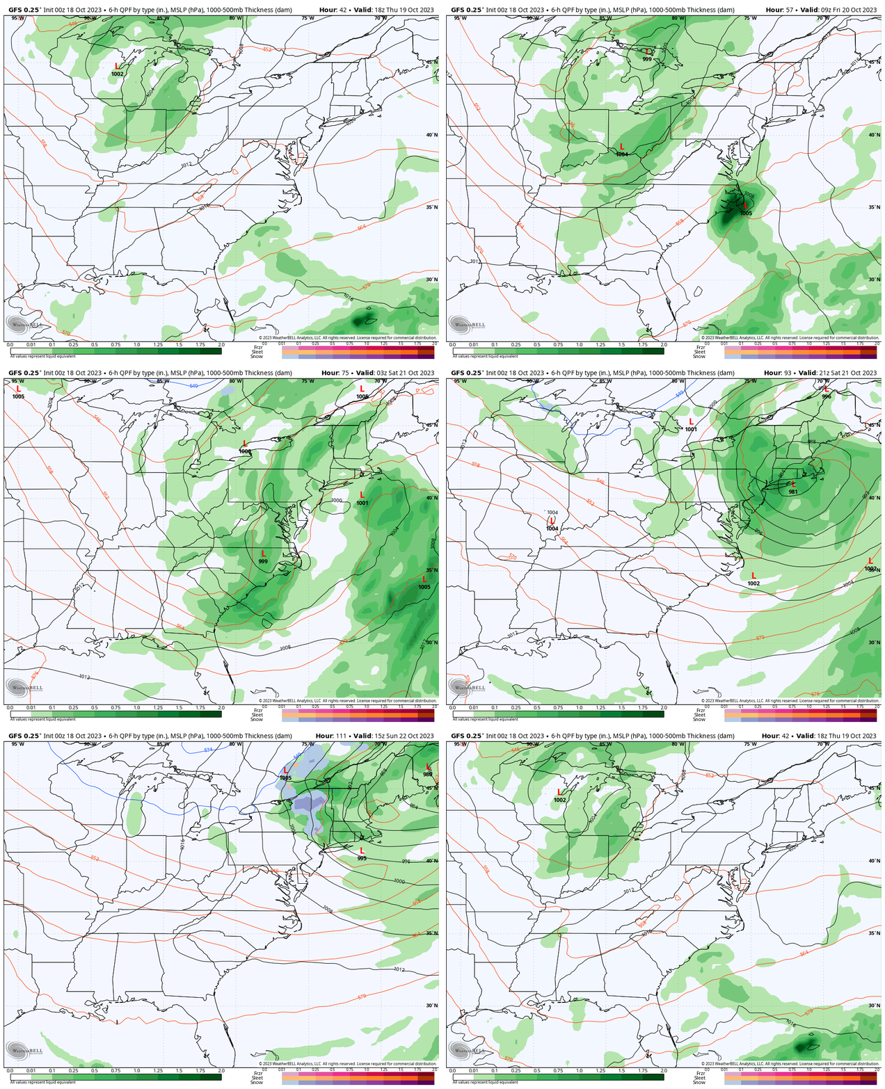
GFS Model Thursday Afternoon to Sunday Afternoon
A two-part system will feed into one larger circulation. We can see the bulk of rain developing later Friday into Saturday morning. As the Low CRANKS, it will increase the winds from the North and cool us down.
Look closely and see snow (blue) on Sunday in the Adirondack Mountains of northern New York.
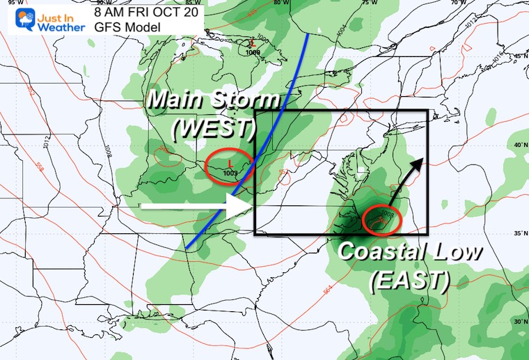
Friday Morning
This storm setup looks familiar… A coastal Low will skirt rain on Delmarva… But the main storm will be arriving from the west.
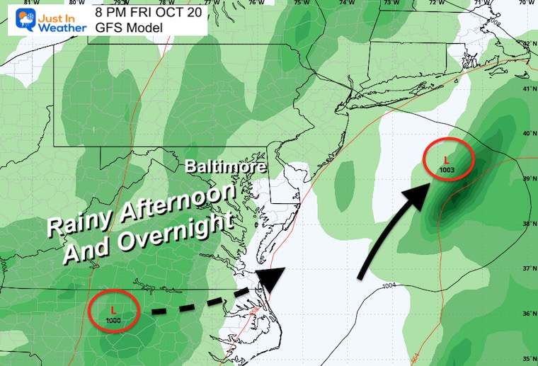
Friday Evening
Rain will be building in from the west and reach central Maryland by late afternoon and evening.
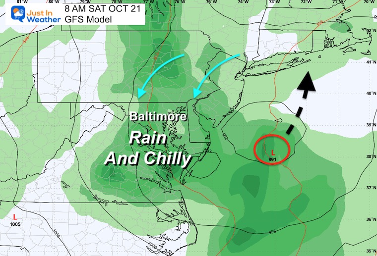
Saturday Morning
Steady rain may be heavy at times overnight and through Saturday morning.
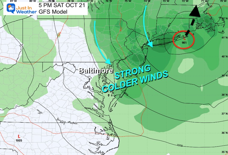
Saturday Afternoon
This storm may wrap up quickly and cut the rain off in our region in the afternoon, while heavy rain will continue across metro New York and New England.
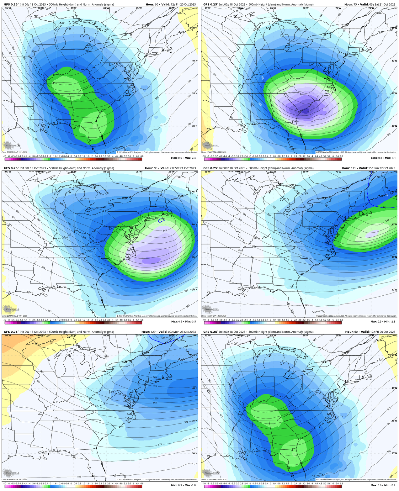
Jet Stream Friday Morning to Monday Morning
This upper air pattern helps show the storm winding up and pulling down colder air (blue) as it passes by.
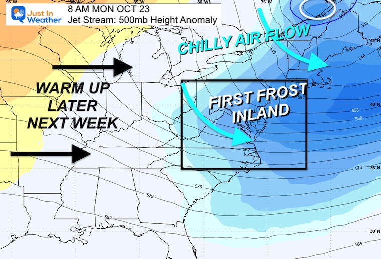
Monday Morning
The coldest part of this pattern may be in place as winds ease Monday morning.
This is when it may get cold enough inland for the first frost.
ALSO SEE:
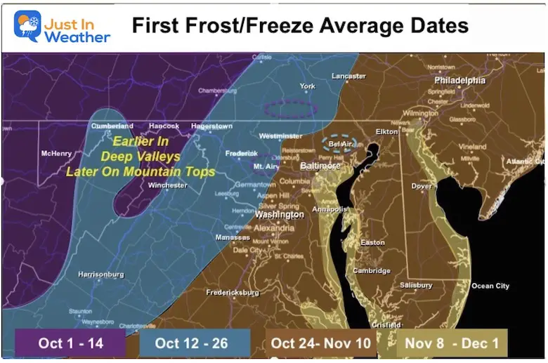
Explore The Average First Frost For MD and PA
7 Day Forecast
Brief warming as winds shift ahead of the next storm. Friday may be wetter on Delmarva in the morning, then we watch the rain from the west expand by the afternoon and evening.
After the storm passes, winds will be strong from the North.
The Ravens Game will be CHILLY!
Monday morning may be close to 40ºF by BWI, with 30s inland and possibly the FIRST FROST!

Subscribe for eMail Alerts
Weather posts straight to your inbox
Sign up and be the first to know!
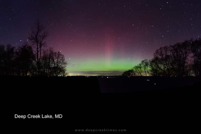
Aurora Photos From Maryland, Delaware, and Virginia
Please share your thoughts and best weather pics/videos, or just keep in touch via social media
-
Facebook: Justin Berk, Meteorologist
-
Twitter
-
Instagram
RESTATING MY MESSAGE ABOUT DYSLEXIA
I am aware there are some spelling and grammar typos and occasional other glitches. I take responsibility for my mistakes and even the computer glitches I may miss. I have made a few public statements over the years, but if you are new here, you may have missed it: I have dyslexia and found out during my second year at Cornell University. It didn’t stop me from getting my meteorology degree and being the first to get the AMS CBM in the Baltimore/Washington region. One of my professors told me that I had made it that far without knowing and to not let it be a crutch going forward. That was Mark Wysocki, and he was absolutely correct! I do miss my mistakes in my own proofreading. The autocorrect spell check on my computer sometimes does an injustice to make it worse. I also can make mistakes in forecasting. No one is perfect at predicting the future. All of the maps and information are accurate. The ‘wordy’ stuff can get sticky. There has been no editor who can check my work when I need it and have it ready to send out in a newsworthy timeline. Barbara Werner is a member of the web team that helps me maintain this site. She has taken it upon herself to edit typos when she is available. That could be AFTER you read this. I accept this and perhaps proves what you read is really from me… It’s part of my charm.
#FITF


