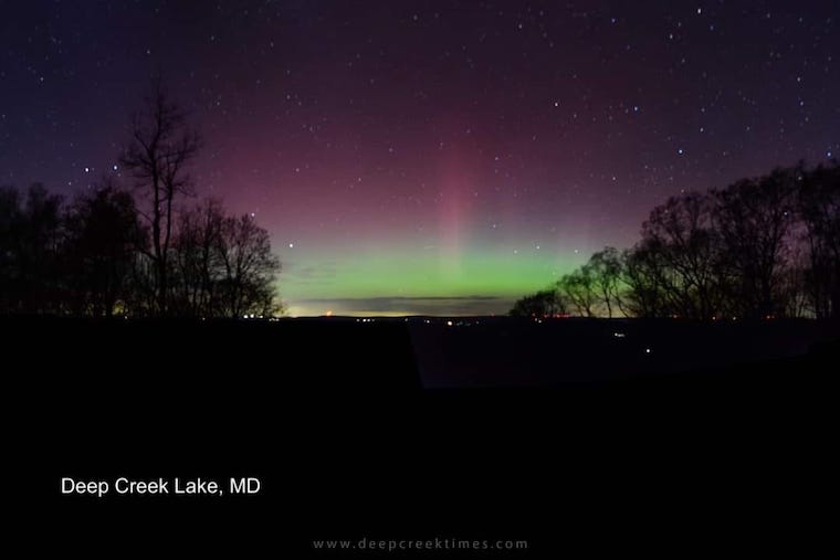
October 5 Warm Air Ending Tropical Storm Philippe Orioles Playoff Weather And Mountains First Flurries
October 5, 2023
Thursday Morning Update
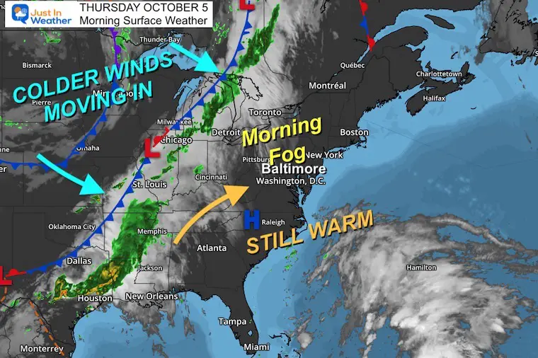
There is a lot to talk about over the next few days. This late summer surge will end and today may seem a little more humid with increasing clouds. Rain showers are possible Friday into Saturday morning with a cold front. We need to address Tropical Storm Philippe off the coast affecting the timing, and how it could enhance the colder winds following the front.
The Orioles playoff game weather will be colder and there is a chance for flurries in the mountains of western Maryland Sunday morning.
Morning Surface Weather
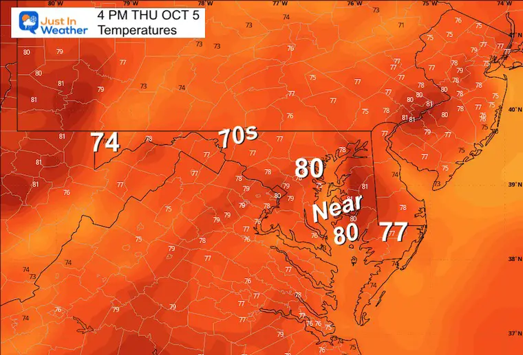
Afternoon Temperature Forecast
Much like yesterday, many areas will reach into the lower 80s.
CLIMATE DATA: Baltimore
TODAY October 5
Sunrise at 7:06 AM
Sunset at 6:43 PM
Normal Low in Baltimore: 51ºF
Record 35ºF in 1965; 1996
Normal High in Baltimore: 72ºF
Record 97ºF 1941
New Reports:
Drought Report September 28
El Niño Advisory: First Look At NOAA’s Winter Outlook Expectations
Winter Outlook 2024 From Two Farmers Almanacs
Return to Cold and Snow
Subscribe for eMail Alerts
Weather posts straight to your inbox
Sign up and be the first to know!
Friday
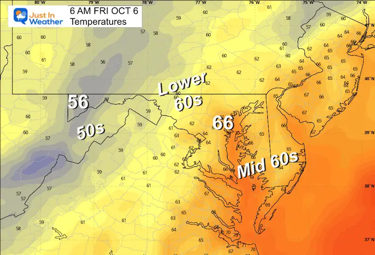
If your area is prone to morning fog (by the bay, a reservoir, or valley) you may see some to start the day. Then the sun will dominate and warm up the afternoon quickly.
Morning Temperatures
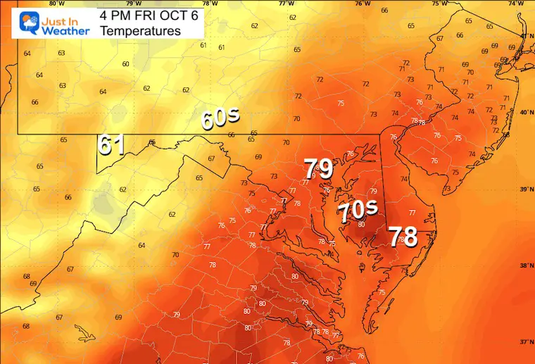
Afternoon Temperatures
Tropical Storm Philippe
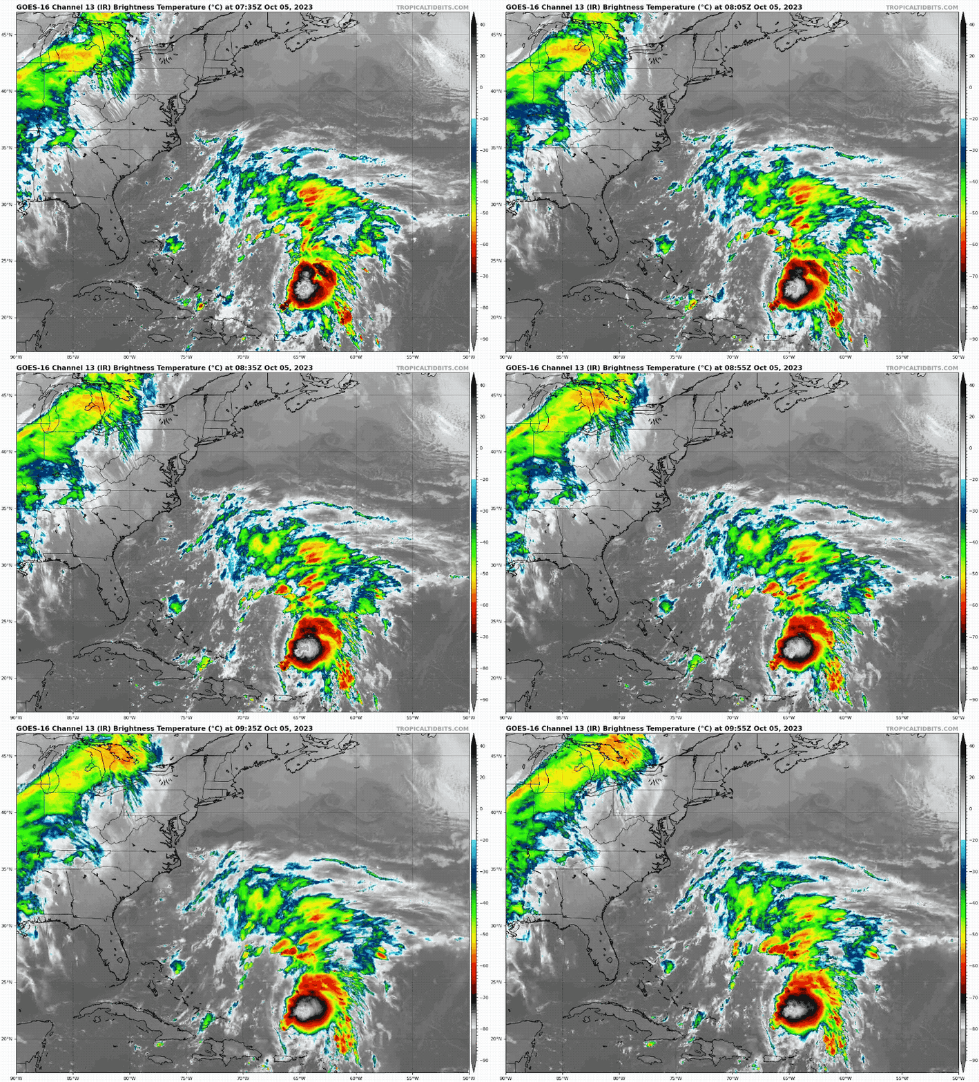
I have not mentioned this storm because it is well offshore. However, I’m looking at it now for two reasons:
It is following a very similar path to Lee (atmospheric memory).
It may affect the cold front we expect to move through and then strengthen the storm to our North.
Satellite Loop
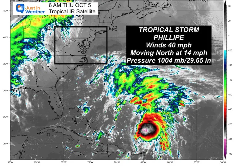
Thursday Morning Update From the National Hurricane Center
SUMMARY OF 500 AM AST…0900 UTC…INFORMATION
———————————————-
- LOCATION…24.8N 65.9W
- ABOUT 445 MI…715 KM N OF ST. THOMAS
- ABOUT 520 MI…840 KM S OF BERMUDA
- MAXIMUM SUSTAINED WINDS…40 MPH…65 KM/H
- PRESENT MOVEMENT…N OR 360 DEGREES AT 14 MPH…22 KM/H
- MINIMUM CENTRAL PRESSURE…1004 MB…29.65 INCHES
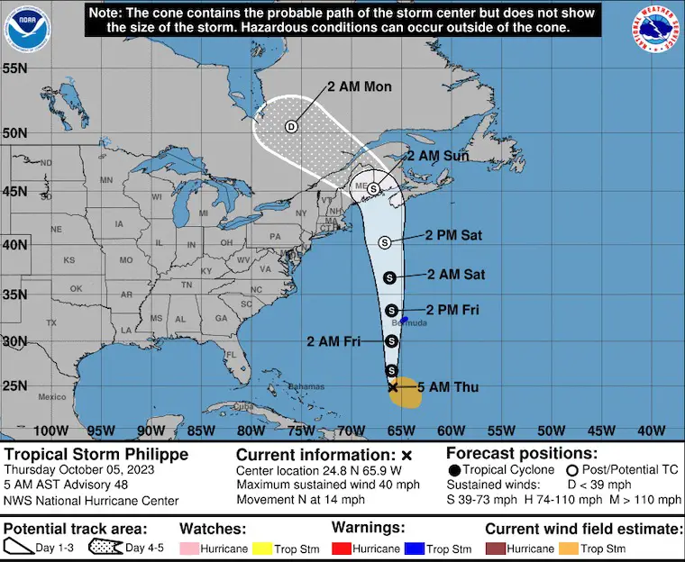
National Hurricane Center Forecast Track
Rain Forecast Friday Morning to Sunday Evening
The cold front will help ignite scattered showers on Friday into Saturday morning.
The timing of this front may be affected by Philippe off the coast, but that will not have an impact on us…
It may help enhance the Low with heavier rain and even snow in Eastern Canada.
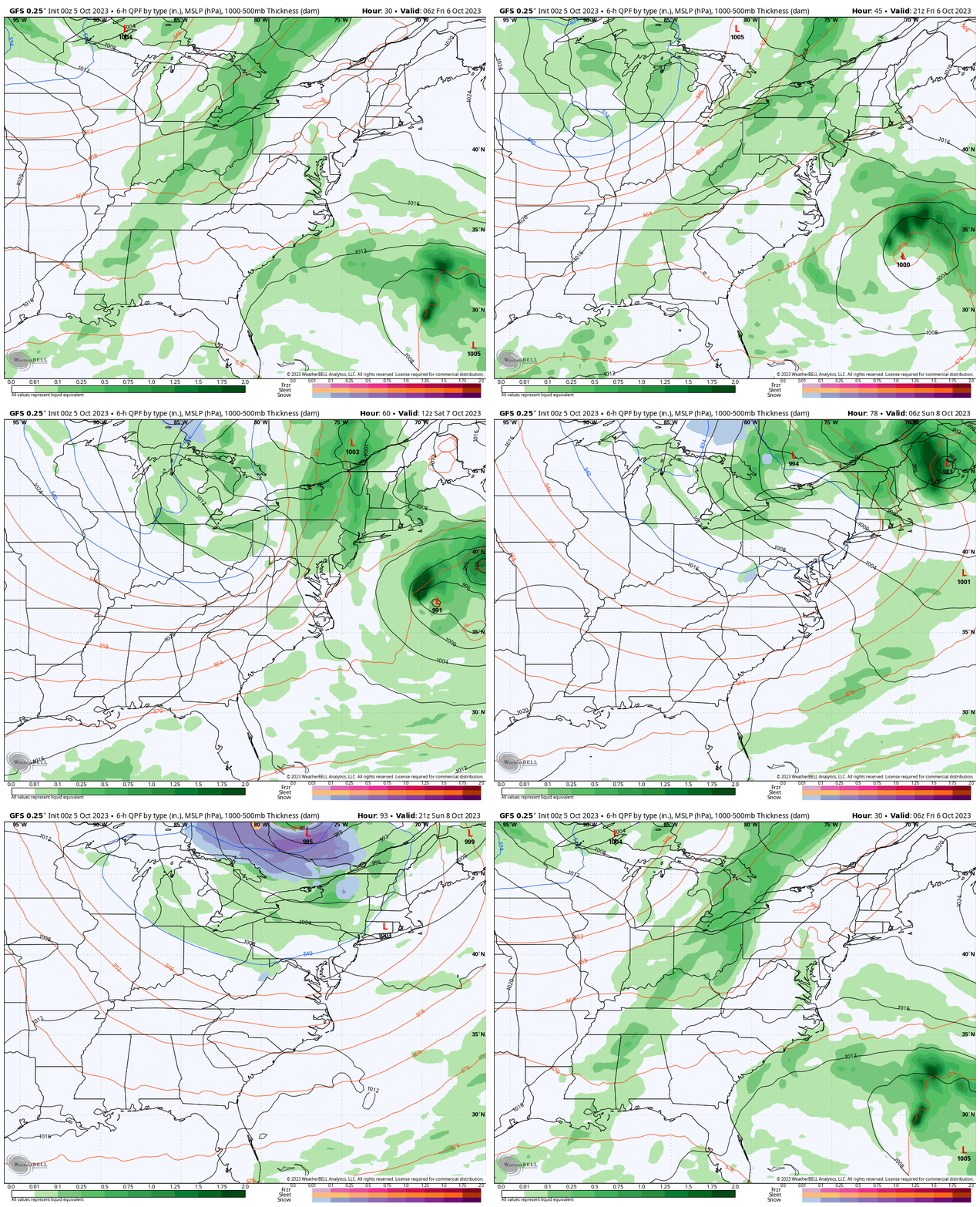
Animation (close) Friday Morning to Sunday Afternoon
The rain with the cold front looks scattered and mostly light on Friday. If there are any heavy bursts they would be overnight and Saturday morning, ending by the afternoon.
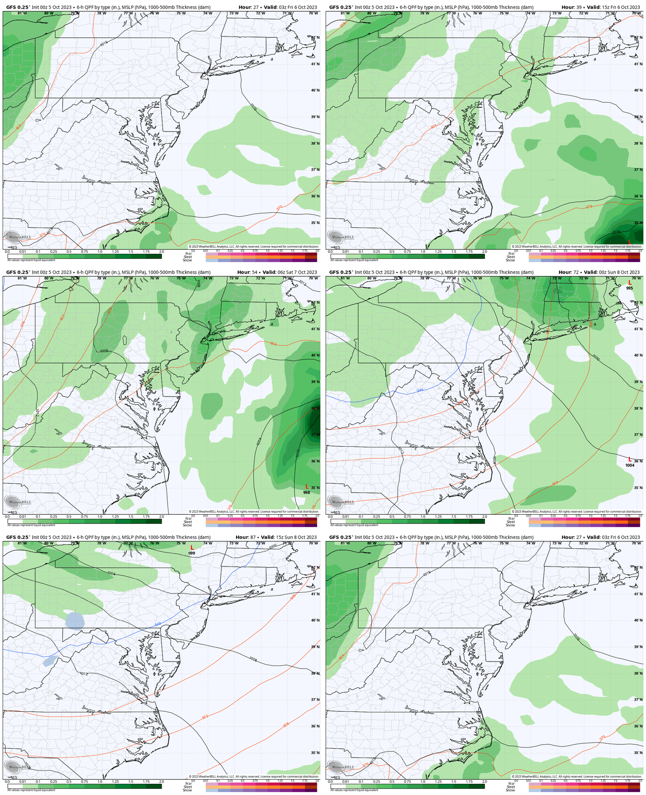
Saturday Afternoon Snapshot
The Orioles game hosting the Texas Rangers will begin at 1 PM. It looks like rain showers will be on the way out (and they look light). If you are heading to the game, plan for a chilly wind and falling temps.
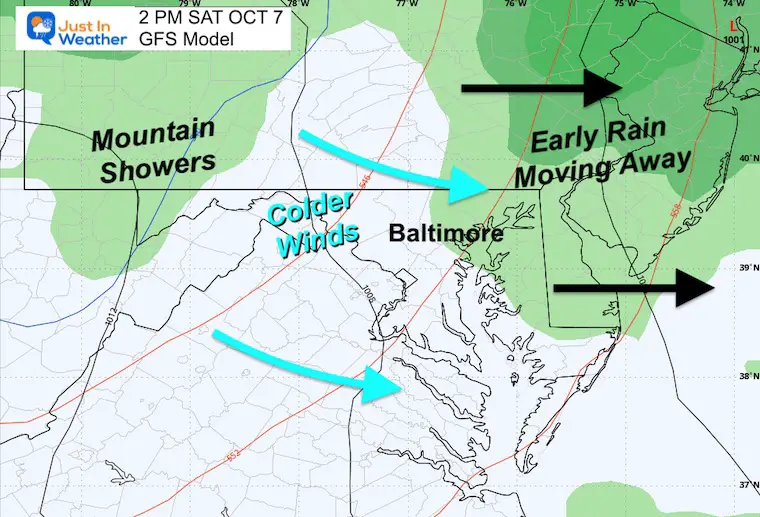
Sunday Morning Temperatures
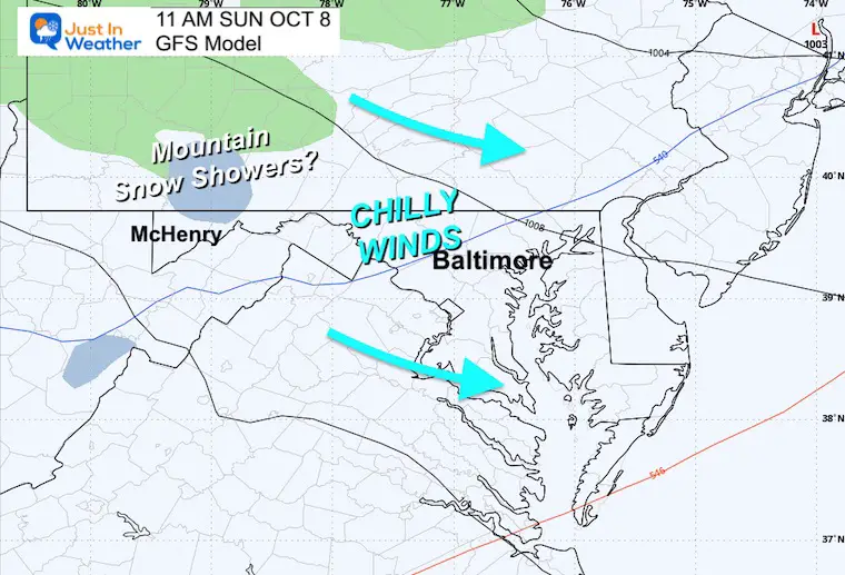
Colder winds will be moving in. While metro areas will drop into the 40s, the inland mountains will reach the 30s.
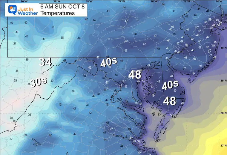
Sunday Morning Snapshot
Colder winds for all of us, and the interesting thing could be the First Flurries or Snow Showers in the mountains by Deep Creek Lake.
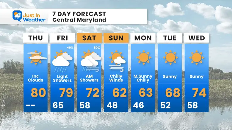
7 Day Forecast
This late surge of summer will come to an end. The cold front may not produce a lot of rain for us, but showers are expected Friday and Saturday morning. At this time it looks like showers will try to move out by early afternoon for the Orioles game. Colder winds will move in during the weekend and bring back a Fall Feel.
Subscribe for eMail Alerts
Weather posts straight to your inbox
Sign up and be the first to know!
Aurora Photos From Maryland, Delaware, and Virginia
Please share your thoughts and best weather pics/videos, or just keep in touch via social media
-
Facebook: Justin Berk, Meteorologist
-
Twitter
-
Instagram
RESTATING MY MESSAGE ABOUT DYSLEXIA
I am aware there are some spelling and grammar typos and occasional other glitches. I take responsibility for my mistakes and even the computer glitches I may miss. I have made a few public statements over the years, but if you are new here, you may have missed it: I have dyslexia and found out during my second year at Cornell University. It didn’t stop me from getting my meteorology degree and being the first to get the AMS CBM in the Baltimore/Washington region. One of my professors told me that I had made it that far without knowing and to not let it be a crutch going forward. That was Mark Wysocki, and he was absolutely correct! I do miss my mistakes in my own proofreading. The autocorrect spell check on my computer sometimes does an injustice to make it worse. I also can make mistakes in forecasting. No one is perfect at predicting the future. All of the maps and information are accurate. The ‘wordy’ stuff can get sticky. There has been no editor who can check my work when I need it and have it ready to send out in a newsworthy timeline. Barbara Werner is a member of the web team that helps me maintain this site. She has taken it upon herself to edit typos when she is available. That could be AFTER you read this. I accept this and perhaps proves what you read is really from me… It’s part of my charm.
#FITF


