Ophelia Downgraded To A Tropical Depression: Rain Forecast Sunday
September 23 Saturday Night Update
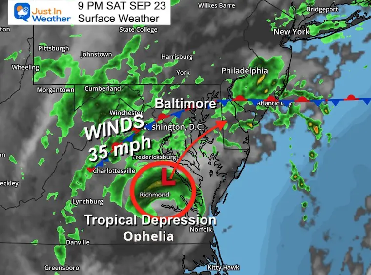
As expected, after 12 hours since landfall, Ophelia has lost a lot of energy and wind. The National Hurricane Center has downgraded this to a Tropical Depression. Top winds are 35 mph.
All Storm Surge and Tropical Storm Warnings had been discontinued.
I get this has been underwhelming for some, while others got the full force of wind and waves. The bulk of the rain has been pushed farther west, inland. Central Maryland rainfall has mostly been between 1/2 inch to a little over 1 inch so far.
I tried to mention in all my posts that this would behave more like a strong Nor’easter. But I see that the storm name and all the follow-up data lead to a larger perception.
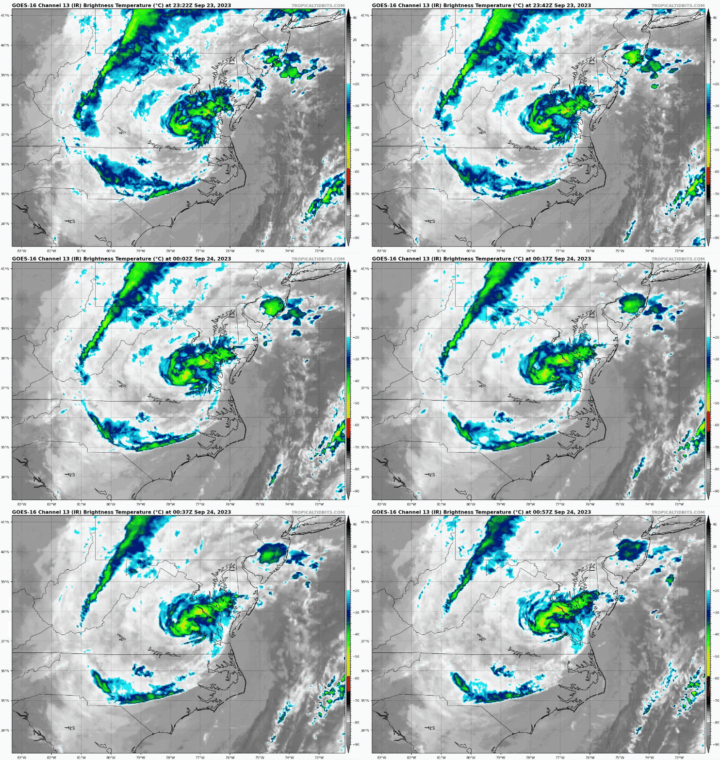
The storm center still has a cluster of rain and spiraling bands that we will track overnight. This storm still is set to move north and pass through Maryland on Sunday.
The remnant energy may still push higher water up the Bay tonight and early Sunday, but the winds left with this storm will be settling down.
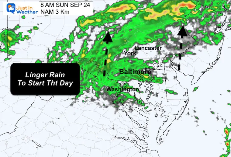
In this post, we see the chance for rain or drying for all local games (Ravens, Commanders, and Nationals).
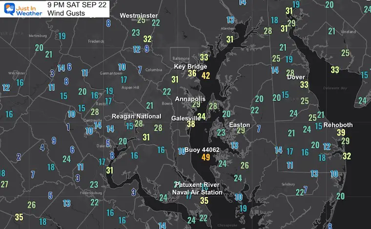
Local Wind Gusts at 9 PM
Gusty winds remain off the ocean, but the top remaining winds seem to be along the Chesapeake Bay.
Live Radar Interactive Widget
Saturday Night Surface Weather
Satellite Loop
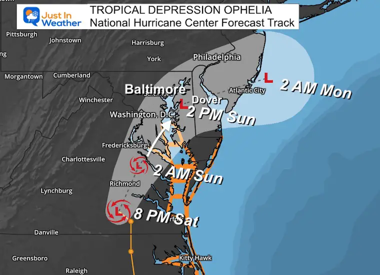
TROPICAL DEPRESSION OPHELIA
National Hurricane Center Update 8 PM
- LOCATION…37.0N 77.6W
- ABOUT 40 MI…60 KM SSW OF RICHMOND VIRGINIA
- ABOUT 165 MI…265 KM WSW OF OCEAN CITY MARYLAND
- MAXIMUM SUSTAINED WINDS…35 MPH…55 KM/H
- PRESENT MOVEMENT…N OR 355 DEGREES AT 9 MPH…15 KM/H
- MINIMUM CENTRAL PRESSURE…1000 MB…29.53 INCHES
Tropical Storm Warning AND NHC Forecast Map
The central Low Pressure is still set to cross the Chesapeake Bay south of Baltimore… This has always been expected to be in a downgraded form and the winds will be much lighter on Sunday.
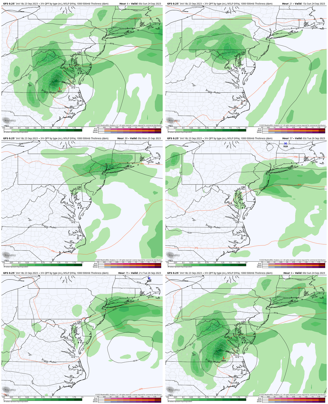
Forecast Animations, then we will look at key timeframes on Sunday.
GFS Model Sunday Night to Tuesday Night
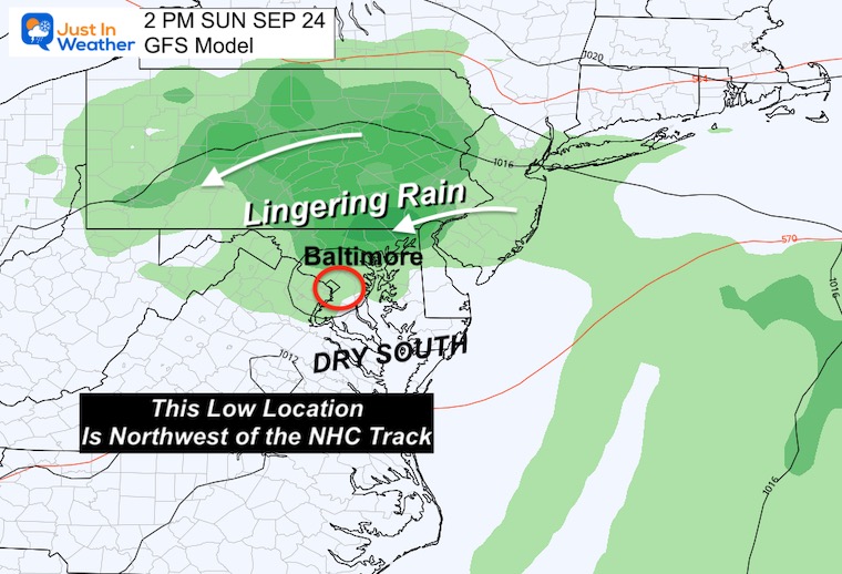
Sunday Afternoon
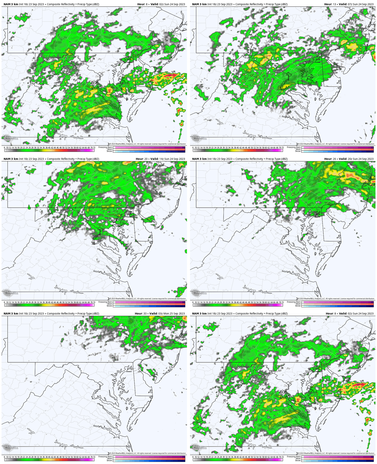
The remnant Low will have more rain to the North. Showers may linger around Baltimore, with more in Pennsylvania.
The winds around the Low will be light, and a cool breeze will persist with the rain. A closer look below.
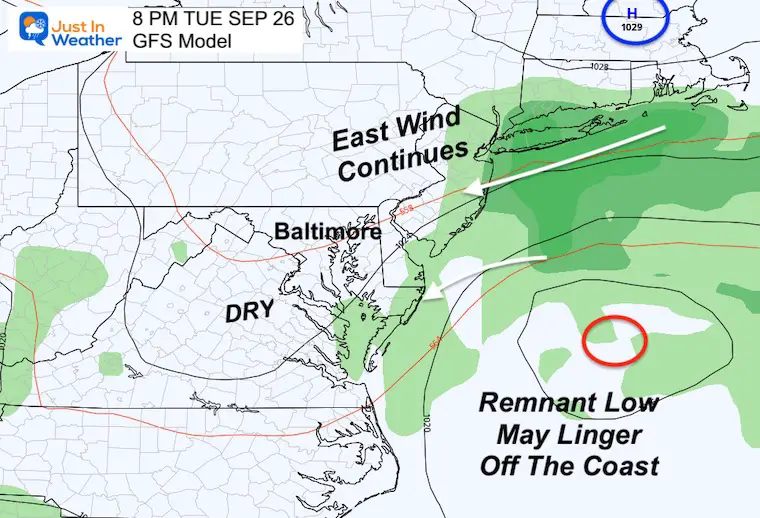
Tuesday Night
The remnant Low may linger off the coast for a few days. This will keep an easterly wind onshore. That may hold the clouds and cooler temps around as well.
Local Forecast Maps
Radar Simulation Saturday Night to Sunday Night
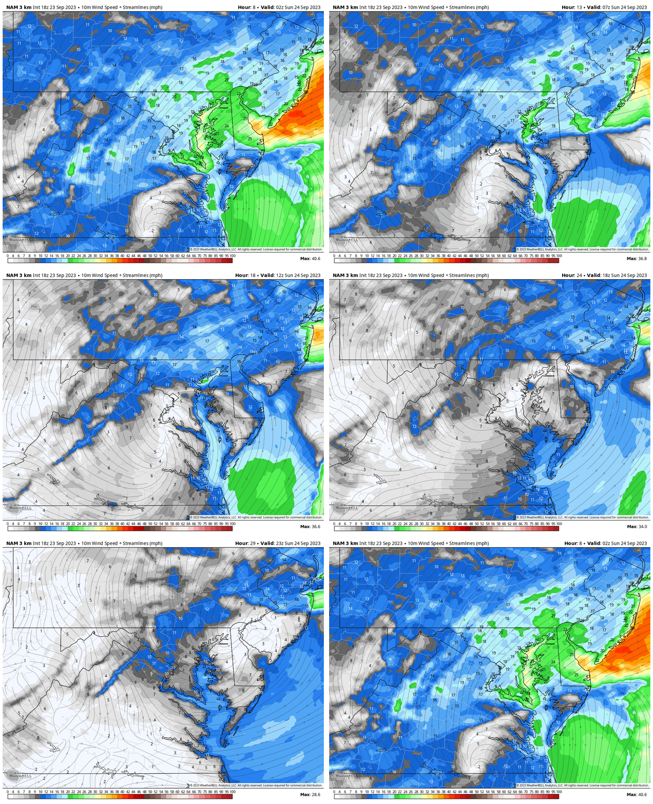
Wind Forecast
Radar Simulation Saturday Night to Sunday Night
Sunday Maps
Morning
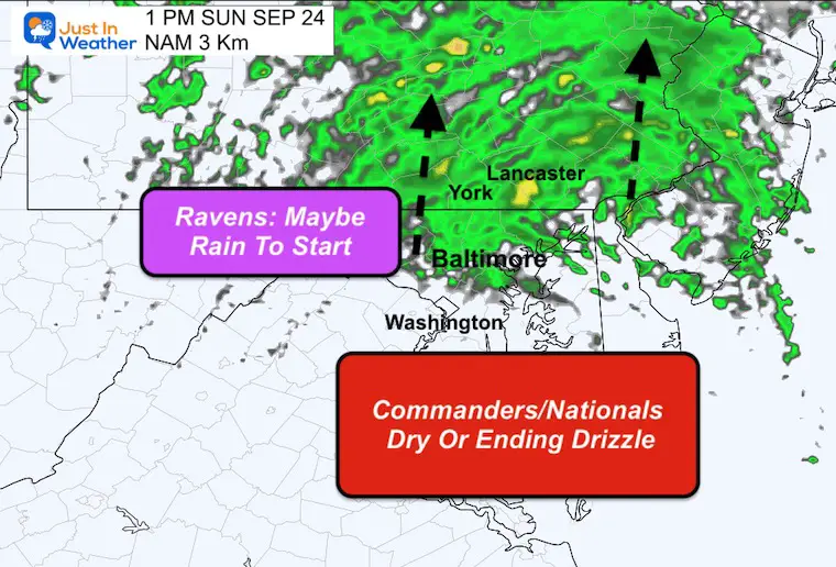
1 PM Game Time
There is a better chance for Washington to dry out while lingering showers will be pulling north of Baltimore.
This looks good for The Commanders, Nationals, and Ravens.
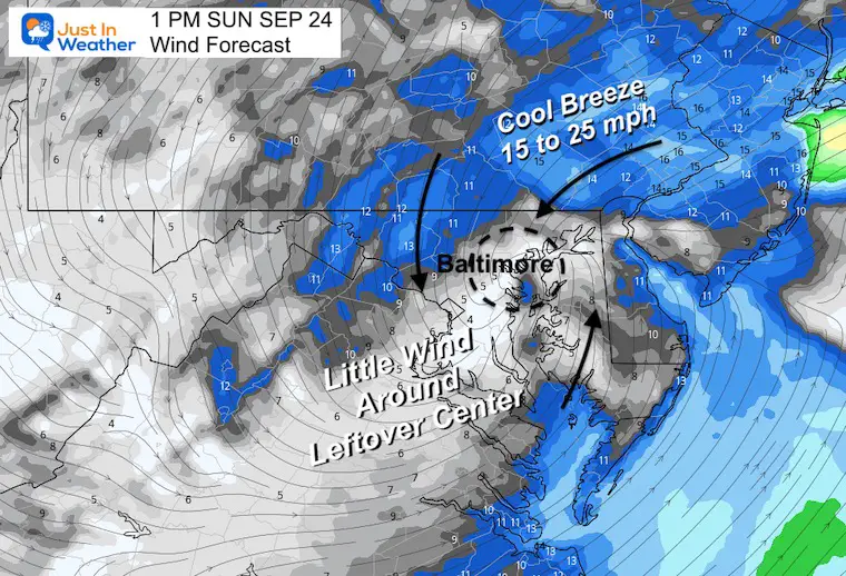
Wind Forecast
Under the center of Low Pressure the winds will be very light. There will be a cool breeze to the north in Pennsylvania where the rain will continue falling.
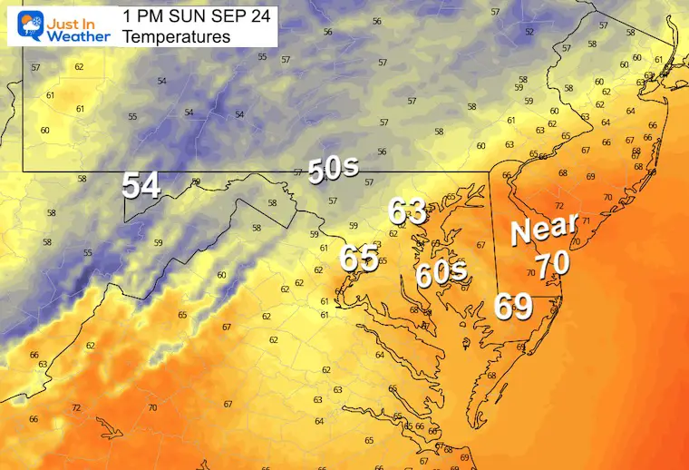
Temperatures
It will be a cool Fall day. Temperatures will be in the 60s at the baseball and football stadiums.
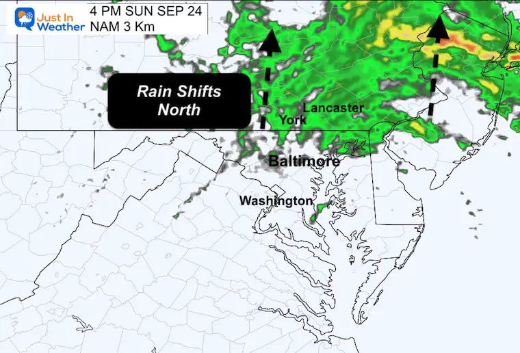
4 PM
What is left of the rain may still be falling in Pennsylvania as it moves north.
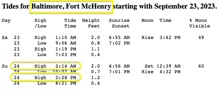
High Tide Tables
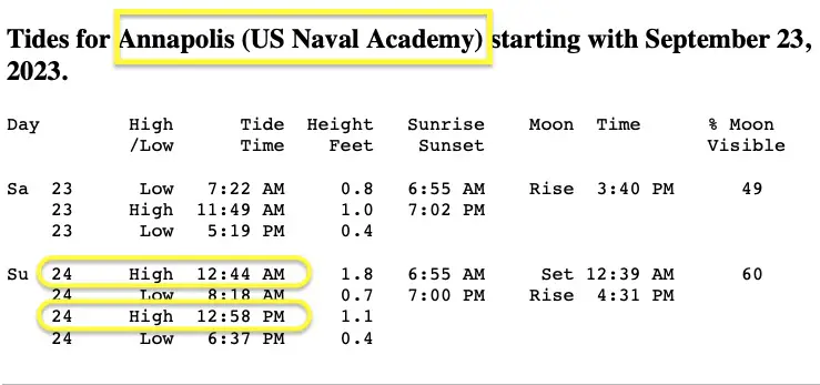
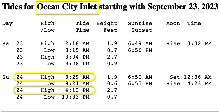
Three Key Points Of Interest. The High Tide overnight and early Sunday are when we may see the highest water.
Additional Tables for Maryland can be generated here: Saltwater Tides
Baltimore: Fort McHenry
Annapolis
Ocean City Inlet
WINDY WIDGET
New Reports:
El Niño Advisory: First Look At NOAA’s Winter Outlook Expectations
Winter Outlook 2024 From Two Farmers Almanacs
Return to Cold and Snow
Subscribe for eMail Alerts
Weather posts straight to your inbox
Sign up and be the first to know!
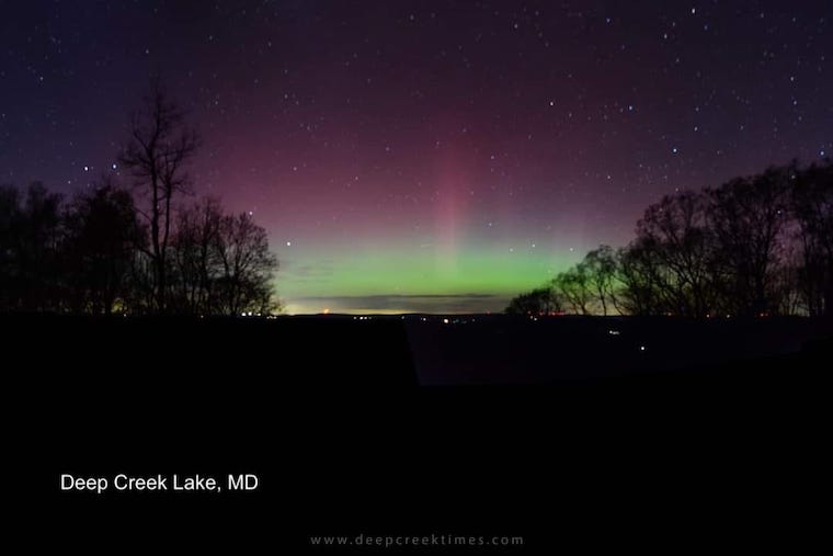
Aurora Photos From Maryland, Delaware, and Virginia
Please share your thoughts and best weather pics/videos, or just keep in touch via social media
-
Facebook: Justin Berk, Meteorologist
-
Twitter
-
Instagram
RESTATING MY MESSAGE ABOUT DYSLEXIA
I am aware there are some spelling and grammar typos and occasional other glitches. I take responsibility for my mistakes and even the computer glitches I may miss. I have made a few public statements over the years, but if you are new here, you may have missed it: I have dyslexia and found out during my second year at Cornell University. It didn’t stop me from getting my meteorology degree and being the first to get the AMS CBM in the Baltimore/Washington region. One of my professors told me that I had made it that far without knowing and to not let it be a crutch going forward. That was Mark Wysocki, and he was absolutely correct! I do miss my mistakes in my own proofreading. The autocorrect spell check on my computer sometimes does an injustice to make it worse. I also can make mistakes in forecasting. No one is perfect at predicting the future. All of the maps and information are accurate. The ‘wordy’ stuff can get sticky. There has been no editor who can check my work when I need it and have it ready to send out in a newsworthy timeline. Barbara Werner is a member of the web team that helps me maintain this site. She has taken it upon herself to edit typos when she is available. That could be AFTER you read this. I accept this and perhaps proves what you read is really from me… It’s part of my charm.
#FITF


