September 23 Saturday Afternoon Update
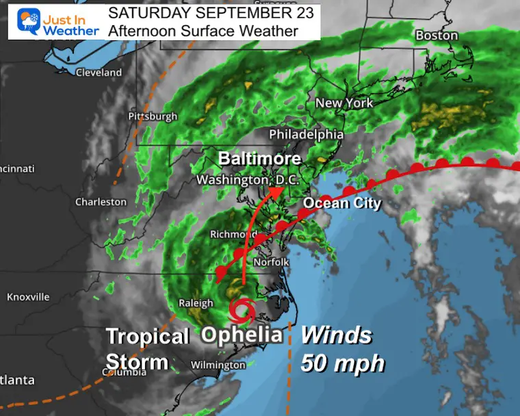
Since Tropical Storm Ophelia made landfall this morning on Emerald Isle, NC it has continued the expected trek north and is weakening. Winds were 70 mph at peak and have since dropped to 50 mph. A weakening inland tropical system tends to drop even more and spread out the wind field. It is like a slow leak on a balloon.
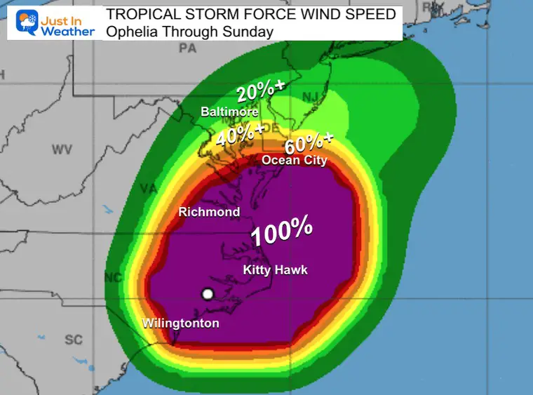
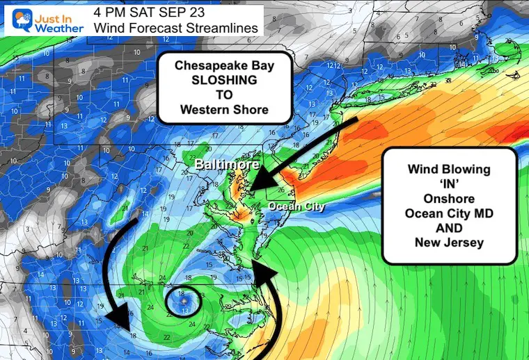
The Tropical Storm Winds extend 320 miles from the center. These winds have been recorded off the Delaware coast and the southern half of the Chesapeake Bay.
Maryland State of Emergency
Governor Moore has declared a State of Emergency for Maryland. Motorists ARE NOT prohibited from driving at this time. However, residents are being advised to avoid driving or being out during the storm. If you must drive and cannot change your plans, please be extra cautious.
Chesapeake Bay Bridge: Phase 2 Restriction
The ONLY types of vehicles allowed across are:
- Cars without exterior cargo;
- Pick-up trucks (to include 2-axle, 6 wheels) without cargo;
- Mini-vans;
- Vans not to include high-profile/conversion vans;
- SUVs
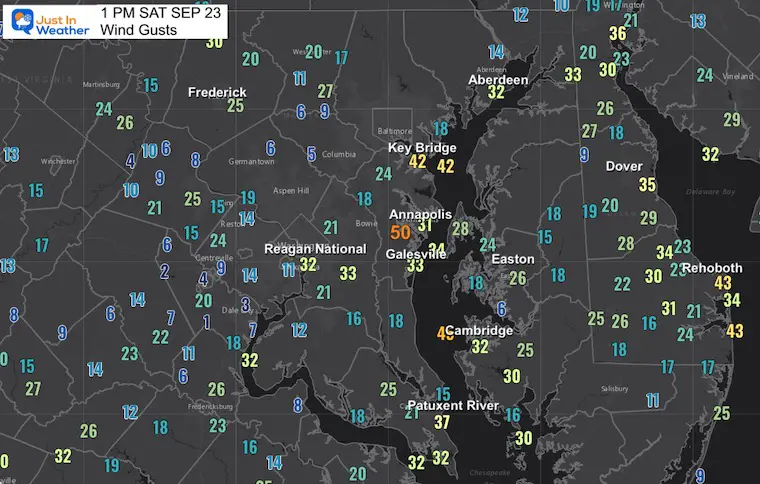
Local Wind Gusts at 1 PM
Peak winds have topped 60 mph off the Delaware Beaches. Most recently near 50 mph by Annapolis.
Tropical Storm Wind Probabilities
This is not something we often see here: The odds of getting winds over 39 mph today and tomorrow.
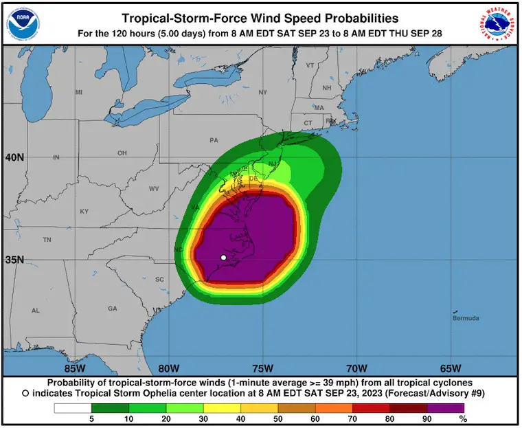
Full View Map From The National Hurricane Center
Saturday Afternoon Surface Weather
Live Radar Interactive Widget
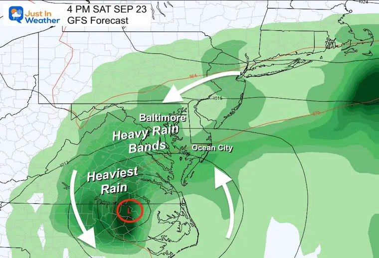
Bands of heavy rain will continue to pinwheel around the larger circulation. If you end up in a lull of rain, it doesn’t mean the storm is done. More is on the way.
Below are animations and forecast timeline maps centered in Maryland and the Mid-Atlantic.
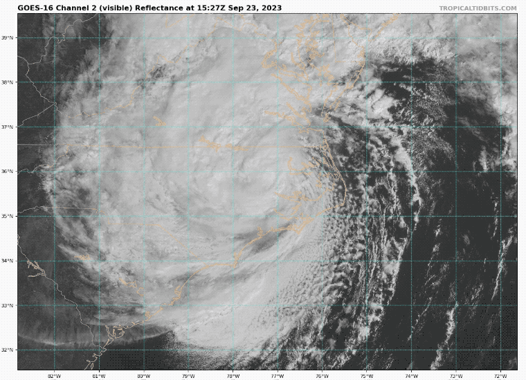
TROPICAL STORM OPHELIA
Visible High Resolution Satellite Loop
National Hurricane Center Update 11 AM
- LOCATION…35.6N 77.2W
- ABOUT 75 MI…125 KM NNW OF CAPE LOOKOUT NORTH CAROLINA
- ABOUT 125 MI…205 KM NNE OF CAPE FEAR NORTH CAROLINA
- MAXIMUM SUSTAINED WINDS…50 MPH…85 KM/H
- PRESENT MOVEMENT…N OR 355 DEGREES AT 13 MPH…20 KM/H
- MINIMUM CENTRAL PRESSURE…990 MB…29.24 INCHES
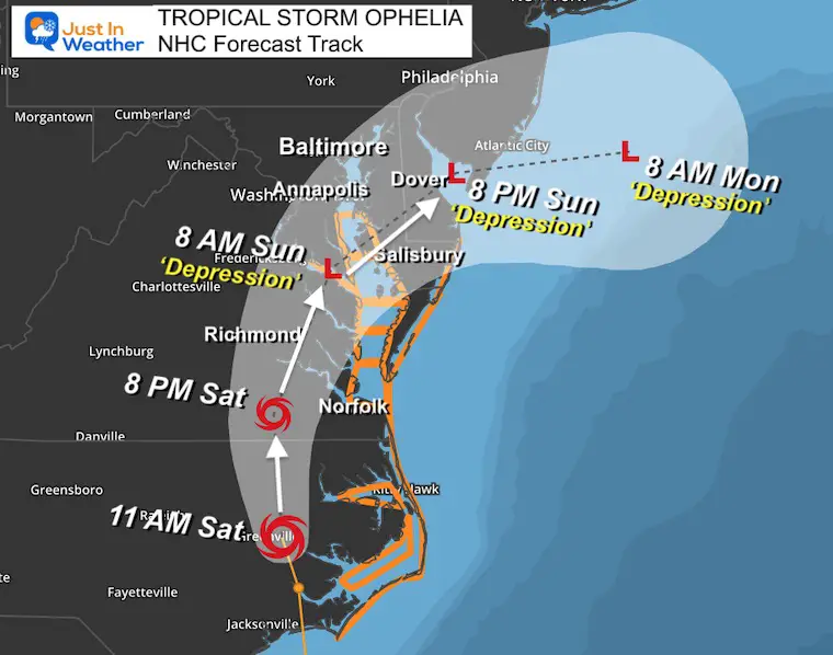
Tropical Storm Warning AND NHC Forecast Map
This track has shifted a little to cross the Chesapeake Bay SOUTH of Baltimore. It will be slowing down in forward speed AND wind speed. It will be downgraded to a Tropical Depression when reaching Maryland.
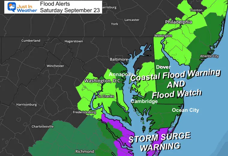
SUMMARY OF WATCHES AND WARNINGS IN EFFECT:
A Tropical Storm Warning is in effect for…
- Ocracoke Inlet, North Carolina to Chincoteague, Virginia
- Chesapeake Bay south of Colonial Beach, Virginia
- Neuse and Pamlico Rivers
- Portions of Pamlico and Albemarle Sounds
A Storm Surge Warning is in effect for…
- Ocracoke Inlet, North Carolina to Chincoteague, Virginia
- Chesapeake Bay south of Colonial Beach, Virginia
- Neuse and Pamlico Rivers
- Portions of Pamlico and Albemarle Sounds
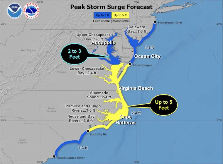
HIGH WATER FORECAST
- Neuse and Bay Rivers…3-5 ft
- Pamlico and Pungo Rivers…3-5 ft
- Chesapeake Bay south of Colonial Beach…2-4 ft
- Ocracoke Inlet, NC to Chincoteague, VA…2-4 ft
- Albemarle Sound…2-4 ft
- Chincoteague, VA to Manasquan Inlet, NJ…1-3 ft
- Upper Chesapeake Bay…1-3 ft
- Delaware Bay…1-3 ft
Local Warning Maps
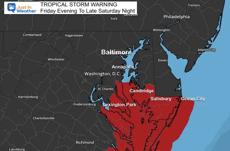
Tropical Storm Warning
Maryland: Calvert, St. Mary’s, Dorchester, Wicomico, Somerset, and Worcester.
Wind Advisory: Inland Winds up to 50 mph. Beaches up to 60 mph.

Flood Advisories
There are two types of flooding:
Salt Water Flooding: Storm Surge 2 to 3 Feet on the Chesapeake Bay.
Fresh Water Flooding: Heavy Rainfall mostly 1 to 3 inches. Some spots up to 5 inches.
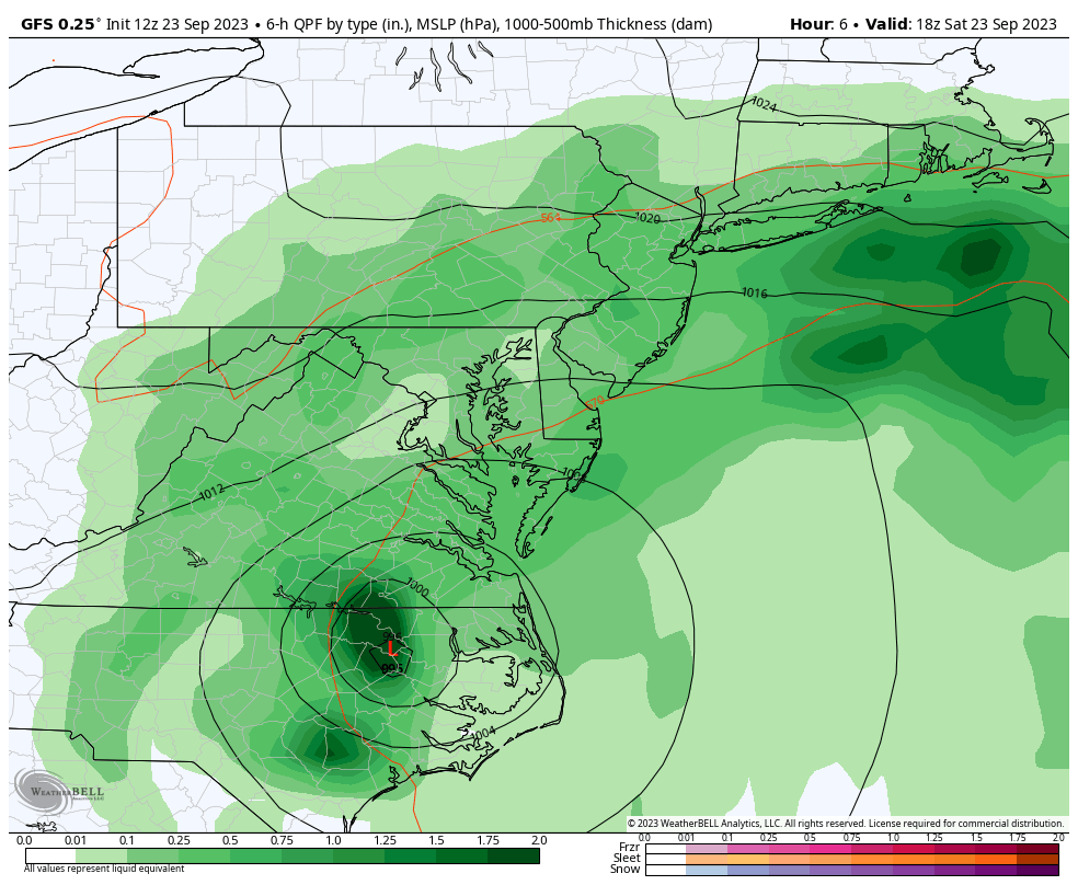
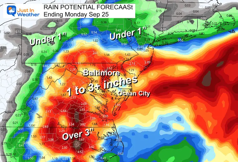
Rainfall
Some places have already seen a few inches of rain. An additional 1 to 3 inches are possible.
I will have a closer look at our home region below.
There are two types of flooding:
- Salt Water Flooding: Storm Surge 2 to 3 Feet on the Chesapeake Bay.
- Fresh Water Flooding: Heavy Rainfall totals mostly 1 to 3 inches. Some spots up to 5 inches.
Forecast Animation
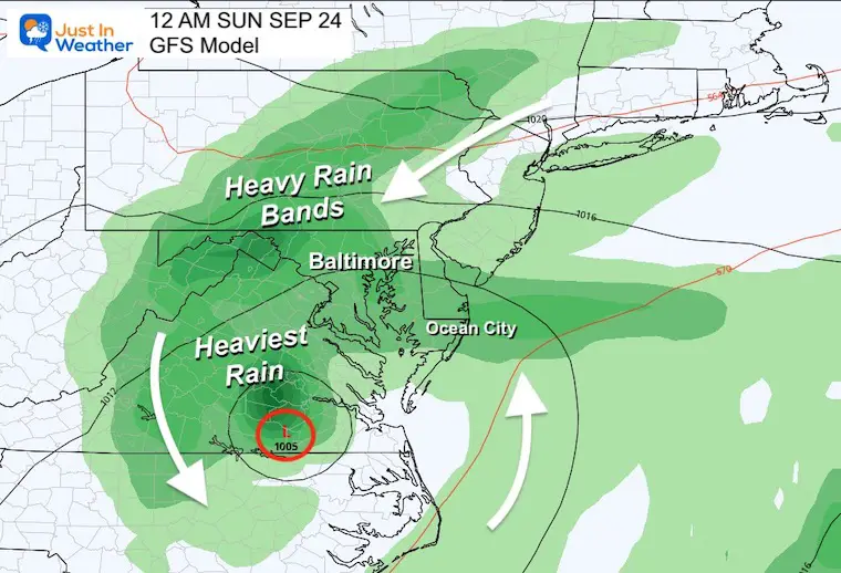
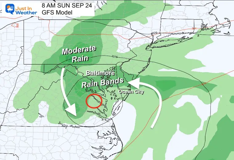
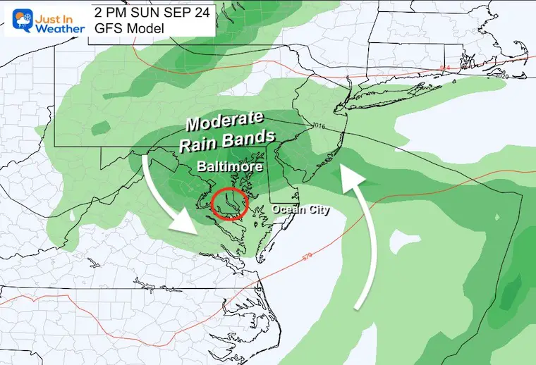
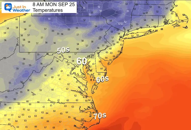
GFS Model Saturday Afternoon To Monday Morning
The heavy rain will be to the north of the center with banding. So you may have lulls at times. It will be concentrated closer to the Low as we go through Sunday and Monday.
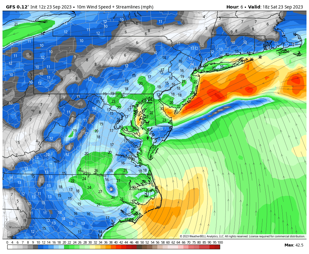
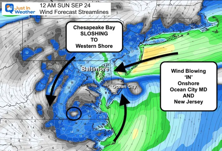
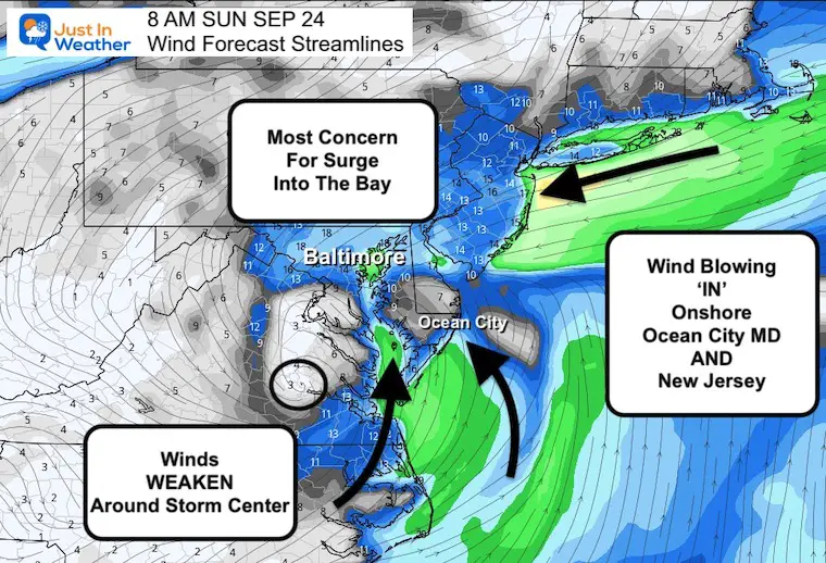
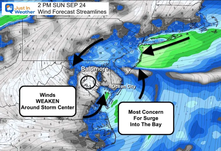
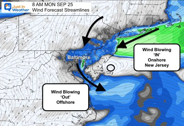
Wind Forecast Saturday Afternoon To Monday Morning
Notice that as the central circulation enters Virginia and Maryland it will weaken quickly!
Key Timeframe Weather Maps
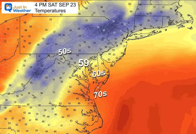
Saturday Afternoon:
Let’s see how these earlier forecast maps hold up:
Saturday Midnight
The storm will get closer and some heavier rain will expand in, while the surface winds actually decrease.
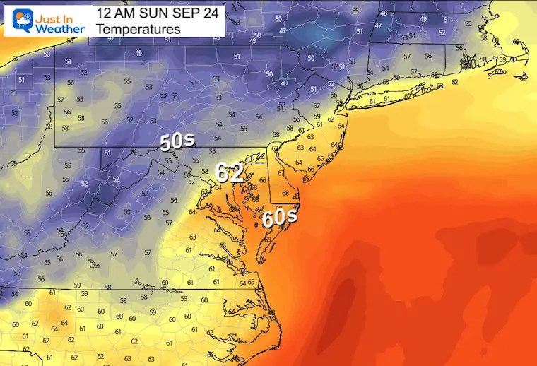
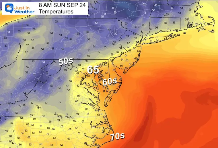
Sunday Morning
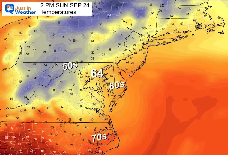
Sunday Afternoon
There still may be some rain and chilly breezes for both Ravens and Commanders football games. But Ophelia is likely to be downgraded to a depression by then with much less wind.
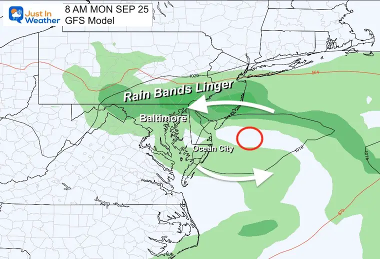
Monday Morning
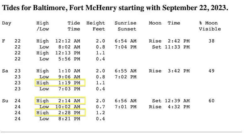
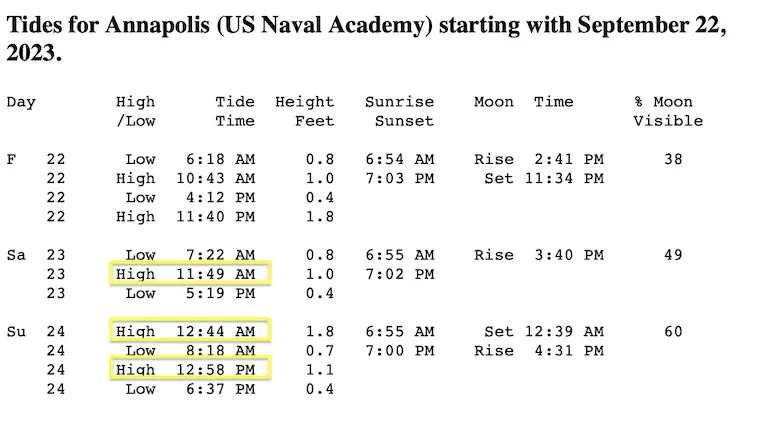
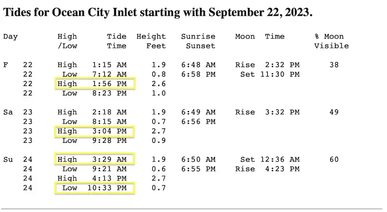
High Tide Tables
Three Key Points Of Interest. The High Tide Saturday night is the one where we may see the highest water.
Additional Tables for Maryland can be generated here: Saltwater Tides
Baltimore: Fort McHenry
Annapolis
Ocean City Inlet
Flooding here is likely all day Saturday
Rainfall Forecast POTENTIAL NEW RAINFALL
Computer model guidance is a suggestion. This should be seen as a range and not precise expectations. It also is missing the rain that has already fallen.
WINDY WIDGET
Additional Note On Airline Travel: Plan for delays with this Tropical Storm. This storm will have high winds at the surface, and even more turbulence aloft.
I do not know how your flight will be affected. I have seen planes fly on schedule in bad weather, and postponed for minimal impact. It is important to consider not only the weather at your airport, but also where the plane came from and where it is going.
Any delays or rerouting can cascade like dominoes on an already delicate system.
New Reports:
Subscribe for eMail Alerts

Please share your thoughts and best weather pics/videos, or just keep in touch via social media
RESTATING MY MESSAGE ABOUT DYSLEXIA
I am aware there are some spelling and grammar typos and occasional other glitches. I take responsibility for my mistakes and even the computer glitches I may miss. I have made a few public statements over the years, but if you are new here, you may have missed it: I have dyslexia and found out during my second year at Cornell University. It didn’t stop me from getting my meteorology degree and being the first to get the AMS CBM in the Baltimore/Washington region. One of my professors told me that I had made it that far without knowing and to not let it be a crutch going forward. That was Mark Wysocki, and he was absolutely correct! I do miss my mistakes in my own proofreading. The autocorrect spell check on my computer sometimes does an injustice to make it worse. I also can make mistakes in forecasting. No one is perfect at predicting the future. All of the maps and information are accurate. The ‘wordy’ stuff can get sticky. There has been no editor who can check my work when I need it and have it ready to send out in a newsworthy timeline. Barbara Werner is a member of the web team that helps me maintain this site. She has taken it upon herself to edit typos when she is available. That could be AFTER you read this. I accept this and perhaps proves what you read is really from me… It’s part of my charm.
#FITF


