September 20 Warming A Little And The Weekend Storm Update
September 20, 2023
Wednesday Morning Update
This may turn out to be a pretty nice sunrise as high clouds have infiltrated our High Pressure. They are the remains of an old front and are simply drying up. But the texture in the sky may be most noticeable around sunrise.
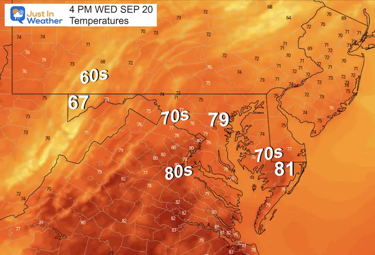
The remainder of today and tomorrow will be nice and the warmest of the week.
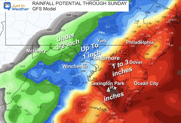
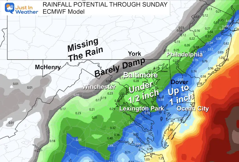
This weekend’s Coastal Storm is starting to take form AND even with a better idea of how this will behave, there is a split among the two main computer models. One brings in more rain than the other, but both focus on Saturday morning with the heaviest. We now have some agreement that it may move out early Sunday, so the Ravens game in Baltimore may be just cool and dry.
I have the model comparisons below.
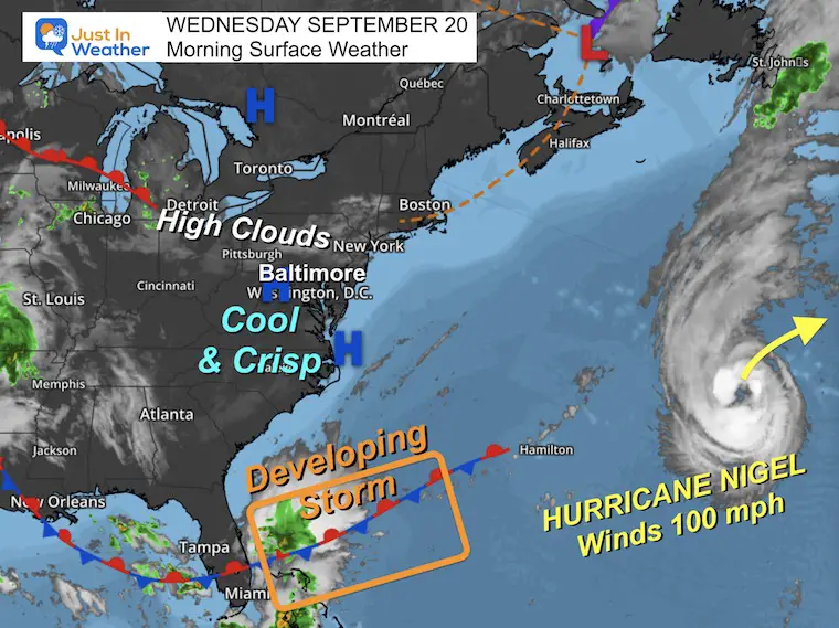
Morning Surface Weather
High-pressure overhead means a dry day… Even with some high clouds this morning.
Hurricane Nigel is still churning at 100 mph, but staying in the central Atlantic. It’s a non-issue for us.
The stationary front across South Florida and The Bahamas is still the focus for something tropical starting to circulate. There is no promise it will get a name, but it will carry a lot of moisture and wind as it moves north.
The timing for arrival is looking like Friday evening and night. The question in our forecast is how close it gets which will determine how much rain we can get.
Afternoon Temperature Forecast
CLIMATE DATA: Baltimore
TODAY September 20
Sunrise at 6:52 AM
Sunset at 7:07 PM
Normal Low in Baltimore: 57ºF
Record 42ºF in 1956; 1959; 2020
Normal High in Baltimore: 78ºF
Record 92ºF 1983
New Reports:
El Niño Advisory: First Look At NOAA’s Winter Outlook Expectations
Winter Outlook 2024 From Two Farmers Almanacs
Return to Cold and Snow
Subscribe for eMail Alerts
Weather posts straight to your inbox
Sign up and be the first to know!
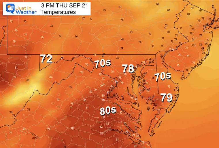
Thursday Weather:
Still mild but increasing wind and high clouds may limit who gets to 80ºF.
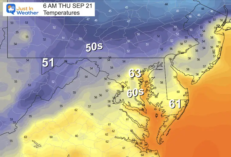
Thursday Morning
Thursday Afternoon
Looking Ahead
Now that we are closer, I feel the need to compare the two extreme potentials. I have been stating with each report that I do not trust the model guidance and to expect a change with each update. Here we go! My headlines will be followed by both model animations and then the key time frames. I will continue to compare each model with every report.
- The GFS (American Model) brings in the storm closer, producing more rain.
- The ECMWF (European Model) keeps the storm farther away with less rain.
- Both bring in the wind with rain Friday into Saturday. More in central Maryland and south/east. Less to the north/west.
- Both show the storm departing the coast on Sunday. Eastern Shore may start wet, but all end dry.
- The Ravens Game is most likely to be dry!
Wind Forecast
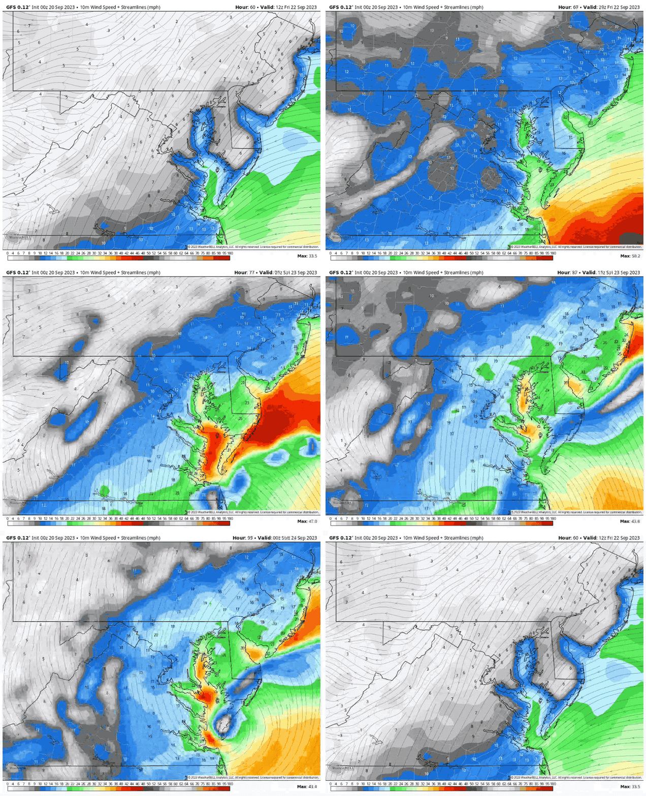
I want to start with the GFS Model as a worst-case scenario as it does look impressive.
Animation Friday Morning to Saturday Night
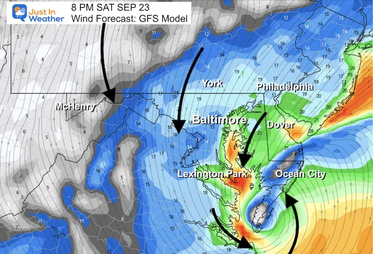
Snapshot Saturday Night
Wind Speed
We can see the center of Low Pressure crossing into Southern Maryland by Saturday night.
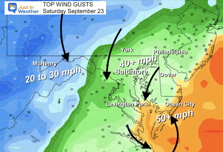
Top Wind Gusts
There will be noticeable winds across the region, central areas may gust over 40 mph, with coastal areas possibly reaching over 50 mph.
GFS Model: Friday Morning to Sunday Afternoon
The closer storm and most rain.
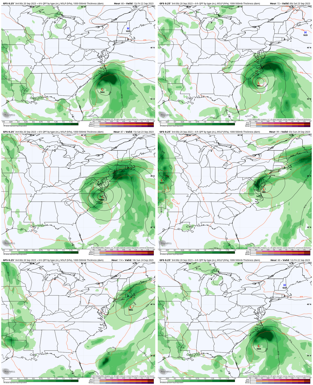
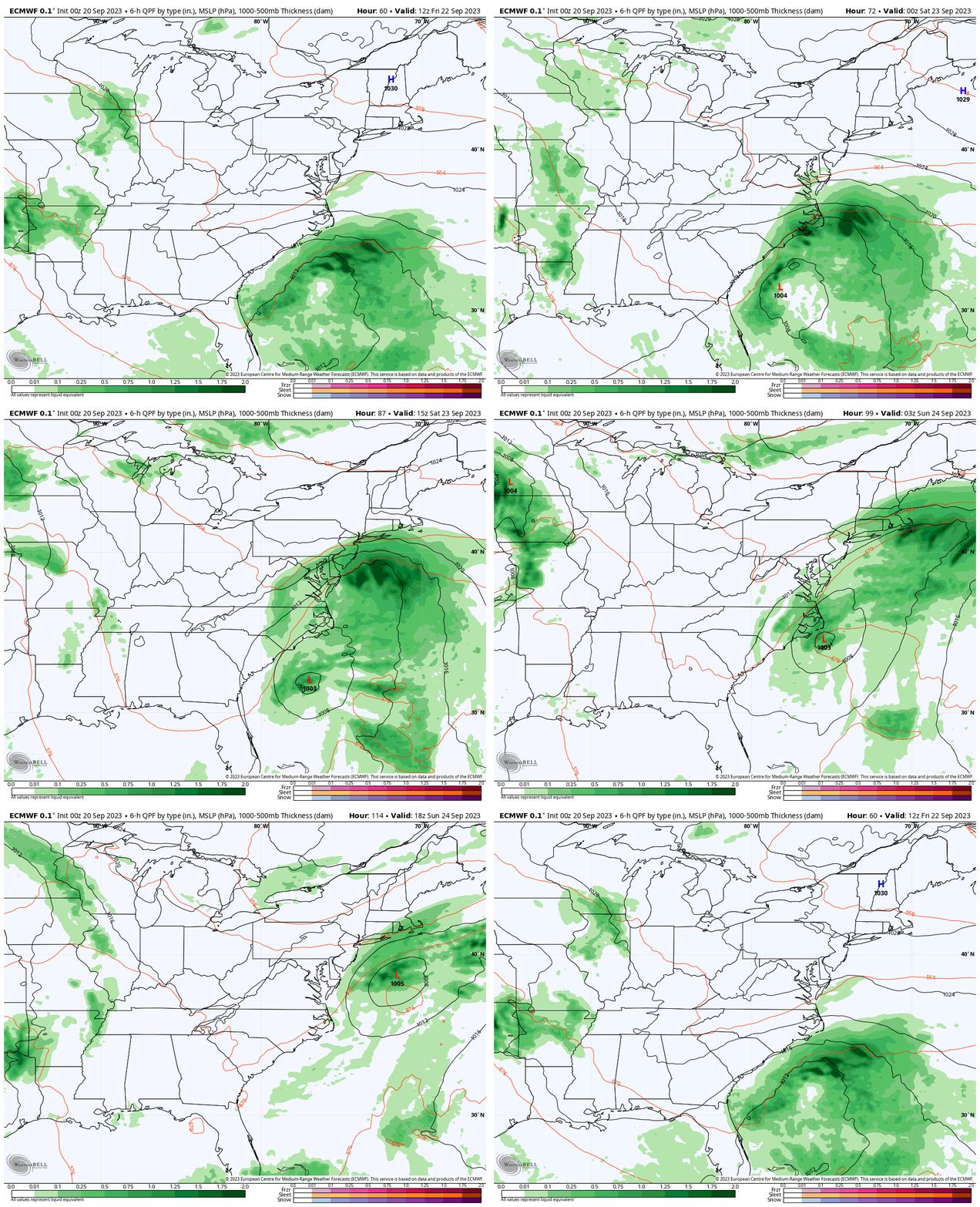
ECMWF Model: Friday Morning to Sunday Afternoon
Keeping the storm farther away with less rain.
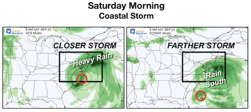
Key Timeframe Model Comparison
Saturday Morning
The day starts rainy and windy. The GFS brings it in for most of the region, while the ECMWF keeps it farther south.
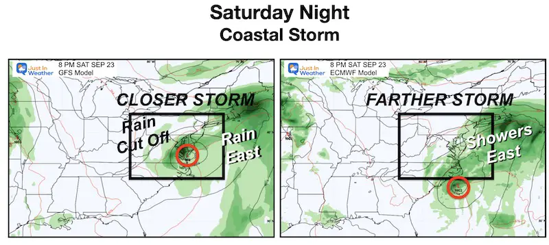
Saturday Night
A tight band of rain in Central Maryland on the GFS, while the European model breaks this up to showers with the Low farther away.
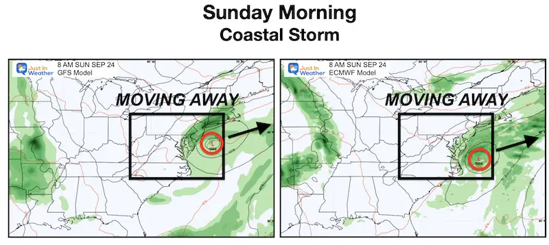
Sunday Morning
Both models show a wet start on Delmarva and dry west of the Bay. The storm will be moving away and more than likely it will be a dry afternoon for the Ravens Game. It still may be cool and breezy, with a stray shower.
Rainfall Potential
Big Difference Between Both Models
GFS = More Rain With Closer Track
ECWMF = Less Rain With Farther Track
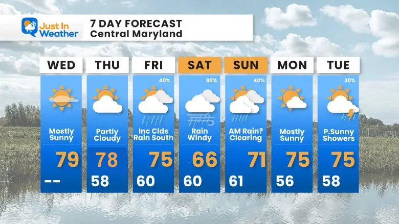
7 Day Forecast
We will see more clouds tomorrow and then turn overcast Friday ahead of the storm.
Saturday is our storm day, then improving Sunday. As of now it looks like Sunday will improve for the Ravens game.
EARLIER IN AUGUST: Maryland Trek 10 For These Kids
I will have a follow-up and recap on our amazing week shortly.
Subscribe for eMail Alerts
Weather posts straight to your inbox
Sign up and be the first to know!
La Niña Has Ended. El Niño May Return By Fall
Aurora Photos From Maryland, Delaware, and Virginia
Please share your thoughts and best weather pics/videos, or just keep in touch via social media
-
Facebook: Justin Berk, Meteorologist
-
Twitter
-
Instagram
RESTATING MY MESSAGE ABOUT DYSLEXIA
I am aware there are some spelling and grammar typos and occasional other glitches. I take responsibility for my mistakes and even the computer glitches I may miss. I have made a few public statements over the years, but if you are new here, you may have missed it: I have dyslexia and found out during my second year at Cornell University. It didn’t stop me from getting my meteorology degree and being the first to get the AMS CBM in the Baltimore/Washington region. One of my professors told me that I had made it that far without knowing and to not let it be a crutch going forward. That was Mark Wysocki, and he was absolutely correct! I do miss my mistakes in my own proofreading. The autocorrect spell check on my computer sometimes does an injustice to make it worse. I also can make mistakes in forecasting. No one is perfect at predicting the future. All of the maps and information are accurate. The ‘wordy’ stuff can get sticky. There has been no editor who can check my work when I need it and have it ready to send out in a newsworthy timeline. Barbara Werner is a member of the web team that helps me maintain this site. She has taken it upon herself to edit typos when she is available. That could be AFTER you read this. I accept this and perhaps proves what you read is really from me… It’s part of my charm.
#FITF


