June 21 Summer Begins Windy Cool And Rainy
June 21, 2023
Wednesday Morning Update
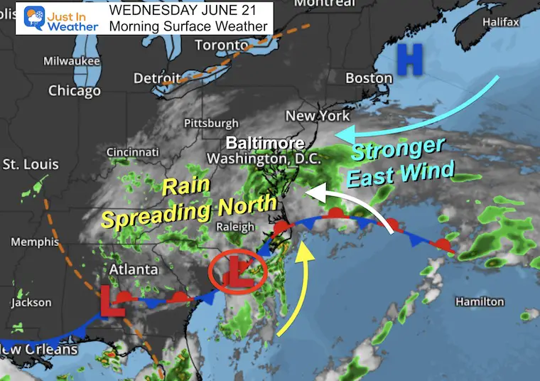
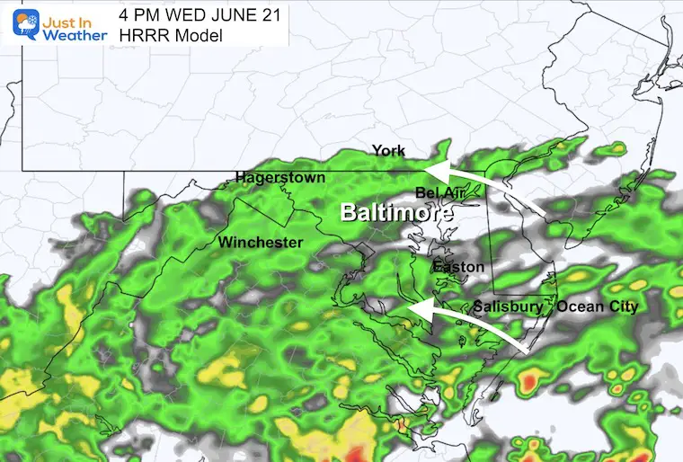
Summer begins today but it will not feel like it for us in the Mid-Atlantic. Rain has already spread into southern and central Maryland. This is slowly advancing north, but it may take until this afternoon to reach Southern Pennsylvania.
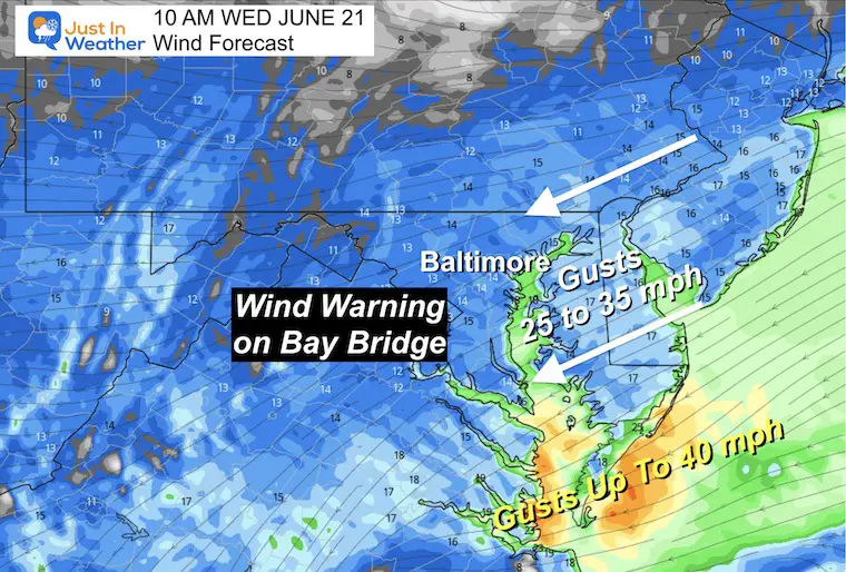
We all get stronger winds from the East keeping clouds and cooler air in place. As a result of gusts up to 35 mph, a Wind Warning with restrictions has been placed on the Chesapeake Bay Bridge.
This system is part of a pattern change that will keep us with a chance of rain with afternoon thunderstorms each day for the next week. It is not possible to detail specific timing and location into the weekend, so it might be best to keep a plan B handy.
Summer Solstice
Today marks the start of summer. At 10:58 AM the sun will reach the farthest north point in the Northern Hemisphere for the year. This is our day with the longest daylight and highest sun angle. In Baltimore:
- Daylight Time: 14 hours, 56 minutes, 23 seconds
- Sunrise at 5:40 AM
- Sunset at 8:36 PM
- Solar Noon at 1:08 PM
- Peak Sun Angle +74.1º
Morning Surface Weather
This is the pattern we will be seeing for much of the next week. Around the larger upper-level set up, Surface Low Pressure to our south and High Pressure off the New England coast are working together. The result is a strong wind from the East/Northeast that will build today. This has brought clouds in and will keep our temperatures low.
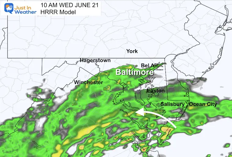
The storm to the south has already brought rain into the southern half of Maryland. This will continue to slowly build north today. Metro areas will get wet before noon, but southern Pennsylvania may have to wait until this afternoon for it to arrive.
Live Radar Widget
Use the controls to pan or zoom the map. Some of the northern edge may show rain on the radar that is not reaching the ground (light blue and light green shades).
Rain Forecast Simulation
Animation 8 AM to 4 PM
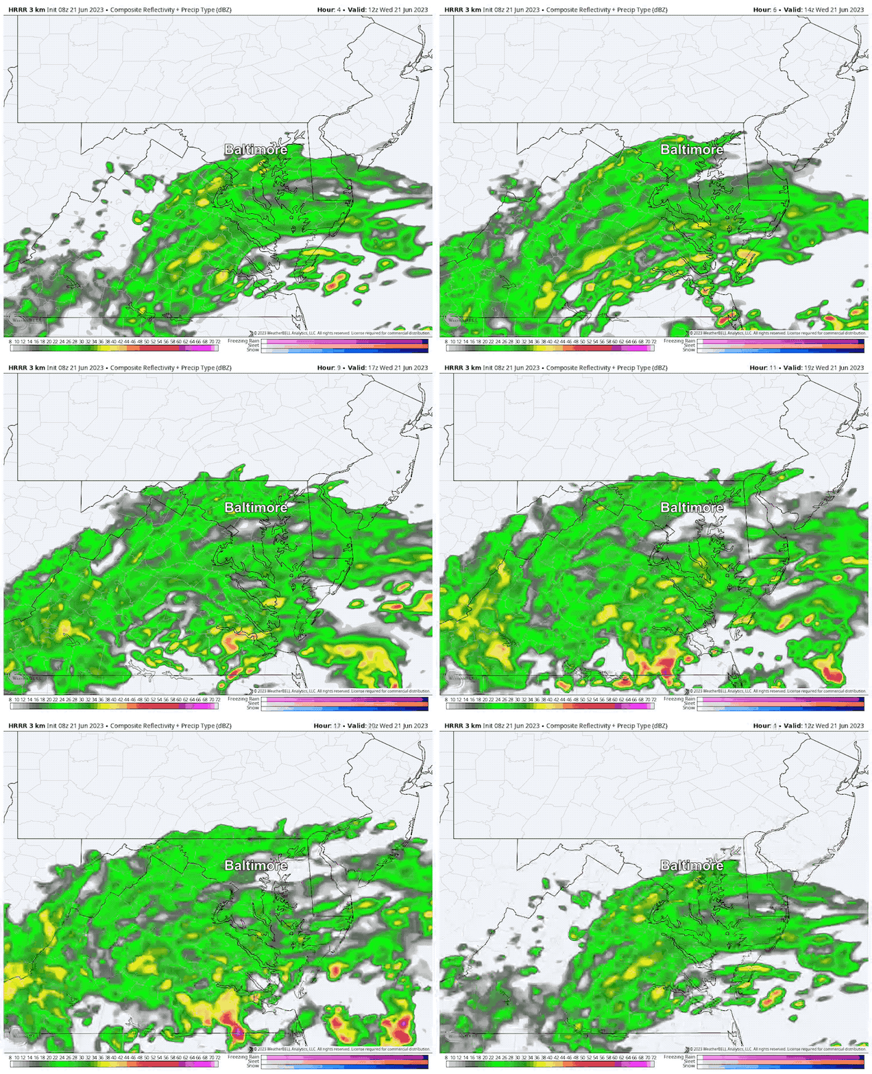
10 AM Snapshot
4 PM Snapshot
Wind Forecast at 4 PM
Steady strong winds from the Northeast will gust to 35 mph. A Wind Warning has been issued for the Chesapeake Bay Bridge. This wind will also produce high tide flooding on the Western Shore, including Annapolis.
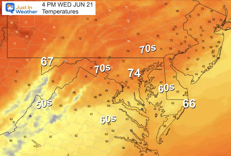
4 PM Temperatures
As a result of the winds, our temperatures will be held back in the 70s. With rain, it may drop into the 60s… We expect even cooler temps tomorrow.
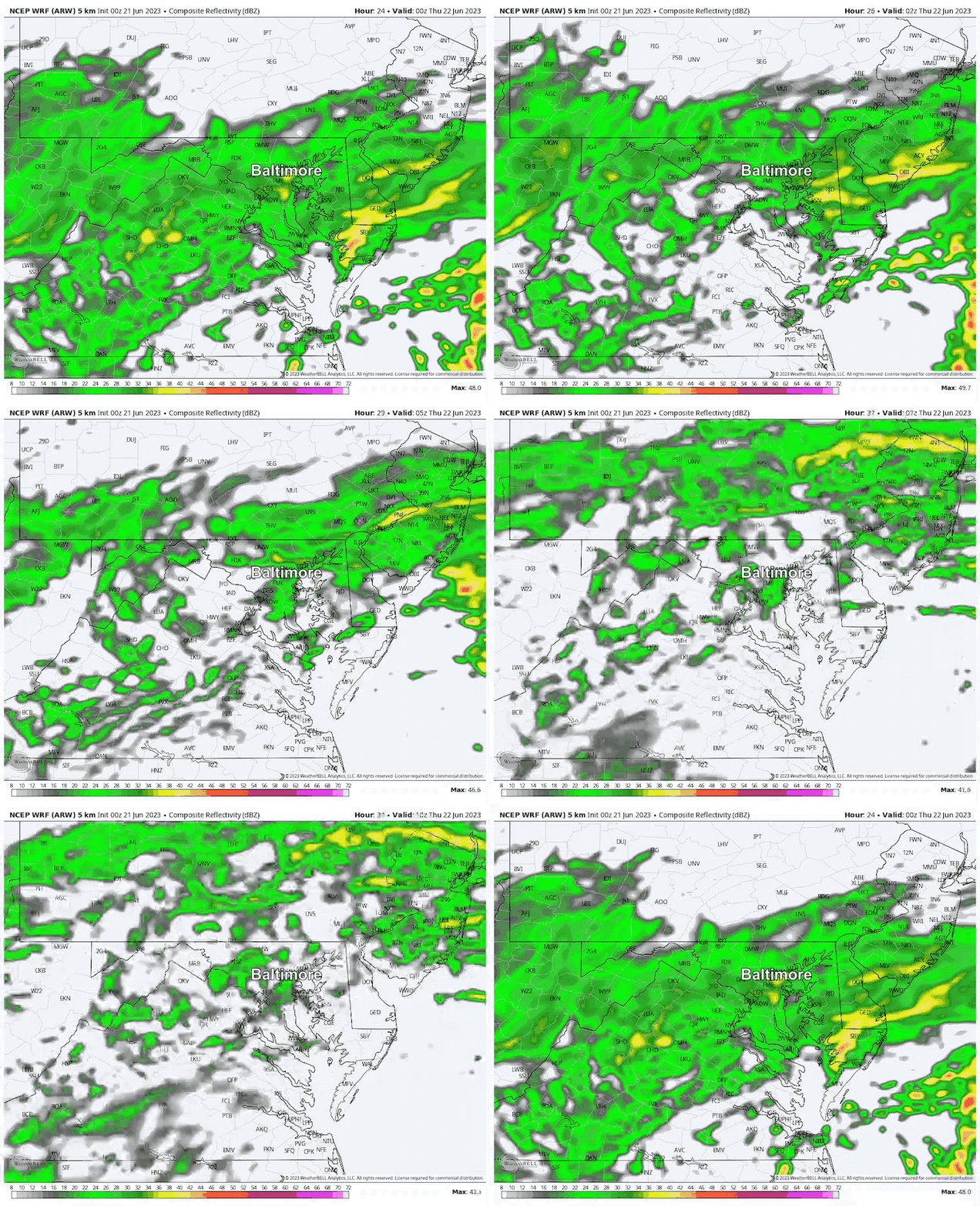
Rain Forecast Through Tonight
8 PM Wed to 6 AM Thu
Steady rain will push north overnight, then break into showers by morning.
TROPICAL WEATHER
Update On Tropical Storm Bret
Winds are up to 60 mph this morning but is now NOT expected to reach hurricane intensity. The track is staying farther south and encountering super-level winds that may be a signal of the growing El Niño.
EXPLORE MORE
2023 Hurricane Season Forecast With An El Niño Watch
Drought Watch Updated June 15
Subscribe for eMail Alerts
Weather posts straight to your inbox
Sign up and be the first to know!
CLIMATE DATA
TODAY June 21
Normal Low in Baltimore: 64ºF
Record 50ºF in 1968
Normal High in Baltimore: 86ºF
Record 100ºF 2012
Thursday Weather
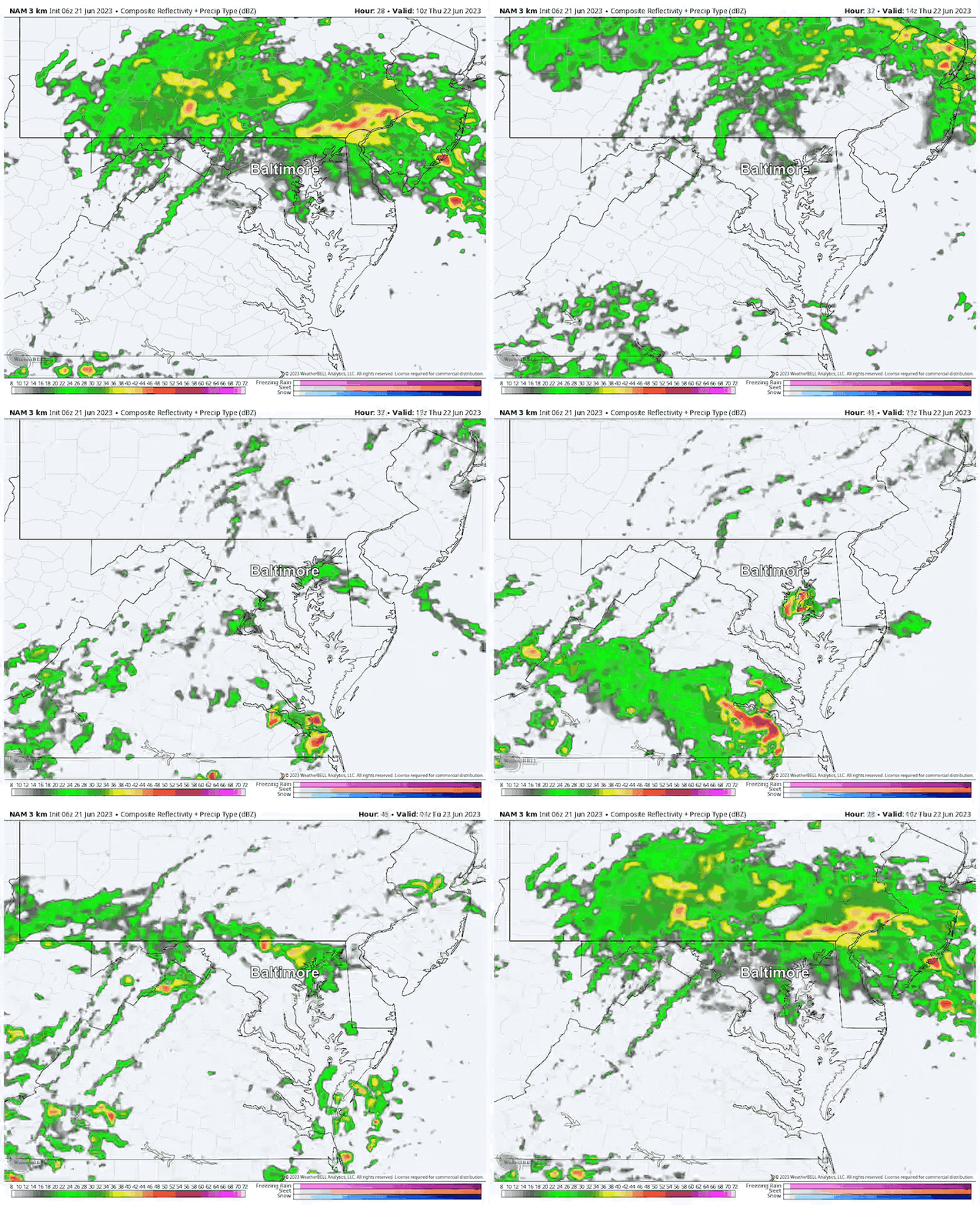
Radar Simulation 6 AM to Midnight
The rain will break up into scattered showers. This product can miss some rain cells, so please do not use this as a promise. This is a guide to show this is more scattered showers with storms later in the evening or at night.
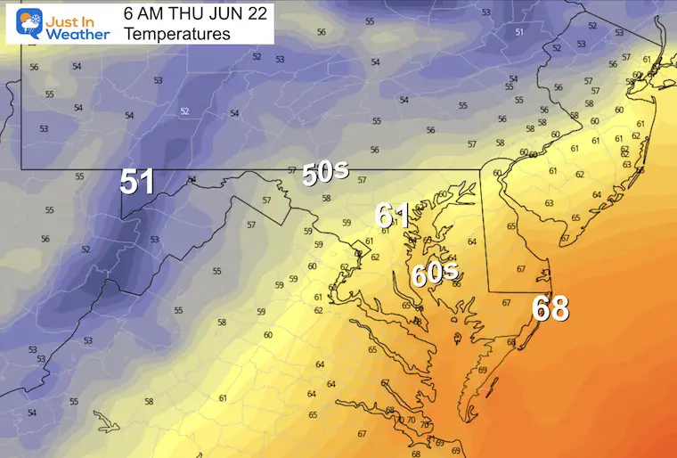
Morning Temperatures
Cooler air will settle in place.
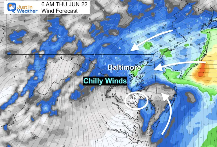
Morning Wind
The circulation shows a surface Low Pressure will ride up the Chesapeake Bay. The strong winds are on the north side, which we will have in the morning. While the winds will ease tomorrow afternoon, a cooler air mass will settle in place.
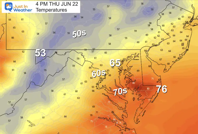
Afternoon Temperatures
Remaining chilly in the 60s for much of the region.
LOOKING AHEAD
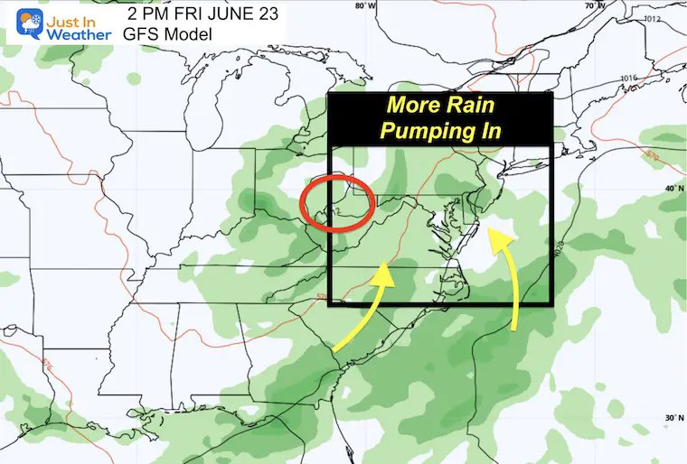
Friday Afternoon
We remain under the influence of a larger Low Pressure to our West pumping in more moisture on East to Southeast Winds. This setup will remain into next week.
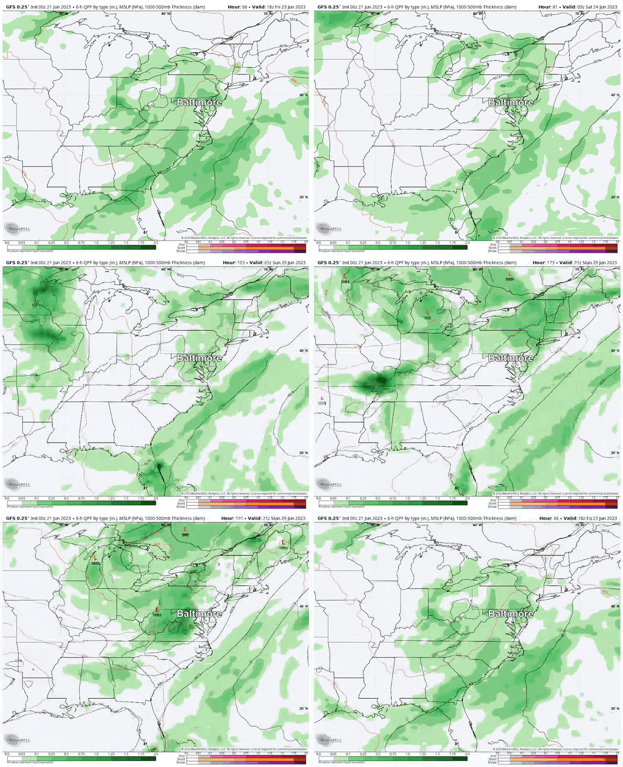
Rain Forecast Friday Afternoon to Monday Evening
The GFS Model shows periodic bands of rain, some may contain downpours each day. The specific timing is not reliable at this time, but more likely pulsing of storms each afternoon and evening with late-day heat.
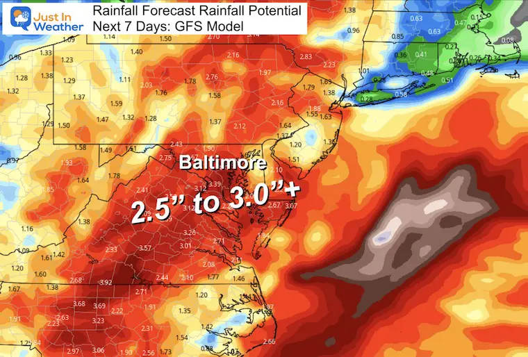
Rain Potential:
This is the 7-Day outlook showing a general 2.5” inches to over 3” for much of our region through next Tuesday.
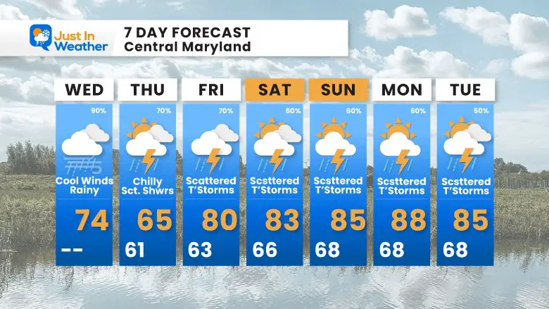
7 Day Forecast
This is the weather we need. Many days with periods of rain. It is IMPOSSIBLE to pin specific timing for your plans farther out in time.
The safe call is to expect showers and thunderstorms at any time any afternoon for the next week. It will be mainly the day of or a day prior to get a better idea of the timing for rain each day. So your plans should have a plan B for the next week.
Subscribe for eMail Alerts
Weather posts straight to your inbox
Sign up and be the first to know!
EXPLORE MORE
Building Drought As We Begin June
La Niña Has Ended. El Niño May Return By Fall
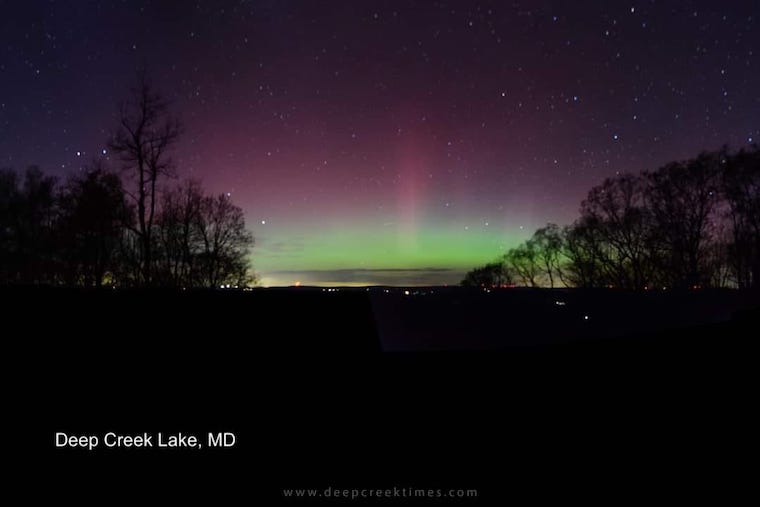
Aurora Photos From Maryland, Delaware, and Virginia
Summertime is the time to get your pest control in order, you have them.
Please share your thoughts, and best weather pics/videos, or just keep in touch via social media
-
Facebook: Justin Berk, Meteorologist
-
Twitter
-
Instagram
RESTATING MY MESSAGE ABOUT DYSLEXIA
I am aware there are some spelling and grammar typos, and occasional other glitches. I take responsibility for my mistakes, and even the computer glitches I may miss. I have made a few public statements over the years, but if you are new here you may have missed it: I have dyslexia, and found out during my second year at Cornell University. It didn’t stop me from getting my meteorology degree, and being first to get the AMS CBM in the Baltimore/Washington region. One of my professors told me that I had made it that far without knowing, and to not let it be a crutch going forward. That was Mark Wysocki and he was absolutely correct! I do miss my mistakes in my own proofreading. The autocorrect spell check on my computer sometimes does an injustice to make it worse. I also can make mistakes in forecasting. No one is perfect predicting the future. All of the maps and information are accurate. The ‘wordy’ stuff can get sticky. There has been no editor that can check my work when I needed it and have it ready to send out in a newsworthy timeline. Barbara Werner is a member of the web team that helps me maintain this site. She has taken it upon herself to edit typos, when she is able. That could be AFTER you read this. I accept this and perhaps proves what you read is really from me… It’s part of my charm.
#FITF


