Tuesday Evening June 20, 2023
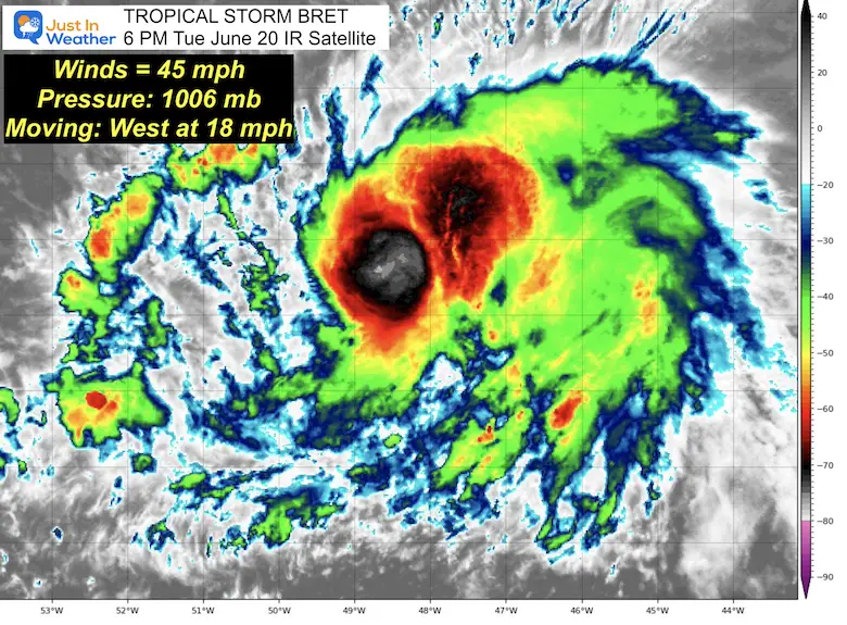
I am about to eat some crow pie with a good explanation. Tropical Storm Bret has slowly increased sustained winds to 45 mph. However, the rapid growth to hurricane intensity is now mostly off the table.
Yesterday I showed the collection of many models suggesting a 65% chance for this to become a hurricane before reaching the Antilles. That is now down less than 5%, while the tracking maps have shifted as well. I’ll explain below.
Tropical Storm Bret Satellite
Official Status Report: 5 PM Advisory
- LOCATION…12.2N 48.6W
- ABOUT 835 MI…1350 KM E OF THE WINDWARD ISLANDS
- MAXIMUM SUSTAINED WINDS…45 MPH…75 KM/H
- PRESENT MOVEMENT…W OR 280 DEGREES AT 18 MPH...30 KM/H
- MINIMUM CENTRAL PRESSURE…1006 MB…29.71 INCHES
Closer Storm Satellite Loop
Wide Satellite Snapshot
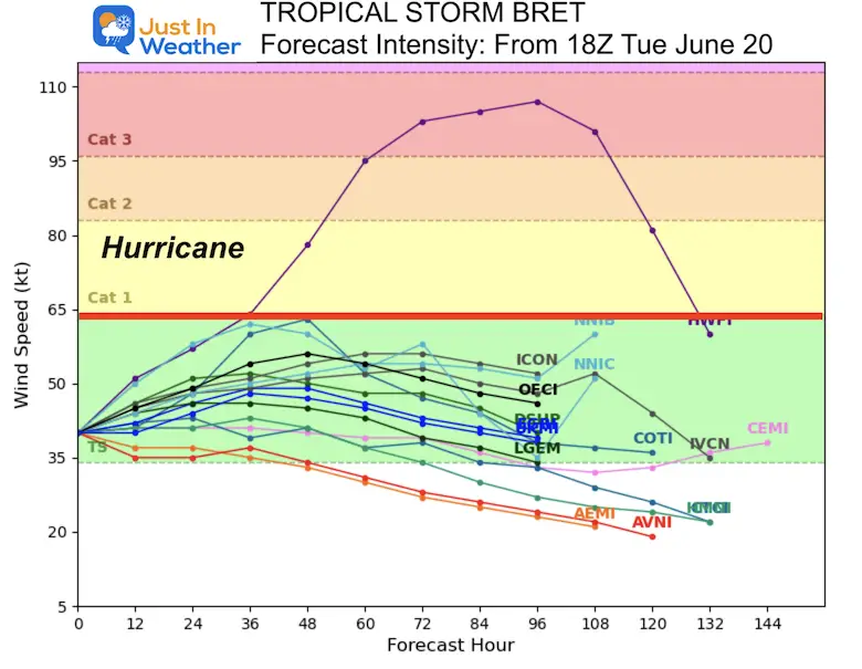
Forecast Model Intensity
There is now a greater than 95% chance this does NOT reach hurricane intensity. I know this is an about-face from the 65% chance that collection showed yesterday.
Personal Note: Computer Models use a lot of different data, including historical comparison. While this system initially looked very strong and had plenty of warm water to travel over for growth, we have seen a shift south with the track.
I believe this might be the first signal of the influence El Niño is having in the upper atmosphere. Faster winds aloft tend to inhibit tropical storm growth in the Atlantic basin.
Only time will tell if this is a trend for the season. The tracks below will be noteworthy to factor in earlier plots for future storms as well.
Also See:
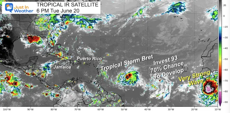
Wide Satellite
The wave behind Bret to the East has a 70% chance to develop in the next 48 hours.
The wave moving off the African coast appears to be the strongest and may also have the potential to develop.
SUMMARY OF WATCHES AND WARNINGS IN EFFECT:
A Tropical Storm Watch is in effect for…
* Barbados
A Tropical Storm Watch means that tropical storm conditions are possible within the watch area, generally within 48 hours.
Interests elsewhere in the Lesser Antilles should monitor the progress of Bret.
Tropical storm watches will likely be required for other islands later tonight.
National Hurricane Center Discussion
At 500 PM AST (2100 UTC), the center of Tropical Storm Bret was located near latitude 12.2 North, longitude 48.6 West. Bret is
moving toward the west near 18 mph (30 km/h), and this general motion is expected to continue for the next several days. On the
forecast track, the center of Bret is expected to move across portions of the Lesser Antilles Thursday afternoon and Thursday night, and then move across the eastern Caribbean Sea on Friday.
Tropical-storm-force winds extend outward up to 45 miles (75 km) from the center.
The estimated minimum central pressure is 1006 mb (29.71 inches). This is a drop of only 2 mb in the last 24 hours.
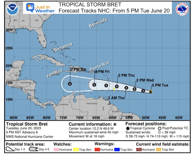
National Hurricane Center Official Forecast Map
Compare to the model forecast plots below.
Note that this track remains nearly due West AND remains at Tropical Storm Intensity (S). This does not appear to be a US storm, however traveling to the Caribbean next week is worth paying attention to.
HAFS-A Model Forecast
This plot is in line with the consensus shown below. Please note that the center tracks well south of Puerto Rico. NOT the landfall that the HWRF Model showed yesterday.
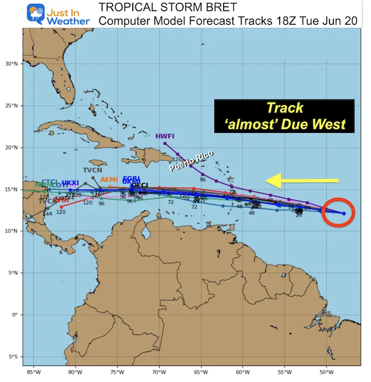
Forecast Global Model Guidance
The collection of model forecast plots all point to a southward track then skirting the southern edge of the eastern Caribbean islands. This is subject to change, and I will be watching for any model bias to show up this week.
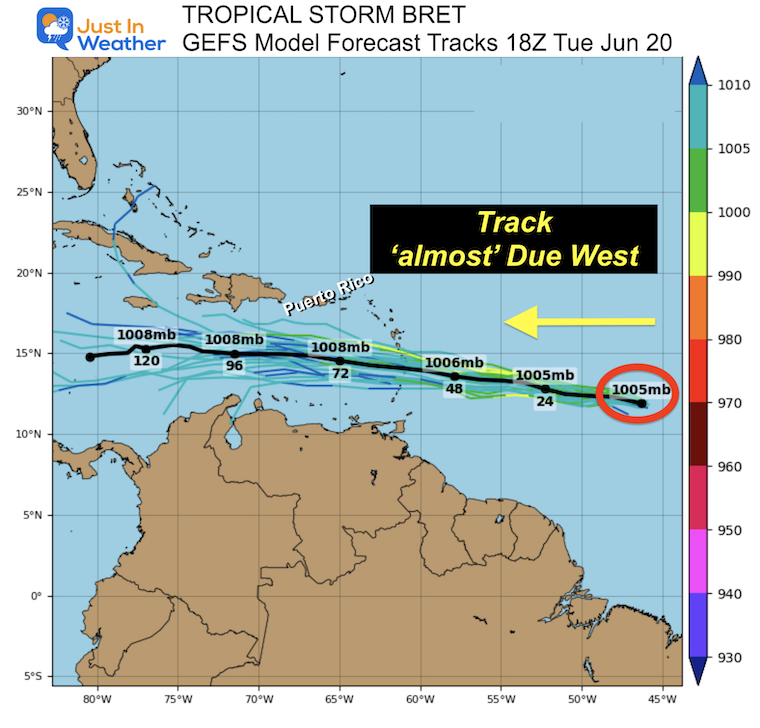
Forecast GFS Model Ensemble Guidance
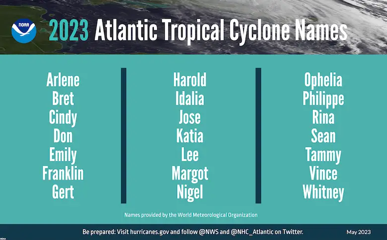
2023 Hurricane Names
Note: On January 16, there was an unnamed Tropical Depression identified by The National Hurricane Center. It did not get a name but will be included in the overall tropical records. It was located about 300 miles from Bermuda.
I will have a more detailed article on the history of names soon.
Names are in alphabetical order.
- Arlene
- Bret
- Cindy
- Don
- Emily
- Franklin
- Gert
- Harold
- Idalia
- Jose
- Katia
- Lee
- Margot
- Nigel
- Ophelia
- Phillipe
- Rina
- Sean
- Tammy
- Vince
- Whitney
Subscribe for eMail Alerts
EXPLORE MORE

Please share your thoughts, and best weather pics/videos, or just keep in touch via social media
RESTATING MY MESSAGE ABOUT DYSLEXIA
I am aware there are some spelling and grammar typos, and occasional other glitches. I take responsibility for my mistakes, and even the computer glitches I may miss. I have made a few public statements over the years, but if you are new here you may have missed it: I have dyslexia, and found out during my second year at Cornell University. It didn’t stop me from getting my meteorology degree, and being first to get the AMS CBM in the Baltimore/Washington region. One of my professors told me that I had made it that far without knowing, and to not let it be a crutch going forward. That was Mark Wysocki and he was absolutely correct! I do miss my mistakes in my own proofreading. The autocorrect spell check on my computer sometimes does an injustice to make it worse. I also can make mistakes in forecasting. No one is perfect predicting the future. All of the maps and information are accurate. The ‘wordy’ stuff can get sticky. There has been no editor that can check my work when I needed it and have it ready to send out in a newsworthy timeline. Barbara Werner is a member of the web team that helps me maintain this site. She has taken it upon herself to edit typos, when she is able. That could be AFTER you read this. I accept this and perhaps proves what you read is really from me… It’s part of my charm.
#FITF


