February 13 Returning Warm Air Then Rain Ends The Week
February 13, 2023
Monday Morning
That storm brought some sleet and wet snow to metro areas, but that was an afterthought with the chilly and heavy rain. It is moving off the coast today and allowing the warmth to return this week
Temps will surge just ahead of the next storm. We will have a few days in the 60s. Any chance to reach 70ºF will depend on the rainfall.
Headlines
- Today: Sun Returns And Warmer
- Mid Week: Like Spring Again
- Storm Brings Soggy Thursday and Friday
- Weekend: Chilly Again
Temperatures
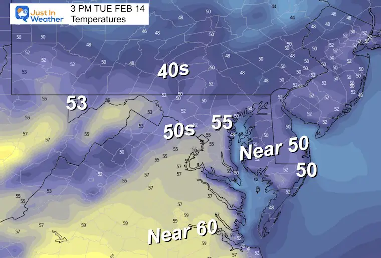
A few spots have dropped to freezing, but any icing would be limited to car tops and elevated steps.
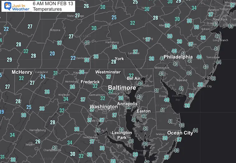
Morning Surface Weather
That storm is moving off the coast and now we set up for a warm spell for the bulk of the week.
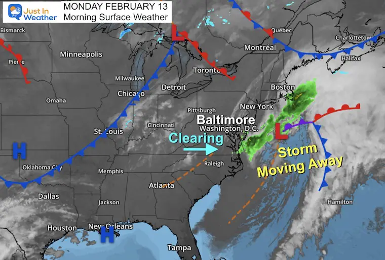
Afternoon Temperatures
Pleasant with more sunshine.
Subscribe for eMail Alerts
Weather posts straight to your inbox
Sign up and be the first to know!
CLIMATE DATA
TODAY February 13
Normal Low in Baltimore: 26ºF
Record 1ºF in 1983
SNOW: 15.5” in 1899
Normal High in Baltimore: 46ºF
Record 72ºF 1951
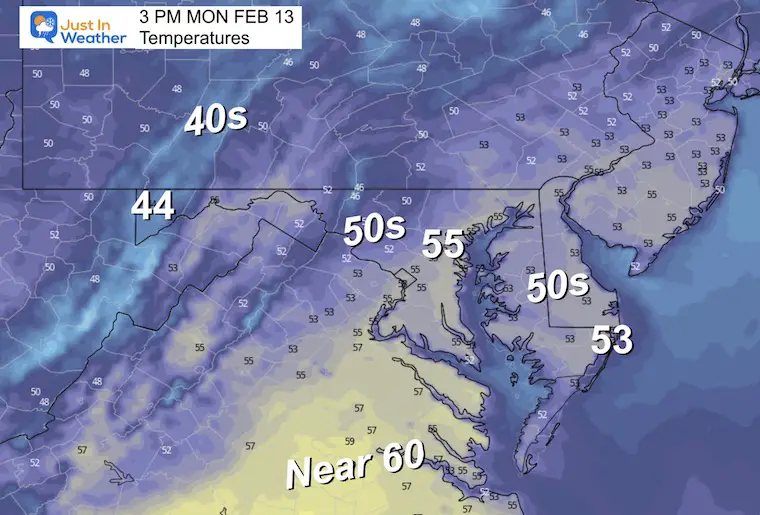
Tuesday
Morning
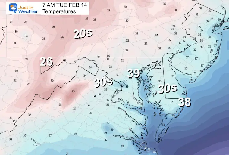
Afternoon
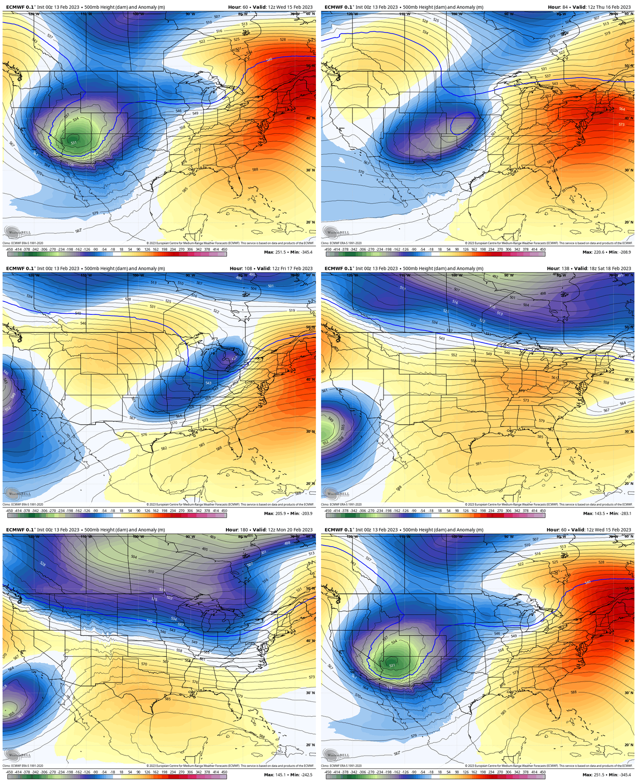
Jet Stream
Wednesday Morning To Monday Morning
Warm in the East and colder/storms across the middle and west of our nation. This active and persistent storm pattern will bring us our warm week, then collapse with a cold surge briefly this coming weekend.
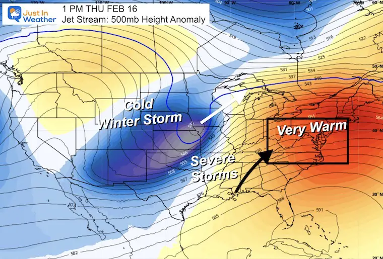
Snapshot Wednesday
I want to pause here for a moment as this will be the theme of the week, and has been all winter. THIS is atmospheric memory on display. A Ridge of High Pressure will pump in warmth mid week. This is ahead of a strong storm that will track to the Great Lakes. Those that have had snow will get more. Those that have had severe storms, will get more. We will get a few more very warm days.
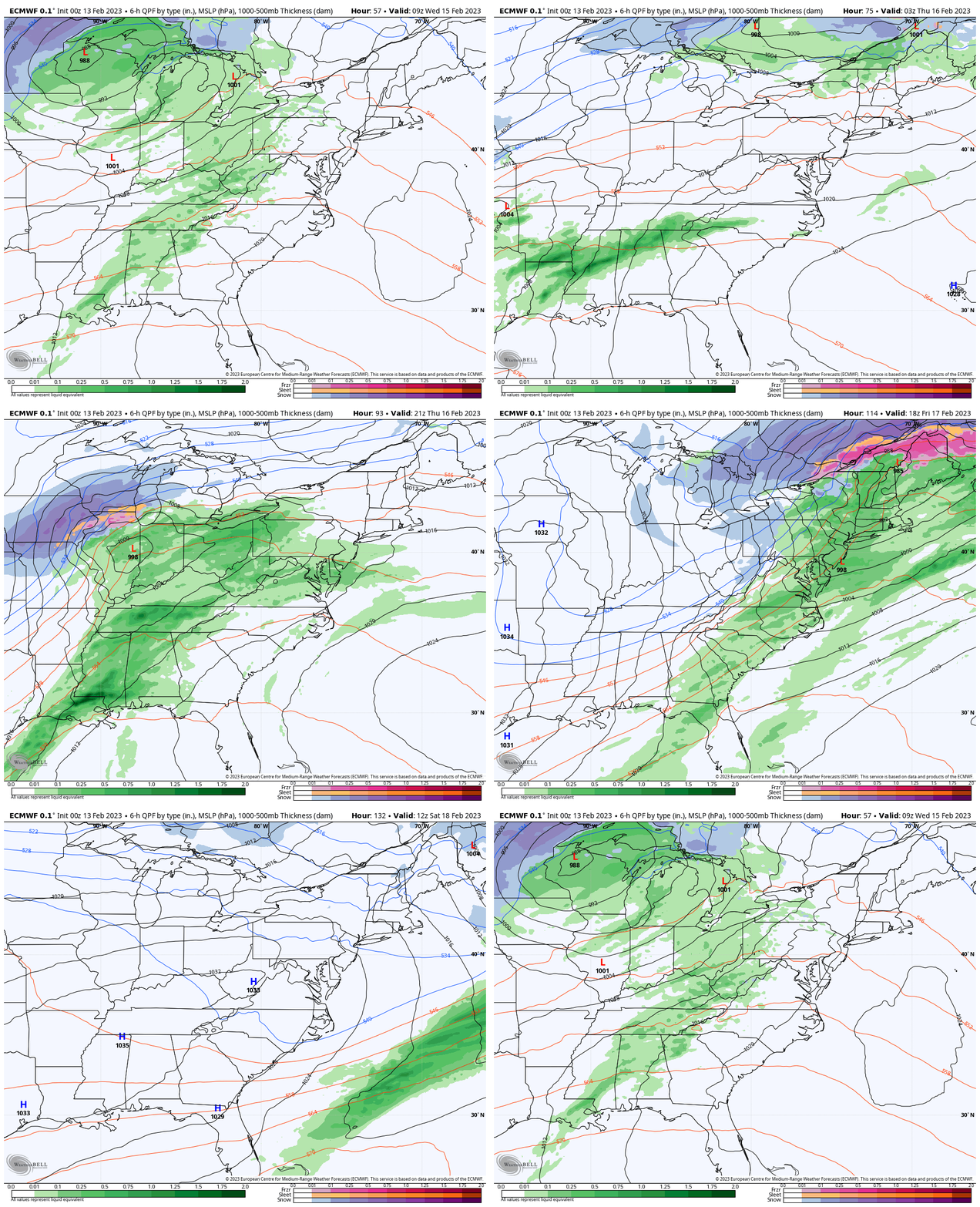
Storm Forecast
ECMWF WED Morning To SAT Afternoon
With the warm air comes the rain. The showers for us on Wednesday may fade, which will be our best chance to overshoot the forecast and aim for near 70ºF. Then more substantial rain is expected Thursday and Friday.
On Friday, a strong cold front will take temps down from the 60s in the morning to the 30s in the afternoon. The only snow nearby will be confined to the higher mountains in western Maryland, PA and WV.
Next weekend will be colder, briefly.. again. Seems like a familiar theme.
NOTES:
The potential to hit 70ºF will be determined by the rain. It looks like our best chance may be on Wednesday, if those showers break up. The rain on Thursday and Friday looks more likely.
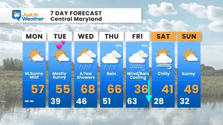
7 Day Forecast
This week is all about the warm temps… Until Friday.
Also See:
Winter History: Low Snow And Late Starts
See my research based on Baltimore data since 1883.
Subscribe for eMail Alerts
Weather posts straight to your inbox
Sign up and be the first to know!
STEM Assemblies/In School Fields Trips Are Back
Click to see more and ‘Book’ a visit to your school
My Winter Outlook: Not A Typical La Niña!
I see many factors to support colder influence with multiple systems. Early and later in winter. Check it out.
Also See The Winter Outlook Series:
Farmer’s Almanac Comparison
September Starts Meteorological Autumn: Weather Climate Stats For Maryland at Baltimore
Triple Dip La Niña Winter
https://justinweather.com/2022/09/09/winter-outlook-2023-la-nina-triple-dip-expectations/
CONNECTION TO WINTER?
If you want a snowy winter, this is what you might want to look for in the rest of the tropical season.
Rainbow Ice Cave In Mt. Rainier A Very Rare Find: Photos And Video
Wooly Bear Caterpillars
https://justinweather.com/2022/10/25/winter-weather-outlook-from-the-wooly-bear-caterpillar/
Persimmon Seeds
Click to see Top 20 and MORE
Normals And Records: Maryland and Baltimore Climate History
Please share your thoughts, best weather pics/videos, or just keep in touch via social media
-
-
Facebook: Justin Berk, Meteorologist
-
Twitter: @JustinWeather
-
Instagram: justinweather
-


