February 12, 2023
Sunday Morning
Today is the day of our chilly coastal storm. You can call it a near miss or a complete bust. The reality is that most of region will miss out on the winter component in this chilly rain. However, we could have some sleet at the start. Farther inland, may still have sleet or wet snow mixed in during the afternoon.
If you are traveling, there are winter advisories through Southwest Virginia and into North Carolina. The mountains along Skyline Drive and near/west of I-81 will be impacted with some accumulating snow.
After this ‘blip’ we are back into the non-winter or spring-like pattern. That means a warm up mid week ahead of our next rain storm. That warm up may feature temperatures approaching 70ºF. Not quite a record for Baltimore, but I will show those below.
Headlines
- Today: Chilly Rain may have some brief sleet
- Slushy snow well inland VA/NC around and west of I-81
- Next Week: Warm Again!
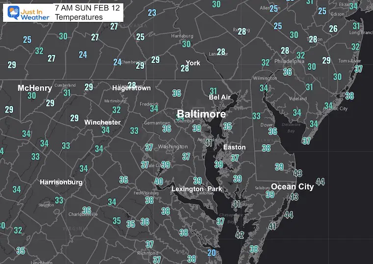
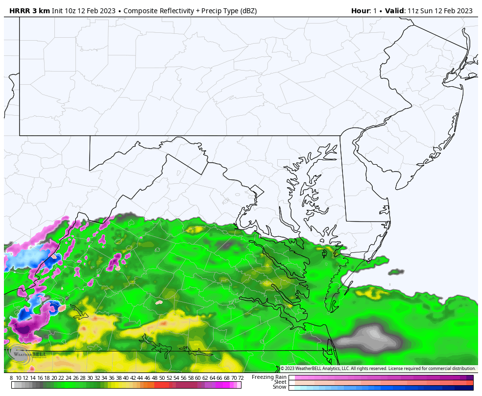
7 AM Snapshots
Temperatures
Chilly but the freezing temps are limited on the surface. This system has always been about the air aloft generating its own cold air… plus some help from higher elevations.
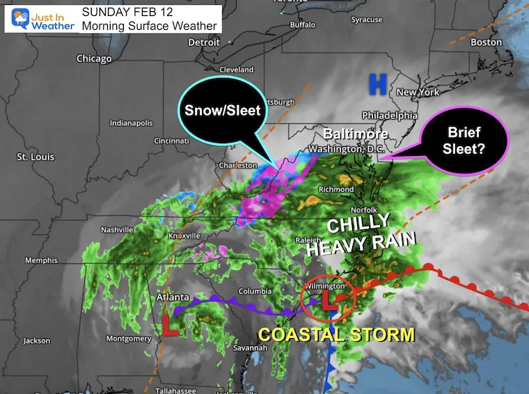
Morning Surface Weather
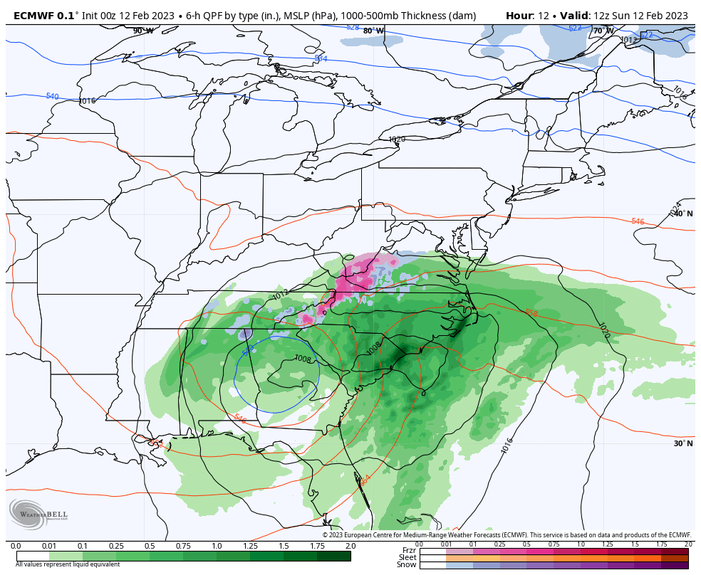
The Coastal Storm is centered along the North Carolina coastline. This is a potent little system, now bumping into some colder air on the edge. That is where slushy snow and sleet have developed across the mountains of North Carolina and Virginia.
High Pressure in Pennsylvania will restrict how far north this system may reach. On that northern edge, there may be some sleet briefly at the start, even with ground temps above freezing.
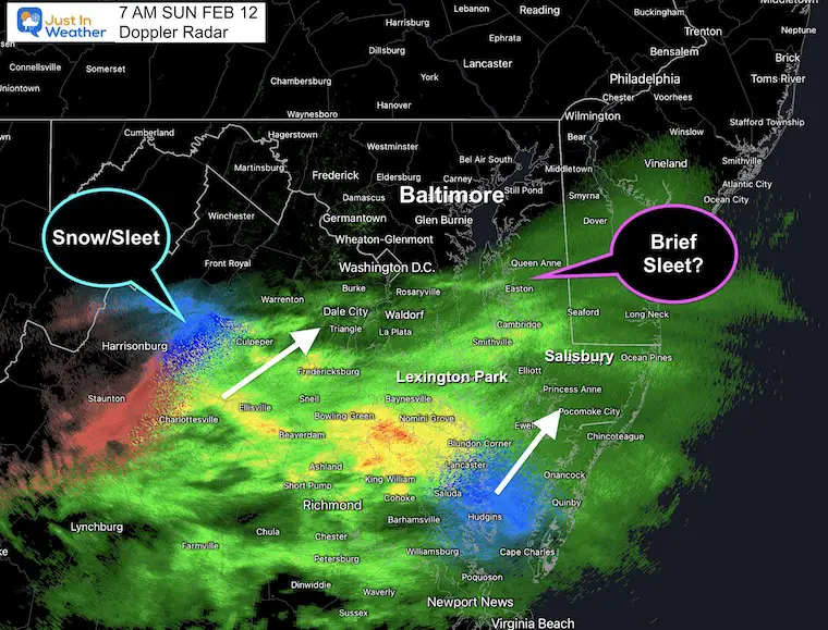
Doppler Radar Snapshot
A pocket of wintry mix has been identified by Doppler Radar north of Newport News in VA.
This leading edge of rain into Maryland is farther north than the model below shows.
That leading edge could catch up to cold enough air for some brief sleet. That includes parts of southern/central Maryland and the Capital District around Washington.
NO STICKAGE is expected.
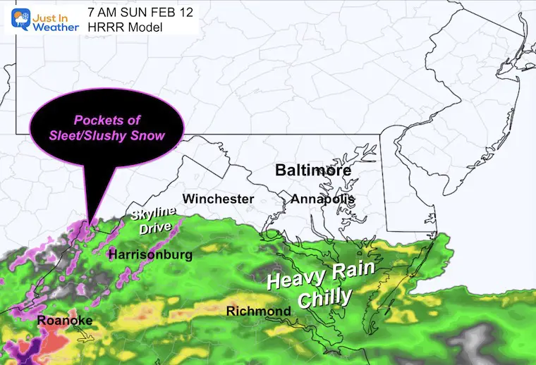
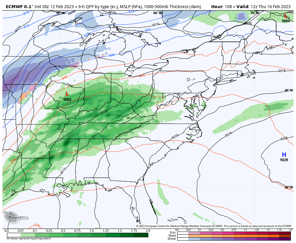
Radar Simulation Forecast For 7 AM
Notice how the leading edge of rain was not as far north. This is part of the model error in how far this may reach today.
Animation to 3 PM
This shows a sharp cut off around Baltimore, but if we account for the bias, the rain (or brief sleet) may reach to the Pennsylvania line.
Note that there will be pockets of heavy rain (yellow) near the leading edge as this pushes north. This is where sleet could mix in…
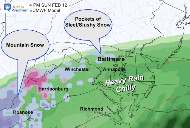
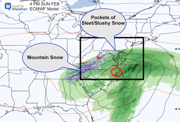
Afternoon Snapshot
The ECWMF Model still suggests there may be pockets of slushy snow or sleet mixed in with the rain on the northern edge in central Maryland. This will not be a stickage event, but might surprise a few if you are looking out the window instead of watching your pre-game special.
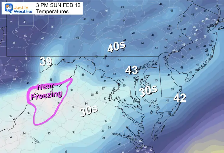
Afternoon Temperatures
Remaining chilly, but the freezing air is limited to the mountains where snow and sleet will continue to fall.
Wider View
The compact coastal Low will produce 1/2 to 1 inch of rain into southern Maryland.
The mountains of North Carolina and Virginia will get the slushy snow.
Storm Animation Through Monday Afternoon
Winter (Snow) Impacts:
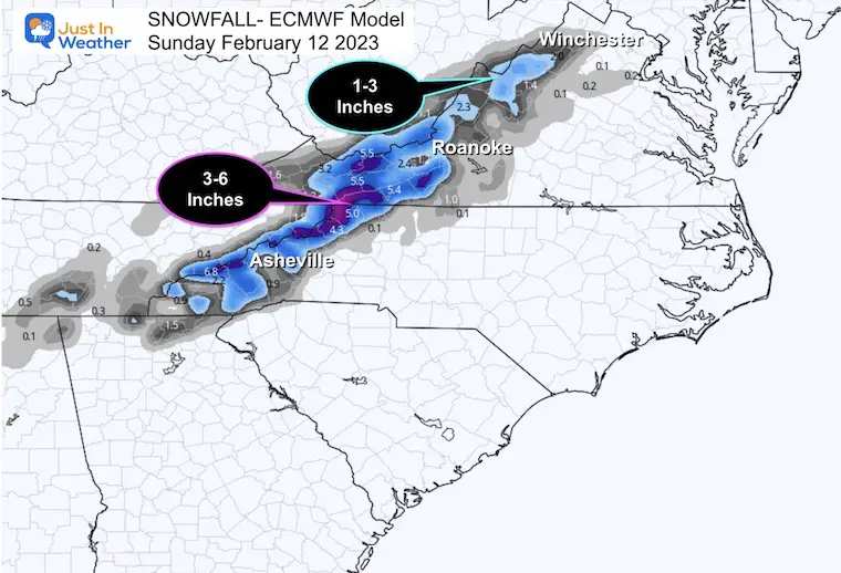
There will be accumulating snow across western Virginia and North Carolina.
Skyline Drive and the I-81 corridor westward is a safe rule of thumb for the impact travel zone.
There will be 1 to 3 inches of snow, with up to 6 inches in the highest mountains of North Carolina above 4,000 Ft.
Subscribe for eMail Alerts
CLIMATE DATA
TODAY February 12
Normal Low in Baltimore: 26ºF
Record 11ºF in 1899
SNOW: 9.6” in 2006
Normal High in Baltimore: 46ºF
Record 73ºF 1999
Monday
The storm will depart and the sky will clear. This will start our warming trend (again).
Temperatures
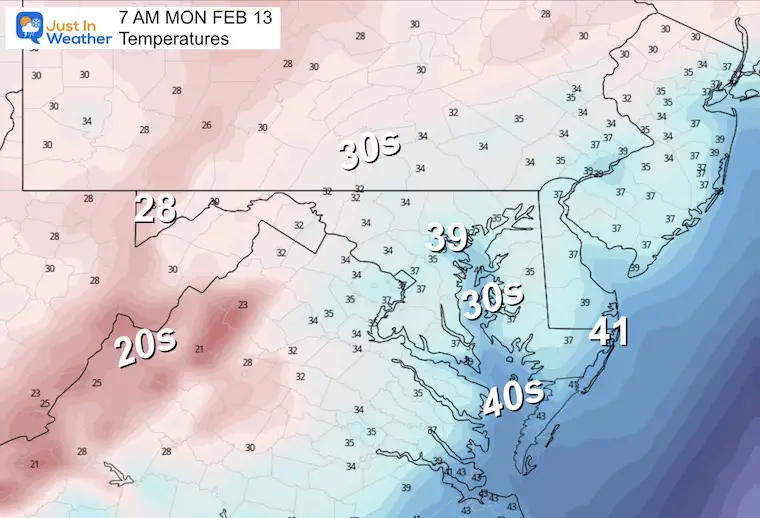
Morning
A chilly start and some of the areas in the mountains that get snow will have an icy start.
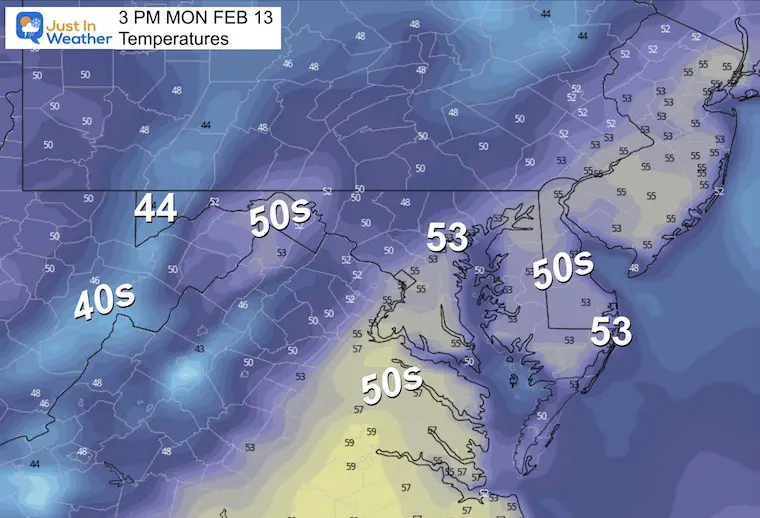
Afternoon
Back to pre-spring warming.
Next Storm
Thursday Morning To Saturday Morning
Talk about Atmospheric Memory – This is the same storm track to the Great Lakes. The result will be another warm rain maker for us, and another severe storm outbreak across the Southern/Gulf States.
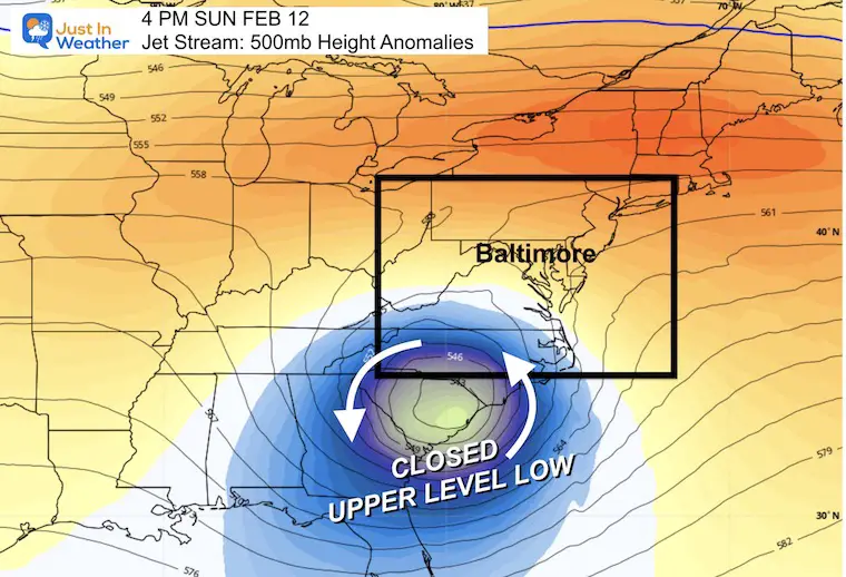
Jet Stream
Big Flip!
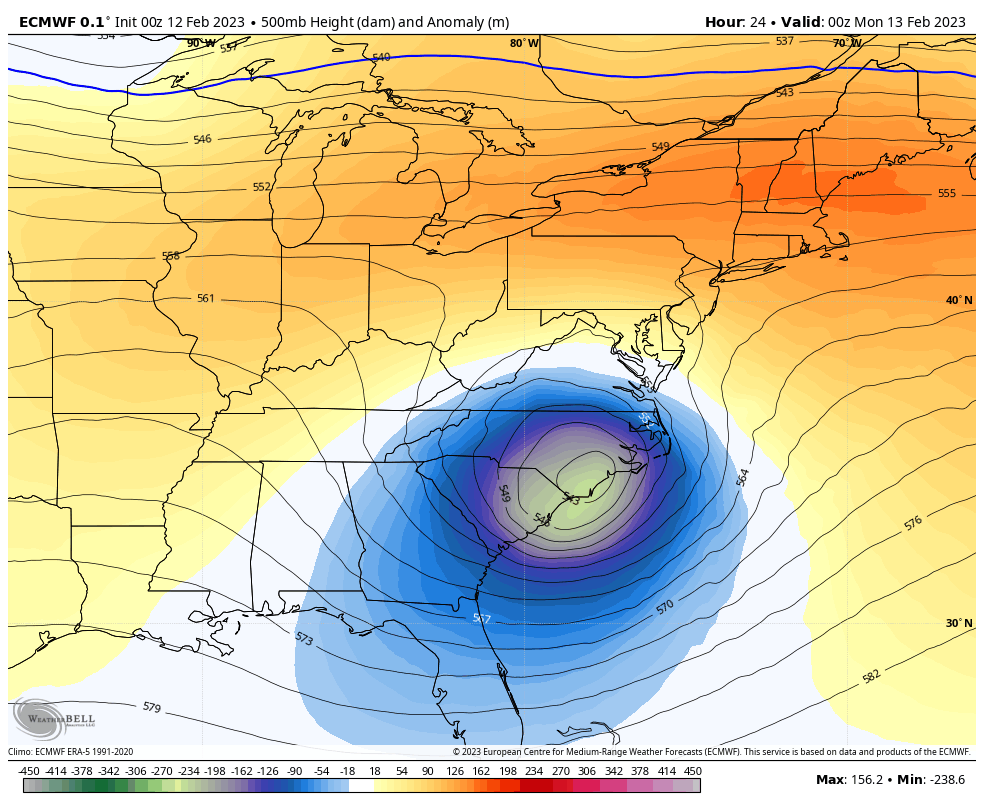
Today’s Closed Low
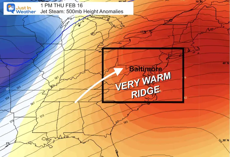
Sunday Night to Friday Night
After our blip, this shows the warm up. A LARGE RIDGE will build across the Eastern US. The net result is keeping that storm track to our west, with a surge of very warm air… ending Friday.
We have a chance to reach 70ºF for one or two days.
Thursday Warm-Up
Many could reach 70ºF once or twice this week. That will depend on the rainfall. But for comparison, I want to show the records that may be just out of reach.
WED (Feb 15) Record High 77ºF in 1949
THU (Feb 16) Record High 75ºF 1954
FRI (Feb 17) Record High 76ºF in 1976
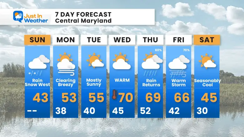
7 Day Forecast
Sunday is still our blip, then we have another pre-spring week ahead.
It could end up warmer if the rain holds off at the end of the week.
Also See:
Winter History: Low Snow And Late Starts
See my research based on Baltimore data since 1883.

Subscribe for eMail Alerts
STEM Assemblies/In School Fields Trips Are Back
Click to see more and ‘Book’ a visit to your school

My Winter Outlook: Not A Typical La Niña!
I see many factors to support colder influence with multiple systems. Early and later in winter. Check it out.
https://justinweather.com/2022/11/22/winter-outlook-2023-for-snow-not-typical-la-nina-plus-polar-vortex-disruption/
Also See The Winter Outlook Series:
https://justinweather.com/2022/11/20/atmospheric-memory-suggests-active-winter-storm-pattern-outlook/
Winter Outlook 2023 From NOAA Very Different Than Farmers Almanacs
Farmer’s Almanac Comparison
Winter Outlook 2023 Early Look At Snow From Two Farmers Almanacs
Triple Dip La Niña Winter
https://justinweather.com/2022/09/09/winter-outlook-2023-la-nina-triple-dip-expectations/
CONNECTION TO WINTER?
If you want a snowy winter, this is what you might want to look for in the rest of the tropical season.
Record August For No Named Tropical Storms: Closer Look At Snow Following
Wooly Bear Caterpillars
https://justinweather.com/2022/10/25/winter-weather-outlook-from-the-wooly-bear-caterpillar/
Persimmon Seeds
Winter Weather Outlook: Persimmon Seeds And Snow Folklore
Click to see Top 20 and MORE
https://justinweather.com/2022/10/28/winter-weather-folklore-top-20-and-more-outlook-signals-from-nature-for-cold-and-snow/
Normals And Records: Maryland and Baltimore Climate History

Please share your thoughts, best weather pics/videos, or just keep in touch via social media


