February 11, 2023
Saturday Morning
All week I have mentioned this weekend storm and asked you to keep an open mind. I want to start off by stating I was ‘wrong’ in my anticipation of the extreme result. I will take my licks on that. Within this warm pattern, this was our one shot at winter and I was looking for a chance of slushy wet snow for a few hours.
What we have seen I can also accept as partially right. The models did push this storm too far south, and it has come back to impact us. So keeping this storm in play worked out.
As for that wintry part, it’s still there, just may not be all here. Please let me explain.
History:
Today is the anniversary of the 1983 Snowstorm. The 22.8” that fell on Baltimore ranks 6th most on record.
Headlines
- Today: Cooler Weekend
- Sunday: Cold Rain, Some Sleet or Slushy Snow
- Next Week: Warm Again
Follow Up Record Report
Baltimore’s BWI tied the record high temperature on Friday. The observation of 66ºF was at 1:35 AM, matching the mark set in 1959.
Now we get a cooler weekend.
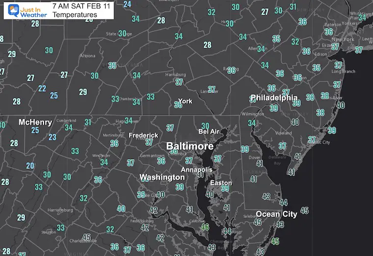
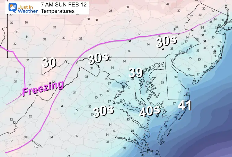
Morning Temperatures At 7 AM
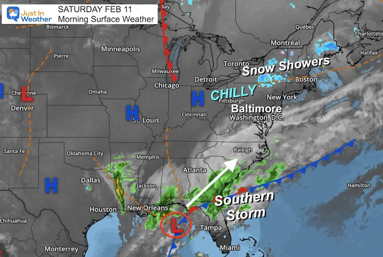
Morning Surface Weather
We are on the edge of High Pressure, chilly air to our north and a developing storm to the south. Our region will be split with more sun in central and northern areas. More clouds into southern Maryland and Southeast Virginia.
That storm will be our weather on Sunday.
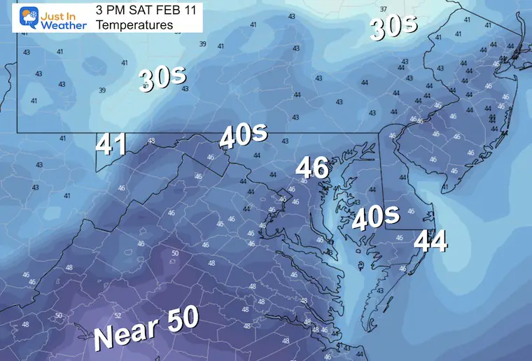
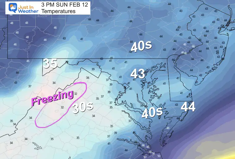
Afternoon Temperatures
Closer to seasonal norms.
Subscribe for eMail Alerts
CLIMATE DATA
TODAY February 11
Normal Low in Baltimore: 26ºF
Record -6ºF in 1899
SNOW: 22.8” 1983 *6th largest snowfall on record!
Normal High in Baltimore: 46ºF
Record 72ºF 1887
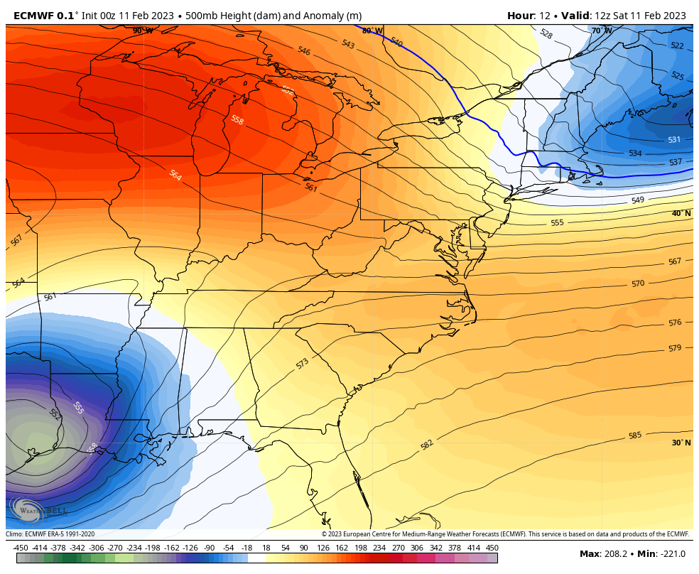
Weather Set Up
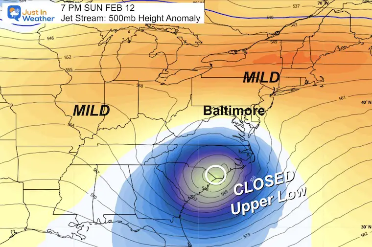
Jet Stream Saturday Morning To Tuesday Evening
This is still all about that Closed Low with a pocket of cold air aloft. The specific track of that cold air is the main opportunity for wintry precipitation.
After this passes, we will be back into the mild weather during next week.
Sunday Night Snapshot
This Closed Low is forecast to track just a little south. Any shift back north would bring this back in play, but for now it looks like the core keeps the best chance for slushy snow to our west and south along the edge of the mountains.
Storm Track
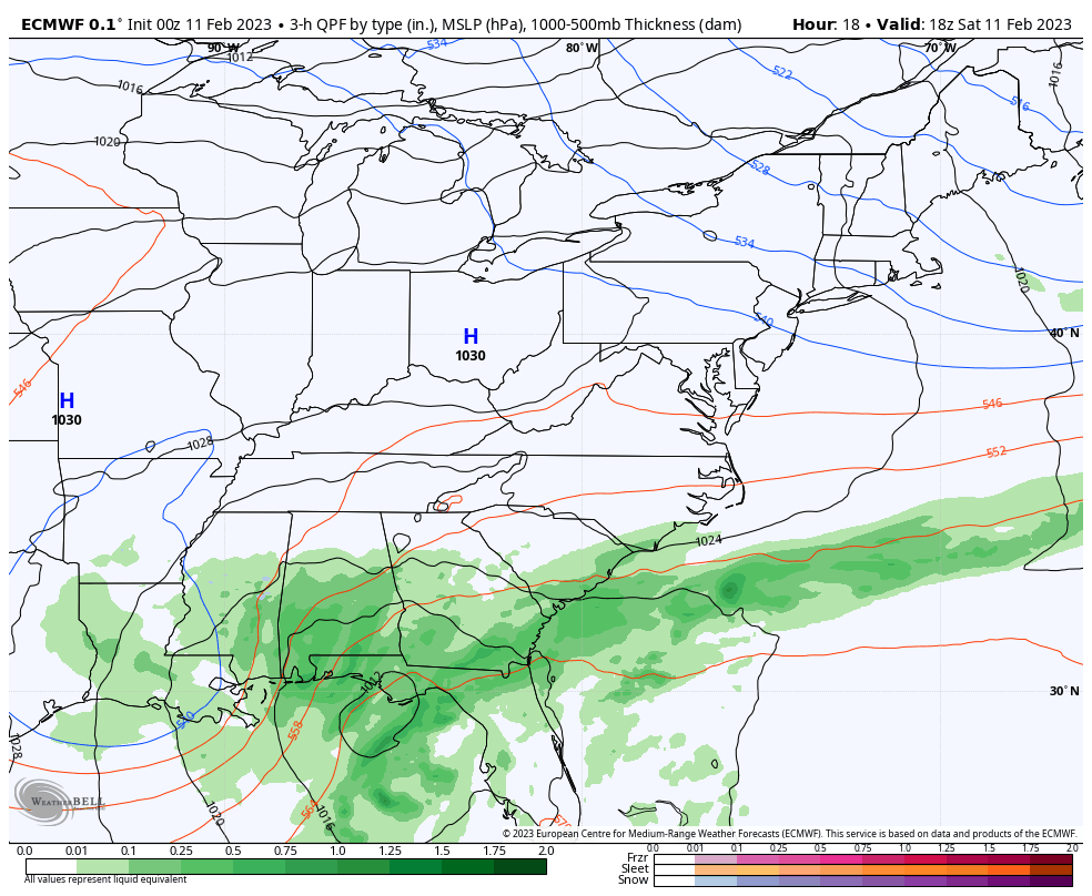
ECMWF Model: Saturday Afternoon to Monday Morning
This model continues to keep this the farther south, and I think like last week it is wrong with the northern edge. It does however, show that this will move off the coast Monday morning.
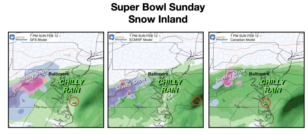
Model Comparison: Sunday Night
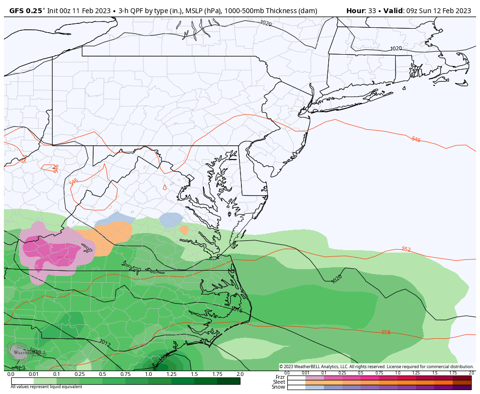
- The GFS Model is the coldest and has slushy snow as close as Carroll County, MD.
- The European barely brings the rain into Baltimore.
- The Canadian GEM brings the cold rain farthest north into southern PA.
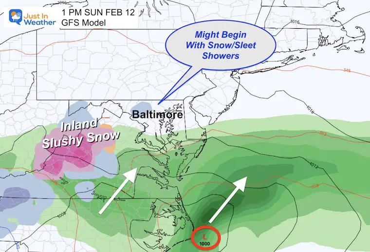
GFS Model
This does suggests the leading edge may produce some light snow or sleet. NOT A TRAVEL IMPACT, but worth a mention.
Storm Animation:
Then some slushy snow could mix in during the evening or at night as close as the western suburbs of Baltimore.
Temperatures Lacking Cold Air
The freezing temps remain restricted to the high mountains.
Morning
Afternoon
Chilly with the rainfall.
NOTES:
I am formally acknowledging that my anticipation for slushy snow was beyond expectations. Many will simply say I was wrong and I get that. I still see the benefit of sharing the model plots that have been wrong, especially when they showed us a dry weekend and I kept the storm in play for us.
This has been a very challenging winter with the rare lack of cold air and snow. This was our one shot for another week at least. While I have plans on Sunday this would have negative affected, I feel the void with the season not behaving.
If we are to get any wintry weather, it will not be until Presidents week or into March, when it becomes harder but not impossible. The weather pattern will change, and I am growing more concerned that may mean a cooler spring.
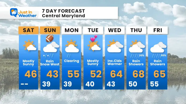
7 Day Forecast
Sunday is still our blip, then we have another pre-spring week ahead.
It could end up warmer if the rain holds off at the end of the week.
Also See:
Winter History: Low Snow And Late Starts
See my research based on Baltimore data since 1883.

Subscribe for eMail Alerts
STEM Assemblies/In School Fields Trips Are Back
Click to see more and ‘Book’ a visit to your school

My Winter Outlook: Not A Typical La Niña!
I see many factors to support colder influence with multiple systems. Early and later in winter. Check it out.
https://justinweather.com/2022/11/22/winter-outlook-2023-for-snow-not-typical-la-nina-plus-polar-vortex-disruption/
Also See The Winter Outlook Series:
https://justinweather.com/2022/11/20/atmospheric-memory-suggests-active-winter-storm-pattern-outlook/
Winter Outlook 2023 La Niña Triple Dip Expectations
Farmer’s Almanac Comparison
September Starts Meteorological Autumn: Weather Climate Stats For Maryland at Baltimore
Triple Dip La Niña Winter
https://justinweather.com/2022/09/09/winter-outlook-2023-la-nina-triple-dip-expectations/
CONNECTION TO WINTER?
If you want a snowy winter, this is what you might want to look for in the rest of the tropical season.
Rainbow Ice Cave In Mt. Rainier A Very Rare Find: Photos And Video
Wooly Bear Caterpillars
https://justinweather.com/2022/10/25/winter-weather-outlook-from-the-wooly-bear-caterpillar/
Persimmon Seeds
Winter Weather Outlook: Persimmon Seeds And Snow Folklore
Click to see Top 20 and MORE
https://justinweather.com/2022/10/28/winter-weather-folklore-top-20-and-more-outlook-signals-from-nature-for-cold-and-snow/
Normals And Records: Maryland and Baltimore Climate History

Please share your thoughts, best weather pics/videos, or just keep in touch via social media


