February 10, 2023
Friday Morning
At this point all we can do is watch the unusual winter and point out the errors in computer models to try and anticipate a better idea of what is next. Then again, we can also reminisce about past winters, such as the record snow storm on this date.
I want to start with yesterday. Baltimore’s BWI hit 68ºF (warmer than the rest of central Maryland), but just 1 degree short of the record.
That mild air remained past midnight. The high temperature has already been hit today. A cold front will slowly cool us while we remain above average.
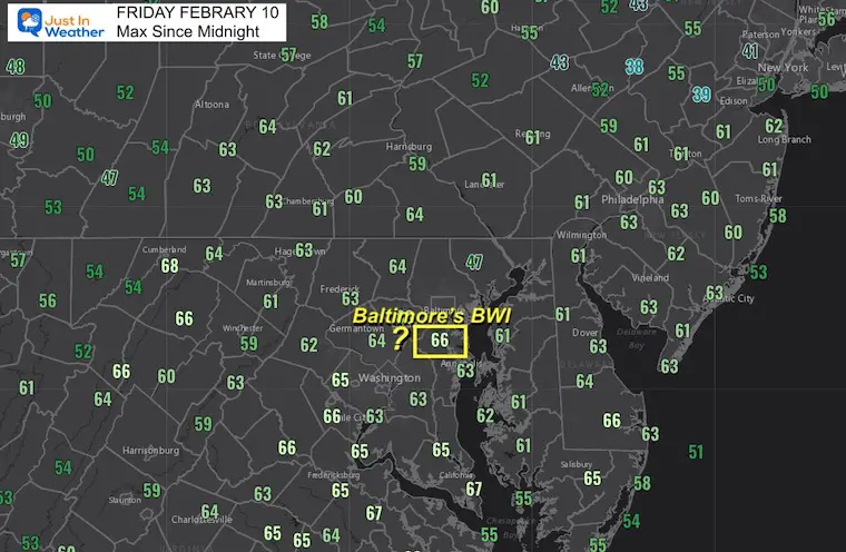
High Temperatures Since Midnight
This product shows 66ºF at Baltimore BWI, however the RAW OBSERVATIONS showed it happened briefly at 1:35 AM. Why is this important? Because the record on this date was 66ºF set in 1960. So we may have tied the mark today.
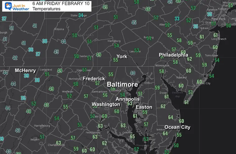
Morning Temperatures At 6 AM
We are cooling down, but still warmer than an average afternoon on this date.
Headlines
- Today: Warm, Cooler Breeze
- Weekend Cooler
- Sunday: Colder Rain/Edge Of Slushy Snow?
- Next Week: Warm Again
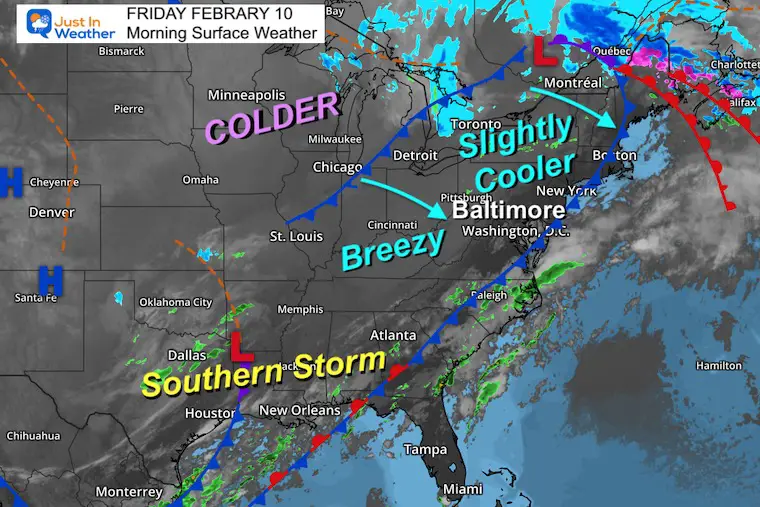
Morning Surface Weather
A weak cold front has moved through and winds have been shifting to a colder direction. We will get back closer to ‘normal’ this weekend as we watch that Southern Storm develop.
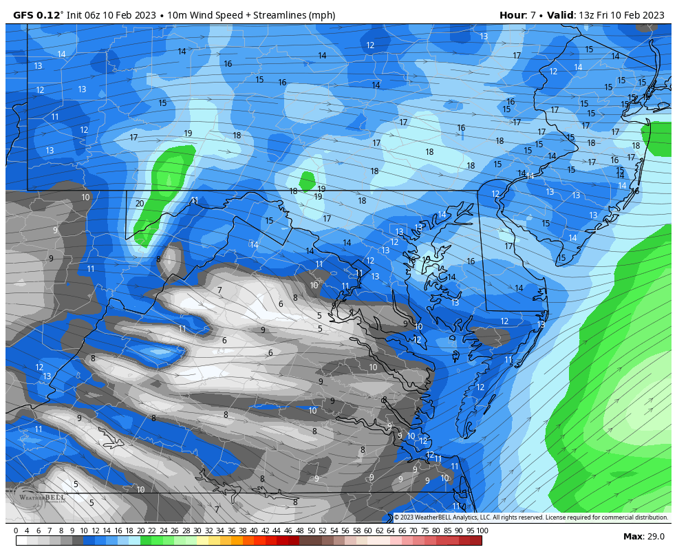
Wind Forecast
Animation 8 AM to 8 PM
Northwest Winds will be 15 to 25 mph. Some gusts over 30 mph.
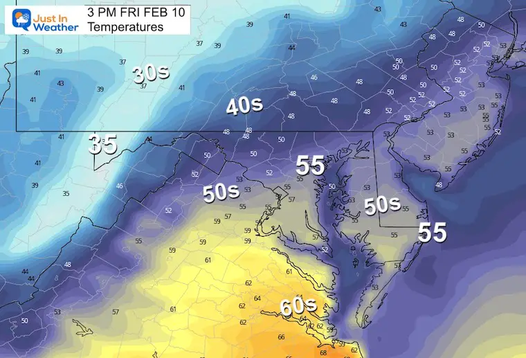
Afternoon Temperatures
Very mild, and often we see numbers warmer than the models suggest.
Subscribe for eMail Alerts
CLIMATE DATA
TODAY February 10
Normal Low in Baltimore: 26ºF
Record -7ºF in 1899
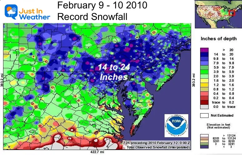
SNOW: 15.5” 2010
Normal High in Baltimore: 45ºF
Record 66ºF 1960
Climate History
On this date in 2010 – The SECOND of TWO BLIZZARDS in 5 days hit our region. Baltimore at BWI officially measured 15.5 inches of snow on this date!
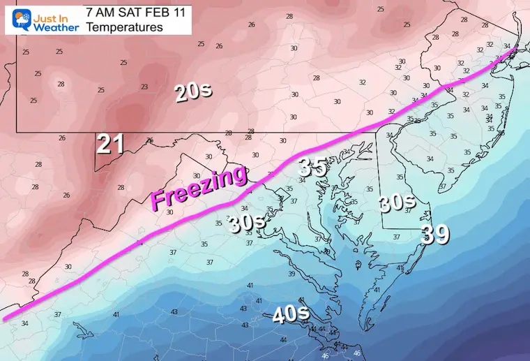
Saturday Weather Morning Temperatures
A little taste of winter… Ever so briefly!
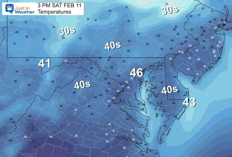
Afternoon Temperatures
This is more in line with seasonal norms.
Jet Stream Animation 7 AM SAT to 7 PM
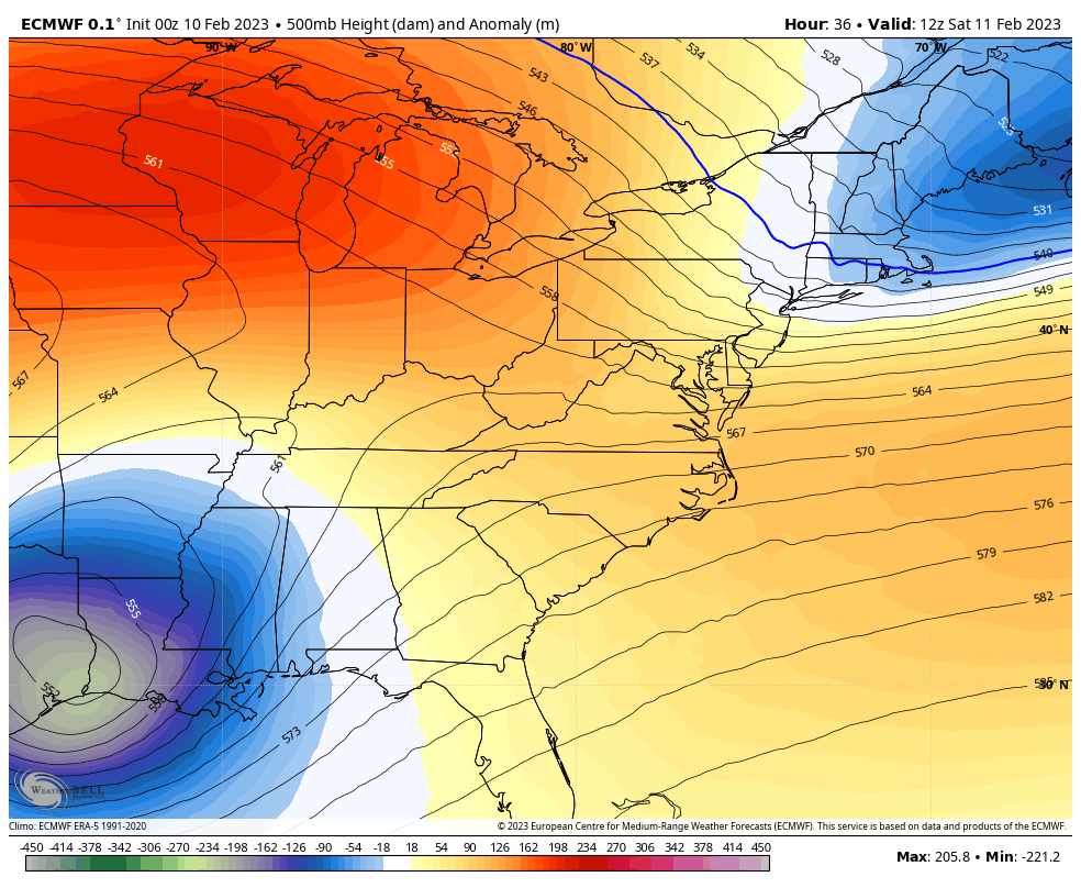
The closed Low crosses the Carolinas, and barely scrapes Maryland. The issue is still about any model error, as we have seen all winter. If this verifies a little farther north, then that colder air will play more of a role mixing in slushy snow.
It’s a BIG IF going against the model guidance. The word SNOW on Super Bowl has kept my attention. I want to reiterate that IF this does happen, temps remain above freezing so stickage would be slushy and brief at best.
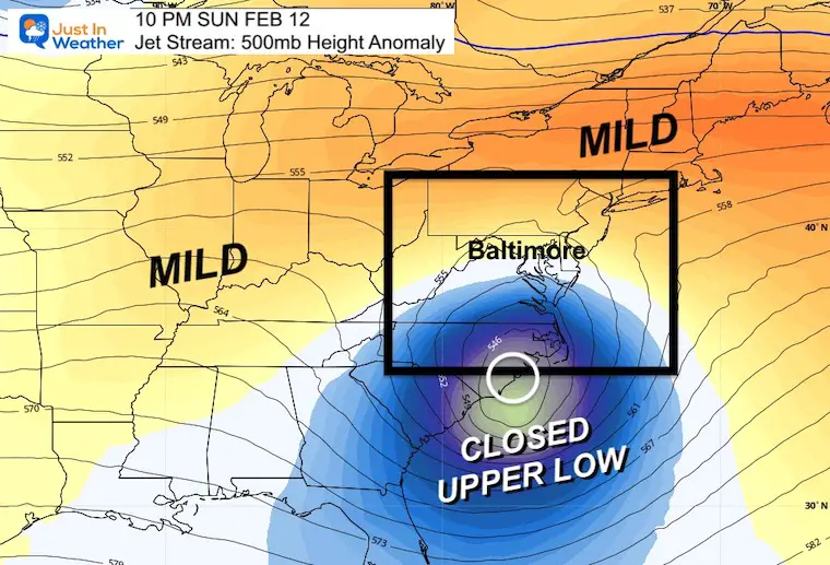
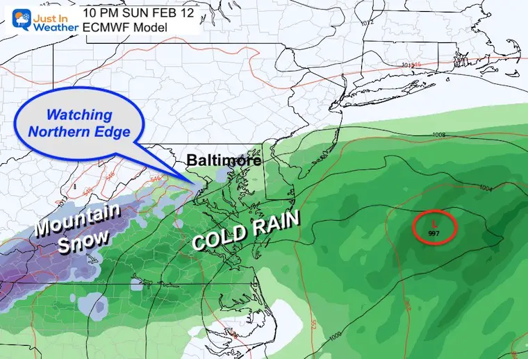
Blip Of Winter On Sunday
This tight core cold circulation is the reason we are talking about a coastal storm. The specific location is the make or break for who will be impacted by this coastal storm.
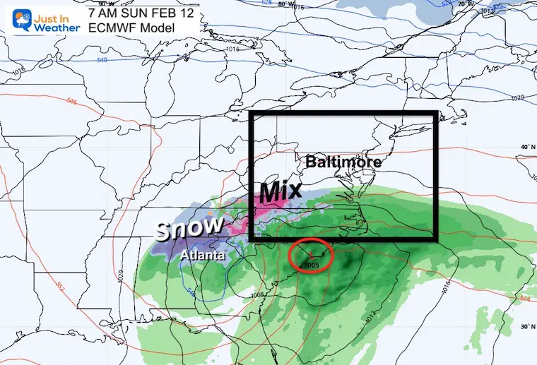
Snapshot Sunday Morning
The ECMWF Model has kept this just to the south. The surprise here is that it now produces snow near and just north of Atlanta, GA in the morning. The mountains of the Carolinas to Virginia hold the forecast line. The rest is still debatable.
Storm Track: ECMWF Model
7 AM Sun to 1 PM Mon
This tight spin has been showing a cut off across central Maryland. This has the cold pocket of air just west and south.
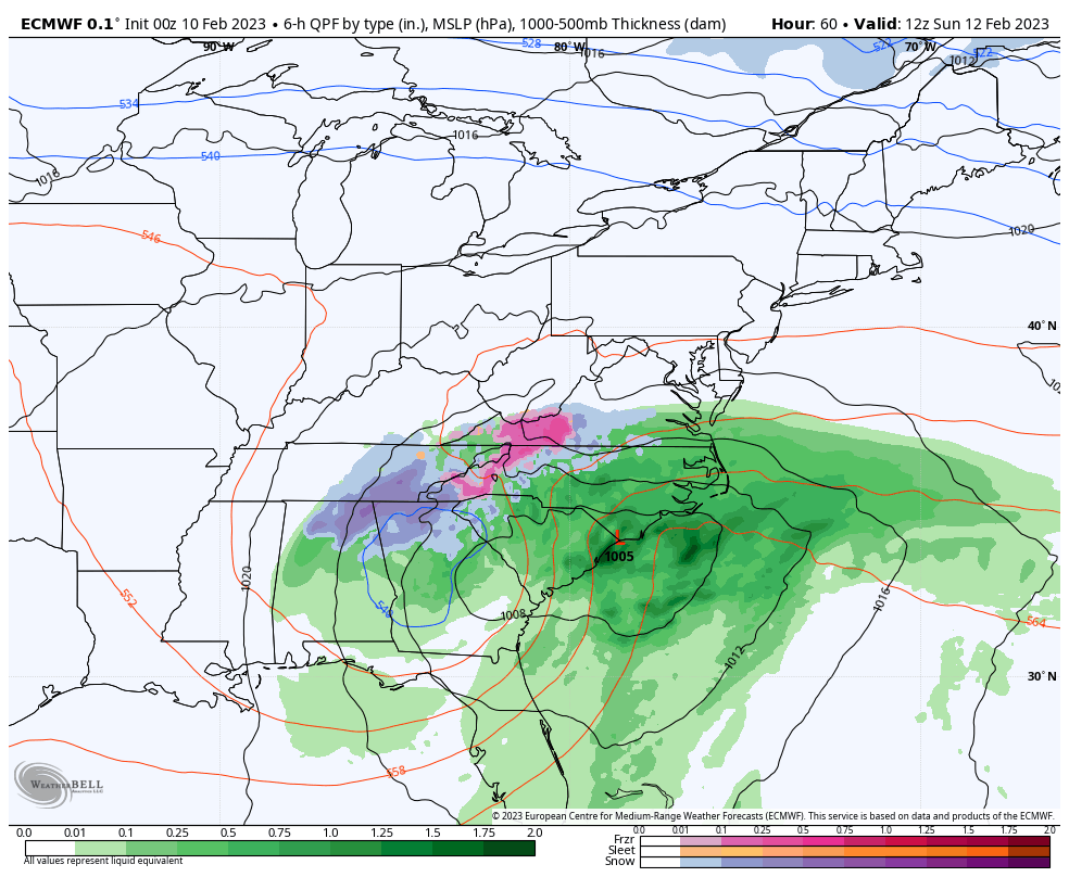
Snap Shot Sunday Night
Using this scenario: Southern Maryland gets a chilly rain, perhaps with some flakes mixed in near Annapolis (not sticking), but northern Maryland and Southern PA dry.
NOTES:
The reason I ask to keep an open mind is based on the model error. We are 60 hours away from Sunday night and I still suspect a shift north from what models are showing now.
Consider this: If models have done this with a few potential snow events that failed to materialize, it is possible to bring a southern system farther north into our region and catch the colder air.
Temps will be above freezing, so if it happens it would be slushy and brief at best.
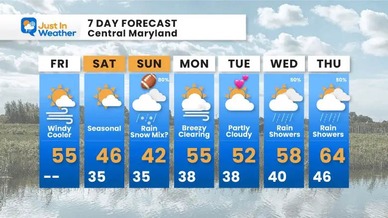
7 Day Forecast
We still have the blip on Sunday, then warm again next week.
Also See:
Winter History: Low Snow And Late Starts
See my research based on Baltimore data since 1883.

Subscribe for eMail Alerts
STEM Assemblies/In School Fields Trips Are Back
Click to see more and ‘Book’ a visit to your school

My Winter Outlook: Not A Typical La Niña!
I see many factors to support colder influence with multiple systems. Early and later in winter. Check it out.
https://justinweather.com/2022/11/22/winter-outlook-2023-for-snow-not-typical-la-nina-plus-polar-vortex-disruption/
Also See The Winter Outlook Series:
https://justinweather.com/2022/11/20/atmospheric-memory-suggests-active-winter-storm-pattern-outlook/
Winter Outlook 2023 From NOAA Very Different Than Farmers Almanacs
Farmer’s Almanac Comparison
Winter Outlook 2023 Early Look At Snow From Two Farmers Almanacs
Triple Dip La Niña Winter
https://justinweather.com/2022/09/09/winter-outlook-2023-la-nina-triple-dip-expectations/
CONNECTION TO WINTER?
If you want a snowy winter, this is what you might want to look for in the rest of the tropical season.
Record August For No Named Tropical Storms: Closer Look At Snow Following
Wooly Bear Caterpillars
Winter Weather Outlook From The Wooly Bear Caterpillar
Persimmon Seeds
Winter Weather Outlook: Persimmon Seeds And Snow Folklore
Click to see Top 20 and MORE
Winter Weather Folklore Top 20 And More Outlook Signals From Nature For Cold And Snow
Normals And Records: Maryland and Baltimore Climate History

Please share your thoughts, best weather pics/videos, or just keep in touch via social media


