February 9, 2023
Thursday Morning
This warm weather pattern has reinforced the notion to keep an open mind with our computer guidance. Yesterday was expected to be nice day, and the temperature in Baltimore surged to 65ºF, much higher than expected. As nice as it was, the record was 72ºF, so we didn’t get there.
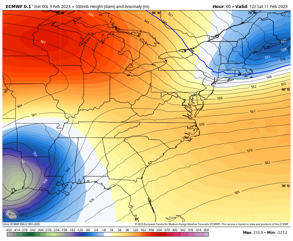
While we have not hit a record, the string of warm days continues to be unusual and will continue into next week. This weekend will be a wrinkle, highlighted by the wintry blip on Super Bowl Sunday. The models have shifted farther north again, and I still think the guidance is having trouble identifying this.
Headlines
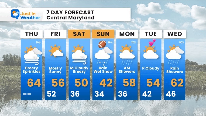
- Today: Warm and Windy
- Weekend Cooler
- Sunday: Colder Rain Mixing With Wet Snow In The Evening
- Next Week: Warm Again
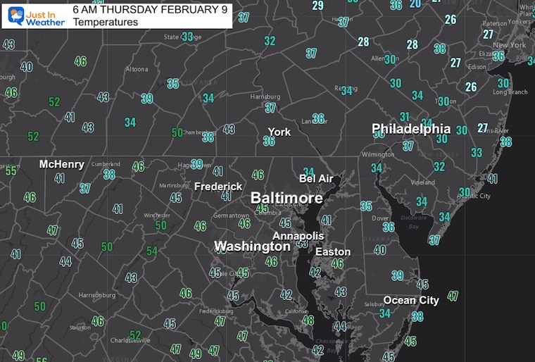
Morning Temperatures
Starting the day quite mild already.
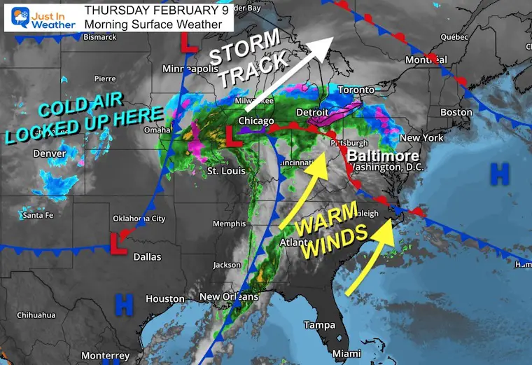
Morning Surface Weather
Atmospheric Memory on display. The winter storm track remains locked well to our west. That is allowing us to pump in the warmer air.
Rain showers have passed to our north this morning. The focus for the day will be the increasing wind.
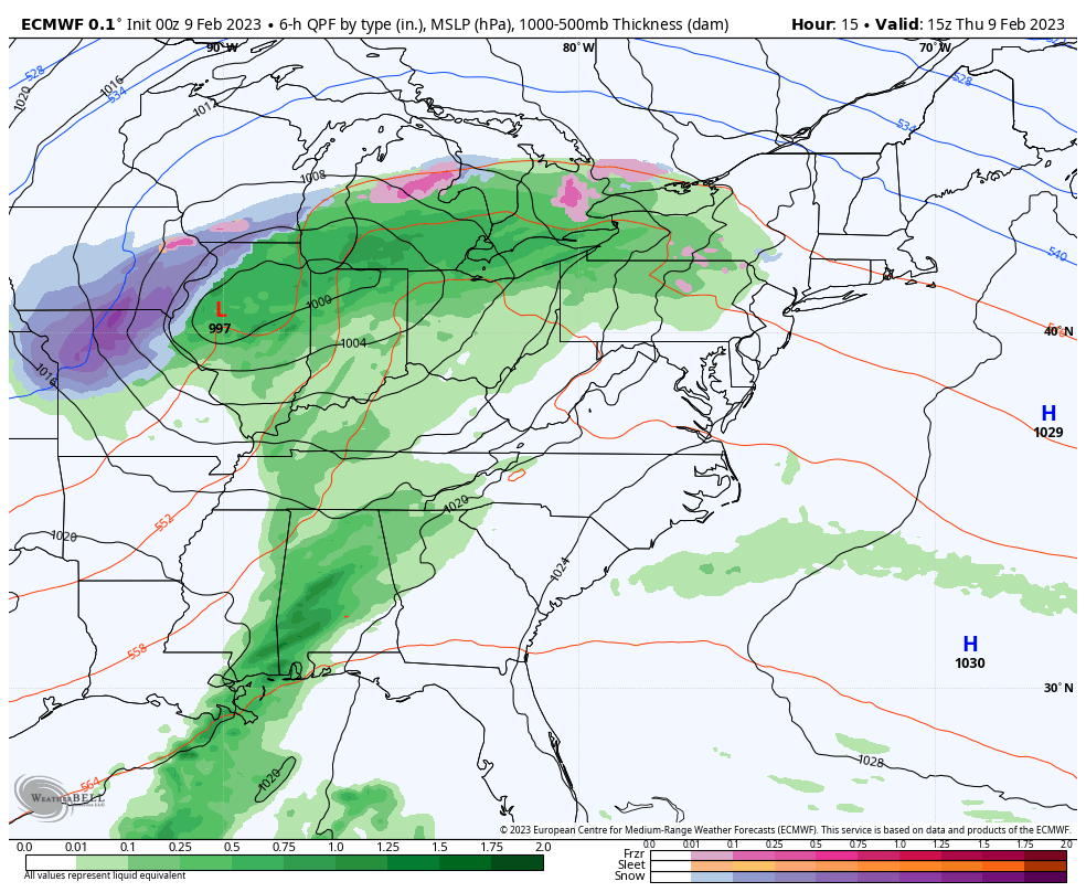
Storm Animation 10 AM to Friday 7 PM
The storm track hits the Great Lakes AGAIN. We miss most of the precipitation, but get the wind and a slight cool down as we clear out tomorrow.
Wind Forecast
Animation 8 AM to 8 PM
Winds will be increasing from the South!
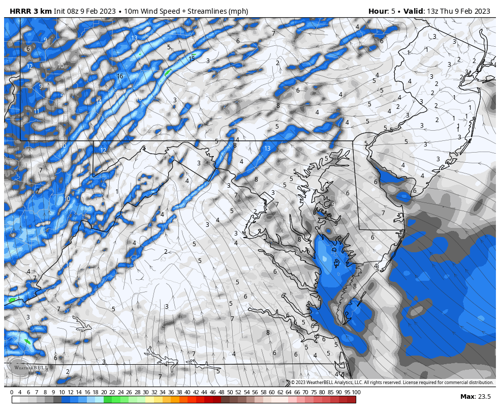
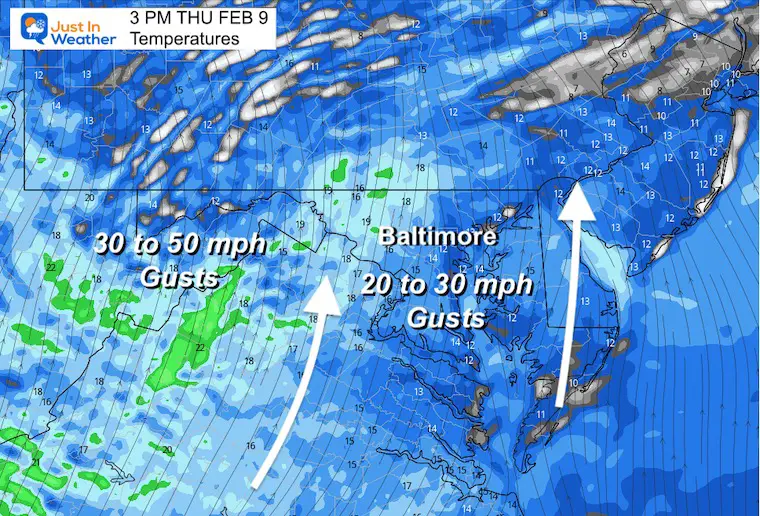
Snapshot
Steady winds will push 20 mph or higher, but the gusts will hit 30 mph in central Maryland. A Wind Advisory has been issued for the mountains where gusts could reach 50 mph.
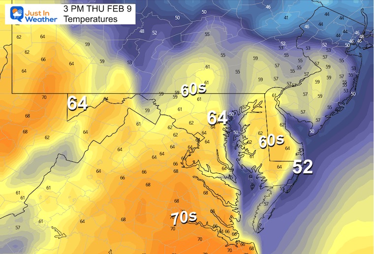
Afternoon Temperatures
Very mild, and often we see numbers warmer than the models suggest.
Subscribe for eMail Alerts
CLIMATE DATA
TODAY February 9
Normal Low in Baltimore: 26ºF
Record -7ºF in 1934
SNOW: 5.0” 1936
Normal High in Baltimore: 45ºF
Record 69ºF 2001
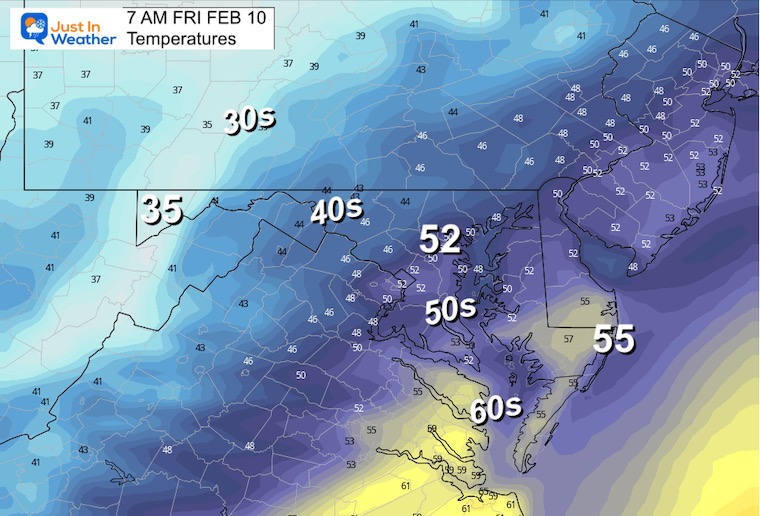
Friday Weather Morning Temperatures
Starting the day even milder. It may feel like spring.
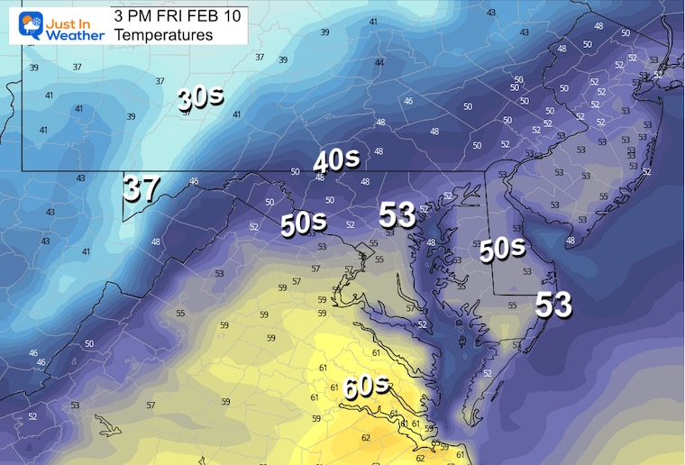
Afternoon Temperatures
Still mild, but not as warm as the past few days. The sunshine will help it feel warmer.
Blip Of Winter On Sunday
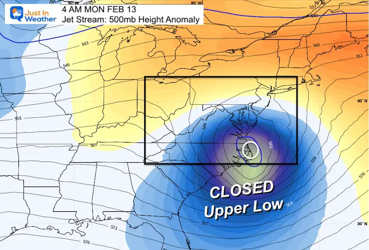
Jet Stream Animation 7 AM SAT to 7 AM MON
This system is all based on a closed Low Pressure in the jet stream that will be passing to our south.
Snapshot 1 AM Monday
The ECMWF Model has shifted North and slowed down. This position puts it closer to us, which supports the cold rain generating its own cold air Sunday evening and night.
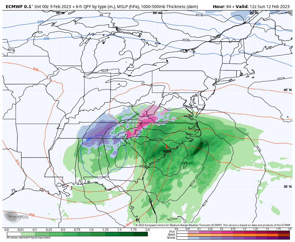
Storm Track: ECMWF Model
7 AM Sun to 4 PM Mon
This will be a tight spin and still open to debate. The entire point is dynamic cooling as it will generate its own cold air. This is more likely inland, but the intensity and track still has the potential to drop a brief heavy wet snow.
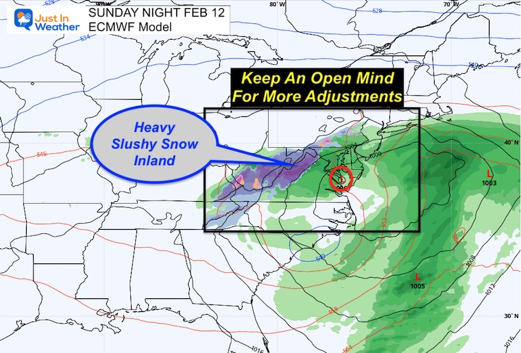
Snap Shot Sunday Night
Inland slushy snow is likely. There is still a chance in central Maryland. Temperatures will be above freezing, so stickage will be limited to the mountains and where heavier pockets of snow can overwhelm the warm ground. If that happens, snow can stick when falling heavily, then melt as soon as it stops.
NOTES:
Once again, this will be on Super Bowl Sunday, so pay attention for updates on impact for travel. Temps will be near freezing, but roads likely to remain warm. A heavy wet snow can lead to slush on roads if intense enough. The timing in the evening does support that as a legitimate chance.
Dynamic Cooling
This is a term you may hear about through this weekend. The location of that Upper Level Low is very important as it will help the storm generate its own cold air. This will happen under the cold pocket aloft by both enhancing precipitation AND that precipitation drawing colder air down to the surface.
In cases like this, rain can change to snow, where it is heavier! Then back to rain as it lightens up.
The dynamic cooling is during the process of forming heavy pockets of precipitation.
7 Day Forecast
The pattern will continue to be warmer than average through next week. Our shot of winter is only Sunday evening and night.
Also See:
Winter History: Low Snow And Late Starts
See my research based on Baltimore data since 1883.

Subscribe for eMail Alerts
STEM Assemblies/In School Fields Trips Are Back
Click to see more and ‘Book’ a visit to your school

My Winter Outlook: Not A Typical La Niña!
I see many factors to support colder influence with multiple systems. Early and later in winter. Check it out.
https://justinweather.com/2022/11/22/winter-outlook-2023-for-snow-not-typical-la-nina-plus-polar-vortex-disruption/
Also See The Winter Outlook Series:
https://justinweather.com/2022/11/20/atmospheric-memory-suggests-active-winter-storm-pattern-outlook/
Winter Outlook 2023 From NOAA Very Different Than Farmers Almanacs
Farmer’s Almanac Comparison
Winter Outlook 2023 Early Look At Snow From Two Farmers Almanacs
Triple Dip La Niña Winter
https://justinweather.com/2022/09/09/winter-outlook-2023-la-nina-triple-dip-expectations/
CONNECTION TO WINTER?
If you want a snowy winter, this is what you might want to look for in the rest of the tropical season.
Record August For No Named Tropical Storms: Closer Look At Snow Following
Wooly Bear Caterpillars
Winter Weather Outlook From The Wooly Bear Caterpillar
Persimmon Seeds
Winter Weather Outlook: Persimmon Seeds And Snow Folklore
Click to see Top 20 and MORE
Winter Weather Folklore Top 20 And More Outlook Signals From Nature For Cold And Snow
Normals And Records: Maryland and Baltimore Climate History

Please share your thoughts, best weather pics/videos, or just keep in touch via social media


