August 22 2022
Monday Morning Update
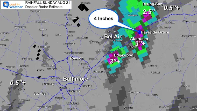
The title of this report may be deceiving, but not for all. Yes, we have ‘another’ stormy day, meaning we have already had storms… Many areas in our region continue to miss out, but those that got hit were hit hard! This was especially true in Harford and Cecil Counties in Northeastern Maryland where 2 to 4 inches of rain fell, and flooding continues along Philadelphia Road this morning.
Below is a look at the rainfall estimated totals, morning radar snapshot showing the redevelopment at sunrise, and Live Radar to keep tracking. Compare this to the simulation for more storms to develop late this afternoon and evening.
Rainfall Recap (as of 6 AM)
We are still adding to this…
Rainfall was concentrated in coastal Harford and Cecil Counties where 2 to over 4 inches of rain fell. Just a few miles west in Baltimore and it was quiet.
Aberdeen and Havre de Grace were the rain winners!
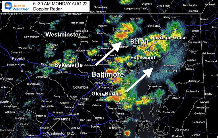
Doppler Radar Snapshot at 6:30 AM
Low Pressure over central Maryland has helped this early morning development of rain showers and downpours!
This cluster should move through by 8 or 9 AM. Then we get a break with more pop up showers around midday and widespread storms between 4 PM and 10 PM.
Live Radar/Lightning Widget
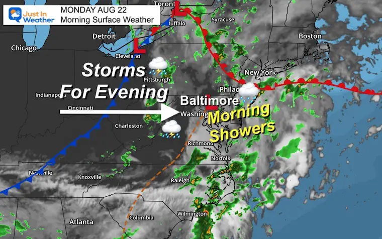
Morning Surface Weather
A mesoscale Low Pressure is passing through central Maryland enhancing the rain and storm development this morning.
The air is very humid and ripe for more storms later today through this evening.
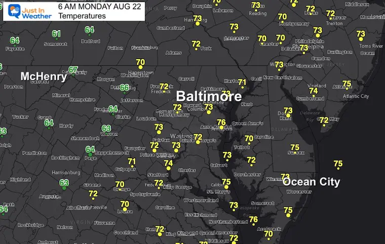
Morning Temperatures
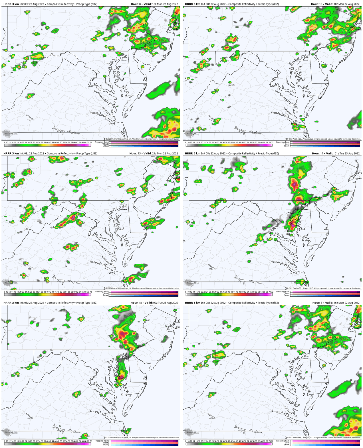
HRRR Model Animation
12 PM to 10 PM
We can see more storms developing this afternoon and a firm line by evening.
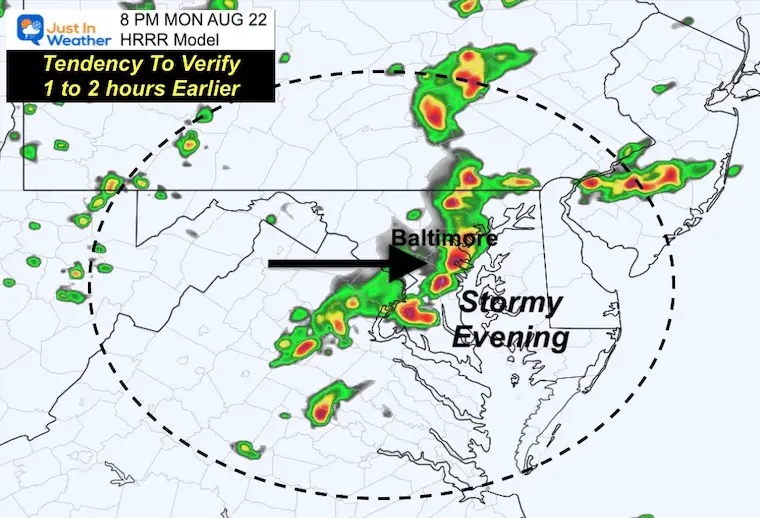
Snapshot at 8 PM
I wanted to highlight that the short range modeling has been underplaying storms by timing and intensity. It is possible we end up with this line 1 to 2 hours earlier than shown, AND storms covering a wider net than shown here.
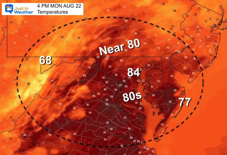
Afternoon Temperatures
CLIMATE DATA
TODAY August 22
Normal Low in Baltimore: 65ºF
Record 52ºF in 1956
Normal High in Baltimore: 86ºF
Record 99ºF 1883
Weather posts straight to your inbox
Sign up and be the first to know!
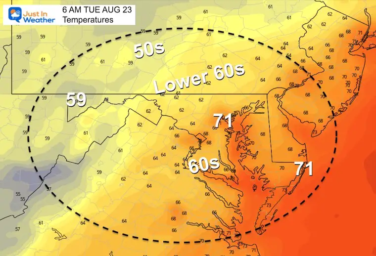
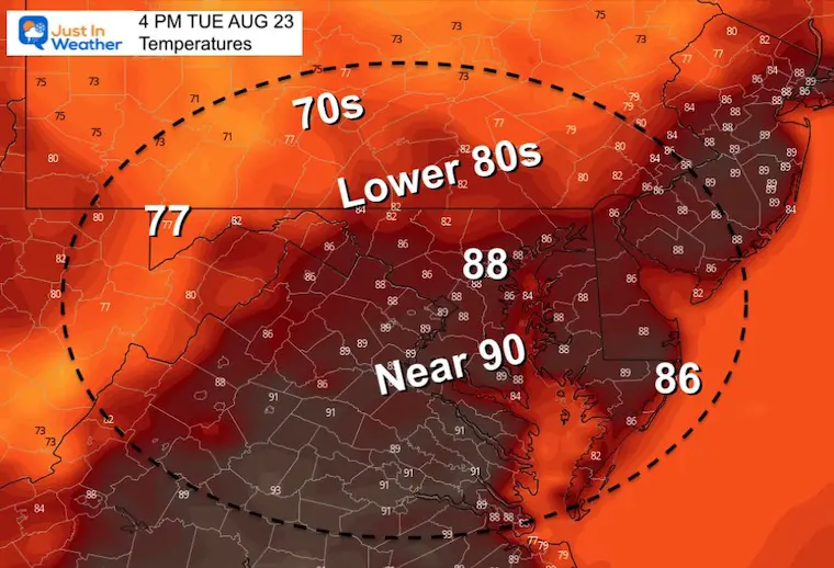
Tuesday Temperatures
Morning
Afternoon
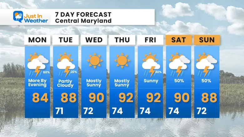
7 Day Forecast
Cancer Can Succit- THE SHIRT
By Popular Demand and Supporting Just In Power Kids
This is the shirt that Power Kid James and his family has embraced… They even surprised us with this sign during our Kids Trek Too event.
It is now available!
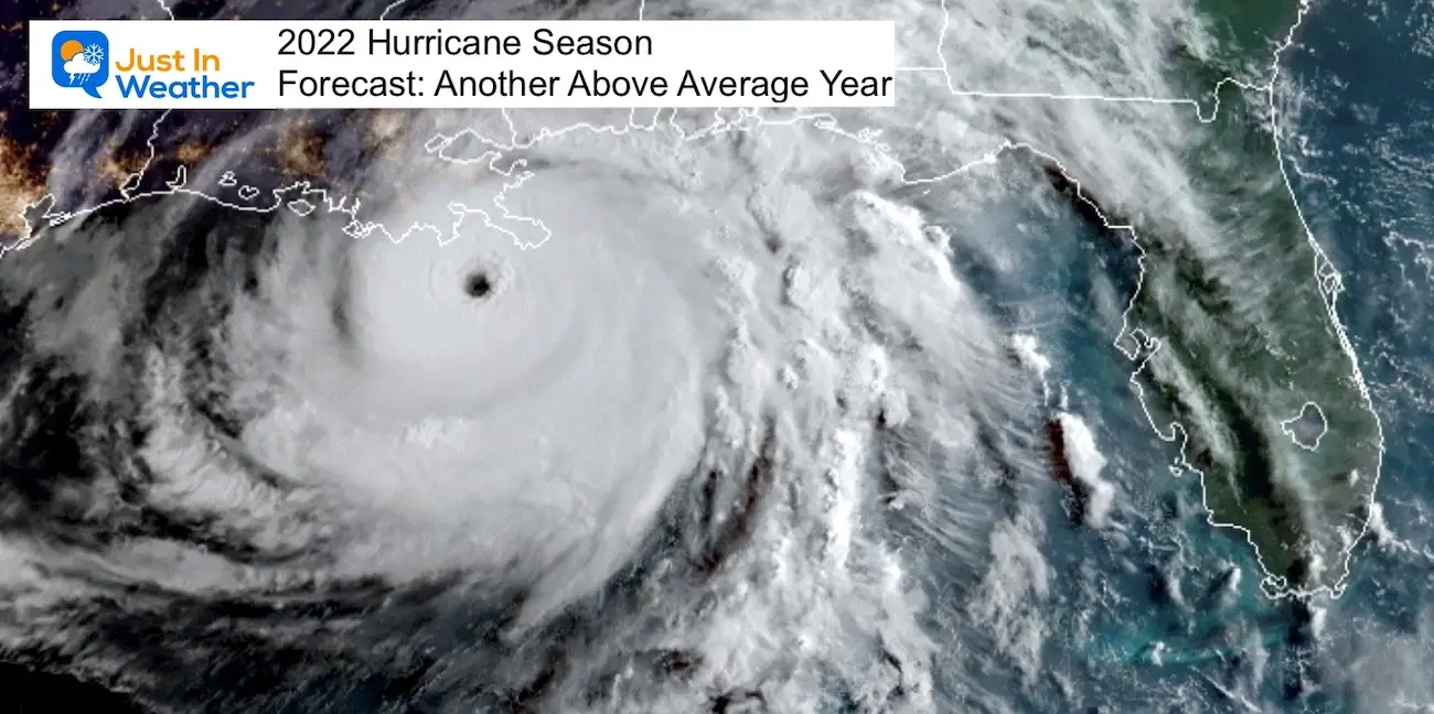
Hurricane Season Forecast: June 1 Through November 30
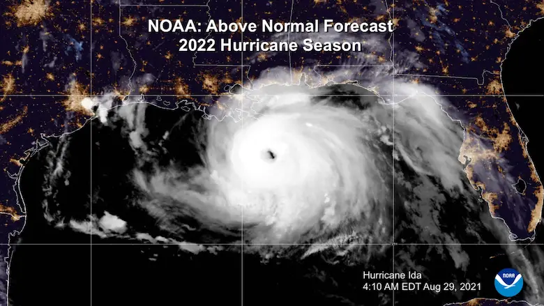
NOAA 2022 Hurricane Forecast- Above Normal Again
Forecast From Colorado State University
Related Posts
NOAA Study: Reducing Air Pollution INCREASED Tropical Storms
Atlantic Tropical History: Maps of Origin Regions Every 10 Days
Recent Storm Reports
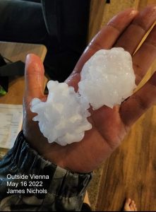
May 16 Large Hail Videos And Storm Tracking Map
Please share your thoughts, best weather pics/videos, or just keep in touch via social media
Facebook: Justin Berk, Meteorologist
Twitter: @JustinWeather
Instagram: justinweather
Connect With A Health Coach
From My Maryland Trek Team
Click the image or here for more info
*Disclaimer due to frequent questions:
I am aware there are some spelling and grammar typos. I have made a few public statements over the years, but if you are new here you may have missed it:
I have dyslexia, and found out at my second year at Cornell. It didn’t stop me from getting my meteorology degree, and being first to get the AMS CBM in the Baltimore/Washington region.
I do miss mistakes in my own proofreading. The autocorrect spell check on my computer sometimes does an injustice to make it worse.
All of the maps and information are accurate. The ‘wordy’ stuff can get sticky.
There is no editor that can check my work when I need it and have it ready to send out in a newsworthy timeline.
I accept this and perhaps proves what you read is really from me…
It’s part of my charm.


