July 25 Severe Storm Risk Today Then We Break The Heat Wave
July 25 2022
Monday Morning Update
We are about the break the heat wave. While there has been extreme weather from record heat in London to the wild fires in California, we have escaped the worst of it. No records were even challenged locally. Yesterday’s high temperature at Baltimore’s BWI was 97ºF, which was well below the 101ºF record and a notch lower than the day before.
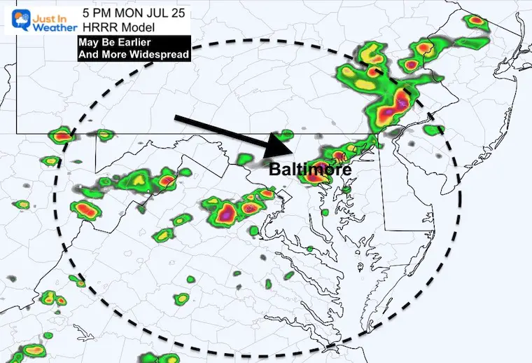
The forecast was also lower than the computer model guidance, with is important to note: I will show some model simulations below, but we have often seen storms erupt earlier and more widespread than displayed.
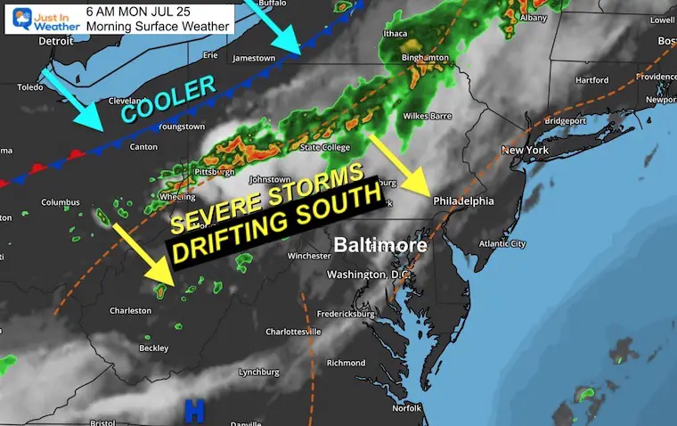
Today we have a severe storm risk, and we might see the flare up earlier than the models have shown… I will explain below.
NOAA Severe Storm Outlook
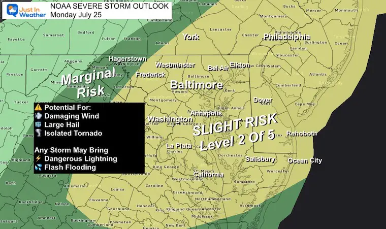
Potential For:
- Damaging Wind
- Large Hail
- Isolated Tornado
Any Storm May Bring
- Dangerous Lightning
- Flash Flooding
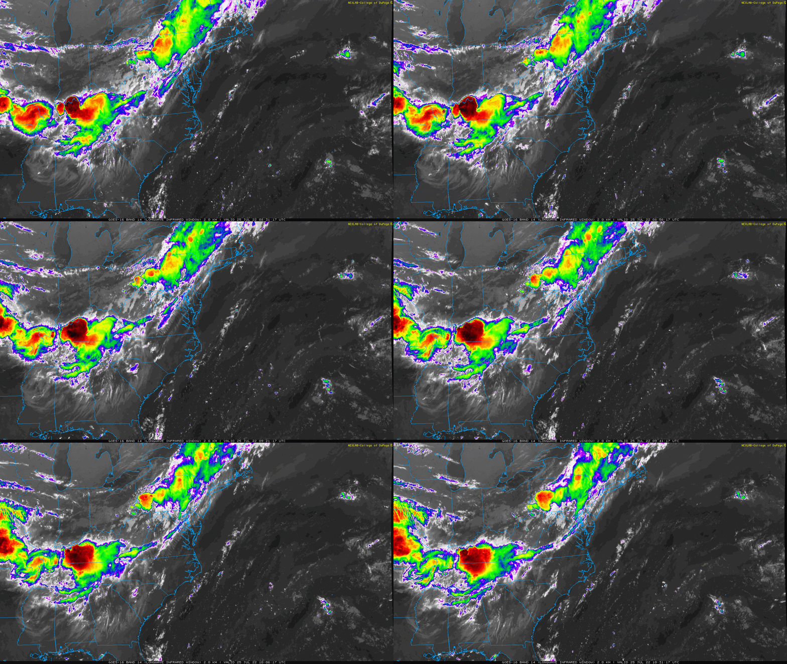
This Morning
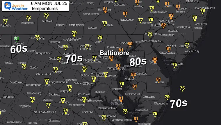
Morning Temperatures
Satellite Loop 5:30 AM to 7:30 AM
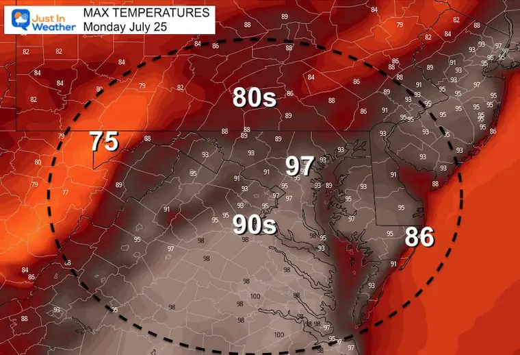
Afternoon Temperatures
Note that the record at BWI was set in 2010. The models have it getting close, and if it is reached it is likely to happen between 3 PM and 5 PM.
Afternoon Storms
This is the HRRR Model Suggestion for a line moving through metro areas/I-95 around 5 PM.
Consider storms any time after 3 PM
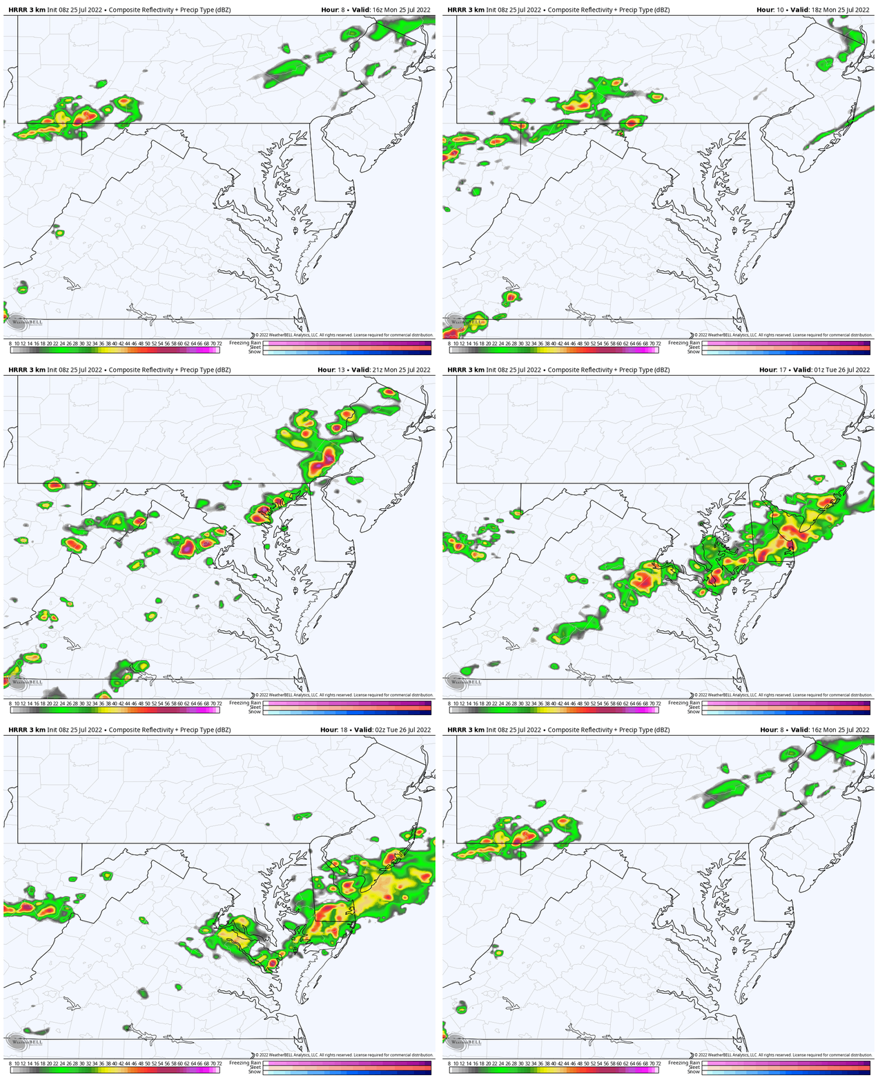
Radar Simulation Noon to 10 PM
This will enhance as it passes south through central potations of The Bay and Southern Maryland to the beaches by evening.
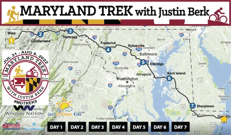
NOTICE: Maryland Trek 9 Begins 6 Days From Today!
I will continue to post weather daily, but my attention will be shifting next week:
My all volunteer team will be hiking and biking 329 from the summit of Wisp to Ocean City in 7 days. We will be sharing the stories of kids in and post cancer treatment and need your support!
This includes donation (100% goes to programs at Just In Power Kids)
Simply Follow Posts on Facebook with a Like, Comment, and or share.
(click the images for info on the event)
CLIMATE DATA
TODAY July 24th
Normal Low in Baltimore: 67ºF
Record 57ºF in 2014
Normal High in Baltimore: 88ºF
Record 100ºF 2016
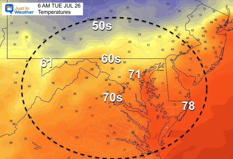
Tuesday Temperatures
Morning
Afternoon
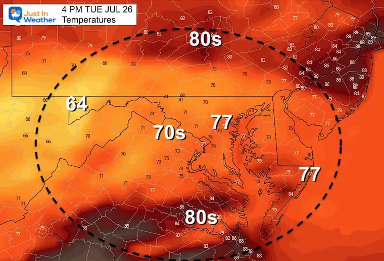
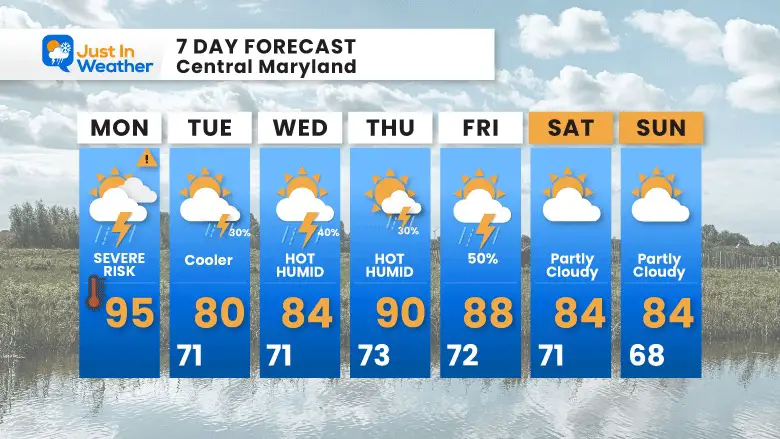
The cold front is expected to stall.. Here we see the reflection of the GFS Model trying to keep us cloudy and hold temps in the 70s. I modified this a little on the 7-day forecast.
Looking Ahead
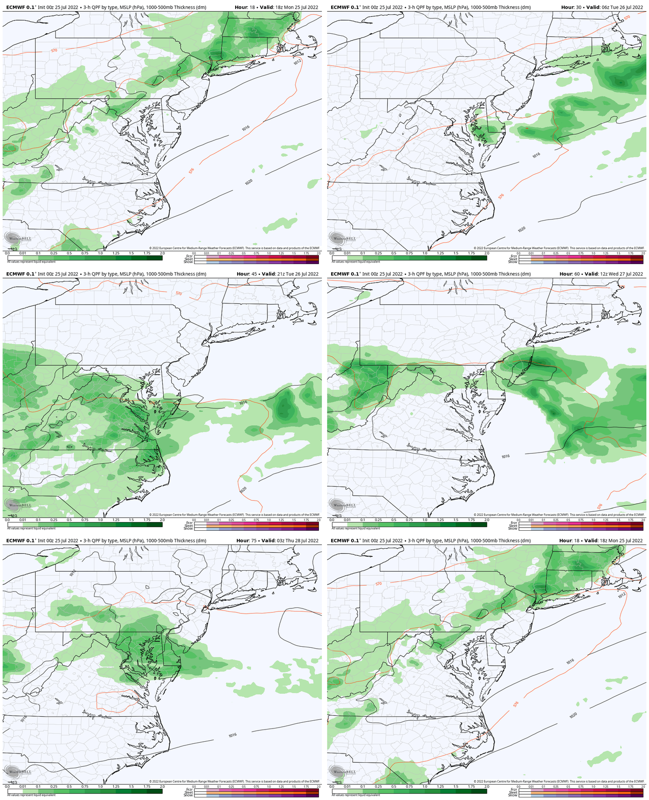
ECMWF Model Though 10 PM Wednesday
The cold front is expected to stall in our region during the week. That will keep the uncertainty of clouds and showers each day.. So please allow a buffer for any particular day in the week ahead…. The focus for showers and storms could shift a little closer or farther from your location on any day….
7 Day Forecast
Recent Storm Reports:
Last Monday
July 12
Was there a tornado? Here are my reports.
Still no formal statement from The National Weather Service
July 12 Severe Storm Radar Scans: Was There A Tornado Or Not?
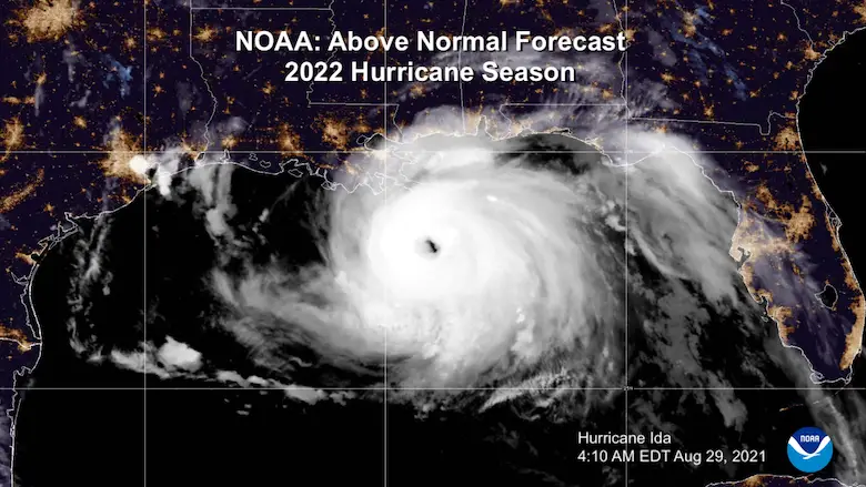
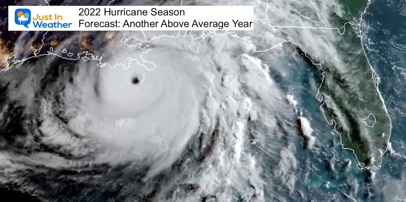
Hurricane Season Forecast: June 1 Through November 30
NOAA 2022 Hurricane Forecast- Above Normal Again
Forecast From Colorado State University
Related Posts
NOAA Study: Reducing Air Pollution INCREASED Tropical Storms
Atlantic Tropical History: Maps of Origin Regions Every 10 Days
Recent Storm Reports
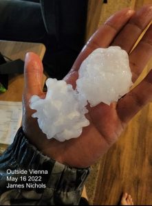
May 16 Large Hail Videos And Storm Tracking Map
Please share your thoughts, best weather pics/video, or just keep in touch via social media
Facebook: Justin Berk, Meteorologist
Twitter: @JustinWeather
Instagram: justinweather
*Disclaimer due to frequent questions:
I am aware there are some spelling and grammar typos. I have made a few public statements over the years, but if you are new here you may have missed it:
I have dyslexia, and found out at my second year at Cornell. I didn’t stop me from getting my meteorology degree, and being first to get the AMS CBM in the Baltimore/Washington region.
I do miss my mistakes in my own proofreading. The autocorrect spell check on my computer sometimes does an injustice to make it worse.
All of the maps and information are accurate. The ‘wordy’ stuff can get sticky.
There is no editor that can check my work when I need it and have it ready to send out in a newsworthy timeline.
I accept this and perhaps proves what you read is really from me…
It’s part of my charm.


