Thursday Evening July 7 Update
If you have plans this weekend, you may already be away of the expected rainfall. This is another slow moving frontal boundary with Low Pressure riding along it. That enhances the rain and can slow down the movement.
I want to emphasize that word ‘potential’ I put in the title for the timeline. I know some LOVE to look at the computer model guidance for rainfall but they are not perfect. That is my caveat to allow for some adjustment.
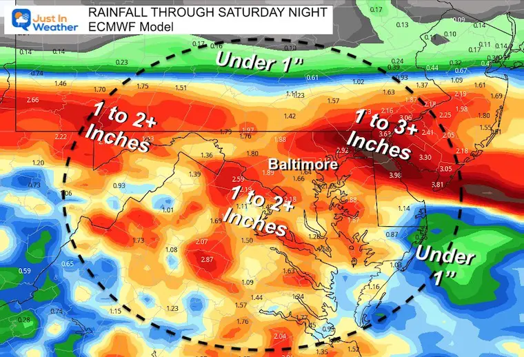
Rainfall Outlook: Possible Flooding
This is looking like a soggy Saturday, with some localized heavy rainfall and flooding. Especial where slow moving of repeating storm cells roll over the same areas.
It is important to note that the last storm 3 to 5 inches for some areas and left others nearly dry. So there are places that need rain, while others could flood easier with soggy soil.
Suggestion:
If you have outdoor plans, there is a small chance for the rain to end later in the day, if you live north of Baltimore in Maryland or Southern PA. But if you live in Central or Southern Maryland to the beaches, the rain will last into the night.
By Sunday, we all should clear out with a refreshing air mass bringing sunshine and comfortable temps.
Radar Simulaitons
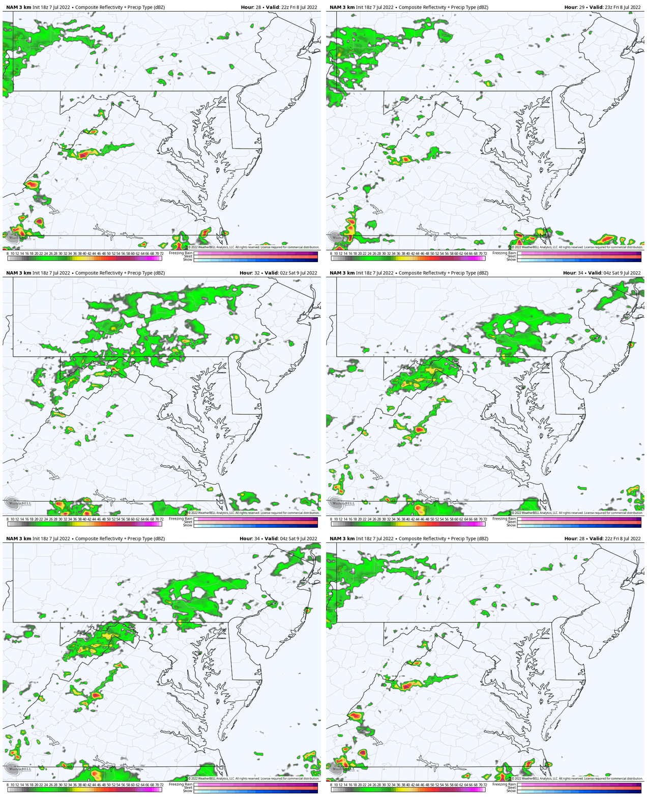
Friday Evening: 6 PM to Midnight
More likely to get west west and north of Baltimore.
To the south and Delmarva you should stay dry.
Saturday
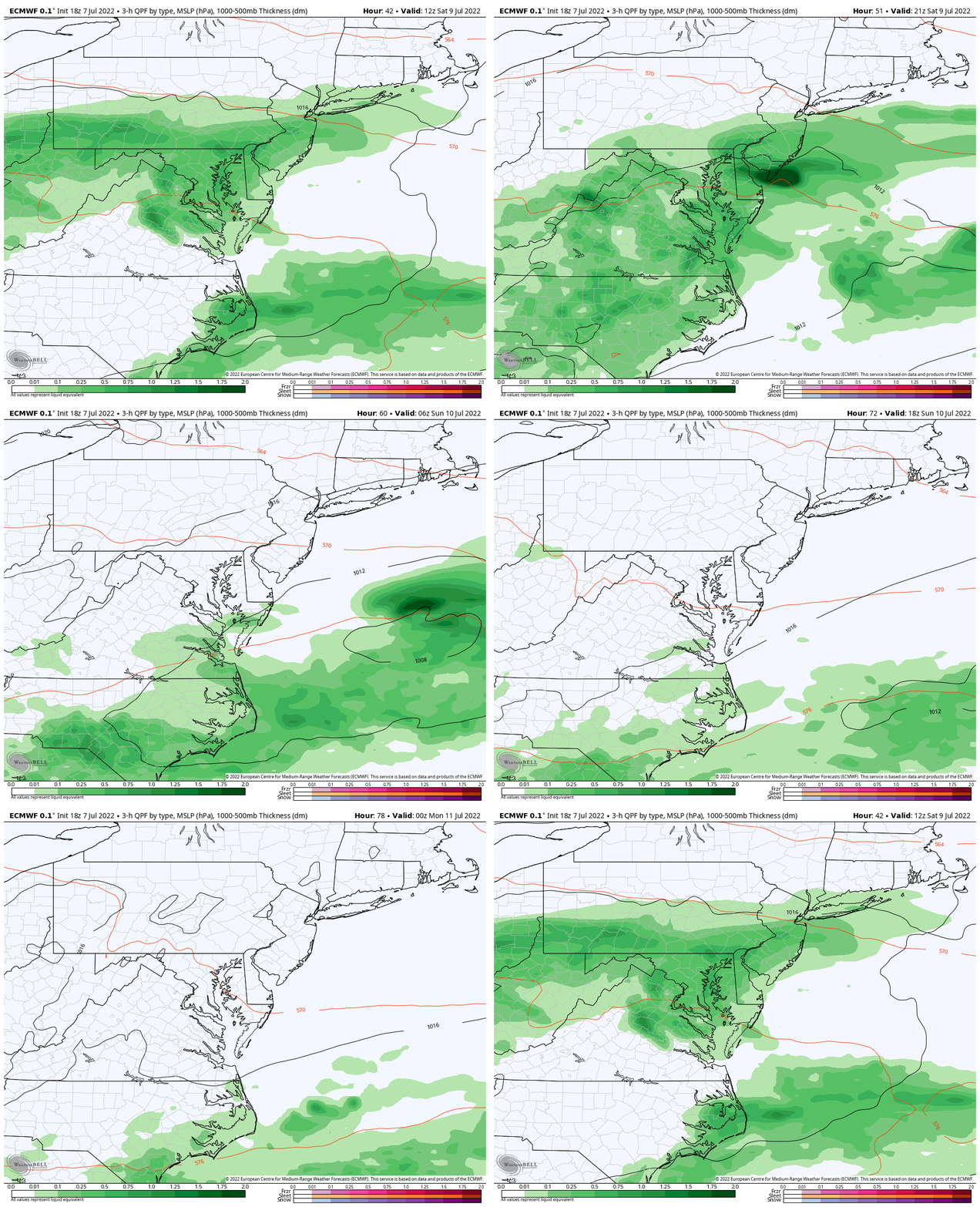
Comparing the NAM to the European Model we can see one difference: The NAM is slower, with the European bringing heavier rain, however a chance to clear out by evening from Baltimore to Annapolis.
NAM 3 Km 6 AM to 8 PM
(Snapshots below)
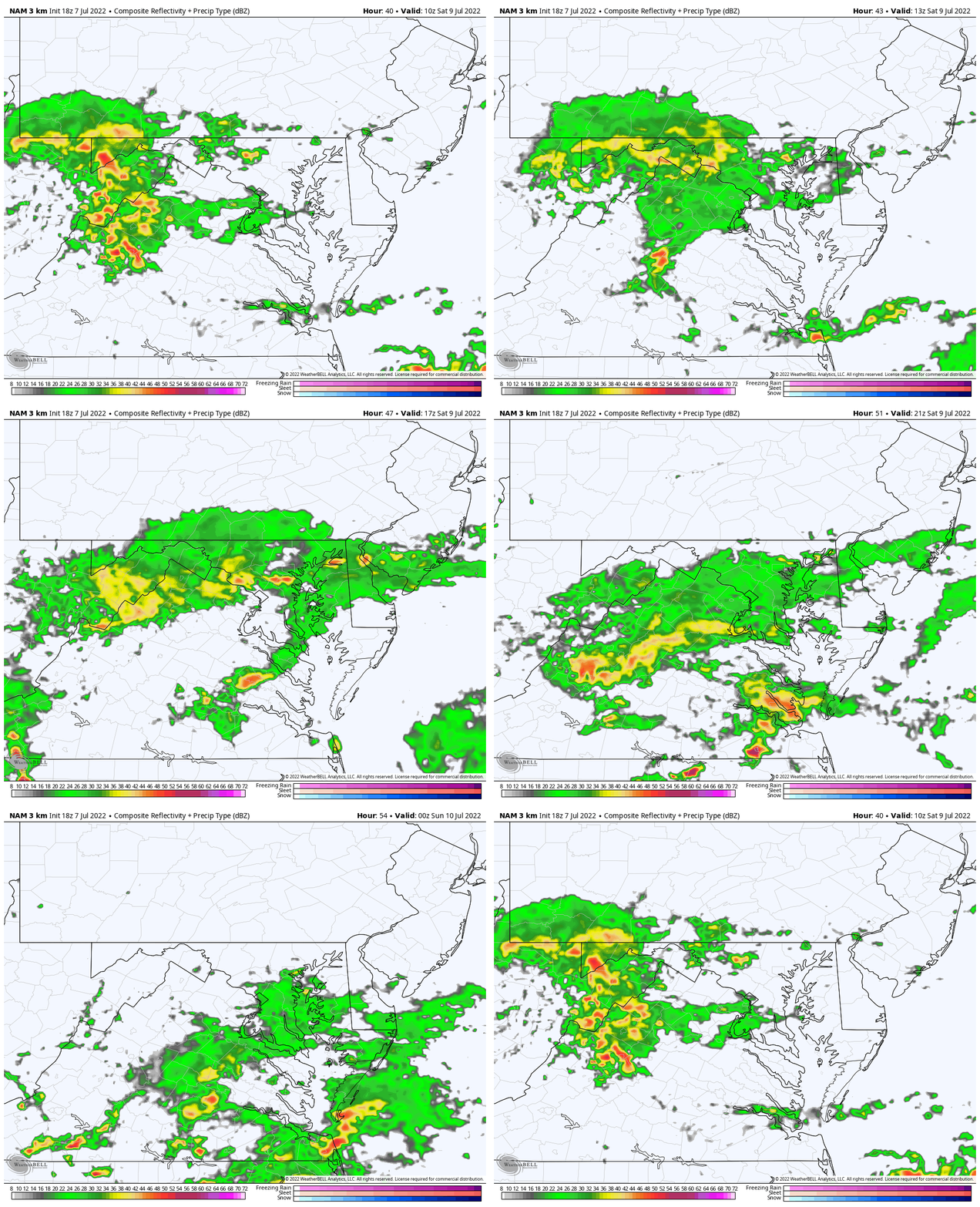
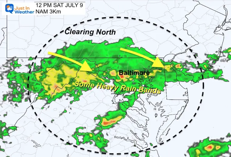
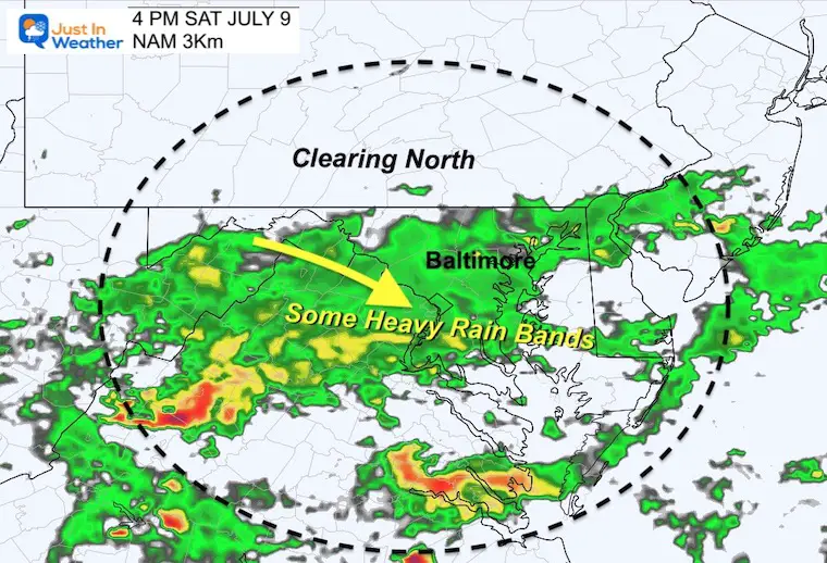
This model is the slower solution and looks like a wet day for many. There will be bands of rain with embedded heavier cells slowly slipping to the south. The timing of this is the wild card for northern areas.
If this speeds up, northern sections could get a nice evening.
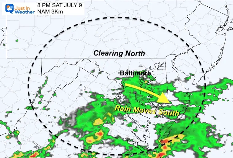
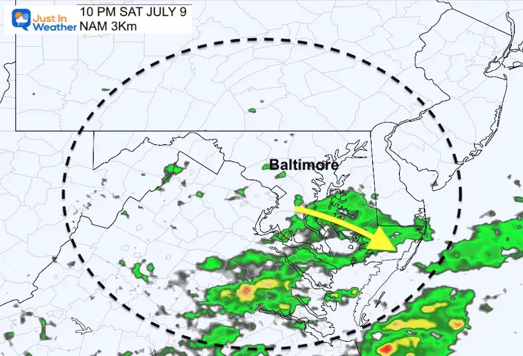
However, this is looking like a soggy afternoon and night through southern Maryland to the beaches.
Snapshots
Noon
Rain in central and western mountains, but a dry start across lower Delmarva and the beaches.
4 PM
Showers expanding south while southern PA may begin to dry out.
8 PM
A chanc for Metro Baltimore to dry out by sunset, but rainy at the beaches.
10 PM
ECMWF Model
6 AM to 6 PM
This solution moves the front though quicker…
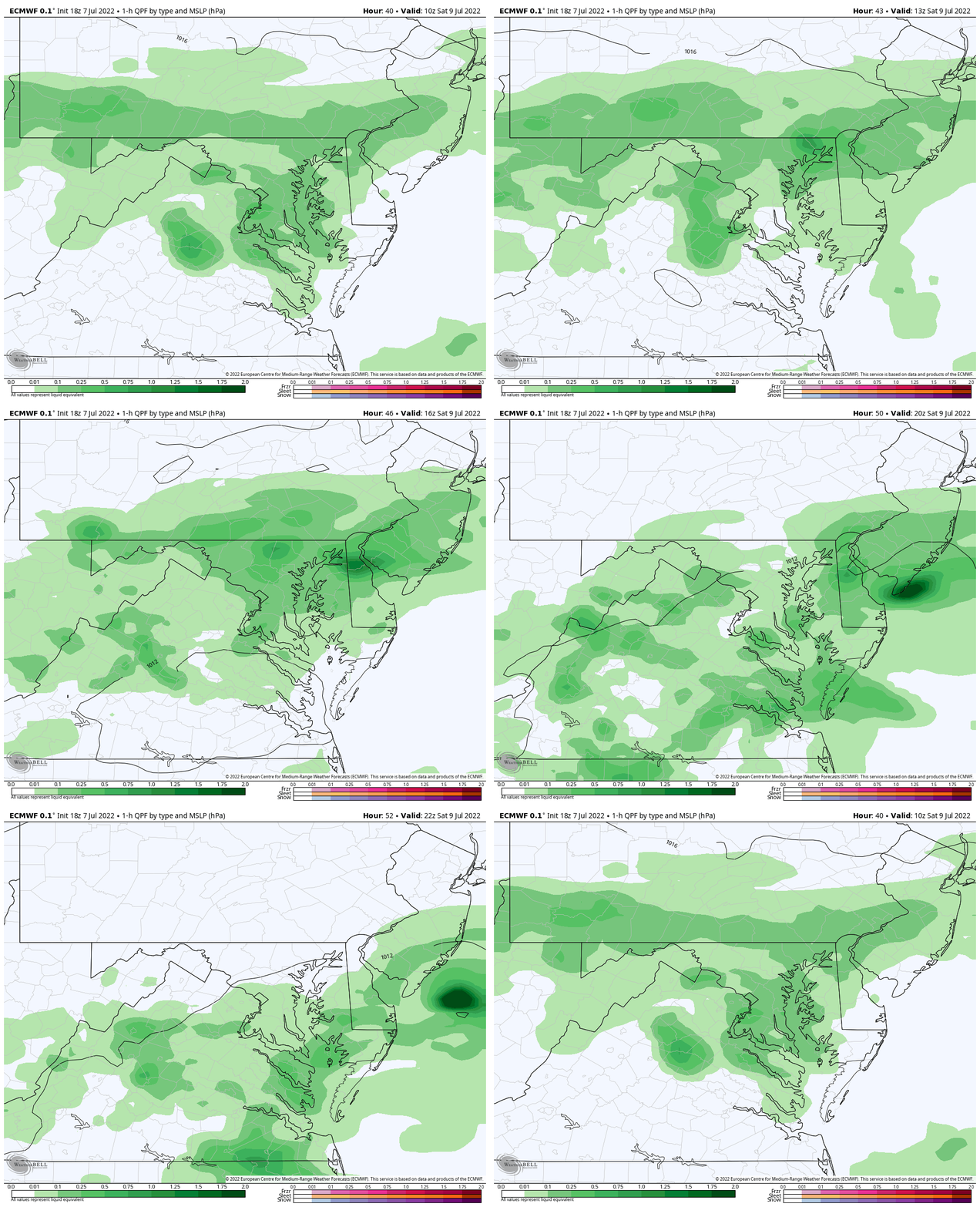
Full Weekend From The Euro
8 AM Saturday to 8 PM Sunday
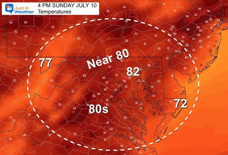
The easy part of this forecast is that Sunday should be a nice day for all. Simply getting the sun back will allow temps to bump back, but still remain unseasonably cool.
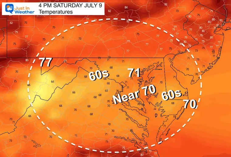
Weekend Afternoon Temperatures
Saturday at 4 PM
Rain will keep temps closer to 70ºF.
Sunday at 4 PM
With the sun returning, a refreshing Canadian Air Mass will feel wonderful. Temps will end up 5 to 10 degrees cooler than ‘average’.
I will have an update with conditions for the beaches in my full morning report.
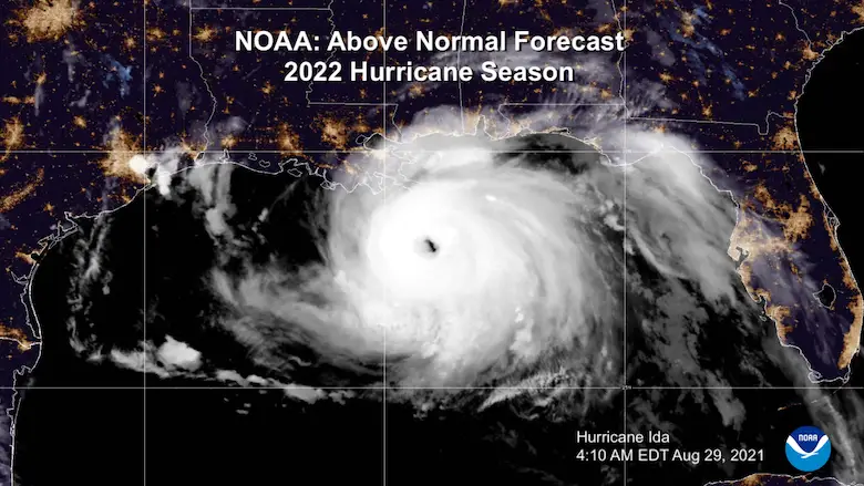
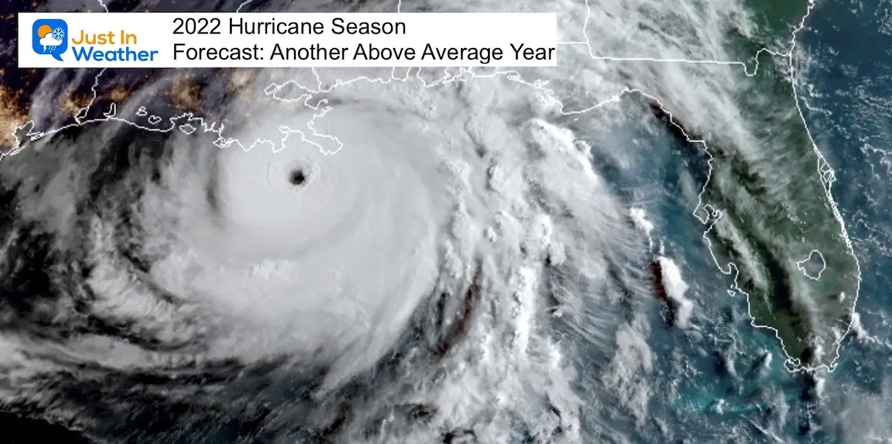
Hurricane Season Forecast: June 1 Through November 30
NOAA 2022 Hurricane Forecast- Above Normal Again
Forecast From Colorado State University
Related Posts
NOAA Study: Reducing Air Pollution INCREASED Tropical Storms
Atlantic Tropical History: Maps of Origin Regions Every 10 Days
Recent Storm Reports
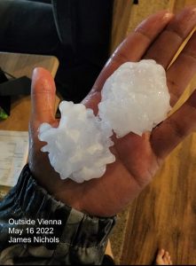
May 16 Large Hail Videos And Storm Tracking Map
Please share your thoughts, best weather pics/video, or just keep in touch via social media
Facebook: Justin Berk, Meteorologist
Twitter: @JustinWeather
Instagram: justinweather
*Disclaimer due to frequent questions:
I am aware there are some spelling and grammar typos. I have made a few public statements over the years, but if you are new here you may have missed it:
I have dyslexia, and found out at my second year at Cornell. I didn’t stop me from getting my meteorology degree, and being first to get the AMS CBM in the Baltimore/Washington region.
I do miss my mistakes in my own proofreading. The autocorrect spell check on my computer sometimes does an injustice to make it worse.
All of the maps and information are accurate. The ‘wordy’ stuff can get sticky.
There is no editor that can check my work when I need it and have it ready to send out in a newsworthy timeline.
I accept this and perhaps proves what you read is really from me…
It’s part of my charm.


