June 28 2022
Tuesday Afternoon Update
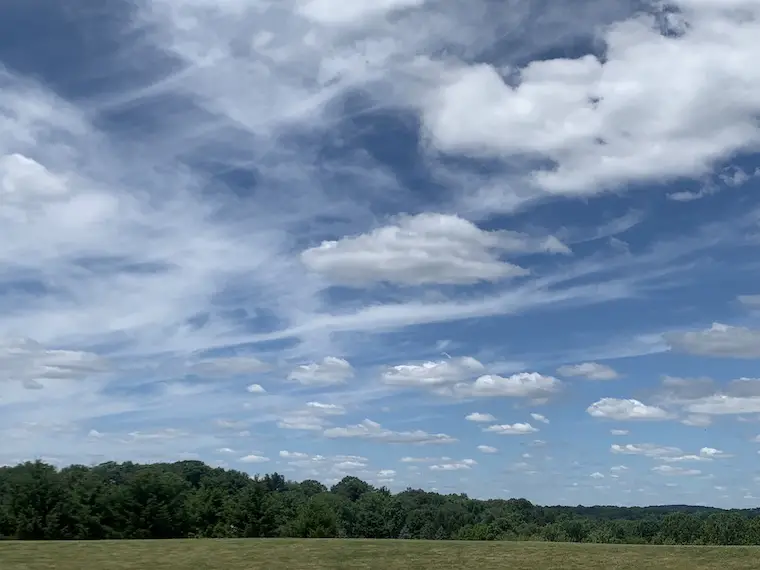
The day started clear, but quickly the sky is filling up with clouds. Two distinct layers of clouds to be more precise.
This is the kind of day when I really want to have a dedicated camera running time lapse video, where you can spot the cloud layers moving in different directions.
Mid Day Photo
On the north side of Baltimore, there has been a build up of clouds with a backdrop of deep blue sky. Such is the case when there is low humidity and a north wind late in June.
Upper Layer = Cirrus Clouds. These high altitude clouds are made of ice crystals. They are wispy and usually transparent.
Lower Layer = Fair Weather Cumulus Clouds. These cotton ball clouds commonly bubble up with the heat of the day. If the upper layer dims the sun, then the lower layer will appear darker, but they are still harmless.
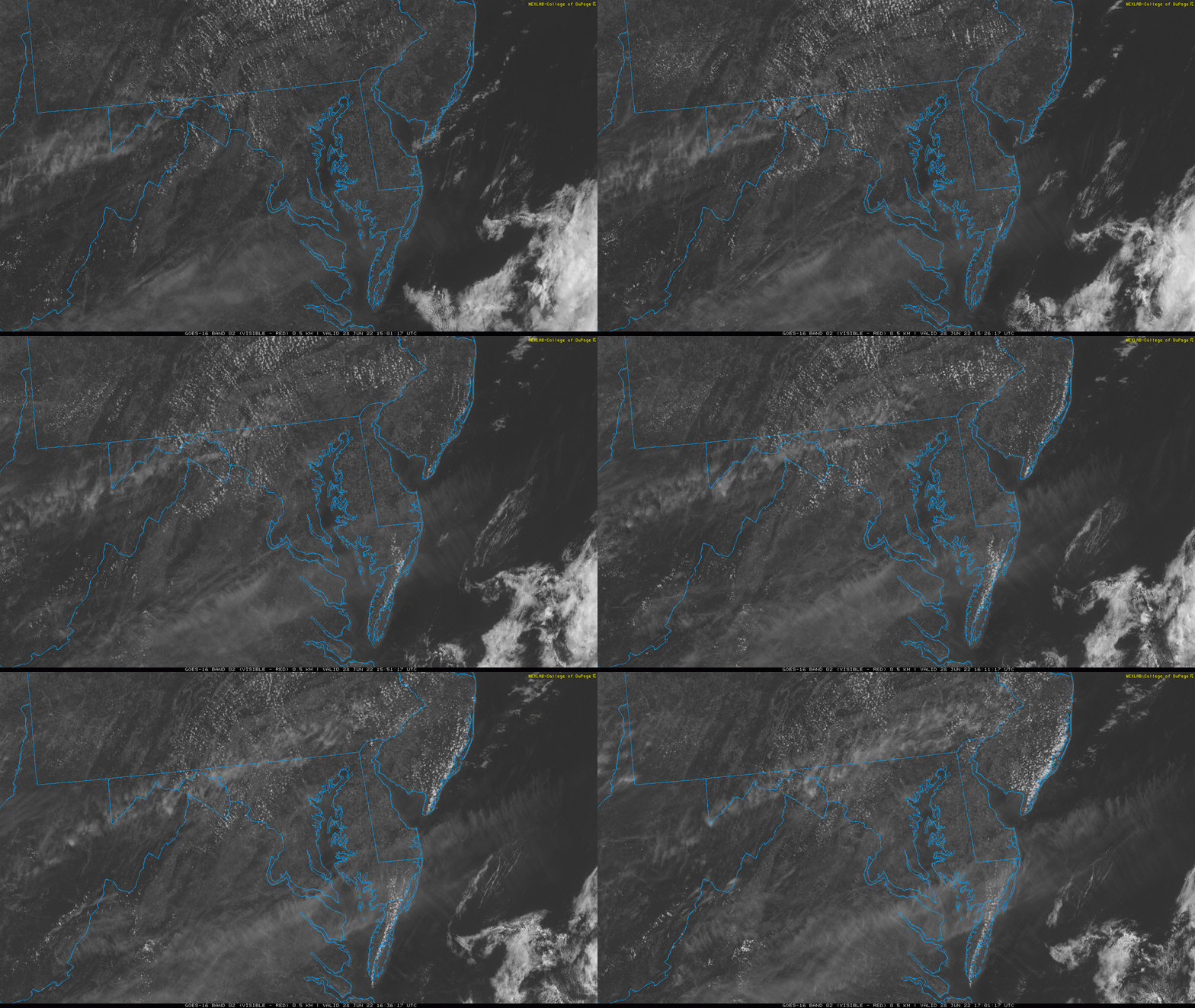
Visible Satellite Loop (Mid Atlantic)
11 AM to 1 PM
Locations we see the multiple cloud layers dominating have been inland and across the coastline from New Jersey to lower Delmarva.
Notice the speckled clouds moving to the south and east with the wind flow. The transparent streamers are the cirrus clouds moving with the upper level flow to the northeast.
Weather Balloon Sounding
Weather balloons are launched twice a day to get a sample of the atmospheric conditions across the country, which are then fed into super computers to help process the computer model forecasts.
Here is the data from the nearby launch at IAD (Sterling, VA) at 8 AM.
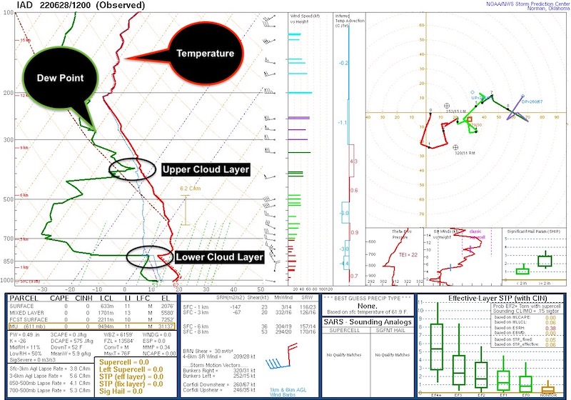
I’ve analyzed the temperature and dew point profile in the upper left corner.
When they are clouds or touch, that is where the Lifted Condensation Layers (LCL) are. This is where clouds form.
Upper Layer = 25,000 Ft
Lower Layer = 5,600 Ft
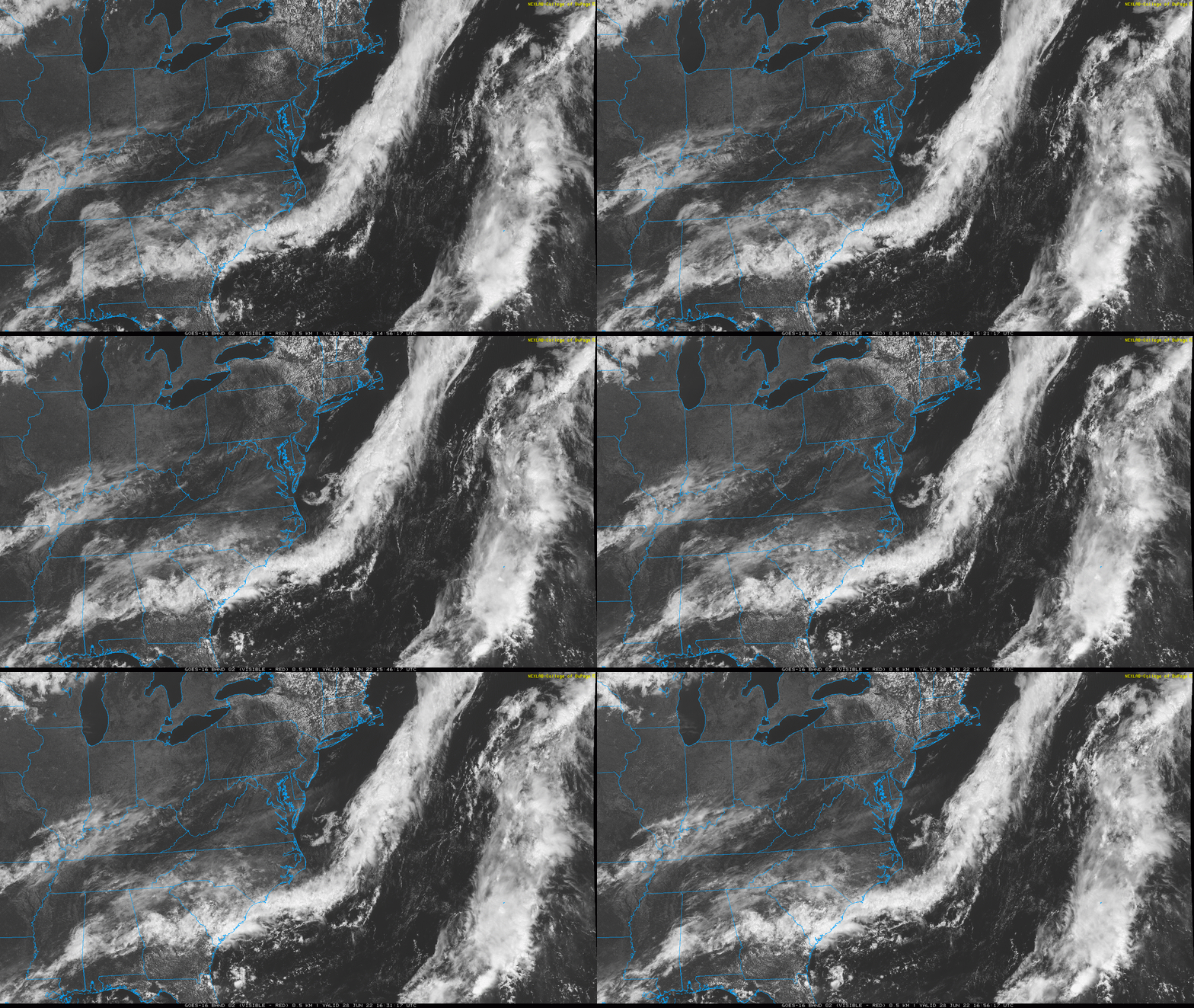
Visible Satellite Loop (Wide View)
11 AM to 1 PM
This map view shows the upper level cloud flow even better.
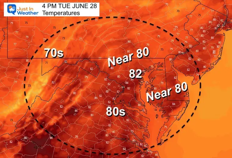
Afternoon Forecast Temperatures
CLIMATE DATA
TODAY June 28th
Normal Low in Baltimore: 65ºF
Record 51ºF in 2007
Normal High in Baltimore: 86ºF
Record 99ºF 2010
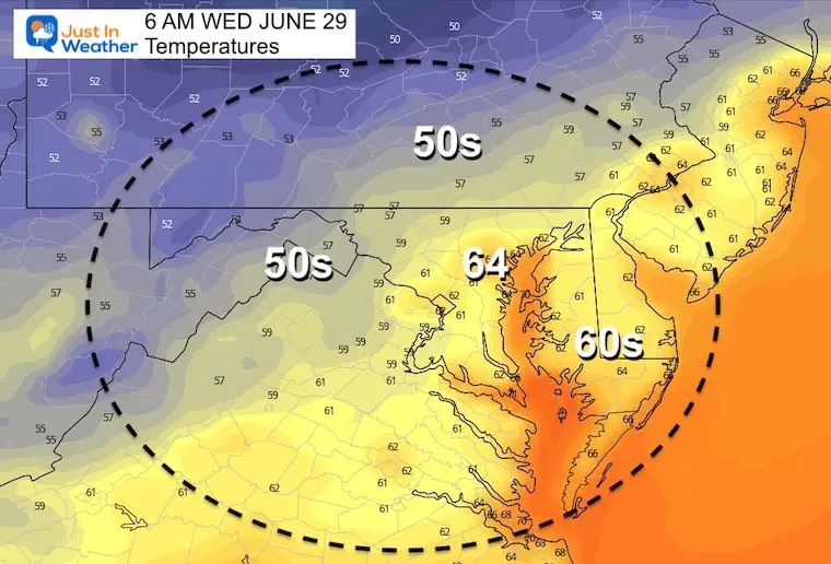
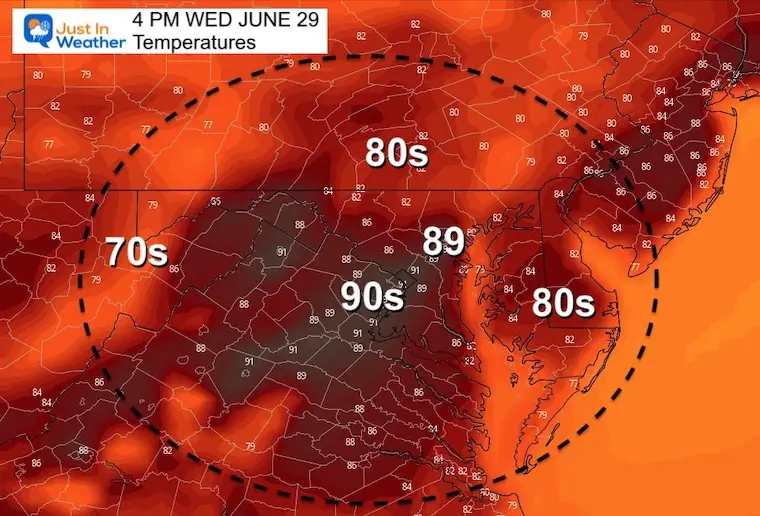
Wednesday
Temperatures start to warm up again
Morning
Afternoon
Looking Ahead:
Most Of This Week Will Be Great For Paddling
TEACHER SPECIAL Click Here
$20 Off 2 hour Rental
Book Your Kayak or Paddle Boat Adventure On The North Chesapeake Bay
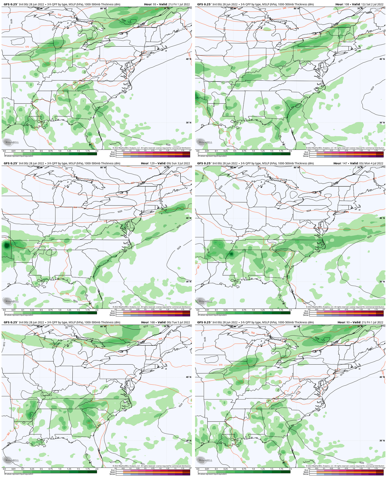
Friday Afternoon to July 4th Evening
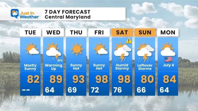
Storms may turn severe on Saturday, with lingering rain on Sunday as the Cold front may take two days to cross our entire region.
As of now, July 4th is looking good!
7 Day Forecast
Heat surges in at the end of the week. Humidity will make it feel like over 100ºF, but only for a couple of days.
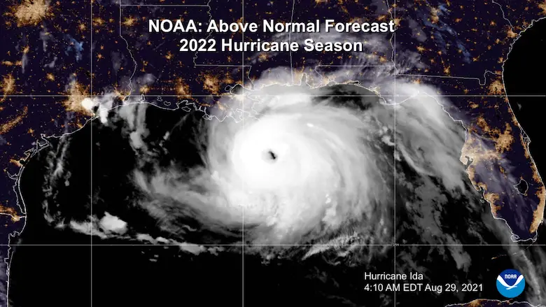
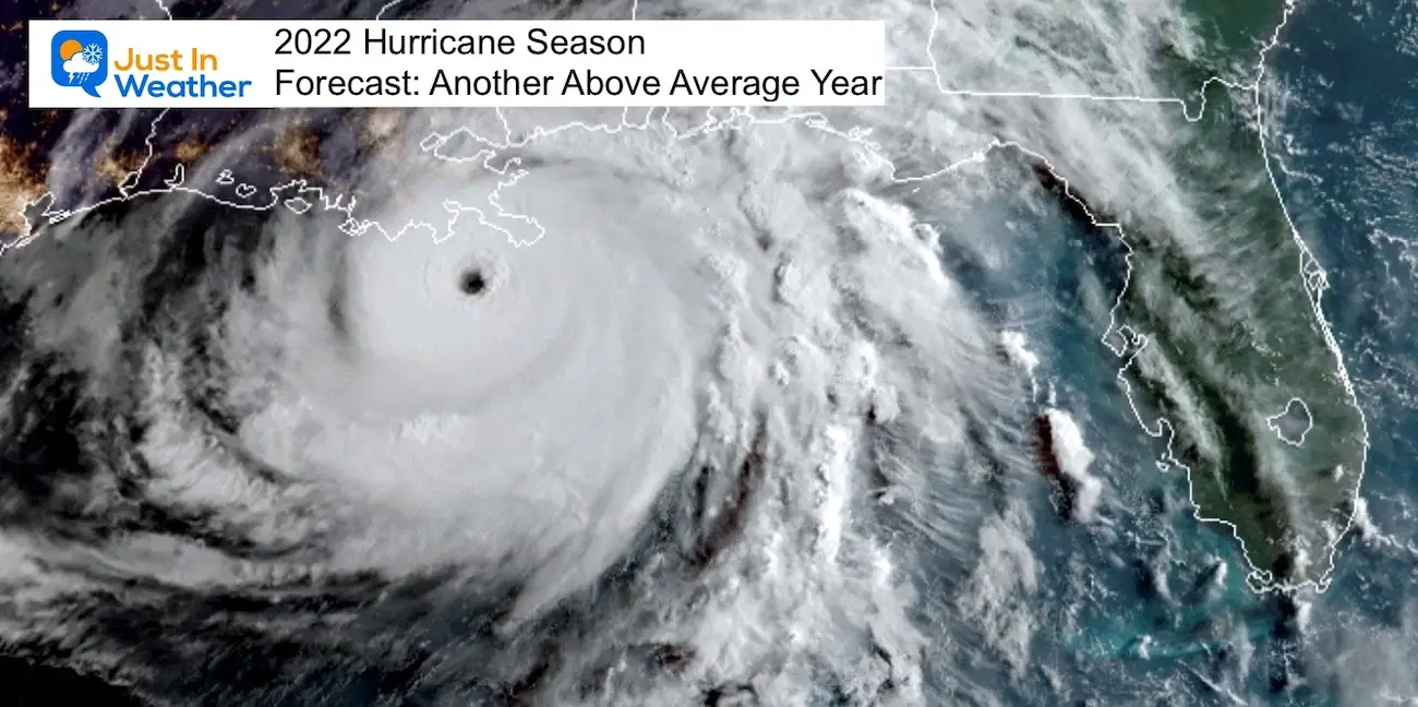
Hurricane Season Forecast: June 1 Through November 30
NOAA 2022 Hurricane Forecast- Above Normal Again
Forecast From Colorado State University
Related Posts
NOAA Study: Reducing Air Pollution INCREASED Tropical Storms
Atlantic Tropical History: Maps of Origin Regions Every 10 Days
Recent Storm Reports
May 16 Large Hail Videos And Storm Tracking Map
Please share your thoughts, best weather pics/video, or just keep in touch via social media
Facebook: Justin Berk, Meteorologist
Twitter: @JustinWeather
Instagram: justinweather
*Disclaimer due to frequent questions:
I am aware there are some spelling and grammar typos. I have made a few public statements over the years, but if you are new here you may have missed it:
I have dyslexia, and found out at my second year at Cornell. I didn’t stop me from getting my meteorology degree, and being first to get the AMS CBM in the Baltimore/Washington region.
I do miss my mistakes in my own proofreading. The autocorrect spell check on my computer sometimes does an injustice to make it worse.
All of the maps and information are accurate. The ‘wordy’ stuff can get sticky.
There is no editor that can check my work when I need it and have it ready to send out in a newsworthy timeline.
I accept this and perhaps proves what you read is really from me…
It’s part of my charm.


