


January 13 Mild Ahead Of Arctic Front That Will Bring Rain To Snow Later Wednesday
Tuesday January 13 We are once again back to mild afternoons with sunshine, but that is about to change. The next cold front will usher in a series of arctic…
Friday January 21 2022
Afternoon Report
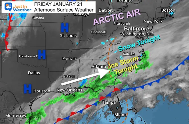
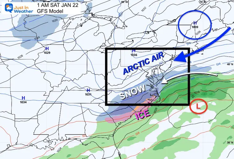
A coastal storm moving across the Southeast US today, will bring snow to a portion of Maryland overnight. The bulk of the action will be in the dark hours tonight, but the impact will linger into the morning thanks to arctic air reaching across the entire Mid Atlantic.
In this post I have a new timeline slider and how much snow can be expected.
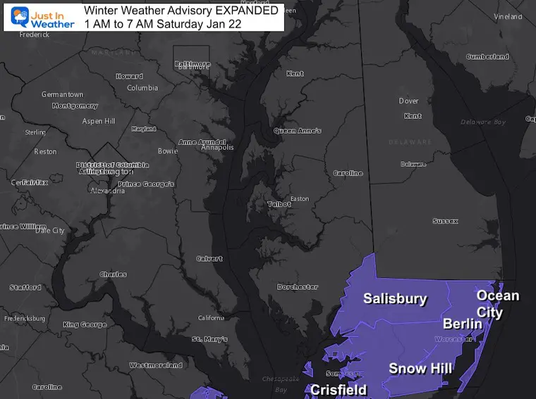
This includes Maryland’s Somerset and Worcester Counties. It was just EXPANDED to include Salisbury and Wicomico County as well.
Also affected: Crisfield, Pocomoke City, Berlin, Snow Hill, And Ocean City are included. Due to limited equipment, road travel is expected to be impacted.
The cold front is very far south into Florida. Moisture from the Gulf of Mexico is streaming into the cold air across the Carolina. A significant ice storm is expected across South Carolina tonight.
Ocean City is going to be on the north end of this event, so it will not reach central Maryland/metro Baltimore.
7 PM Friday to 10 AM Saturday
This is going to be a quick event, and if you look closely the bump of snow to the north will be far away from the core Low Pressure.
Low Pressure is plotted fat offshore. The winds wrapping around it. Combined with the edge of the Arctic High Pressure in New England, will develop a band of snow across low Delmarva.
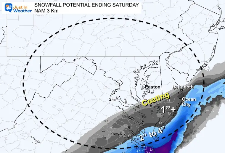
Hourly timeline from the NAM 3 Km model.
This gives a better demonstration of the brief bump north of the snow. Some should reach into lower Delaware and northwest of Salisbury. But the impact snow will be closer to the beach and southward.


Most likely the northern edge of any coating may reach Cambridge to Rehoboth.
There may be an inch in Salisbury, with more in Ocean City.
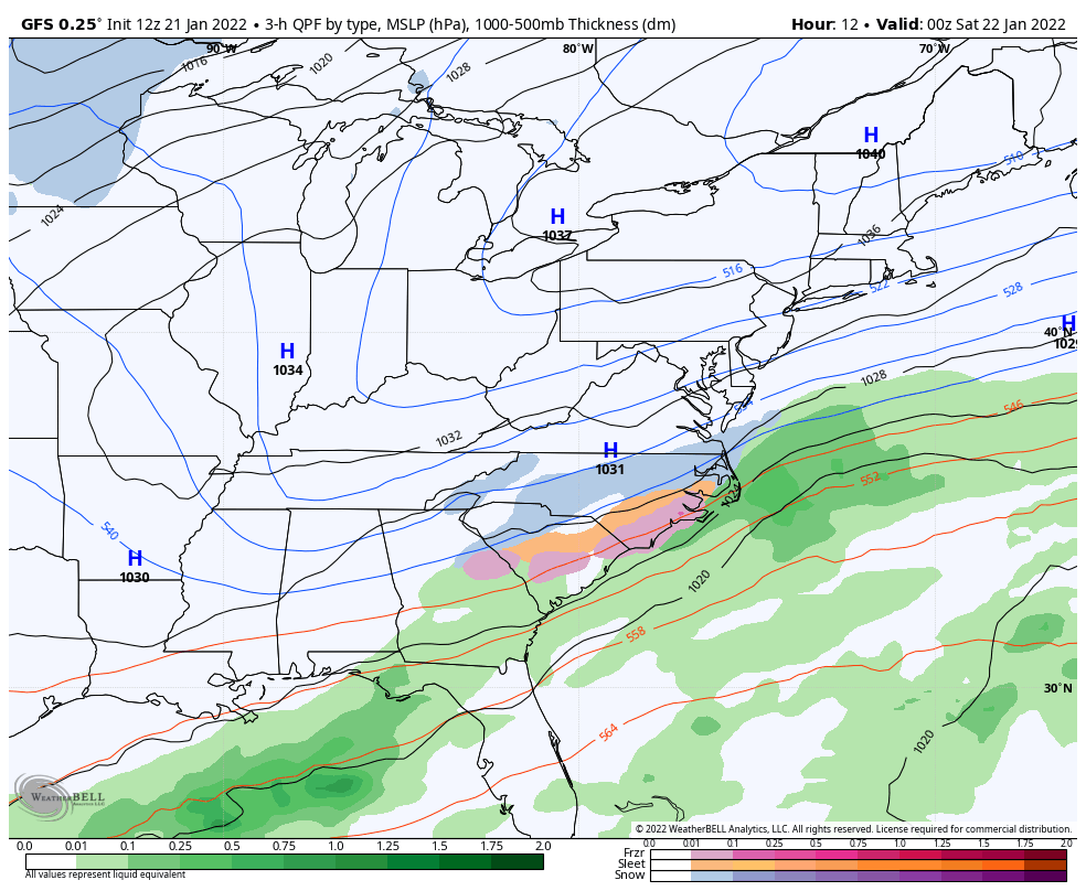
GFS Model
The GFS Model does pull the snow a little farther north, with a coating to Easton.
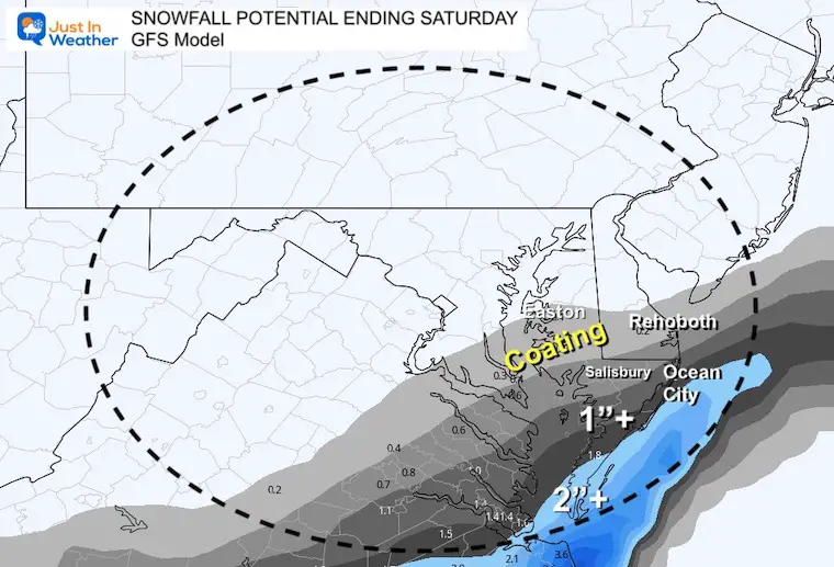
Temps will be cold enough for stickage around Ocean City.
Also note: Baltimore may have the coldest morning in a few years!
BWI reached 15ºF on Jan 4 and 16. If it reaches 14ºF, it would be the coldest since Feb 2, 2019.

Cleanup in the snow zone will be close to 30ºF

We enter the weekend very cold, and a small system could bring light snow showers Sunday evening.
Most of the outlook is cold, with one mild day Tuesday. That will include a cold front that brings another round of rain ending as snow.

Sign up and be the first to know!


Last Winter Recap: My Old Outlook And Your Grades Of My Storm Forecasts


