


May 12 Mothers Day Showers And Another Aurora Viewing Tonight May Be Better
Sunday May 12 Mother's Day Morning Report Today, we focus on the all-important Mother’s Day weather and the ongoing impact of the latest Solar Storm. We have been stuck in…
January 13, 2024
Saturday Morning Update
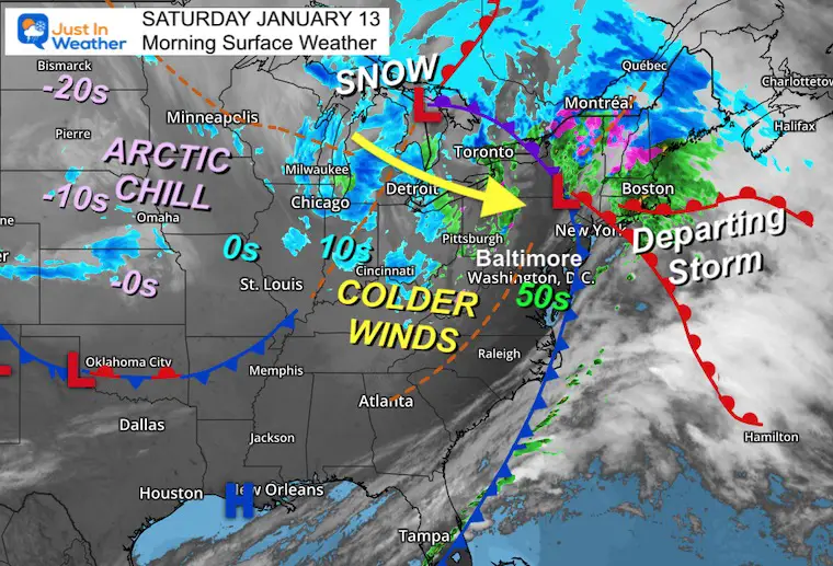
The good news is that the storm we just had underperformed. The squall line did not fully materialize. Wind and flood damage was mitigated, and we definitely had much less impact than the prior storm on Tuesday.
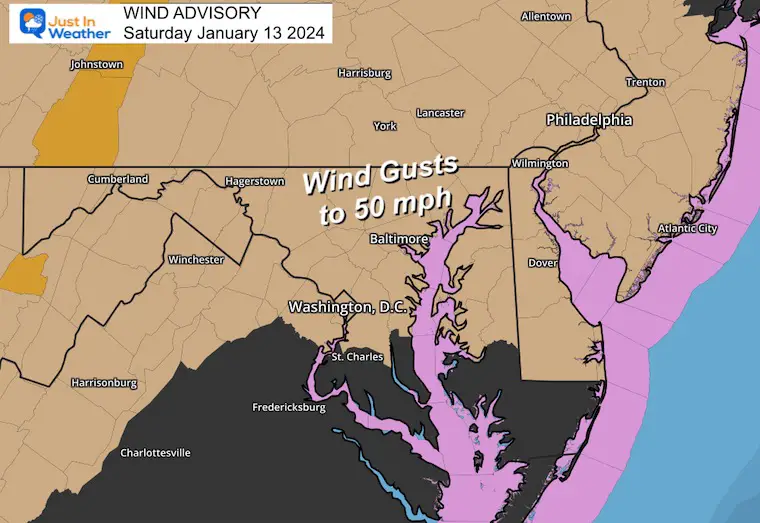
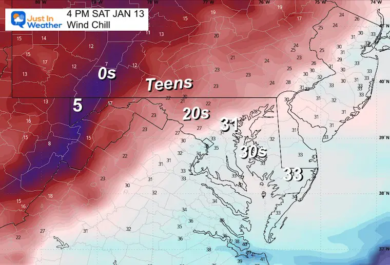
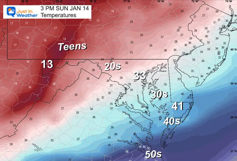
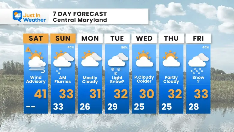
Now, we get the cold air wrapping in the back side. This new air mass will come in with force, so A Wind Advisory remains in place. Gusts up to 50 mph as temperatures will drop during the day. We will have a wind chill later today!
An upper air disturbance will bring a chance for snow showers east of the mountains on Sunday morning.
As for Tuesday, I still see a hint of light snow but not a strong storm. The upper-level energy may remain jet streak based, but not fully translating to an organized surface Low. If the ‘spin’ can get generated sooner, then it will change. But for now, we must lean on the light side.
Arctic air will remain for the week ahead.
The double barrel Low Pressure is located between Lake Huron and The Catskill Mountains in New York.
Colder winds will pick up quickly as a new air mass arrives.
The core of this cold has temperatures BELOW ZERO across the Central and Northern Plains.
Strong winds will average 20 to 30 mph. Peak gusts may reach 50 mph.
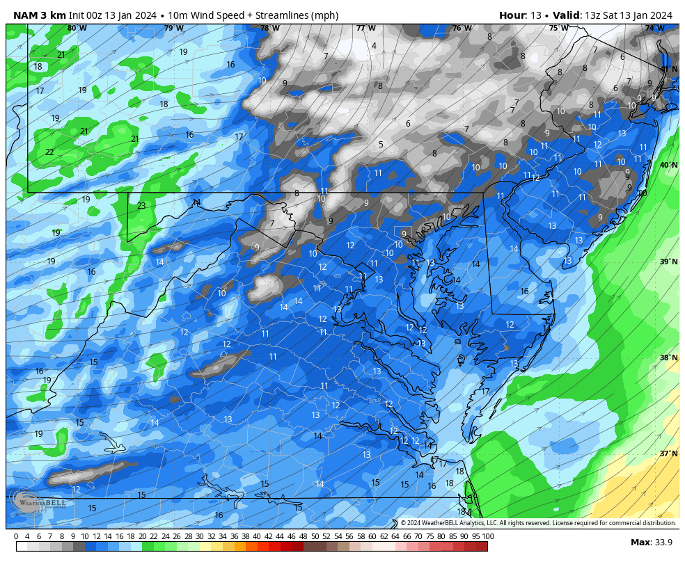
The numbers may actually drop during the day as the new air mass arrives.
It will feel at least 10 degrees colder with the strong wind!
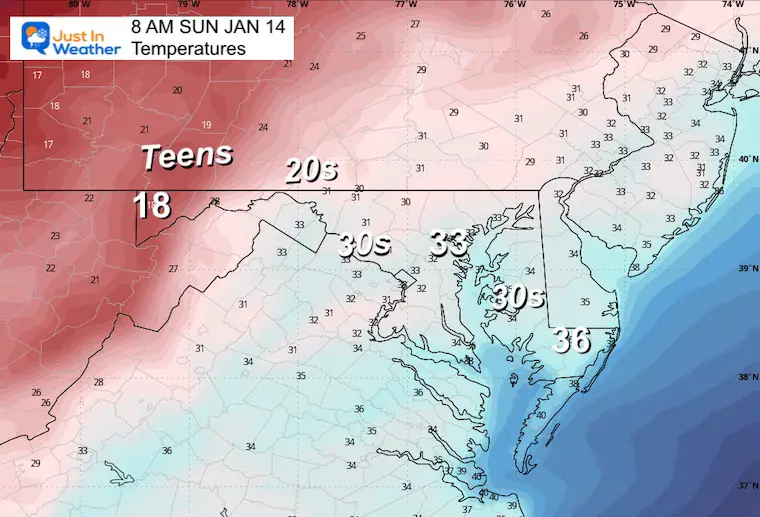
TODAY January 13
Sunrise at 7:25 AM
Sunset at 5:06 PM
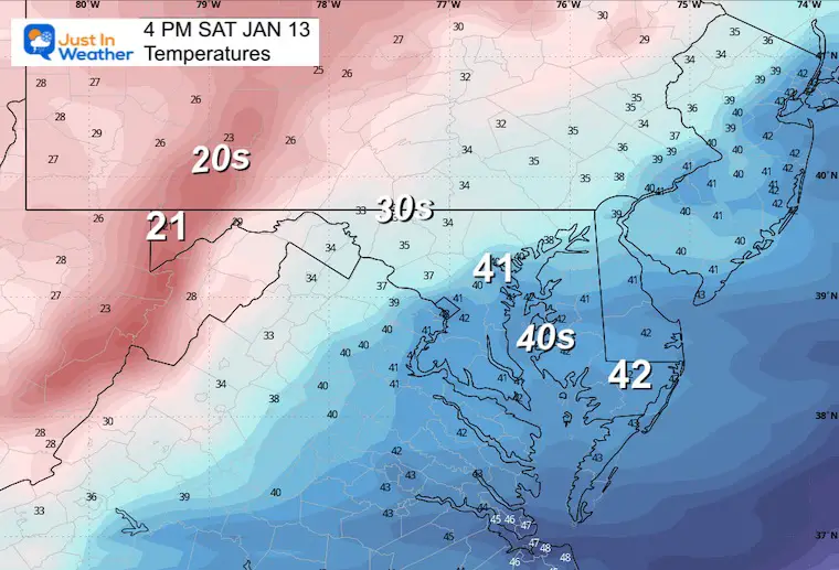
Normal Low in Baltimore: 26ºF
Record 0ºF in 1912; 1981
Normal High in Baltimore: 43ºF
Record 76ºF 1932
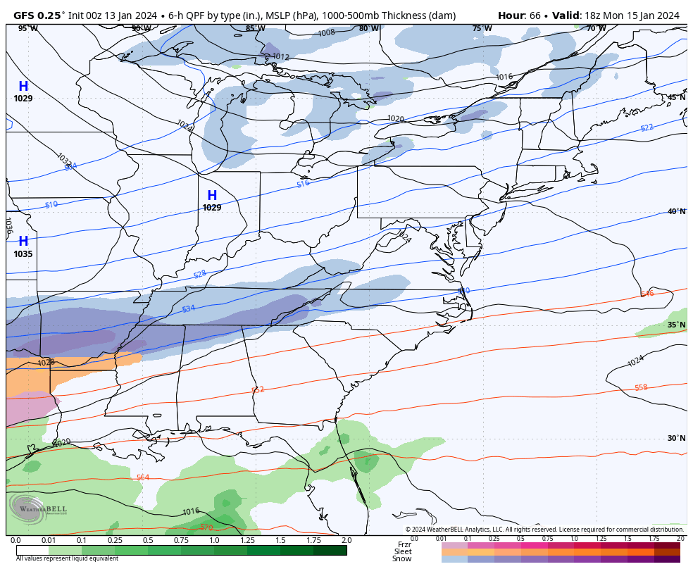
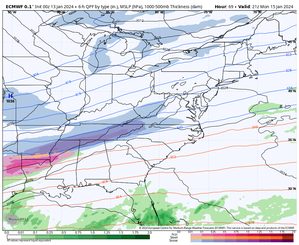
The energy from a jet streak with the arrival of arctic air may be enough to carry one disturbance over the mountains. This has been reflected in the radar simulation.
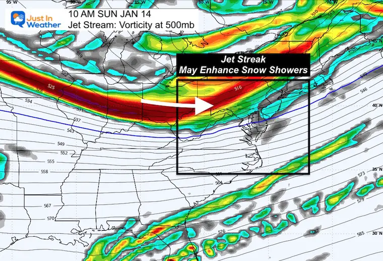
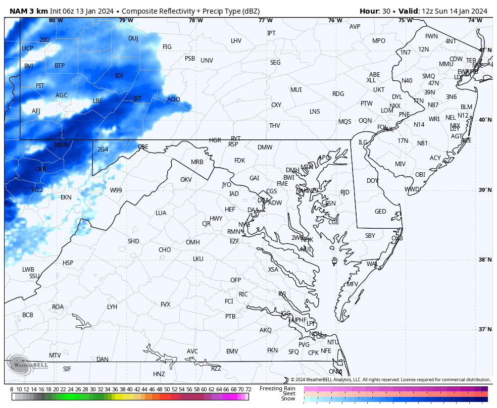
This trough may show up as a line of snow showers. It may display as flurries with pockets of heavier showers and a brief coating in spots.
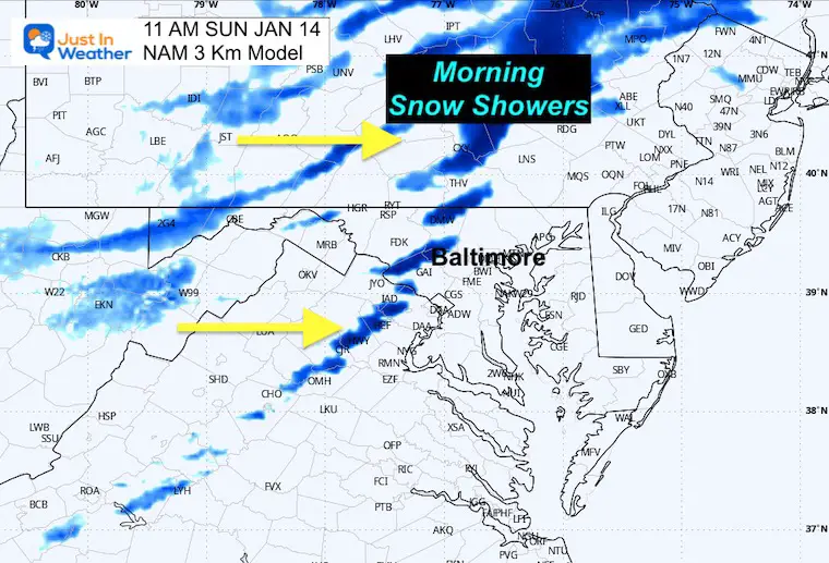
This is still looking like a weak system with more of a jet streak than an organized Low Pressure for us. I need to lean towards the lighter side for this system. If you really want an idea of what this can produce, the best suggestion is a coating to maybe 1 or 2 inches at best.
The most noticeable part of the next week will be the true winter cold. This is not extreme for our region, but much of the week may remain near or below freezing, even in metro areas.
This may help ice formation on the northern part of the Chesapeake Bay and area reservoirs.
I’ve included the


Computer Models Support East Coast Storm Track

The latest NOAA report is confident in a Very Strong event. Possibly HISTORIC! This refers to the temperatures in the Pacific, with impacts on the US Winter Storm Track.

Winter Weather Folklore: Top 20 and more signals from nature for snow.
Winter Outlook 2024 From Two Farmers Almanacs Return to Cold and Snow


Click to see more and ‘Book’ a visit to your school

I am aware there are some spelling and grammar typos and occasional other glitches. I take responsibility for my mistakes and even the computer glitches I may miss. I have made a few public statements over the years, but if you are new here, you may have missed it: I have dyslexia and found out during my second year at Cornell University. It didn’t stop me from getting my meteorology degree and being the first to get the AMS CBM in the Baltimore/Washington region. One of my professors told me that I had made it that far without knowing and to not let it be a crutch going forward. That was Mark Wysocki, and he was absolutely correct! I do miss my mistakes in my own proofreading. The autocorrect spell check on my computer sometimes does an injustice to make it worse. I also can make mistakes in forecasting. No one is perfect at predicting the future. All of the maps and information are accurate. The ‘wordy’ stuff can get sticky. There has been no editor who can check my work when I need it and have it ready to send out in a newsworthy timeline. Barbara Werner is a member of the web team that helps me maintain this site. She has taken it upon herself to edit typos when she is available. That could be AFTER you read this. I accept this and perhaps proves what you read is really from me… It’s part of my charm.
#FITF