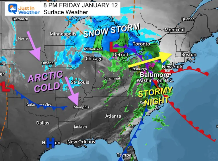
Friday January 12 2024
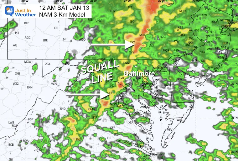
This is a quick update for the storm expectations tonight and a quick look at if snow is on next week. The rain has moved in and seems to be lining up with the short-range modeling. That would bring the squall line through the cities within an hour of midnight.
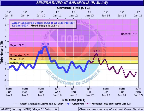
Strong winds ahead of it from the south will add to the flood concerns on the Chesapeake Bay for areas that were impacted by the Tuesday storm. Then, the winds will swing to the West and keep up the Advisory for many areas through Saturday.
Storm Set Up
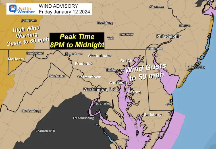
Wind Advisory/Warning
- Annapolis to Southern Maryland and Delmarva: Winds gusting to 55 mph
- Inland winds will still gust 40 to 50 mph even where there is no advisory.
- Mountains: Winds gusting to 60 mph or high on the western facing slopes.
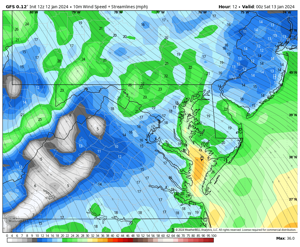
Wind Forecast: 8 PM Fri to Noon Sat
We can see the front move through close to midnight, shifting the winds to the West after the storm passes.
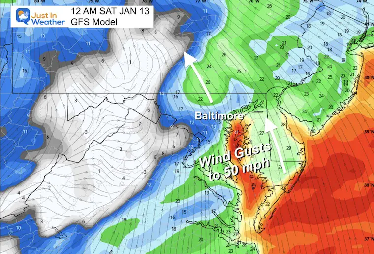
Snapshot: Midnight
Ahead of the squall line, winds will be FROM THE SOUTH/SOUTHEAST
This is the same direction as the Tuesday storm. This will push water up the Bay AND crosswinds on the Bay Bridge.
FLOOD WATCH/COASTAL ADVISORY
Inland rainfall may exceed 1 inch.
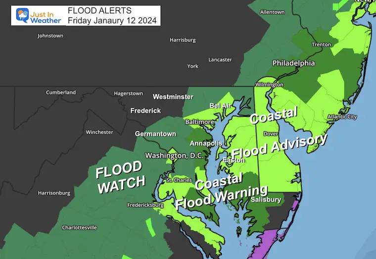
Coastal areas:
IMPACTS…At 3.5 feet, water reaches the floor of the Maritime
Museum in Annapolis, begins to cover Bowyer Road on the Naval
Academy campus, and numerous businesses on Dock Street are flooded, along with the City Dock parking lot.
* ADDITIONAL DETAILS…Tides up to 3 feet above normal. The next high tide at Annapolis U.S. Naval Academy is at 5:56 AM and 7:02 PM.
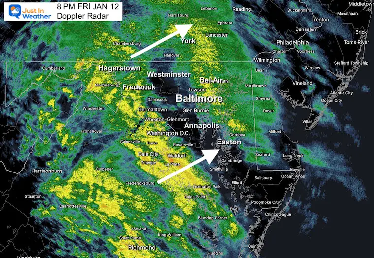
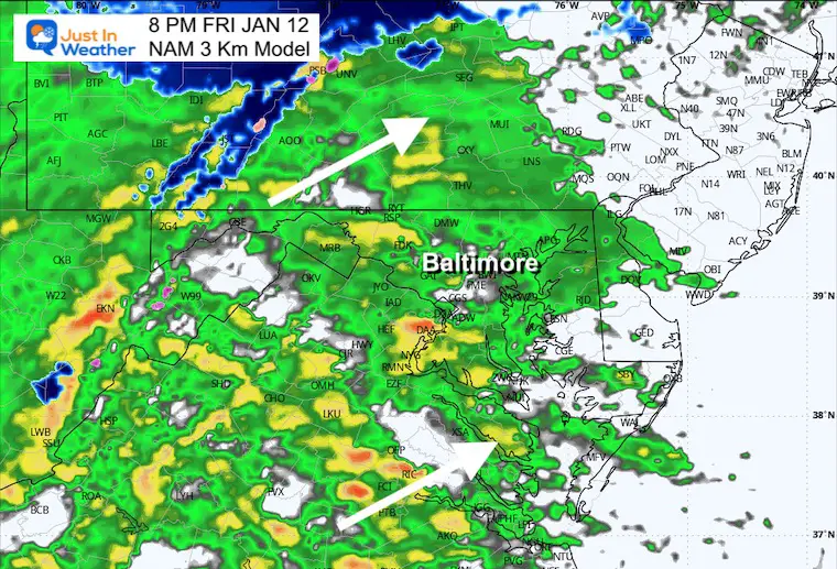
Live Radar Widget
Compare The Evening Observations To Forecast
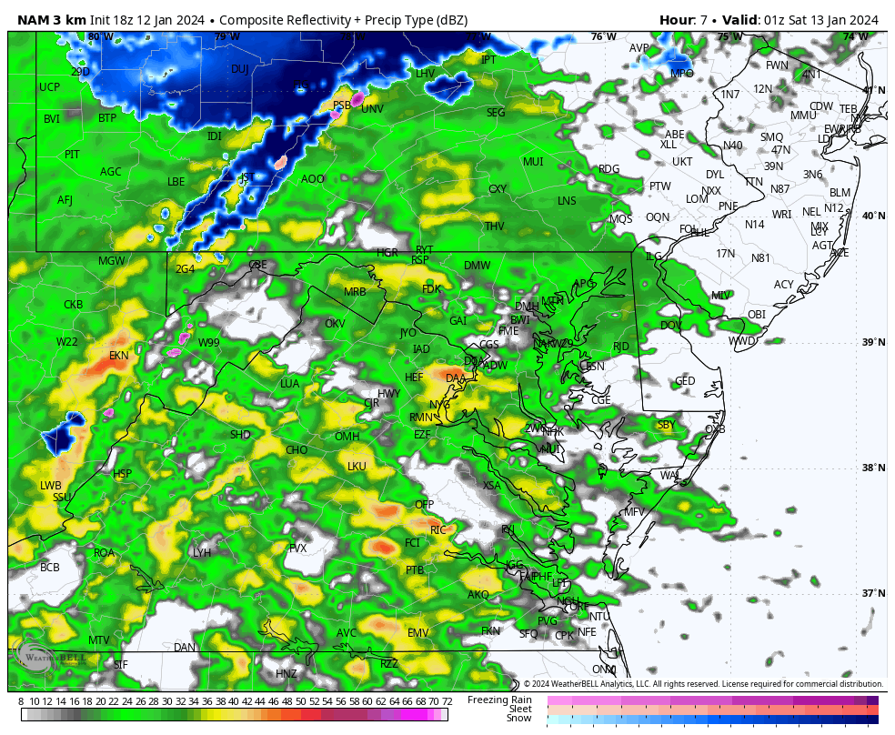
8 PM Doppler Radar
8 PM Forecast from NAM 3 Km
Midnight: Squall Line
This may arrive a little faster than shown here.
Radar Simulation 8 PM to Noon Saturday
After the squall line passes, there may be some leftover rain showers in the morning.
Snow will return to the high mountains of western Maryland.
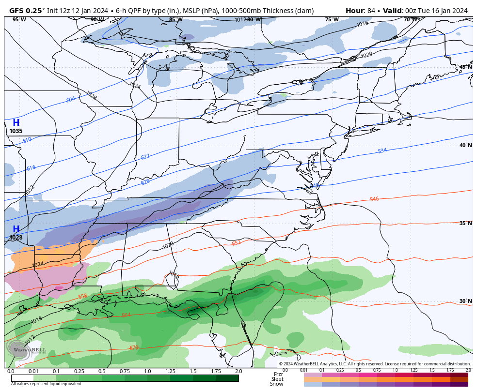
Next Storm: Snow Tuesday?
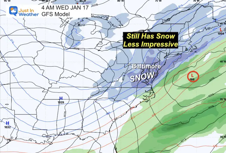
There is still snow to show, but it is not as impressive. The main point is that the European Model has brought the snow back, while the GFS Model still has the storm.
I often tell my clients we can’t truly know the next storm until the first storm does its thing. They are connected. I expect there may be some more wiggle room to possibly bring this back into focus in the next day.
GFS Model
Monday Morning to Wednesday Morning
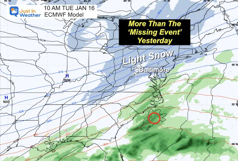
Snapshot Early Wednesday Morning
This has shifted to be a little later…
European ECMWF Model
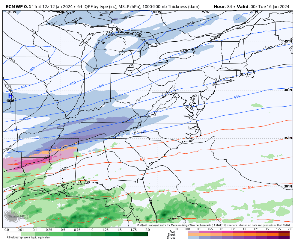
Snapshot Tuesday Afternoon
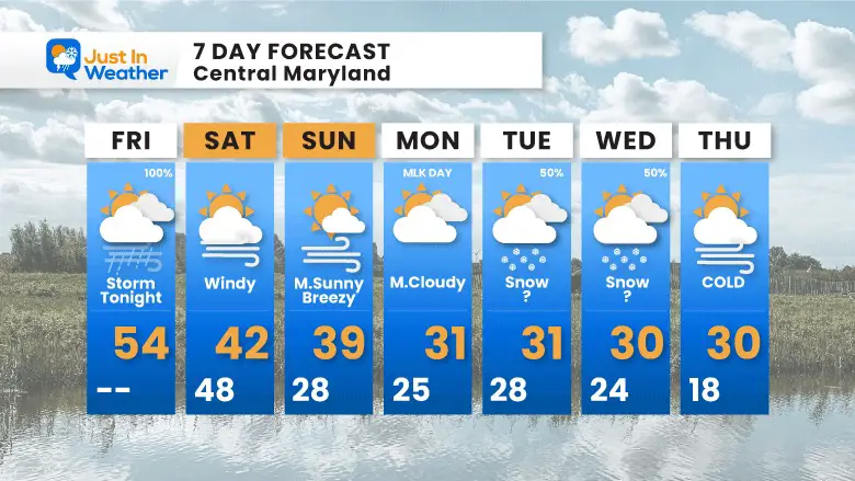
7 Day Forecast
I am keeping that snow risk at 50% until the modeling can get more in agreement.
The arctic blast has shown up on all models.
These numbers represent Baltimore at BWI. It will be colder inland…. And there have been some suggestions for even colder temps during this stretch. We would need snow on the ground to assist.
Subscribe for eMail Alerts
RECENT Winter Outlook Reports:

El Niño Winter Updates

Computer Models Support East Coast Storm Track

El Niño Advisory
The latest NOAA report is confident in a Very Strong event. Possibly HISTORIC! This refers to the temperatures in the Pacific, with impacts on the US Winter Storm Track.

Winter Weather Folklore: Top 20 and more signals from nature for snow.
NOAA’s Winter Outlook 2024
Winter Outlook 2024 From Two Farmers Almanacs Return to Cold and Snow
Explore More
Maryland Snow Climate History And Other Winter Pages

Faith in the Flakes Gear

STEM Assemblies/In School Fields Trips Are Back
Click to see more and ‘Book’ a visit to your school

Please share your thoughts and best weather pics/videos, or just keep in touch via social media
RESTATING MY MESSAGE ABOUT DYSLEXIA
I am aware there are some spelling and grammar typos and occasional other glitches. I take responsibility for my mistakes and even the computer glitches I may miss. I have made a few public statements over the years, but if you are new here, you may have missed it: I have dyslexia and found out during my second year at Cornell University. It didn’t stop me from getting my meteorology degree and being the first to get the AMS CBM in the Baltimore/Washington region. One of my professors told me that I had made it that far without knowing and to not let it be a crutch going forward. That was Mark Wysocki, and he was absolutely correct! I do miss my mistakes in my own proofreading. The autocorrect spell check on my computer sometimes does an injustice to make it worse. I also can make mistakes in forecasting. No one is perfect at predicting the future. All of the maps and information are accurate. The ‘wordy’ stuff can get sticky. There has been no editor who can check my work when I need it and have it ready to send out in a newsworthy timeline. Barbara Werner is a member of the web team that helps me maintain this site. She has taken it upon herself to edit typos when she is available. That could be AFTER you read this. I accept this and perhaps proves what you read is really from me… It’s part of my charm.
#FITF


