


May 12 Mothers Day Showers And Another Aurora Viewing Tonight May Be Better
Sunday May 12 Mother's Day Morning Report Today, we focus on the all-important Mother’s Day weather and the ongoing impact of the latest Solar Storm. We have been stuck in…
January 9, 2024
Tuesday Morning Update
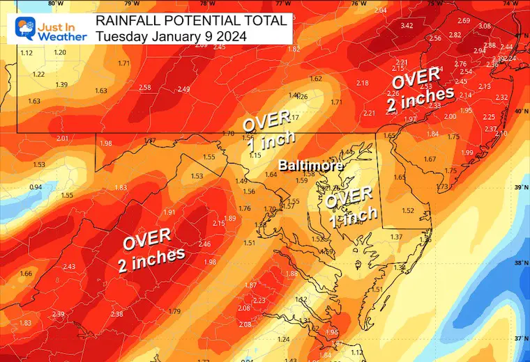
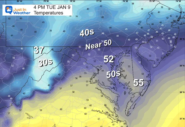
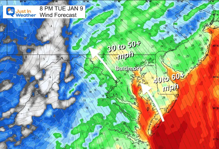
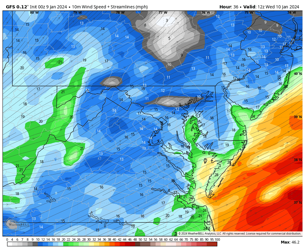
This is a Day to take seriously. While some computer models have been overestimating a few parameters, We can expect a broad area to get winds gusting to 50 mph, with some areas around the Chesapeake Bay and Delmarva up close to 70 mph. In addition, rainfall will range between 1 and 3 inches. Rain will arrive this morning, but the conditions will get worse mid-afternoon through tonight.
I want to address the Warnings and Advisories and then get to the weather maps.
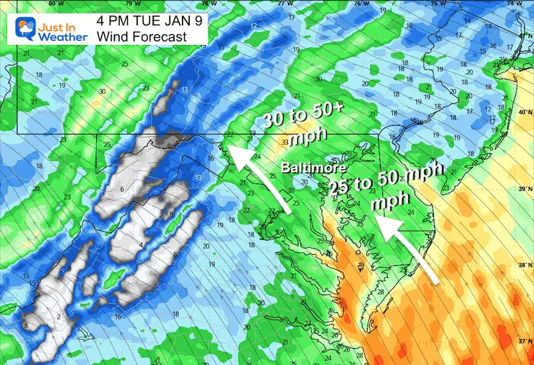
The High Wind Warning AFTER 3 PM includes Baltimore and Annapolis!
Gusts to 60 mph or higher.
Wind Advisory inland for gusts to 50 mph (or higher).
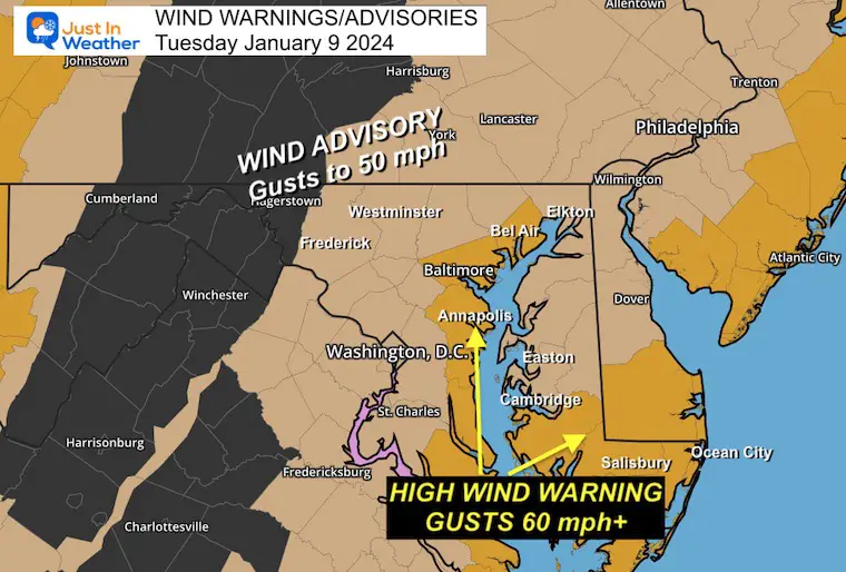
This may be overdone, so I included a realistic range for most areas. Some spots may end up higher.
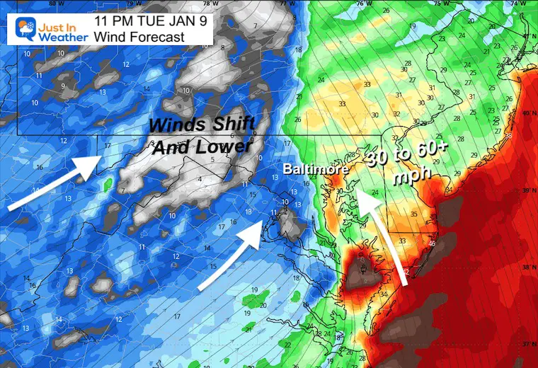
Winds will be moving FROM the South and Southeast.

This includes heavy rain AND water being pushed up the Chesapeake Bay.
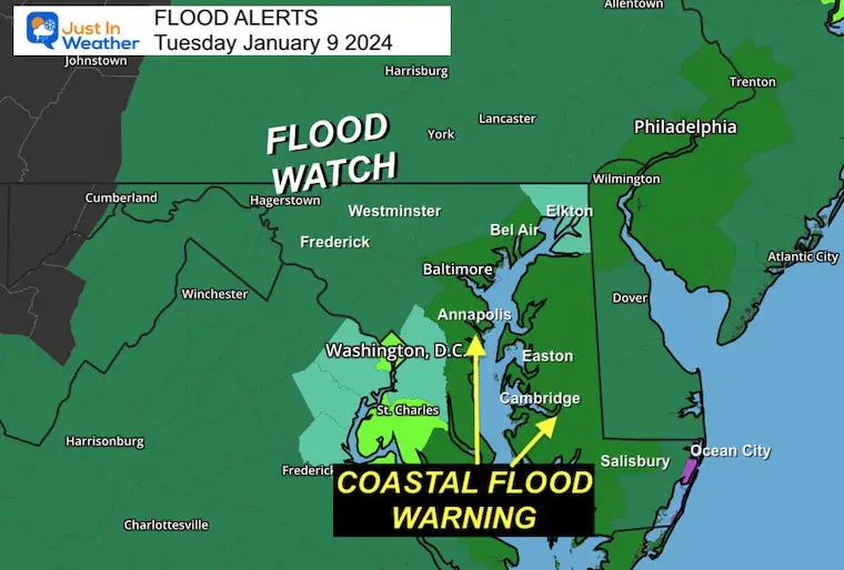
Between 1 and up to 3 inches possible.
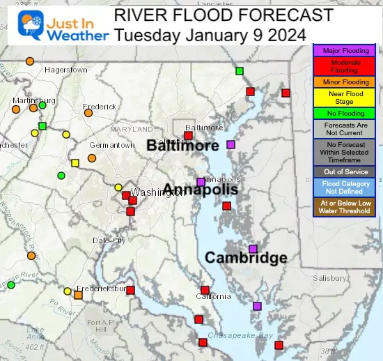
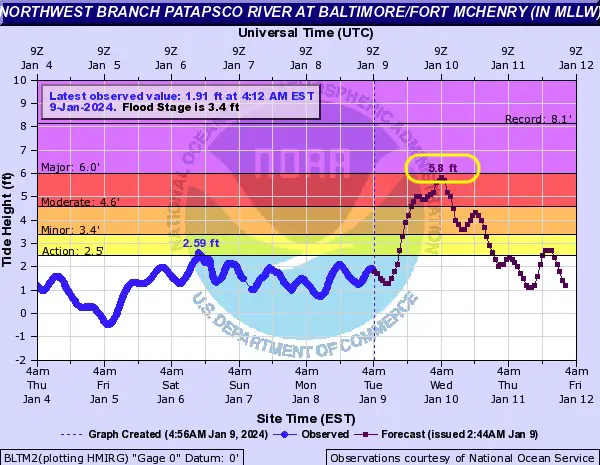
Moderate Flooding AFTER 4 PM, peak Midnight to 4 AM Wednesday due to rainwater flowing out.
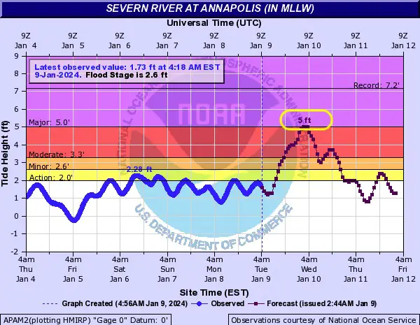
Moderate Flooding AFTER 2 PM, peak Midnight to 4 AM Wednesday due to rainwater flowing out.
Moderate Flooding AFTER 2 PM, peak Midnight.
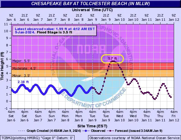
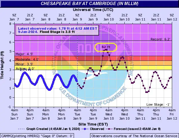
Major Flooding is expected to peak AFTER MIDNIGHT.
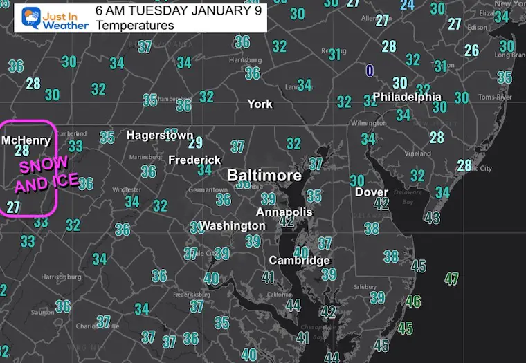
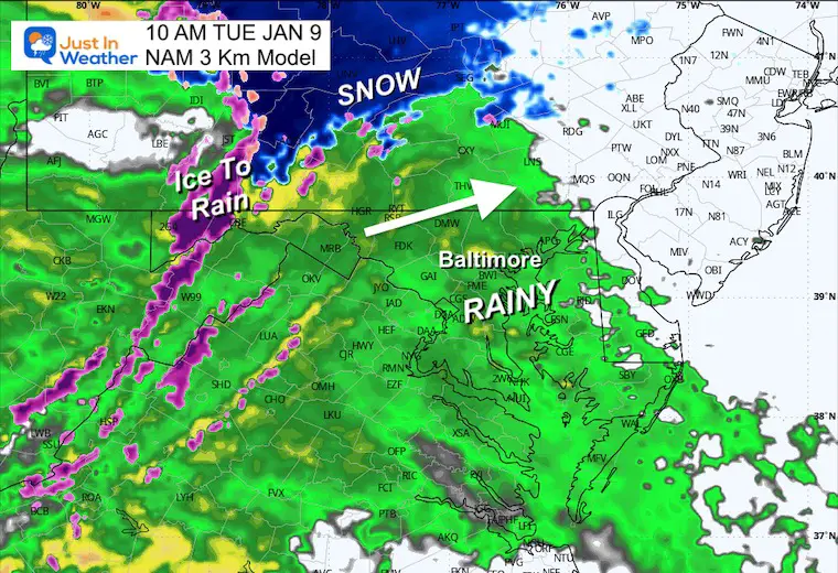
Winter Storm Warning for 4 to 6 inches of snow in Garrett County… until early afternoon… then changing to rain.
This webcam is positioned at The Greene Turtle Deep Creek Lake and shows Wisp Resort, including a zoomed-in view of Squirrel Cage, The Face, the terrain park, Boulder, the mountain coaster, the tubing park, and a shot of McHenry Cove at Deep Creek Lake!
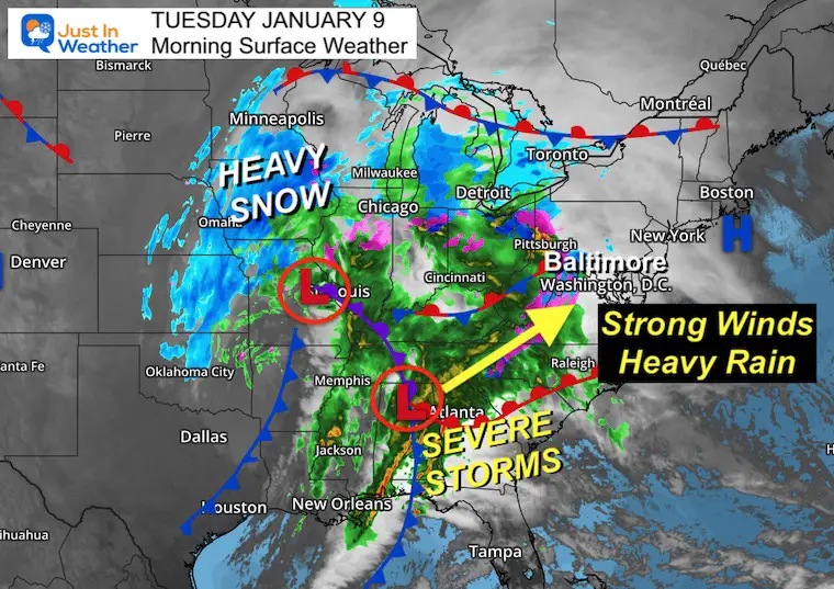
This is a large storm with a cold and heavy snow side in the Northern Plains.
Severe Storms across the eastern Gulf Coast states are a signal for the energy moving our way today.
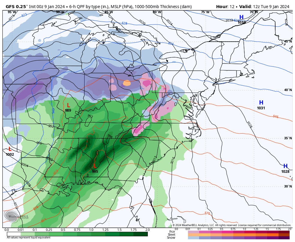
Steady rain will be in place. Snow and ice in the mountains will transition to rain.
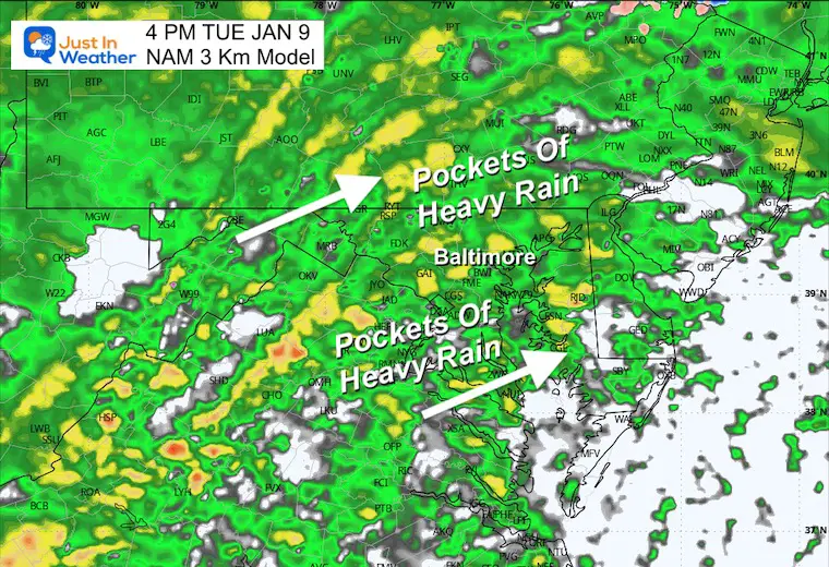
4 PM
Pockets of Heavy rain! Winds will be increasing.
Wind Forecast
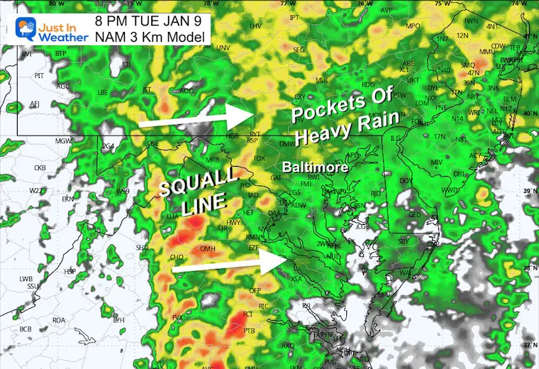
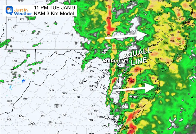
Watching the arrival of the Squall Line. That will have the strongest Winds!
Wind Forecast
11 PM
The SQUALL LINE will cross metro areas between 9 PM and 11 PM. Often, it arrives a little faster than models suggest.

CLIMATE DATA: Baltimore
TODAY January 9
Sunrise at 7:26 AM
Sunset at 5:01 PM
Normal Low in Baltimore: 26ºF
Record 2ºF in 1970
Normal High in Baltimore: 43ºF
Record 75ºF 1937
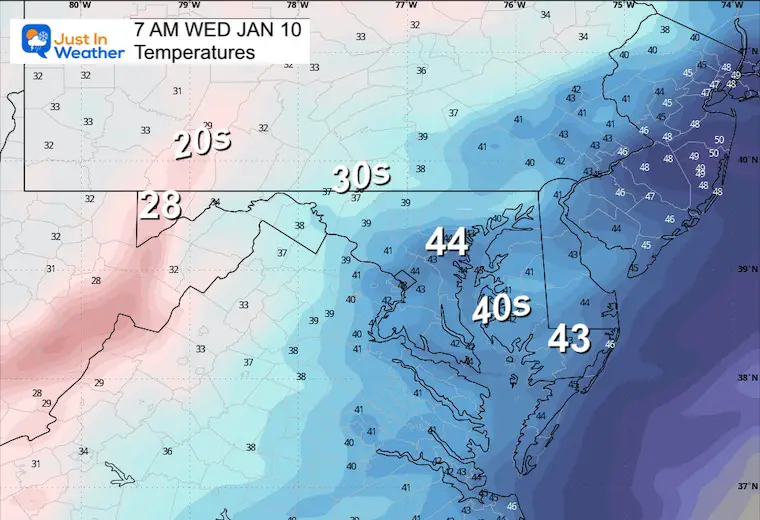
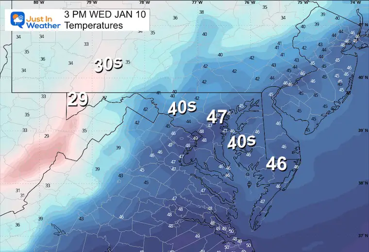
Wind Forecast 7 AM to 7 PM
Winds may still gust 30 to 40 mph… FROM THE WEST
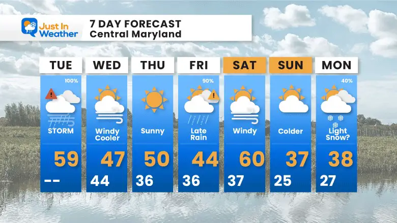
This looks like an overnight rain, ending Saturday and then bringing gusty winds.
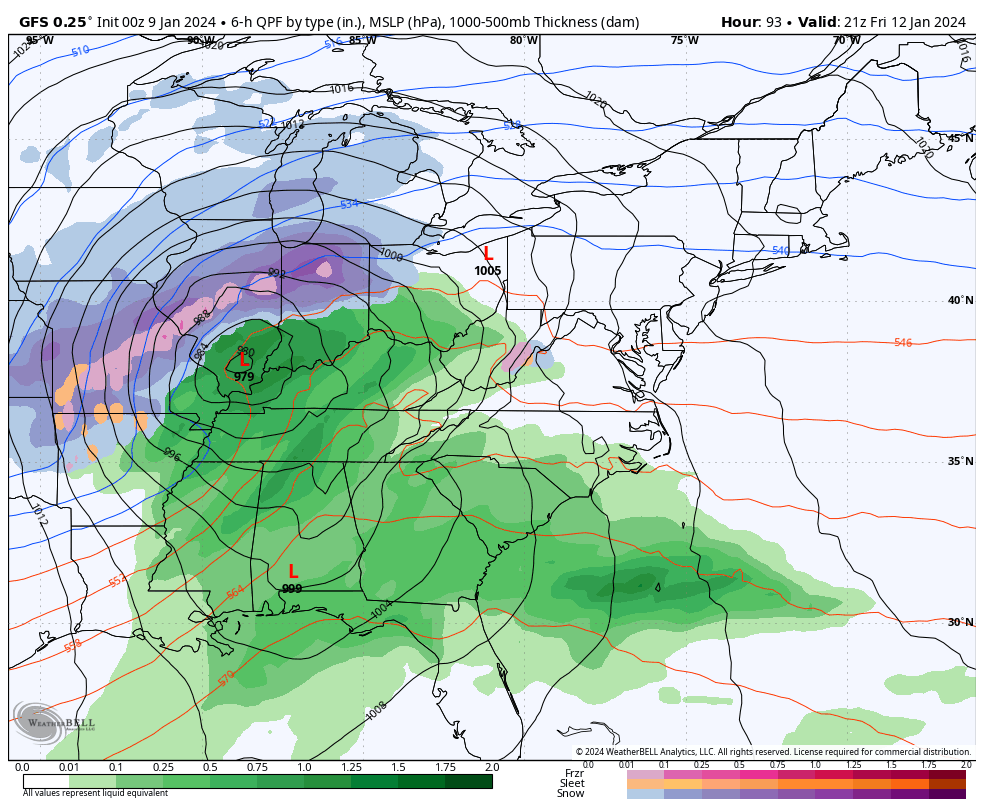
Winds will ease by Thursday, then the next storm arrives by Friday evening… ending Saturday morning.
Colder air will arrive with a chance for light snow on Monday MLK Day.


Computer Models Support East Coast Storm Track

The latest NOAA report is confident in a Very Strong event. Possibly HISTORIC! This refers to the temperatures in the Pacific, with impacts on the US Winter Storm Track.

Winter Weather Folklore: Top 20 and more signals from nature for snow.
Winter Outlook 2024 From Two Farmers Almanacs Return to Cold and Snow


Click to see more and ‘Book’ a visit to your school

I am aware there are some spelling and grammar typos and occasional other glitches. I take responsibility for my mistakes and even the computer glitches I may miss. I have made a few public statements over the years, but if you are new here, you may have missed it: I have dyslexia and found out during my second year at Cornell University. It didn’t stop me from getting my meteorology degree and being the first to get the AMS CBM in the Baltimore/Washington region. One of my professors told me that I had made it that far without knowing and to not let it be a crutch going forward. That was Mark Wysocki, and he was absolutely correct! I do miss my mistakes in my own proofreading. The autocorrect spell check on my computer sometimes does an injustice to make it worse. I also can make mistakes in forecasting. No one is perfect at predicting the future. All of the maps and information are accurate. The ‘wordy’ stuff can get sticky. There has been no editor who can check my work when I need it and have it ready to send out in a newsworthy timeline. Barbara Werner is a member of the web team that helps me maintain this site. She has taken it upon herself to edit typos when she is available. That could be AFTER you read this. I accept this and perhaps proves what you read is really from me… It’s part of my charm.
#FITF