Monday January 8 2024
There has been a lot of concern for the storm expected on Tuesday. The high winds and heavy rain will get worse later in the day and at night. As a precaution, some areas schools have already announced closing early in anticipation of the conditions. It will be a bumpy day, but I see the peak of the storm passing through after dark.
Concerns:
- Downed Trees
- Flying Decorations/Lawn Furniture
- Power Outages
- Flooding from heavy rain
- Flooding from high water on the Chesapeake Bay.
Storm Animation Summary
Tuesday Morning to Wednesday Afternoon
I have received many messages asking about a ‘hurricane’. This is not that type of storm. There have been some computer models suggesting winds may briefly reach up over 70 mph on Delmarva. I often see these products overestimate the conditions. I will show them below… Even if not reached, the squall line that may produce the intense air flow will likely lead to concerns about power outages to impacts on area bridges.
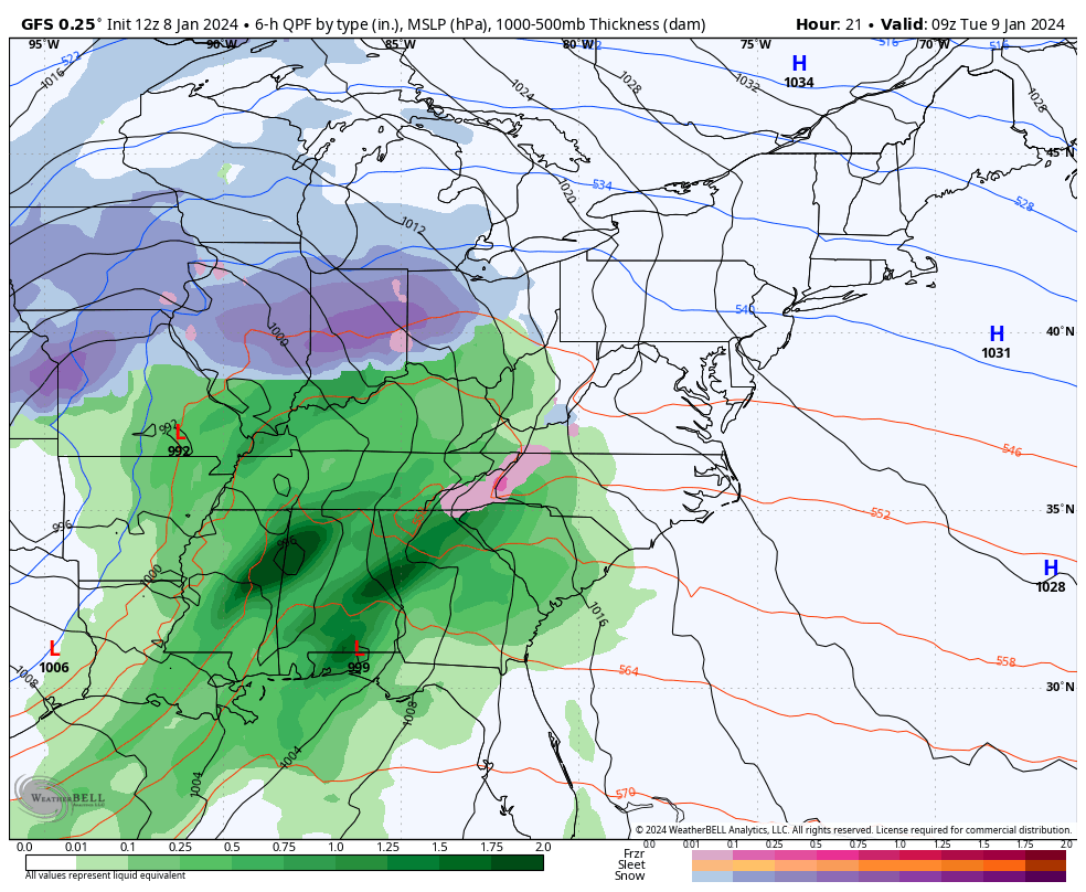
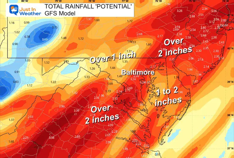
Flooding is another concern. Heavy rain may range from 1 to 3 inches, in addition to winds piling high water up the Chesapeake Bay FROM THE SOUTH. A few Rivers have a Major Flood Stage Forecast.
Here is a quick look at what we can expect. Let’s start with the Wind and Water.
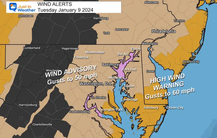
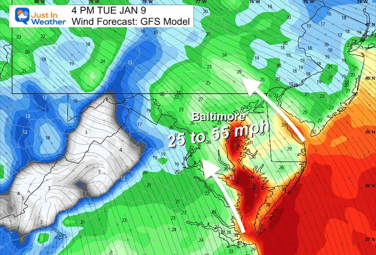
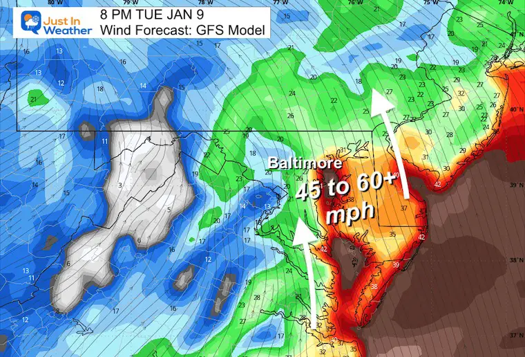
WIND ALERTS After 3 PM Tuesday
Wind Advisory:
High Wind Watch:
- Wind Gusts 60 mph – or higher
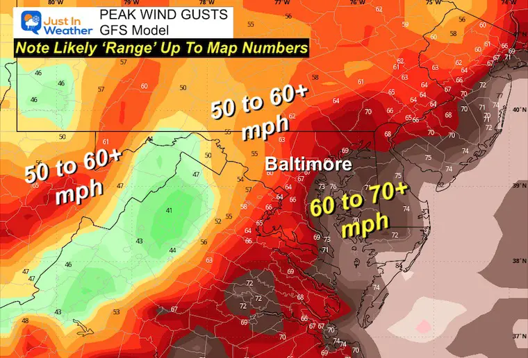
Peak Wind Gusts
7 PM to Midnight
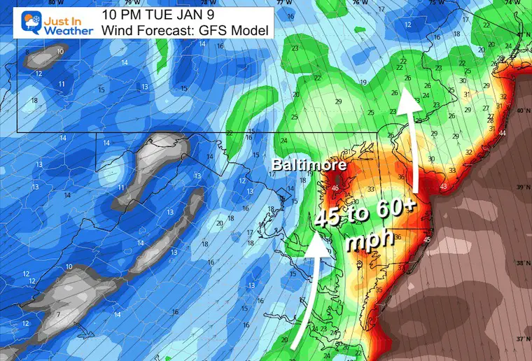
This product and a few others may overdo the wind gusts. It is still safe to expect OVER 50 mph with the squall line covering a large area.
The highest winds will be by the water and on Delmarva.
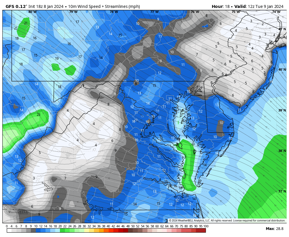
Wind Forecast Animation
7 AM to Midnight
Timeline snapshots are below.
Water
Flood Watch: Heavy rainfall over 1 inch.
Coastal Flood Watch: Wind piling high water up the Chesapeake Bay.

Rain Forecast
River Flood Forecast
The National Weather Service has identified a few areas (in purple) to reach close to Major Flood Stage. See the charts below.
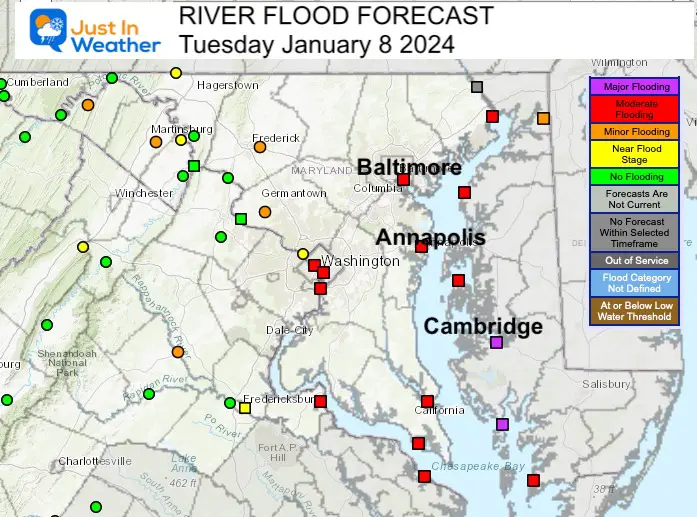
Moderate to Major Flood Stage Forecast
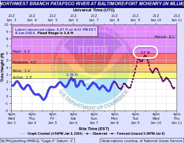
Baltimore at Fort McHenry
5.7 Ft height just below Major Flood Stage around 8 PM.
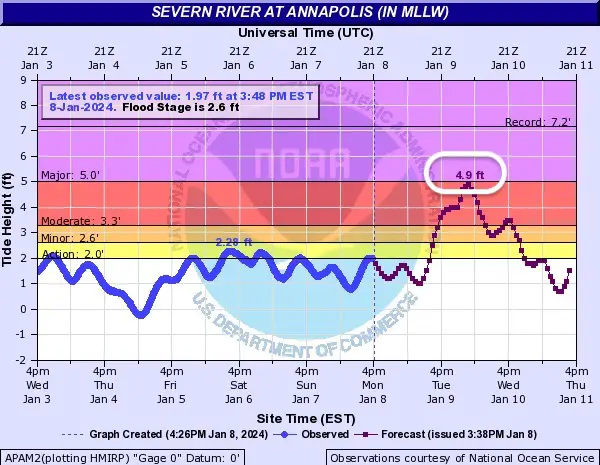
Annapolis at Severn River
4.9 Ft height just below Major Flood Stage around 7 PM.
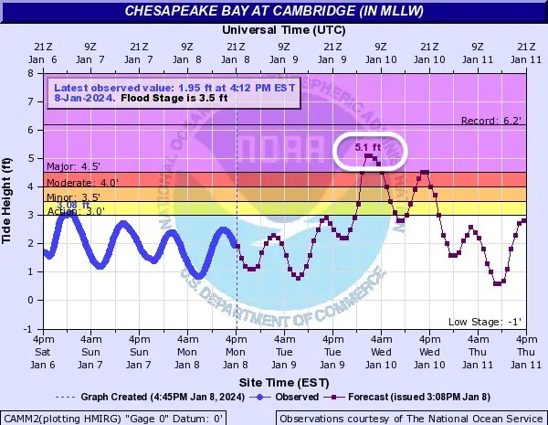
Cambridge
5.1 Ft height just below Major Flood Stage around 9 PM to 11 PM.
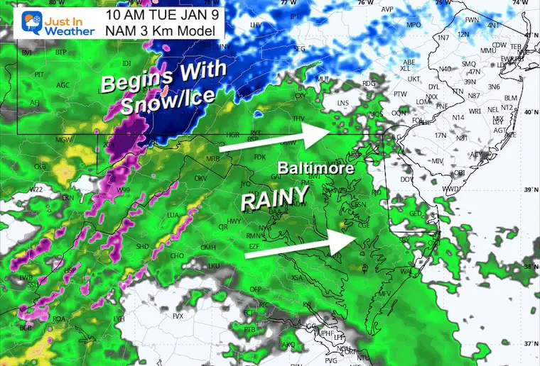
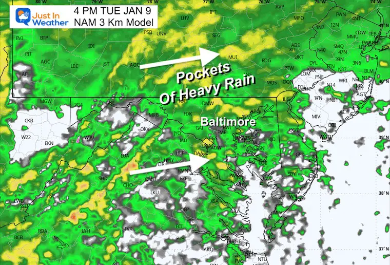
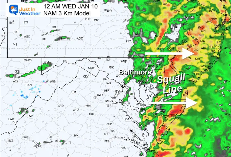
Radar Simulation
9 AM to Midnight
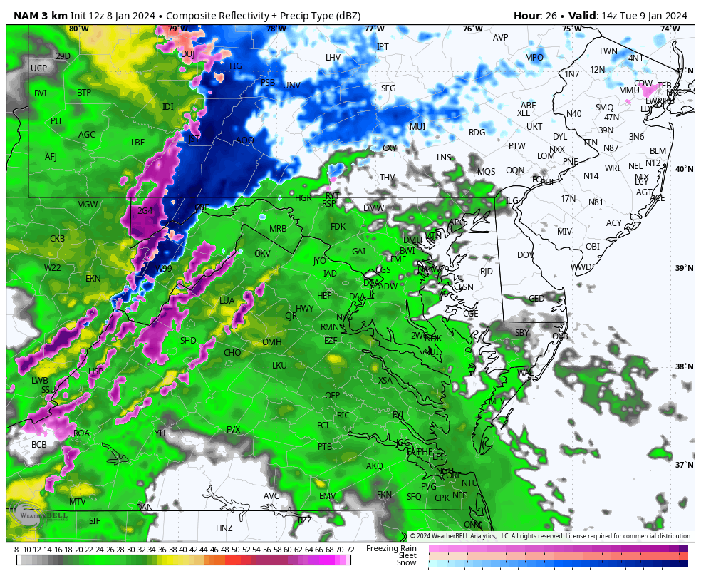
Snapshots
10 AM
This may begin briefly with snow and ice in the mountains. A Winter Weather Advisory has been issued to include Cumberland and McHenry.
NOTE: Conditions will get worse in the Afternoon and Evening.
4 PM
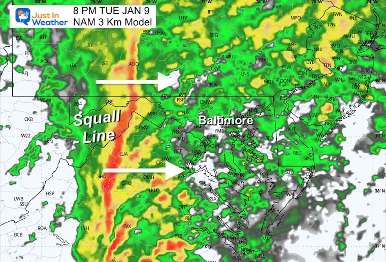
Radar Simulation
Wind
8 PM
Radar Simulation
Wind
10 PM
Radar Simulation
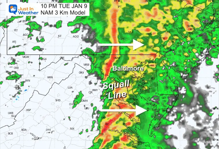
Wind
Midnight
The squall line should approach the beaches by this time…
Subscribe for eMail Alerts
RECENT Winter Outlook Reports:

El Niño Winter Updates

Computer Models Support East Coast Storm Track

El Niño Advisory
The latest NOAA report is confident in a Very Strong event. Possibly HISTORIC! This refers to the temperatures in the Pacific, with impacts on the US Winter Storm Track.

Winter Weather Folklore: Top 20 and more signals from nature for snow.
NOAA’s Winter Outlook 2024
Winter Outlook 2024 From Two Farmers Almanacs Return to Cold and Snow
Explore More
Maryland Snow Climate History And Other Winter Pages

Faith in the Flakes Gear

STEM Assemblies/In School Fields Trips Are Back
Click to see more and ‘Book’ a visit to your school

Please share your thoughts and best weather pics/videos, or just keep in touch via social media
RESTATING MY MESSAGE ABOUT DYSLEXIA
I am aware there are some spelling and grammar typos and occasional other glitches. I take responsibility for my mistakes and even the computer glitches I may miss. I have made a few public statements over the years, but if you are new here, you may have missed it: I have dyslexia and found out during my second year at Cornell University. It didn’t stop me from getting my meteorology degree and being the first to get the AMS CBM in the Baltimore/Washington region. One of my professors told me that I had made it that far without knowing and to not let it be a crutch going forward. That was Mark Wysocki, and he was absolutely correct! I do miss my mistakes in my own proofreading. The autocorrect spell check on my computer sometimes does an injustice to make it worse. I also can make mistakes in forecasting. No one is perfect at predicting the future. All of the maps and information are accurate. The ‘wordy’ stuff can get sticky. There has been no editor who can check my work when I need it and have it ready to send out in a newsworthy timeline. Barbara Werner is a member of the web team that helps me maintain this site. She has taken it upon herself to edit typos when she is available. That could be AFTER you read this. I accept this and perhaps proves what you read is really from me… It’s part of my charm.
#FITF


