December 28, 2023
Thursday Morning Update
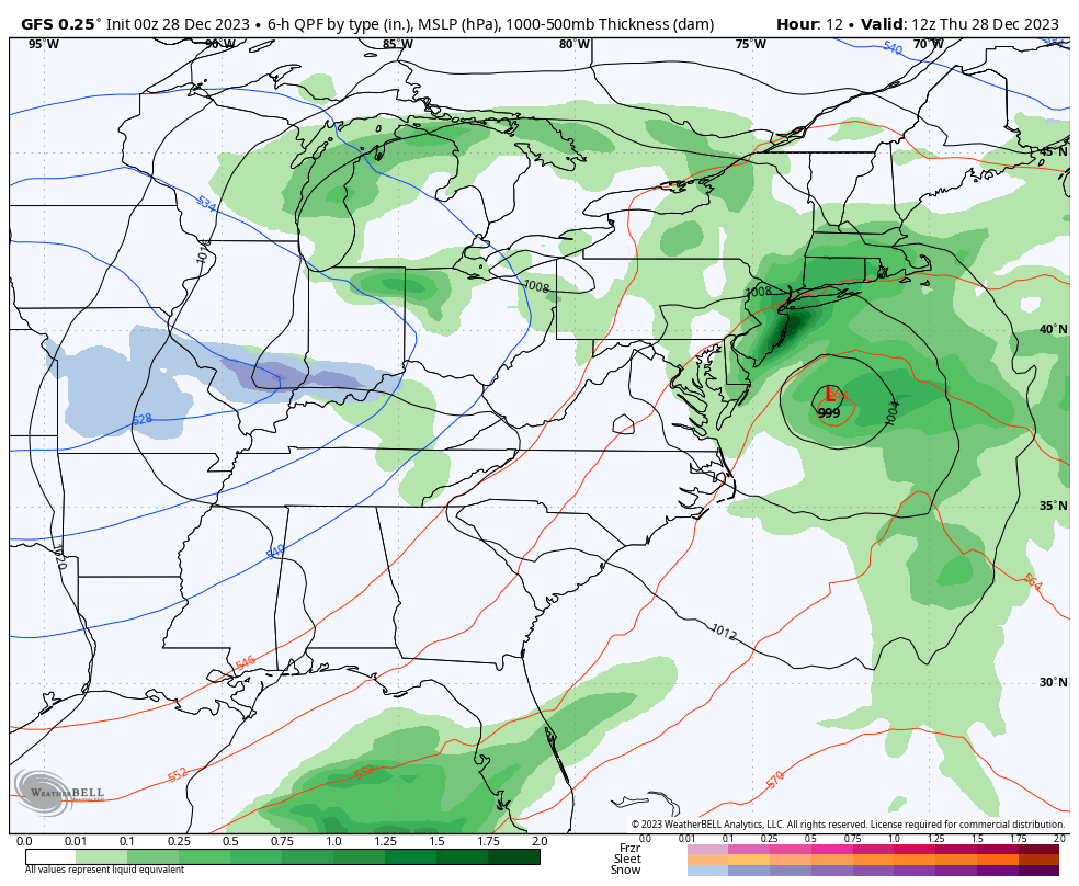
Last night brought some very heavy rainfall to our region. The complete storm maps will be available this morning, but I can confirm the daily rainfall record was set in Baltimore:
December 27 2023 = 1.62”
Old record: 1.21” on Dec 27 in 1894
While we are discussing records, many people have commented about this mild pattern and the new norm. If we look back to the record high for this date, 74ºF was reached in 1946. It has been warmer, often, and long ago. We will get back to a seasonal chill this weekend.
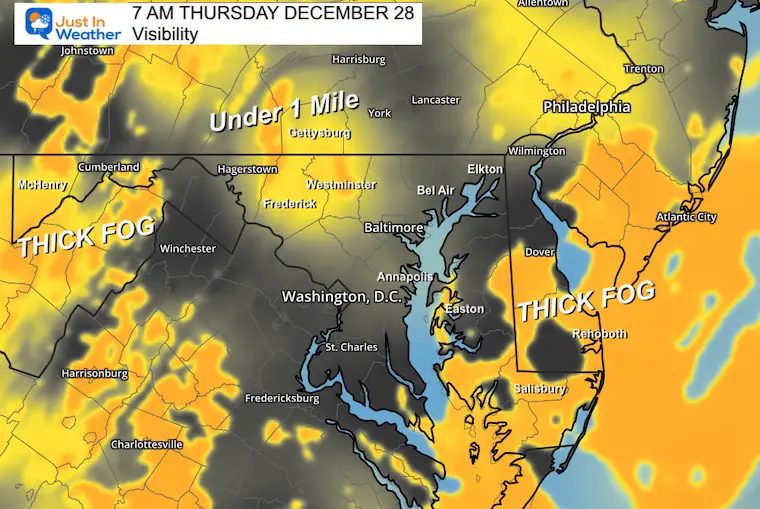
Morning Visibility
The ground is still soggy, and the air is saturated. There are pockets of very thick fog along the Delmarva/ocean coast. Also the inland suburbs and higher mountains farther west.
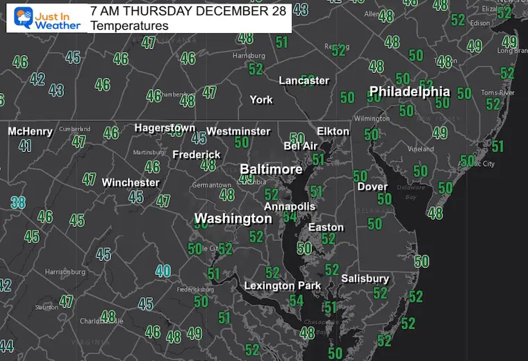
Morning Temperatures
Live Radar Widget
Not much will show up, but you can track the departing storm.
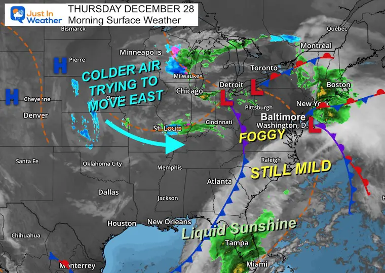
Morning Surface Weather
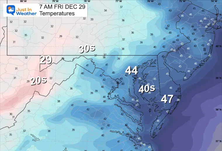
Areas of thick fog this morning, and remaining mild today. The cold air from the inland blizzard will be on the move and will reach us tomorrow. This will be the start of the pattern to get us to seasonal and colder air over the next two weeks.
Storm Forecast Today Through Saturday
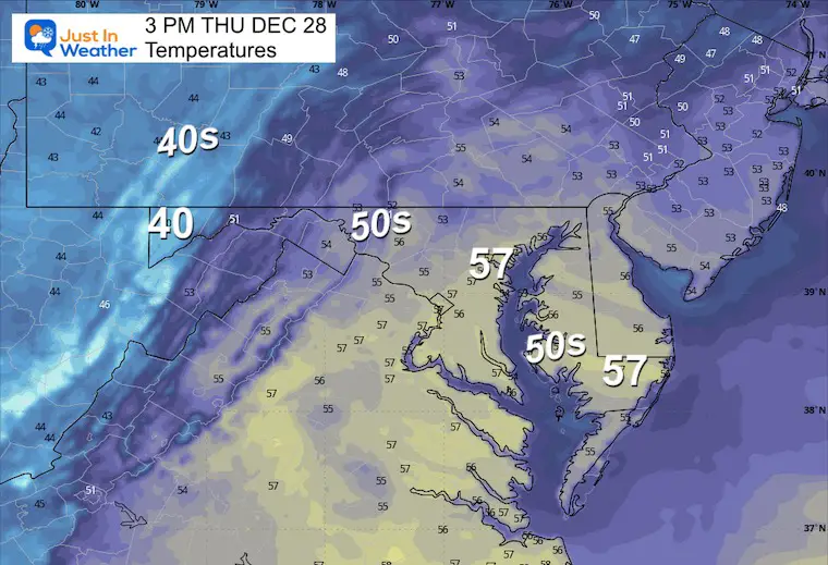
Afternoon Temperatures
CLIMATE DATA: Baltimore
TODAY December 28
Sunrise at 7:25 AM
Sunset at 4:51 PM
Normal Low in Baltimore: 27ºF
Record 10ºF in 1950/2017
Normal High in Baltimore: 45ºF
Record 74ºF 1946
Friday Weather
Morning Temperatures
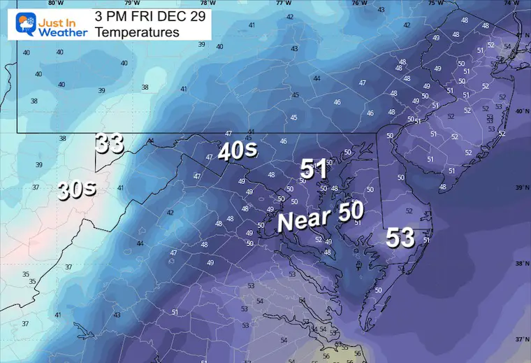
Afternoon Temperatures
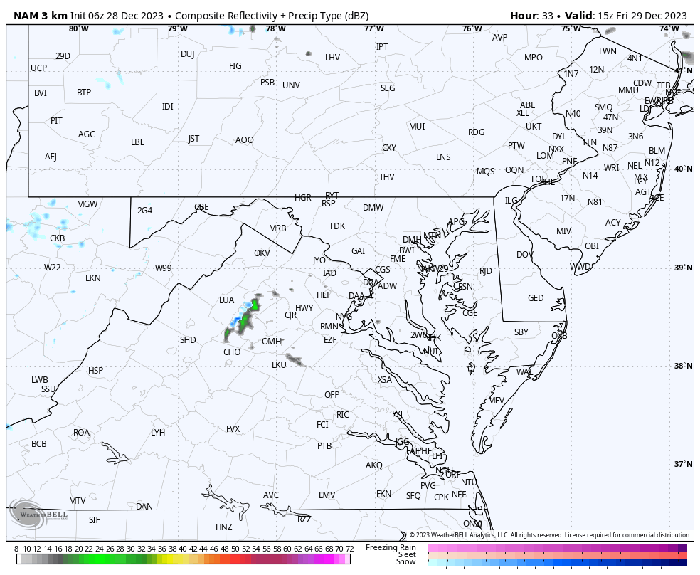
Radar Simulation Noon to Midnight
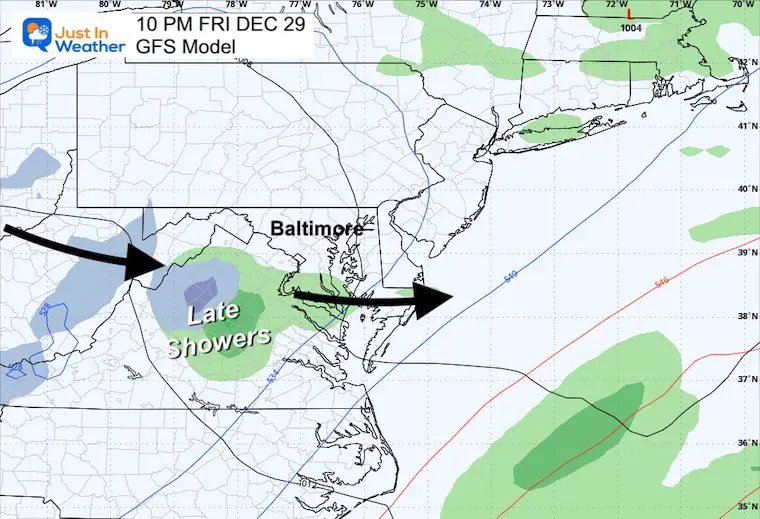
Depending on where the heavier rain sets up, there may be spots that can get over 1 inch.
Friday Night
The best chance of a shower might be on a track from the mountains through central Virginia.
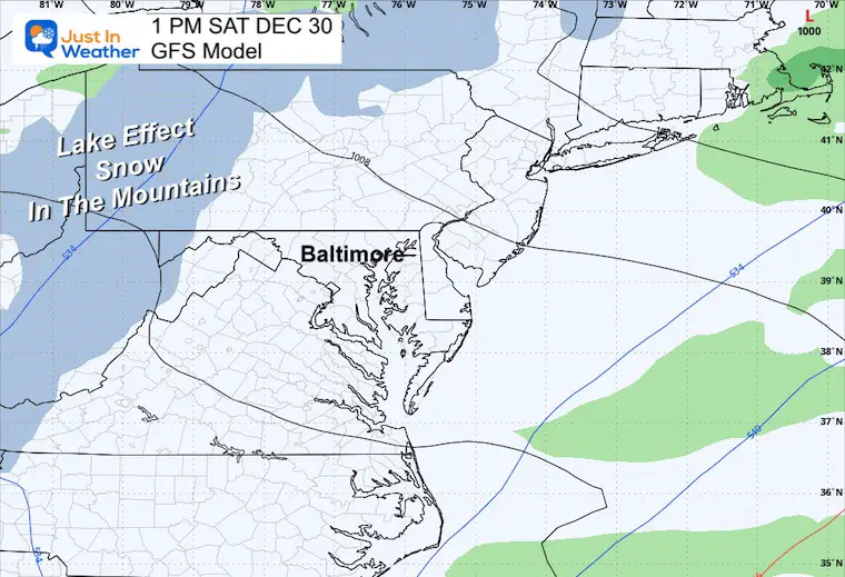
Saturday
Snow showers in the mountains.
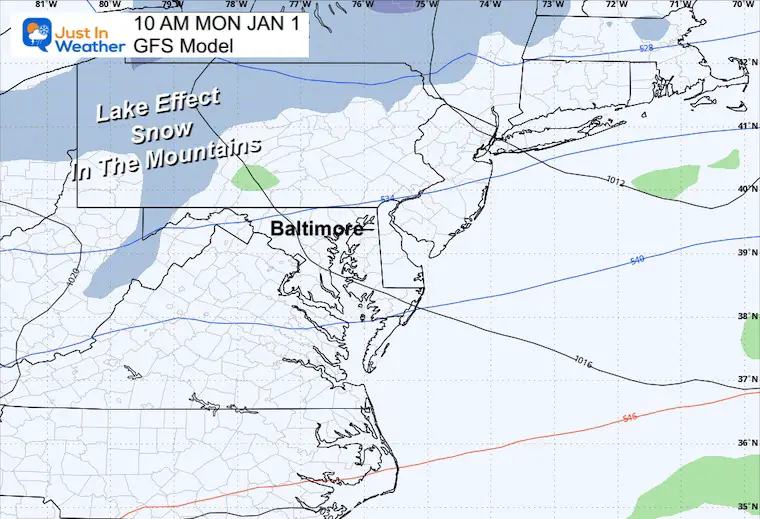
New Year’s Day
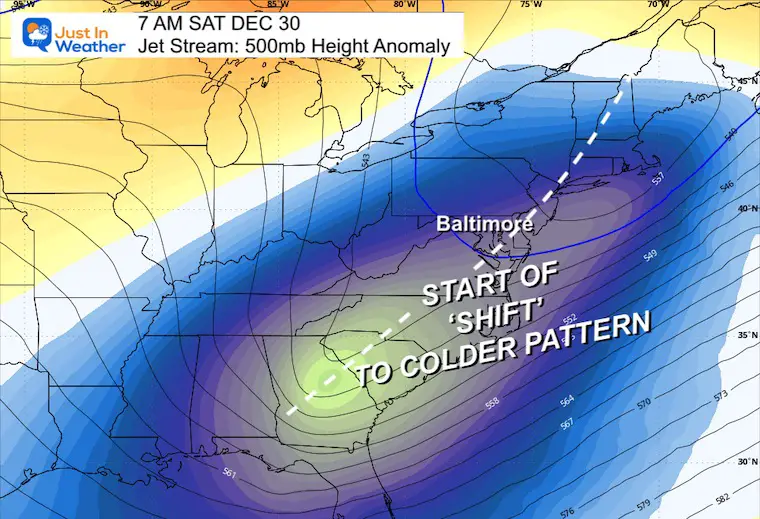
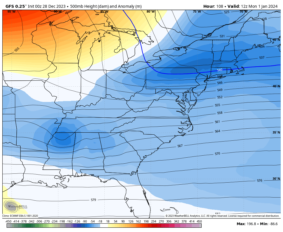
Weather Forecast Jet Stream
Saturday December 30
The trough crossing the East Coast is not the arctic air but the start of the return to a normal and colder trend into January.
Animation Mon Jan 1 to Fri Jan 5
A few more impulses next week are showing the trend for colder air. This may include a storm with winter precipitation mid-week. That is still not certain, but the support for something to develop is there for Wednesday and Thursday.
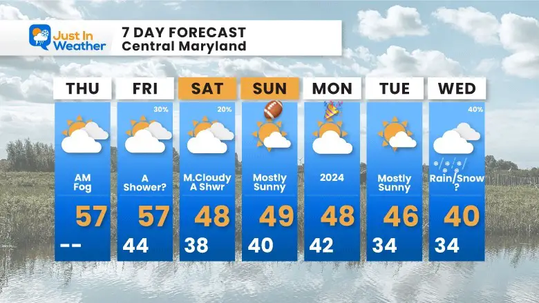
7 Day Forecast
Not much excitement here, but definitely a change. The colder shift brings us back to seasonal temps on Friday.
Ravens game weather and New Year’s celebrations will have quiet and chilly weather.
I posted a 40% chance for a rain-snow mix next Wednesday. I do see potential for a new storm, but am anticipating the modeling is not locked in properly. I am bringing this in a day earlier with the colder air.
Subscribe for eMail Alerts
RECENT Winter Outlook Reports:

El Niño Winter Updates

Computer Models Support East Coast Storm Track

El Niño Advisory
The latest NOAA report is confident in a Very Strong event. Possibly HISTORIC! This refers to the temperatures in the Pacific, with impacts on the US Winter Storm Track.

Winter Weather Folklore: Top 20 and more signals from nature for snow.
NOAA’s Winter Outlook 2024
Winter Outlook 2024 From Two Farmers Almanacs Return to Cold and Snow
Explore More
Maryland Snow Climate History And Other Winter Pages

Faith in the Flakes Gear

STEM Assemblies/In School Fields Trips Are Back
Click to see more and ‘Book’ a visit to your school

Please share your thoughts and best weather pics/videos, or just keep in touch via social media
RESTATING MY MESSAGE ABOUT DYSLEXIA
I am aware there are some spelling and grammar typos and occasional other glitches. I take responsibility for my mistakes and even the computer glitches I may miss. I have made a few public statements over the years, but if you are new here, you may have missed it: I have dyslexia and found out during my second year at Cornell University. It didn’t stop me from getting my meteorology degree and being the first to get the AMS CBM in the Baltimore/Washington region. One of my professors told me that I had made it that far without knowing and to not let it be a crutch going forward. That was Mark Wysocki, and he was absolutely correct! I do miss my mistakes in my own proofreading. The autocorrect spell check on my computer sometimes does an injustice to make it worse. I also can make mistakes in forecasting. No one is perfect at predicting the future. All of the maps and information are accurate. The ‘wordy’ stuff can get sticky. There has been no editor who can check my work when I need it and have it ready to send out in a newsworthy timeline. Barbara Werner is a member of the web team that helps me maintain this site. She has taken it upon herself to edit typos when she is available. That could be AFTER you read this. I accept this and perhaps proves what you read is really from me… It’s part of my charm.
#FITF


