December 25 2023
Christmas Evening Update
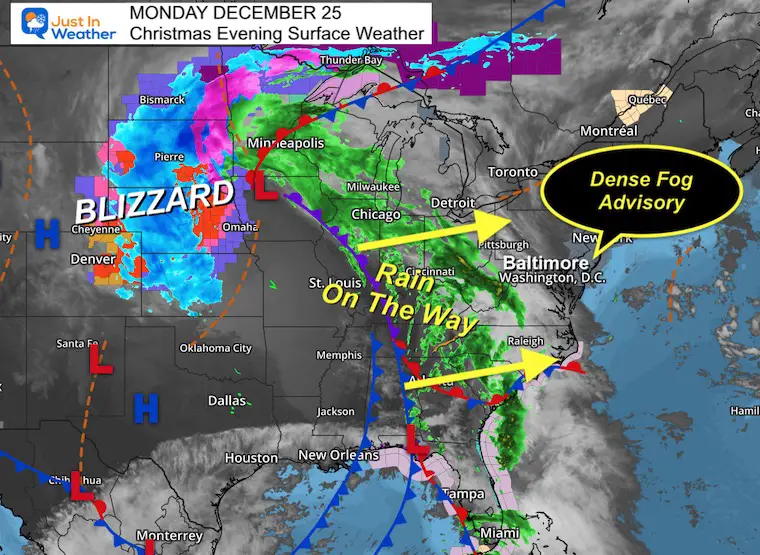
I hope you had a great holiday! I wanted to update a few things quickly for this holiday week. The winds will be from the East overnight, bringing in moisture and producing thick fog near coastal areas. There is a Dense Fog Advisory for Delmarva to the coast, but there will be some fog around the Bay and in the northern hills. This will set us up for a few damp days.
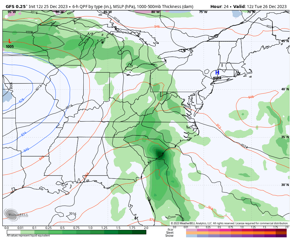
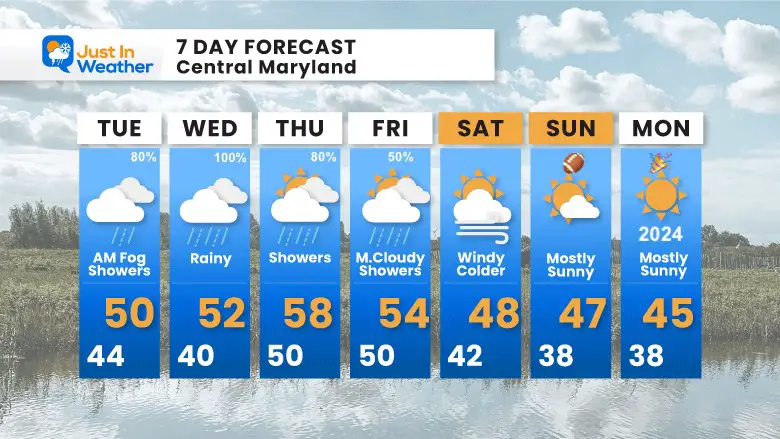
The heaviest rain will be on Wednesday, then lingering showers on Thursday.
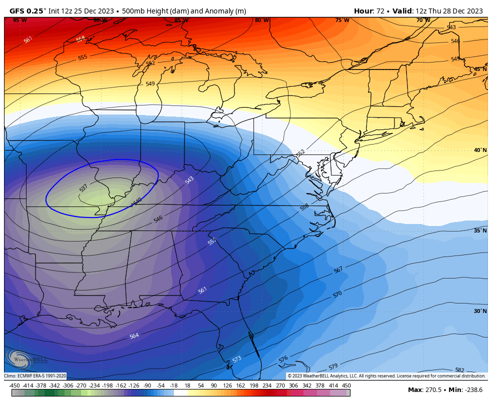
The pattern will start to turn colder. I do not see arctic air yet, but I see signals of the adjustment, which plays into our El Niño winter expectations. That usually brings a mild December, followed by the winter pattern for January and February.
No White Christmas: No Problem
It is not as common as you might imagine. So, not having snow this year is no worry, as it has no correlation to the rest of the season.
Surface Weather
This large storm is the driving force for millions. We are on the warm and soon to be wet side. The winds from the Atlantic will bring in the fog and feed the incoming rain.
Blizzard Warnings on the back side for Nebraska and South Dakota.
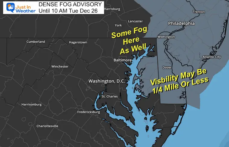
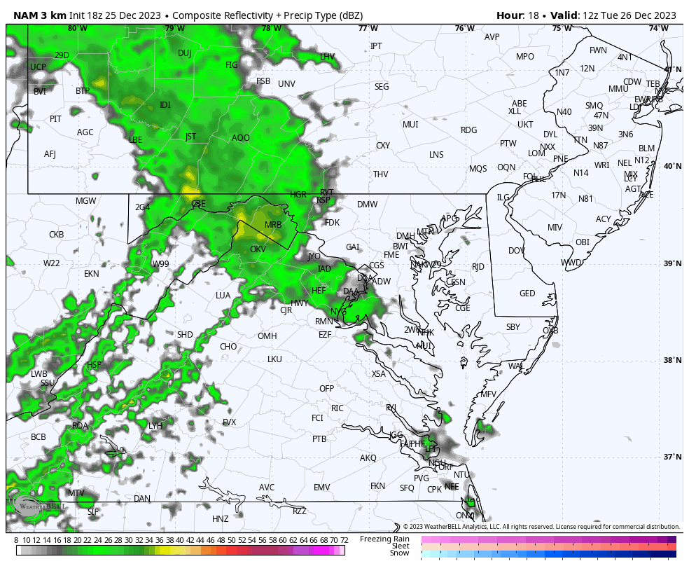
Dense Fog Advisory
This includes Kent, Queen Anne’s, and Caroline Counties in MD, all of Delaware, SE PA, and NJ: Visibility may be under 1/4 mile.
There may be fog into central Maryland and Southern PA as well, but not as thick!
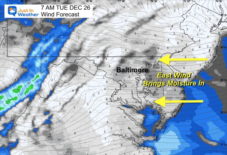
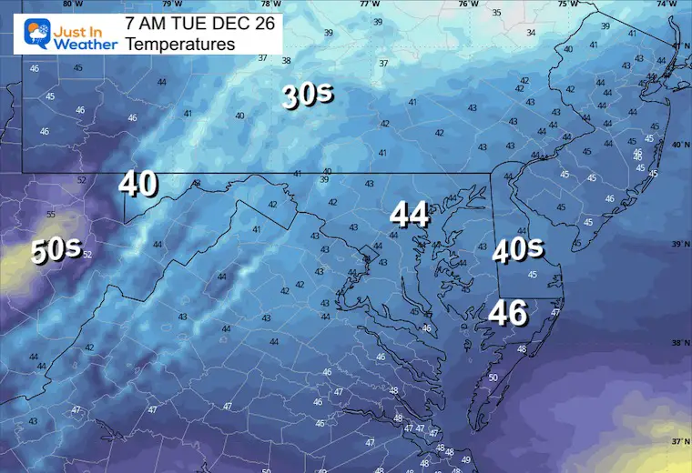
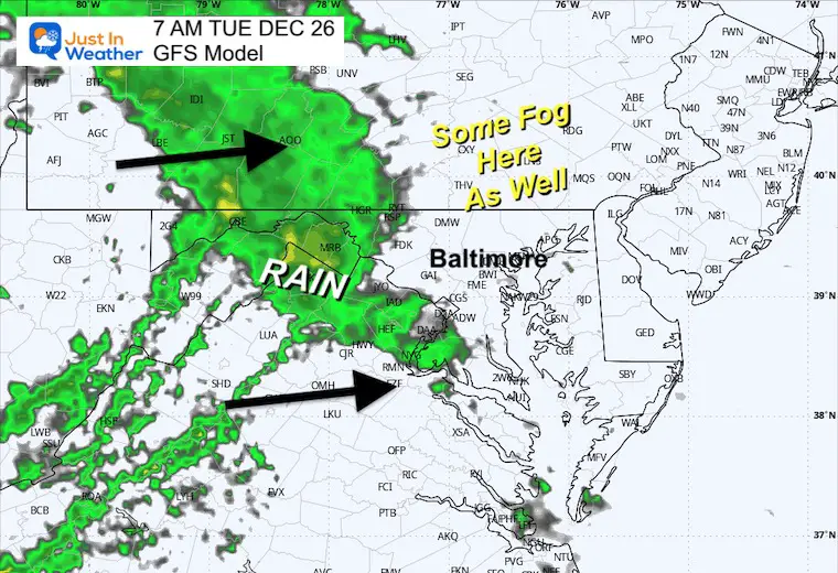
Tuesday Morning Weather
Wind Forecast
The winds will be light but from the east with plenty of moisture.
Temperatures
The day will start in the lower to mid-40s for most of our region.
Radar Simulation at 7 AM
Rain will cross the mountains from the West, while fog will be near and east of the Chesapeake Bay.
Radar Simulation from 7 AM to Midnight
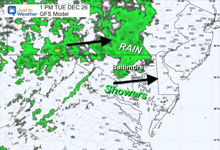
Afternoon Snapshot
Rain will be more likely in central Maryland, to the mountains and north. Often, we see more rain than shown on this product, so I would still plan for showers even south of Baltimore.
Storm Wider View
Tuesday Morning to Thursday Morning
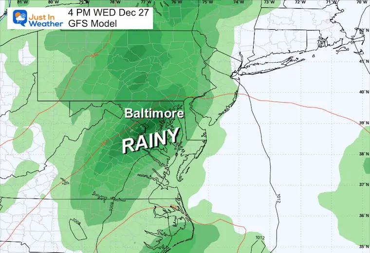
Snapshot Wednesday
The heaviest rain will be on this day. There may be a brief round of thunderstorms as well.
Looking Ahead
Jet Stream Thursday Morning to Next Tuesday Morning
The change is showing up. This is NOT arctic air, but it will be colder with a few more impulses to lock us in for January.
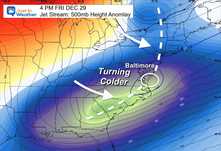
Snapshot Friday
As the storm passes, the shift to colder air will be on Friday afternoon.
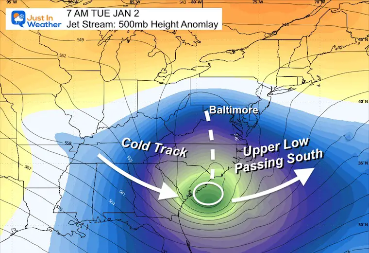
Next Tuesday
Starting off the New Year, we see an upper-level Low passing to our south. I like the pattern and still see some wiggle room for this to shift north. NOT seeing a weather event now may play to our benefit as the coordination may time out better than seen here 9 days away.
If we can get some form of snow or wintry weather, I would start to look here.
7 Day Outlook
This is just a guide into the New Year.
The Ravens Game and New Year’s celebrations should have quiet weather.
Subscribe for eMail Alerts
RECENT Winter Outlook Reports:

El Niño Winter Updates

Computer Models Support East Coast Storm Track

El Niño Advisory
The latest NOAA report is confident in a Very Strong event. Possibly HISTORIC! This refers to the temperatures in the Pacific, with impacts on the US Winter Storm Track.

Winter Weather Folklore: Top 20 and more signals from nature for snow.
NOAA’s Winter Outlook 2024
Winter Outlook 2024 From Two Farmers Almanacs Return to Cold and Snow
Explore More
Maryland Snow Climate History And Other Winter Pages

Faith in the Flakes Gear

STEM Assemblies/In School Fields Trips Are Back
Click to see more and ‘Book’ a visit to your school

Please share your thoughts and best weather pics/videos, or just keep in touch via social media
RESTATING MY MESSAGE ABOUT DYSLEXIA
I am aware there are some spelling and grammar typos and occasional other glitches. I take responsibility for my mistakes and even the computer glitches I may miss. I have made a few public statements over the years, but if you are new here, you may have missed it: I have dyslexia and found out during my second year at Cornell University. It didn’t stop me from getting my meteorology degree and being the first to get the AMS CBM in the Baltimore/Washington region. One of my professors told me that I had made it that far without knowing and to not let it be a crutch going forward. That was Mark Wysocki, and he was absolutely correct! I do miss my mistakes in my own proofreading. The autocorrect spell check on my computer sometimes does an injustice to make it worse. I also can make mistakes in forecasting. No one is perfect at predicting the future. All of the maps and information are accurate. The ‘wordy’ stuff can get sticky. There has been no editor who can check my work when I need it and have it ready to send out in a newsworthy timeline. Barbara Werner is a member of the web team that helps me maintain this site. She has taken it upon herself to edit typos when she is available. That could be AFTER you read this. I accept this and perhaps proves what you read is really from me… It’s part of my charm.
#FITF


