


Soggy Saturday Update: Rain Timeline Through Preakness In Baltimore
Friday, May 17, 2024 As we approach another weekend, we have yet another weather system bringing us rain. This will make 16 of 20 weekends this year with some wet…
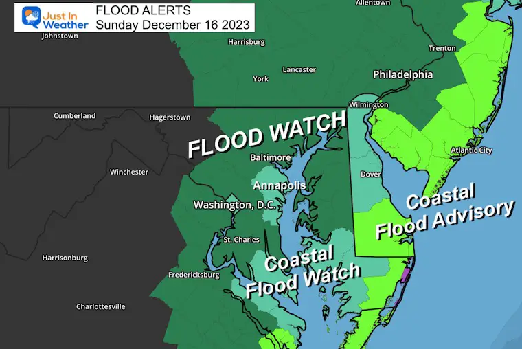
December 16 2023
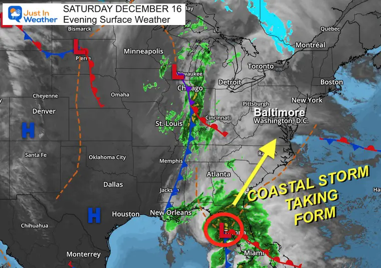
Saturday Night Update
The storm we have talked about for a few days has now taken form. An organized Low Pressure is off the west coast of Florida and will spread north up the East Coast on Sunday.
This event will bring multiple weather concerns for our region:
Low Pressure is located just west of Tampa, FL. This is continuing to develop and will move to the Northeast as it grows stronger.
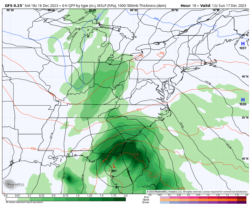
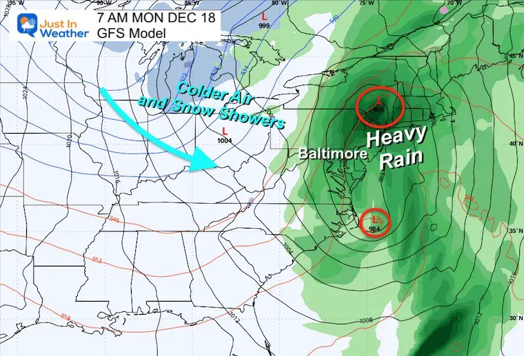
The rain is expected to develop by the afternoon. The heaviest rain will fall overnight.
The track of Low Pressure may be close to the Chesapeake Bay. This will bring the heaviest rain in the morning to the north. The strong winds may lull as it passes, then be followed by a period of dry and mild conditions.
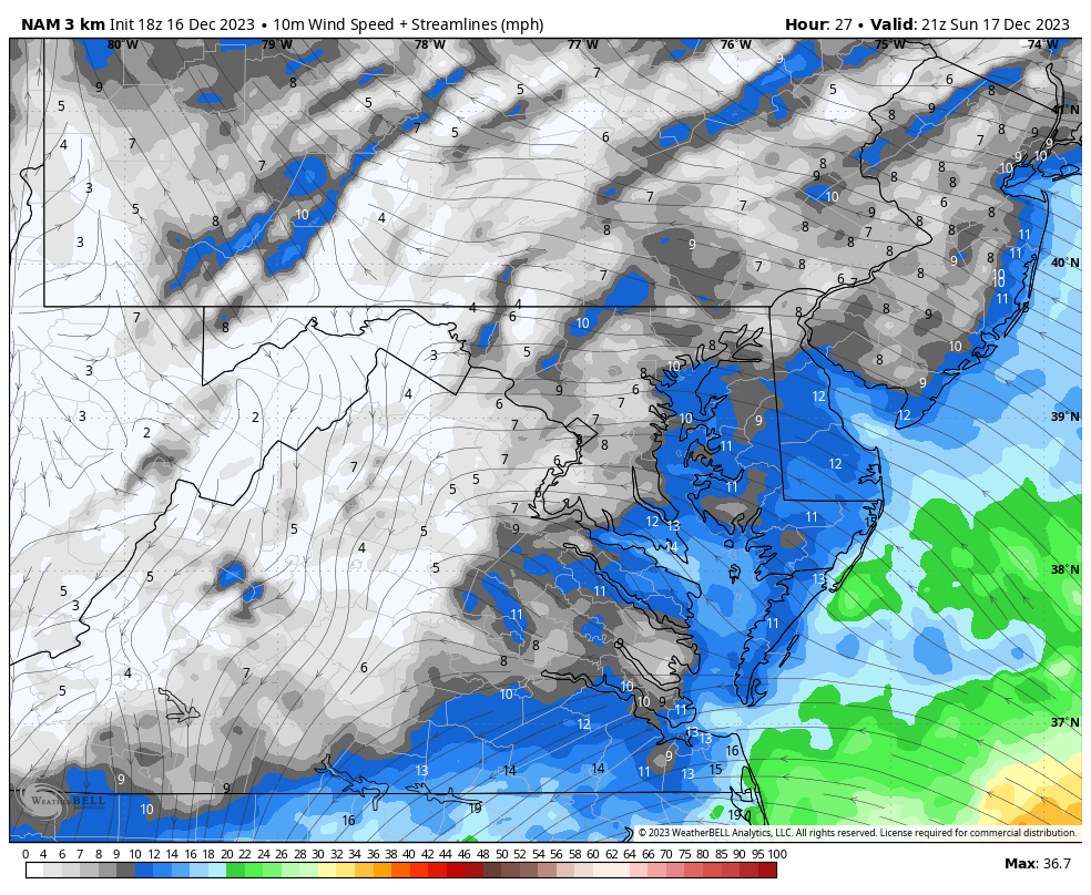
Spotty showers will be breaking out across the region. This is NOT the organized rain that will move in from the south later…
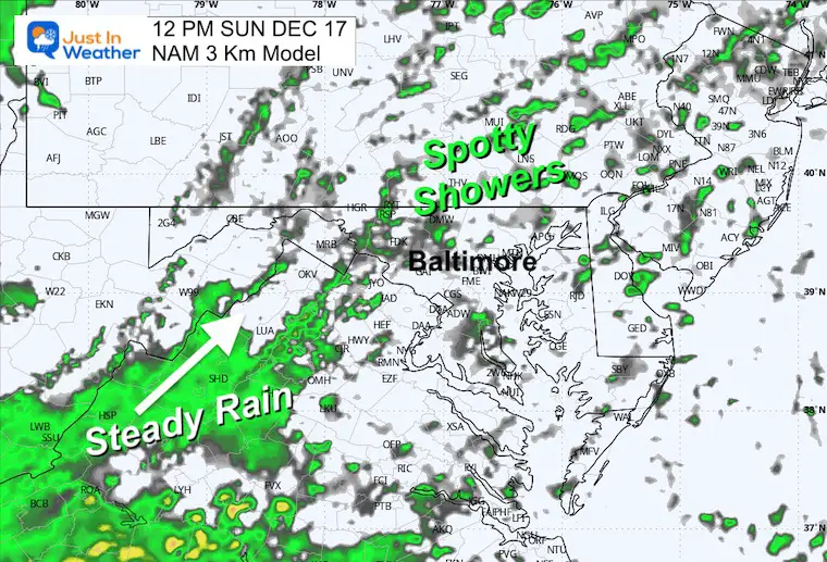
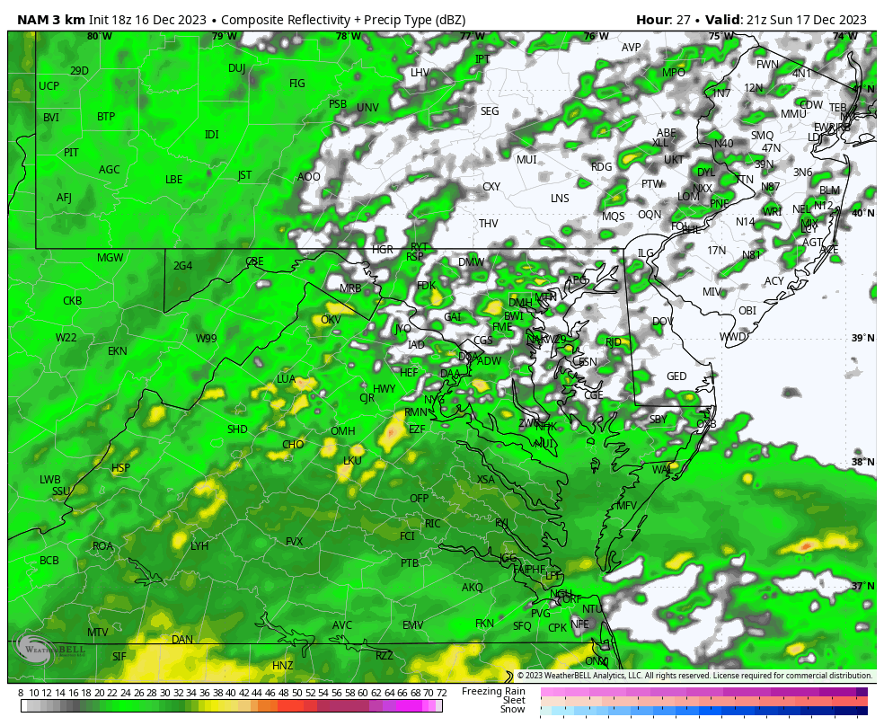
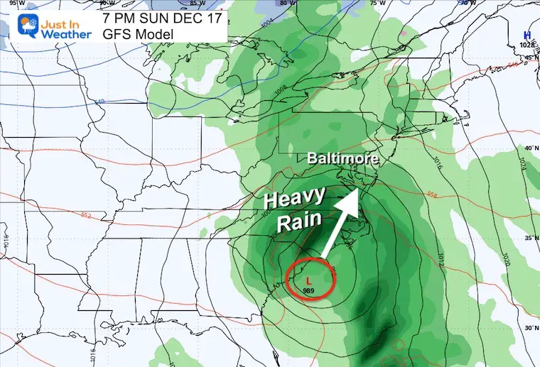
Steady rain will be in place, with heavy rain moving from south to north. The heaviest rain will be at night. If you have plans to go out and watch the Ravens game, this may affect your drive home later.
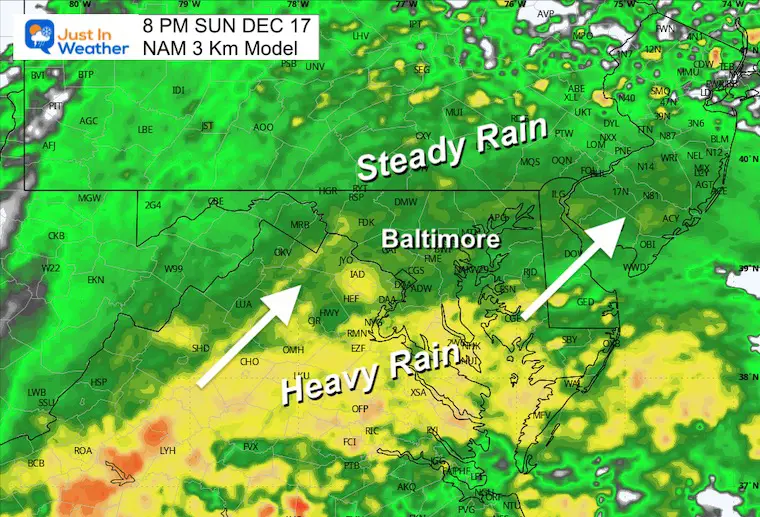
The back edge of the rain should be moving through to the north by noon.
Colder winds will follow. There will already be snow showers breaking out in the mountains. Some flurries and snow showers may follow into metro areas later in the day.
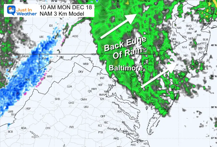
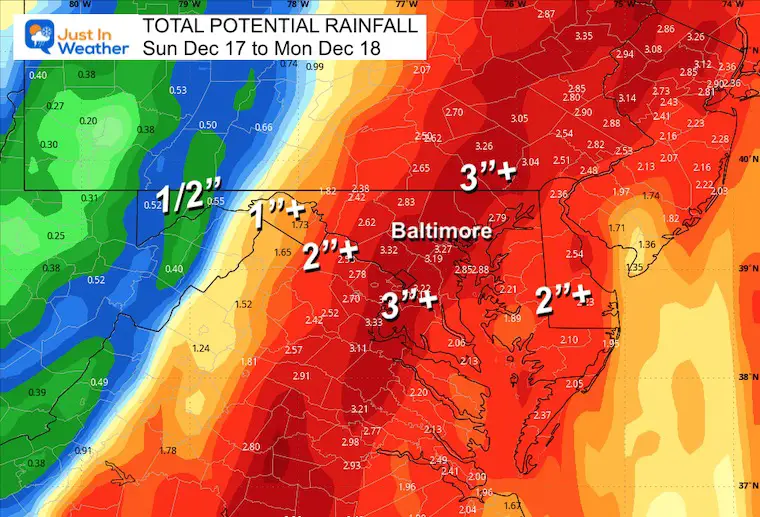
The heaviest rain might be over I-95 to I-83, including Central Maryland and Central Pennsylvania.
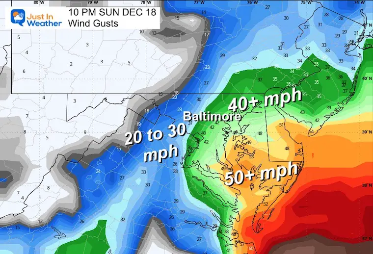
The peak winds will be overnight. They may range from:


Computer Models Support East Coast Storm Track

The latest NOAA report is confident in a Very Strong event. Possibly HISTORIC! This refers to the temperatures in the Pacific, with impacts on the US Winter Storm Track.

Winter Weather Folklore: Top 20 and more signals from nature for snow.
Winter Outlook 2024 From Two Farmers Almanacs Return to Cold and Snow
Subscribe for eMail Alerts


Click to see more and ‘Book’ a visit to your school

I am aware there are some spelling and grammar typos and occasional other glitches. I take responsibility for my mistakes and even the computer glitches I may miss. I have made a few public statements over the years, but if you are new here, you may have missed it: I have dyslexia and found out during my second year at Cornell University. It didn’t stop me from getting my meteorology degree and being the first to get the AMS CBM in the Baltimore/Washington region. One of my professors told me that I had made it that far without knowing and to not let it be a crutch going forward. That was Mark Wysocki, and he was absolutely correct! I do miss my mistakes in my own proofreading. The autocorrect spell check on my computer sometimes does an injustice to make it worse. I also can make mistakes in forecasting. No one is perfect at predicting the future. All of the maps and information are accurate. The ‘wordy’ stuff can get sticky. There has been no editor who can check my work when I need it and have it ready to send out in a newsworthy timeline. Barbara Werner is a member of the web team that helps me maintain this site. She has taken it upon herself to edit typos when she is available. That could be AFTER you read this. I accept this and perhaps proves what you read is really from me… It’s part of my charm.
#FITF