December 16, 2023
Saturday Morning Update
Our next storm has NOT FORMED YET. It will develop in the Gulf of Mexico later today, then organized Low Pressure will move up the East Coast. It will bring us Heavy Rain, High Winds, and High Water into The Chesapeake Bay and along the coast.
Colder air will follow, which may bring us snow showers Monday night and Tuesday.
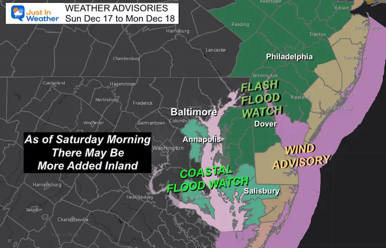
Weather Advisories
The focus here has been for flooding in coastal areas from high water AND for winds gusting to 60 mph along the coast.
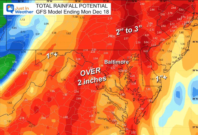
There is a Flood Watch for heavy rain across northern Delmarva and metro Philadelphia, where over 2 inches of rain is expected.
I ‘expect’ the ‘Watch’ to also be issued in central Maryland and PA today. The confusion is because of different NWS offices issuing for their own counties independently.
Morning Surface Weather
High Pressure is still in control for the Mid-Atlantic and will provide us with another sunny and mild day. 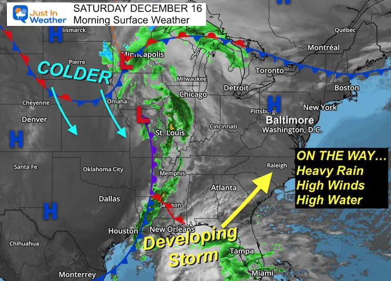
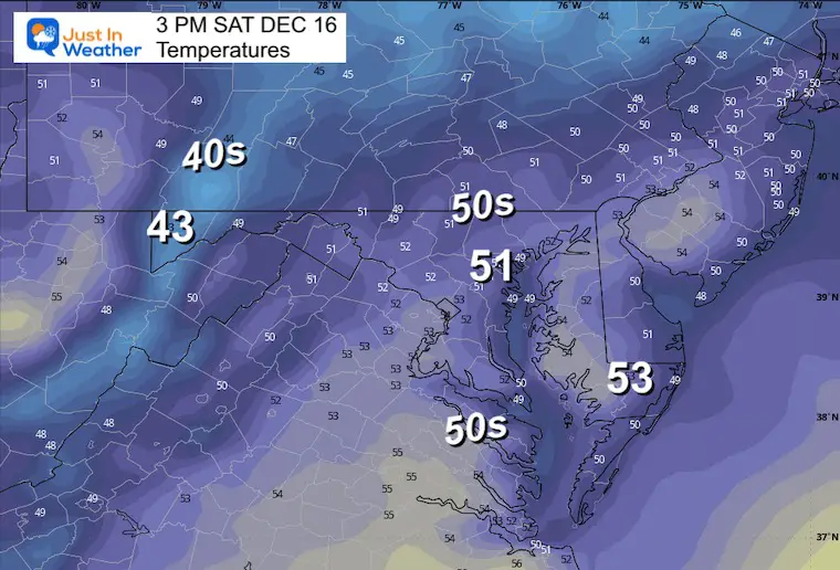
Afternoon Temperatures
CLIMATE DATA: Baltimore
TODAY December 16
Sunrise at 7:19 AM
Sunset at 4:45 PM
Normal Low in Baltimore: 30ºF
Record 10ºF in 1951
Normal High in Baltimore: 47ºF
Record 71ºF 1971
Winter Outlook Reports Links below the 7-Day Forecast
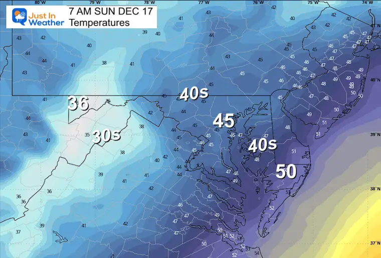
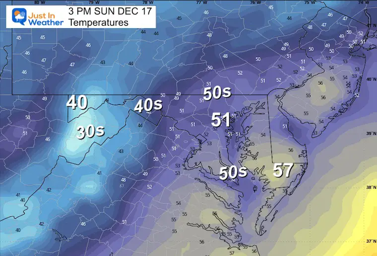
Sunday Temperatures
Morning
Afternoon
Temperatures will continue to rise and may peak around midnight. The high temperature for Monday will likely be in the morning.
Storm Animation: Sunday Morning to Tuesday Morning
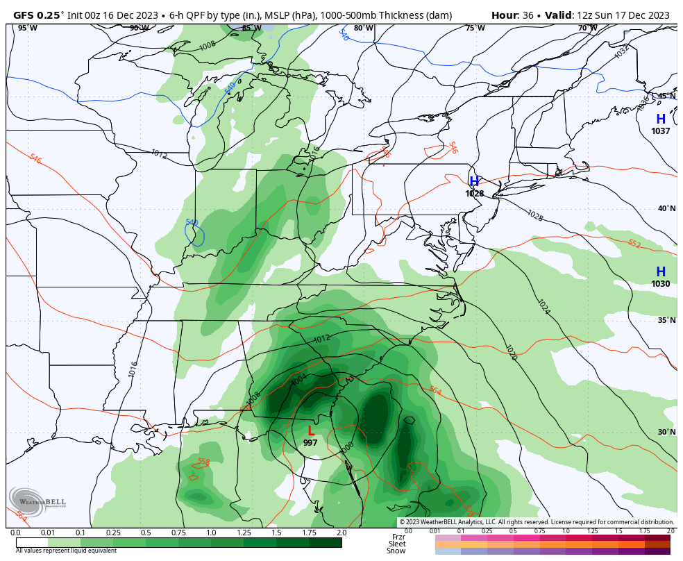
GFS MODEL – This has been the most consistent with the storm track… The European Model has followed this solution.
Snapshots
Sunday Night
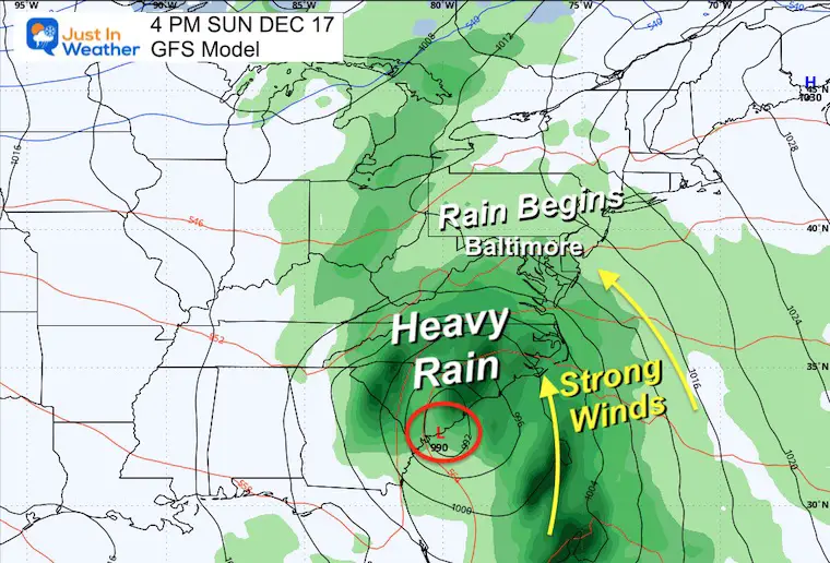
The Primary Low storm track has shifted a little farther east of Maryland. This still brings the heaviest rain with it to include metro areas.
Like last week, there will be rain during the day, but the heaviest rain and strongest winds are expected at night.
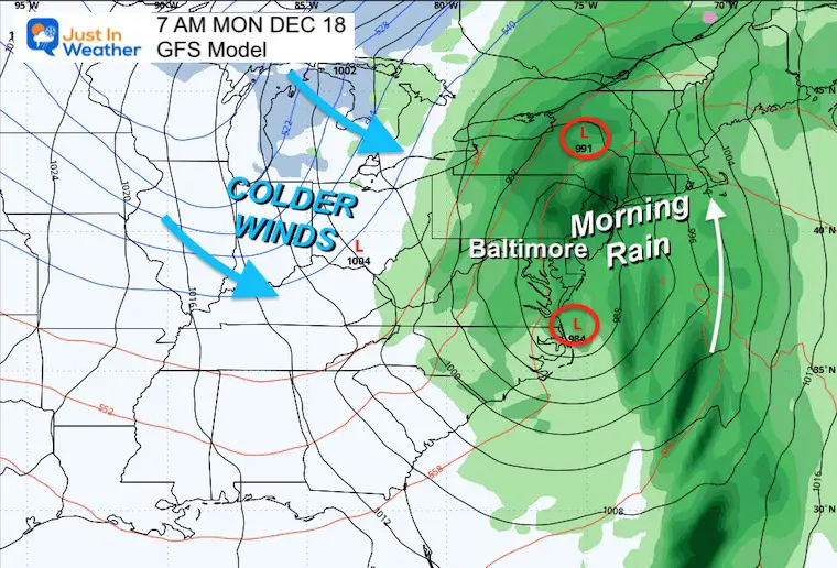
Monday Morning
The core Low will pass through early in the morning, with the heaviest rain overnight and lingering into the morning. We will dry out during the day, allowing the colder air to spill in later.
Rain Forecast Potential
Once again, we see a large area west of the Chesapeake Bay with over 2 inches of rain. Less is expected on the immediate coast and west into the high mountains.
Wind Forecast: 3 PM Sun to 3 PM Mon
Winds will increase from the South and East ahead of the storm. This is why we will be on the warmer side… and if this were mid-winter, this track would still be warm and not a snowy one….
Sunday Night
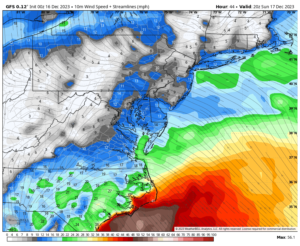
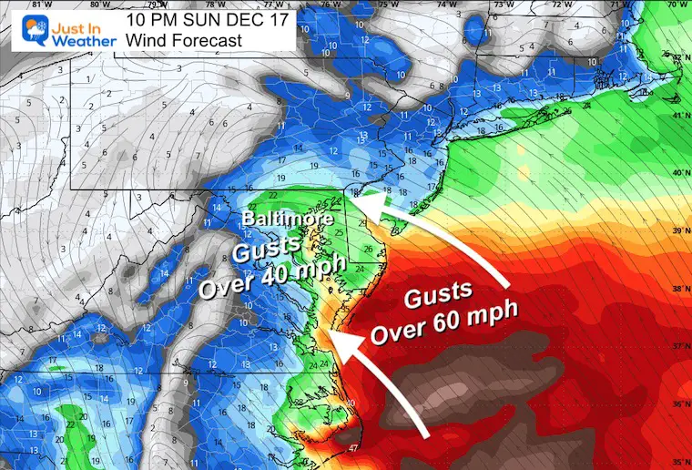
As the heavy rain moves in, winds will gust overnight to 40 mph inland. This will pile the high water into the Chesapeake Bay.
The ocean coast may see winds gust over 60 mph.
Monday Morning
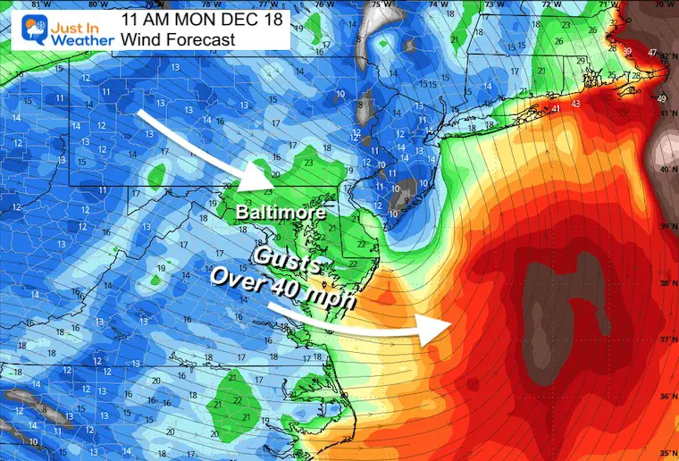
After Low Pressure moves away, colder winds from the Northwest may still gust between 25 and 40+ mph.
Monday Night
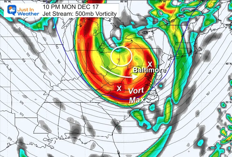
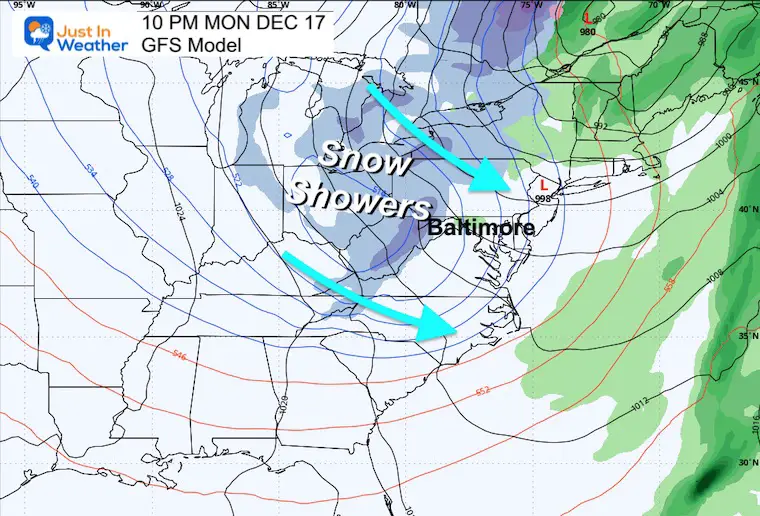
The colder winds and upper-level energy will bring snow showers and flurries overnight and into Tuesday.
This set up is not handled well on this product, but I still am keeping the likelihood in place.
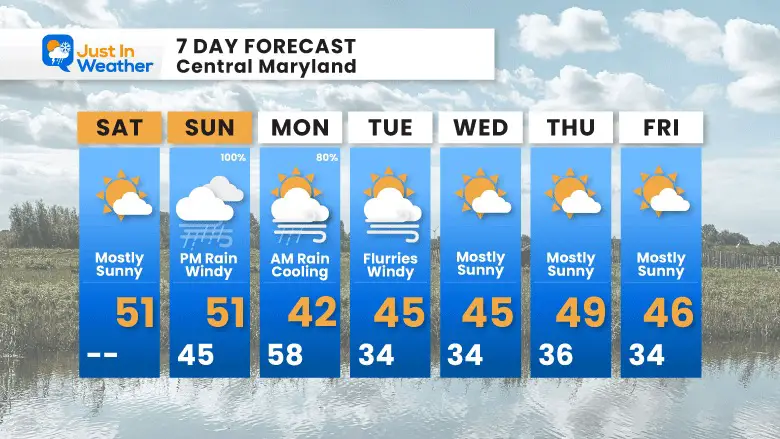
7 Day Forecast
The direct impact of the storm will be from Sunday afternoon to Monday morning. The colder winds that follow may bring snow showers or flurries Monday night into Tuesday.
Subscribe for eMail Alerts
RECENT Winter Outlook Reports:

El Niño Winter Updates

Computer Models Support East Coast Storm Track

El Niño Advisory
The latest NOAA report is confident in a Very Strong event. Possibly HISTORIC! This refers to the temperatures in the Pacific, with impacts on the US Winter Storm Track.

Winter Weather Folklore: Top 20 and more signals from nature for snow.
NOAA’s Winter Outlook 2024
Winter Outlook 2024 From Two Farmers Almanacs Return to Cold and Snow
Explore More
Maryland Snow Climate History And Other Winter Pages

Faith in the Flakes Gear

STEM Assemblies/In School Fields Trips Are Back
Click to see more and ‘Book’ a visit to your school

Please share your thoughts and best weather pics/videos, or just keep in touch via social media
RESTATING MY MESSAGE ABOUT DYSLEXIA
I am aware there are some spelling and grammar typos and occasional other glitches. I take responsibility for my mistakes and even the computer glitches I may miss. I have made a few public statements over the years, but if you are new here, you may have missed it: I have dyslexia and found out during my second year at Cornell University. It didn’t stop me from getting my meteorology degree and being the first to get the AMS CBM in the Baltimore/Washington region. One of my professors told me that I had made it that far without knowing and to not let it be a crutch going forward. That was Mark Wysocki, and he was absolutely correct! I do miss my mistakes in my own proofreading. The autocorrect spell check on my computer sometimes does an injustice to make it worse. I also can make mistakes in forecasting. No one is perfect at predicting the future. All of the maps and information are accurate. The ‘wordy’ stuff can get sticky. There has been no editor who can check my work when I need it and have it ready to send out in a newsworthy timeline. Barbara Werner is a member of the web team that helps me maintain this site. She has taken it upon herself to edit typos when she is available. That could be AFTER you read this. I accept this and perhaps proves what you read is really from me… It’s part of my charm.
#FITF


