


May 19 Weather Sunday Starts Foggy The Warming With Sun And Summer Heat On The Way
Sunday May 19 Morning Report The aftermath of the rainy Saturday is plenty of leftover moisture. This has left us with a bit of humidity and areas of thick fog…
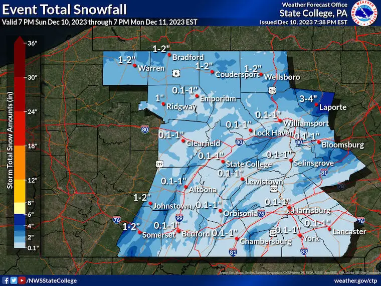
Sunday December 10 2023
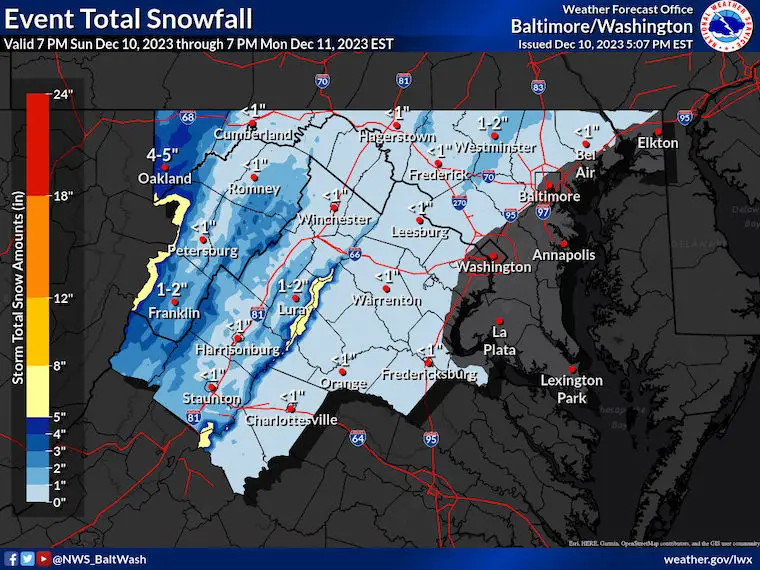
The first snow of the season might be about to fall for many areas in central Maryland and the surrounding region. There may be more snow before sunrise than all of last year for some spots, but don’t get too excited yet…
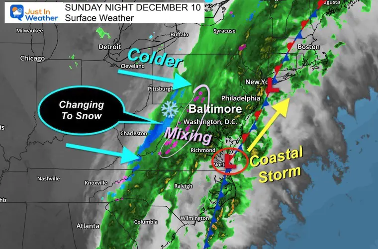
Low Pressure has taken form this evening and is riding along the front and near the coast. This is the main player that has enhanced the heavy rain (after the Ravens game) and will allow colder air to move in. It has already changed over to snow in the mountains, and that line will push east overnight.
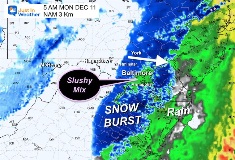
The expectation is that there will be slushy snow that will reach metro Baltimore before sunrise, however, the temperatures will remain above freezing. This poses the complication for stickage… At this time, I think it will be confined inland. But getting a slushy coating on the grass near the beltway is possible.
Some inland areas could get slush on the roads and make for a test of the sampling for school timing. No promises, but some schools may be checking for possible delays across the normally colder inland counties.
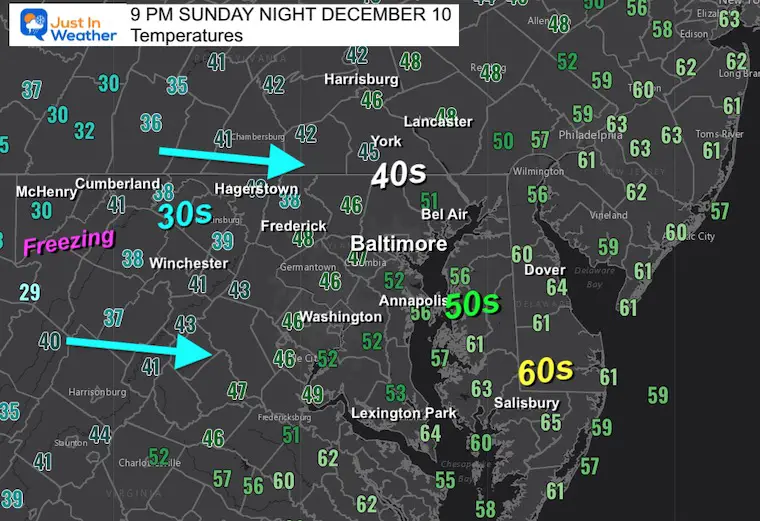
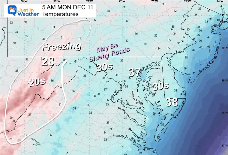
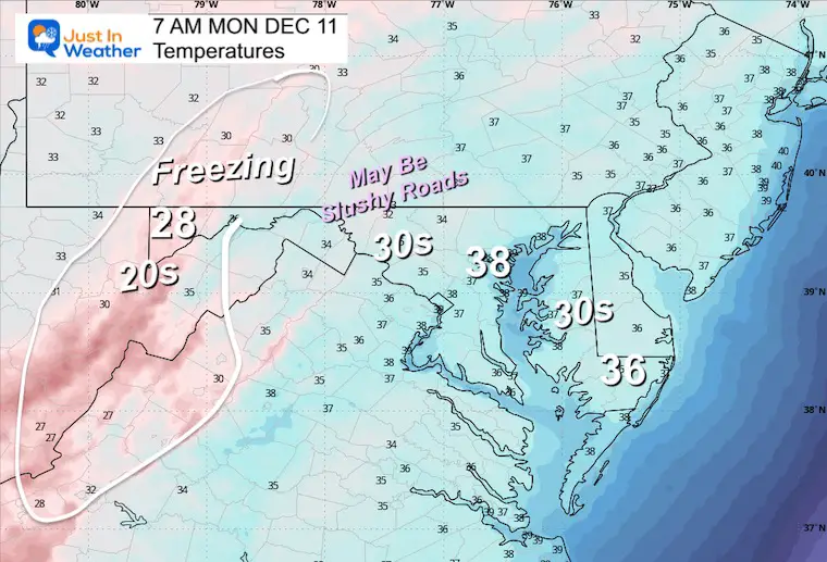
Notice the dramatic drop from the 60s on the Lower Eastern Shore to 40s in the Western suburbs, to 30s and freezing in the high mountains.
There is confirmation of snow falling in the mountains, more than identified here.
There has been some mixing on the ridges of Skyline Drive and along I-81.
Heavy Rain has resurged across Central Maryland and I-95.
This webcam is positioned at The Greene Turtle Deep Creek Lake and shows Wisp Resort, including a zoomed-in view of Squirrel Cage, The Face, the terrain park, Boulder, the mountain coaster, the tubing park and a shot of McHenry Cove at Deep Creek Lake!
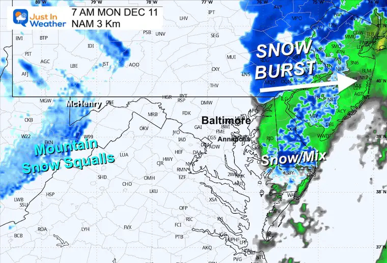
Watch the snow advance to the east before sunrise.
The snow burst may reach Baltimore and York by this time.
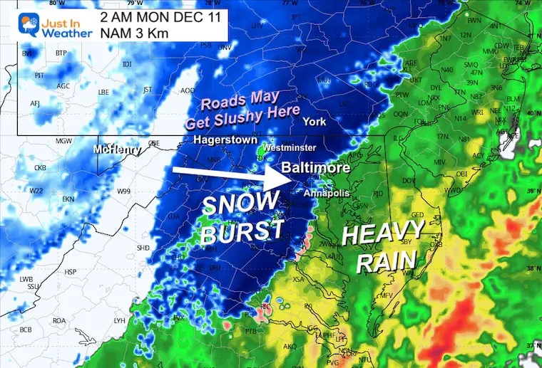
A few hours with slushy snow… and the back edge will be approaching across the mountains.
This is IMPORTANT! It will be ABOVE FREEZING!
Heavy snow can briefly overtake the warmer ground, but a lot of snow will melt.
This is speeding up in a hurry and may be over by sunrise.
Still above freezing.
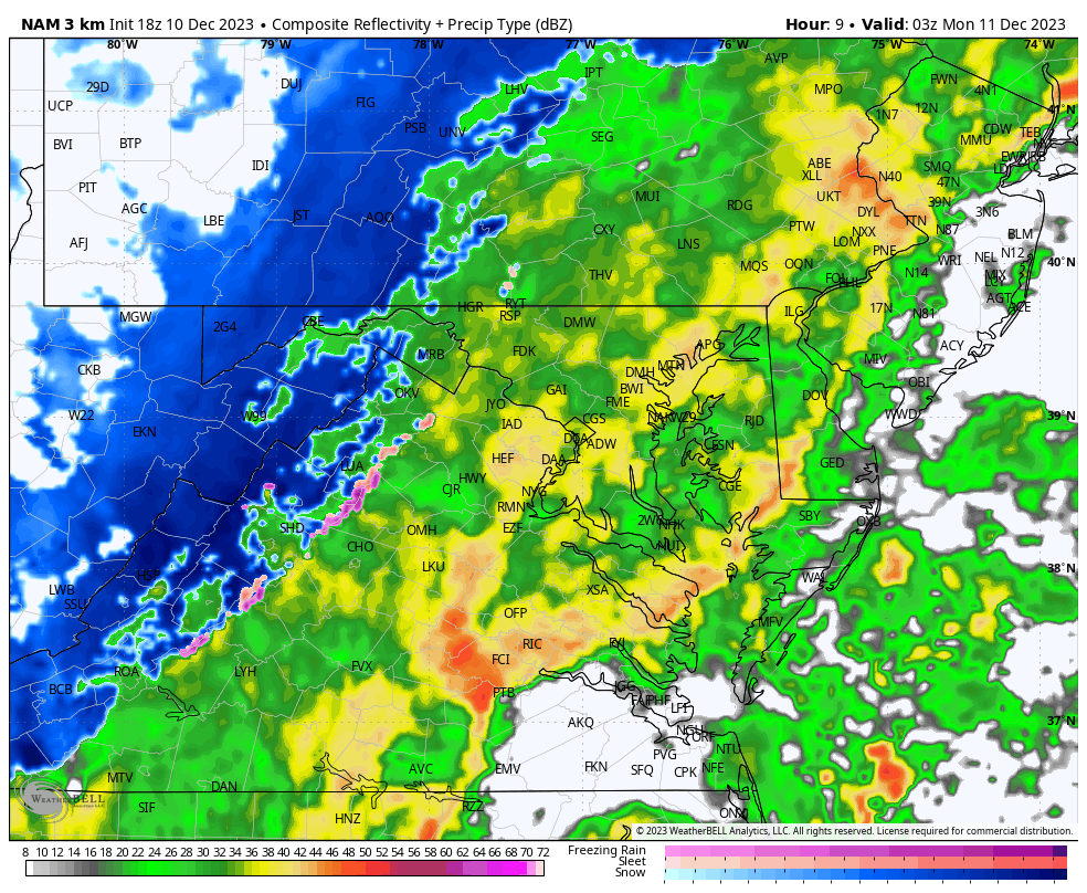
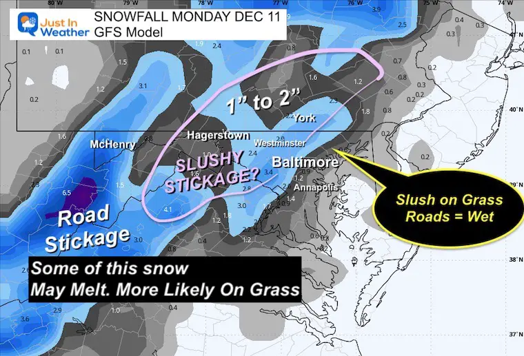
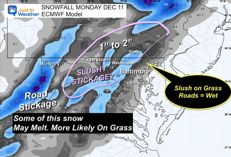
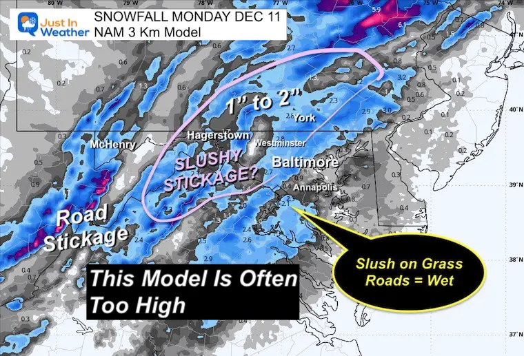
I am showing three model maps to compare. I did not make a map for this event, but want to highlight:
Metro areas may only have a coating on the grass and cars.
Inland could get some briefly on the roads in Northern Baltimore, Carroll, Frederick, Washington Counties in MD and into Southern PA.
There will be snow-covered roads near Frostburg, McHenry/Oakland, and the high mountains of WV.


Computer Models Support East Coast Storm Track

The latest NOAA report is confident in a Very Strong event. Possibly HISTORIC! This refers to the temperatures in the Pacific, with impacts on the US Winter Storm Track.

Winter Weather Folklore: Top 20 and more signals from nature for snow.
Winter Outlook 2024 From Two Farmers Almanacs Return to Cold and Snow
Subscribe for eMail Alerts


Click to see more and ‘Book’ a visit to your school

I am aware there are some spelling and grammar typos and occasional other glitches. I take responsibility for my mistakes and even the computer glitches I may miss. I have made a few public statements over the years, but if you are new here, you may have missed it: I have dyslexia and found out during my second year at Cornell University. It didn’t stop me from getting my meteorology degree and being the first to get the AMS CBM in the Baltimore/Washington region. One of my professors told me that I had made it that far without knowing and to not let it be a crutch going forward. That was Mark Wysocki, and he was absolutely correct! I do miss my mistakes in my own proofreading. The autocorrect spell check on my computer sometimes does an injustice to make it worse. I also can make mistakes in forecasting. No one is perfect at predicting the future. All of the maps and information are accurate. The ‘wordy’ stuff can get sticky. There has been no editor who can check my work when I need it and have it ready to send out in a newsworthy timeline. Barbara Werner is a member of the web team that helps me maintain this site. She has taken it upon herself to edit typos when she is available. That could be AFTER you read this. I accept this and perhaps proves what you read is really from me… It’s part of my charm.
#FITF