October 2 A Few More Sunny Warm Afternoons And Climate Highlights For The Month
October 2, 2023
Monday Morning Update
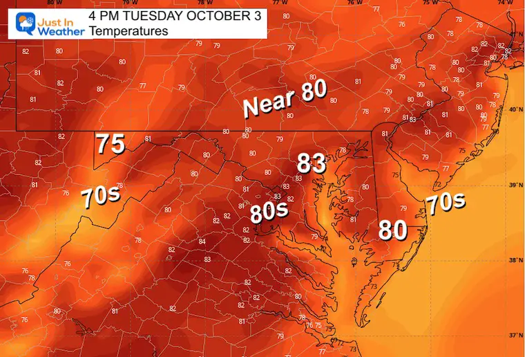
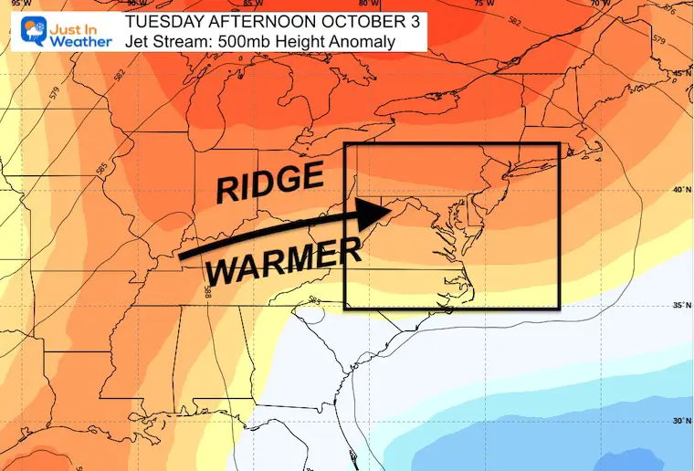
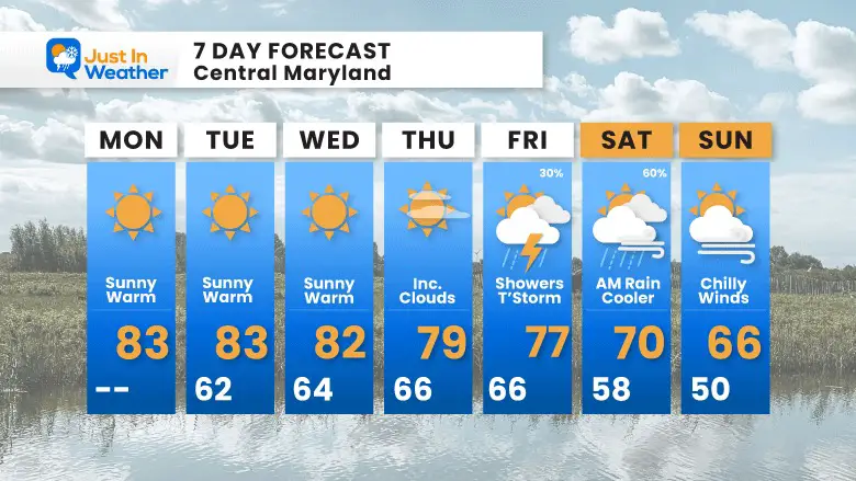
If you liked the end of the weekend, you are going to love the next few days. High Pressure dominates the Eastern US as an upper-level ridge is helping to pump in warm temperatures. The sunshine will allow the next few afternoons to surge into the lower 80s for most of this week.
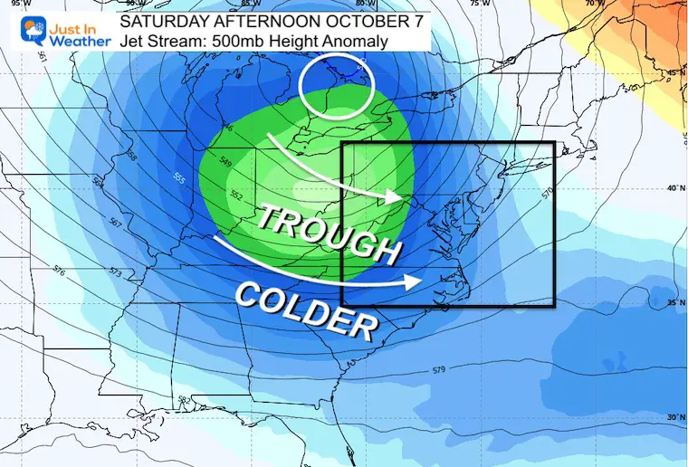
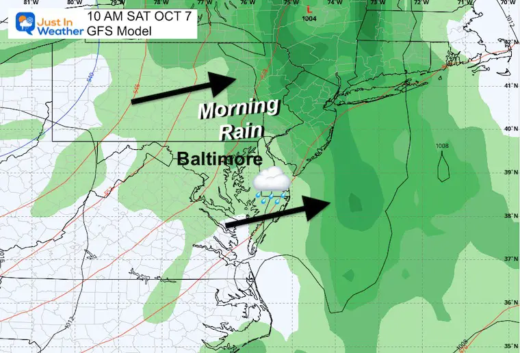
Eventually, the pattern will break down, and the timing looks like Friday. Showers and thunderstorms with the next cold front are likely to arrive Friday, and then pull out on Saturday. Over the weekend colder winds will bring temps back down to the 60s for most and mornings may drop into the 40s inland.
In case you missed it… This was from Sunday Morning
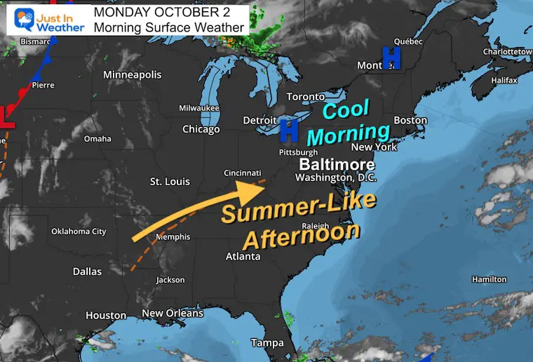
Morning Surface Weather
A very quiet weather map with High Pressure controlling most of the East Coast. This is what translates to sunshine and warm afternoons.
Off the coast, we can finally say goodbye to Ophelia.
Temperature Forecast
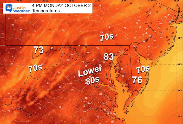
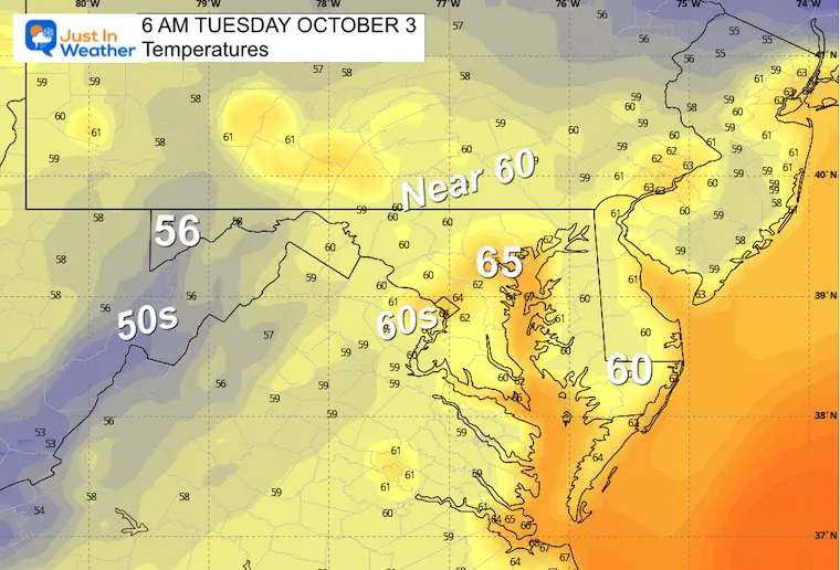
Much like yesterday, many areas will reach into the lower 80s.
RE5PECT – Shirts and Hoodies
In case you missed it, my friends helped me make this tribute to Brooks Robinson. Proceeds will go to Boys and Girls Clubs of America. He played Little League with them in Little Rock before moving to Baltimore.
Click here or the image to get yours:
Sizes: T’s in Kids, Ladies(District), Unisex(Next Level), plus Hoodies (SportTek)!
CLIMATE DATA: Baltimore
TODAY October 2
Sunrise at 7:03 AM
Sunset at 6:48 PM
Normal Low in Baltimore: 52ºF
Record 35ºF in 1997
Normal High in Baltimore: 74ºF
Record 98ºF 2019
OCTOBER CLIMATE HIGHLIGHTS
By October 31: Highs Average 63ºF; Lows Average 41ºF
Baltimore Temperature Extremes
Coldest 25ºF
Hottest 98ºF
Wettest 9.23” in 2005
Snow: On 9 Dates
Earliest Trace:
October 9, 1903
Earliest Measured Snow:
0.3” October 10 in 1979
Additional Measured Snow
1.3” October 19-20 in 1940
MOST SNOW
2.4” October 30 in 1925
Full Moon: October 28 = Hunter’s Moon
New Reports:
Drought Report September 28
El Niño Advisory: First Look At NOAA’s Winter Outlook Expectations
Winter Outlook 2024 From Two Farmers Almanacs
Return to Cold and Snow
Subscribe for eMail Alerts
Weather posts straight to your inbox
Sign up and be the first to know!
Tuesday
If your area is prone to morning fog (by the bay, a reservoir, or valley) you may have some to start the day. Then the sun will dominate and the afternoon will warm up quickly.
Morning Temperatures
Afternoon Temperatures
Animation: Tuesday to Next Monday
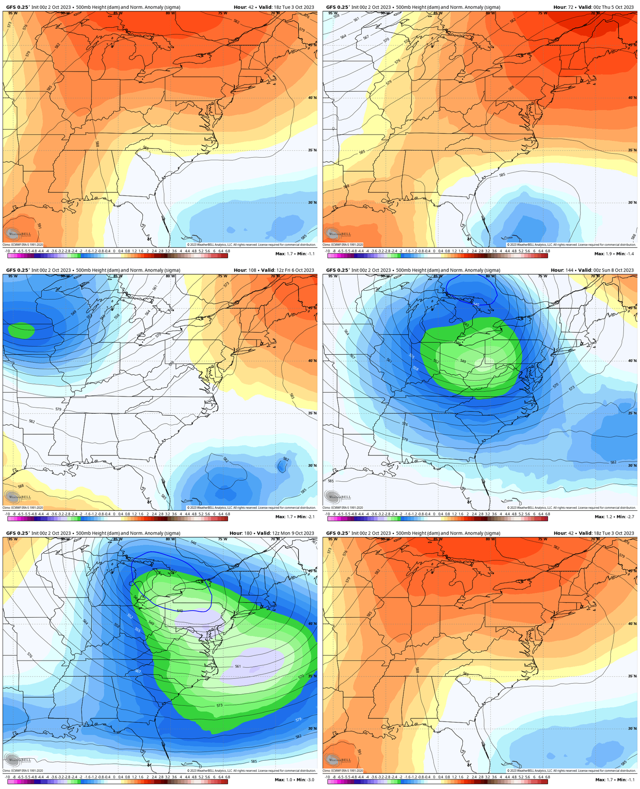
After we kick this trough off the coast, a ridge with High Pressure will build in a warmer air mass all week. The next modification will be noticeable next weekend. That is the pattern change that will truly make it feel like Autumn.
Jet Stream Animation Snapshots
Tuesday
Saturday
Rain Forecast: Thursday to Sunday
Clouds and humidity will increase on Thursday. The rain looks more likely on Friday with Thunderstorms and lingering rain on Saturday morning slowly moving out.
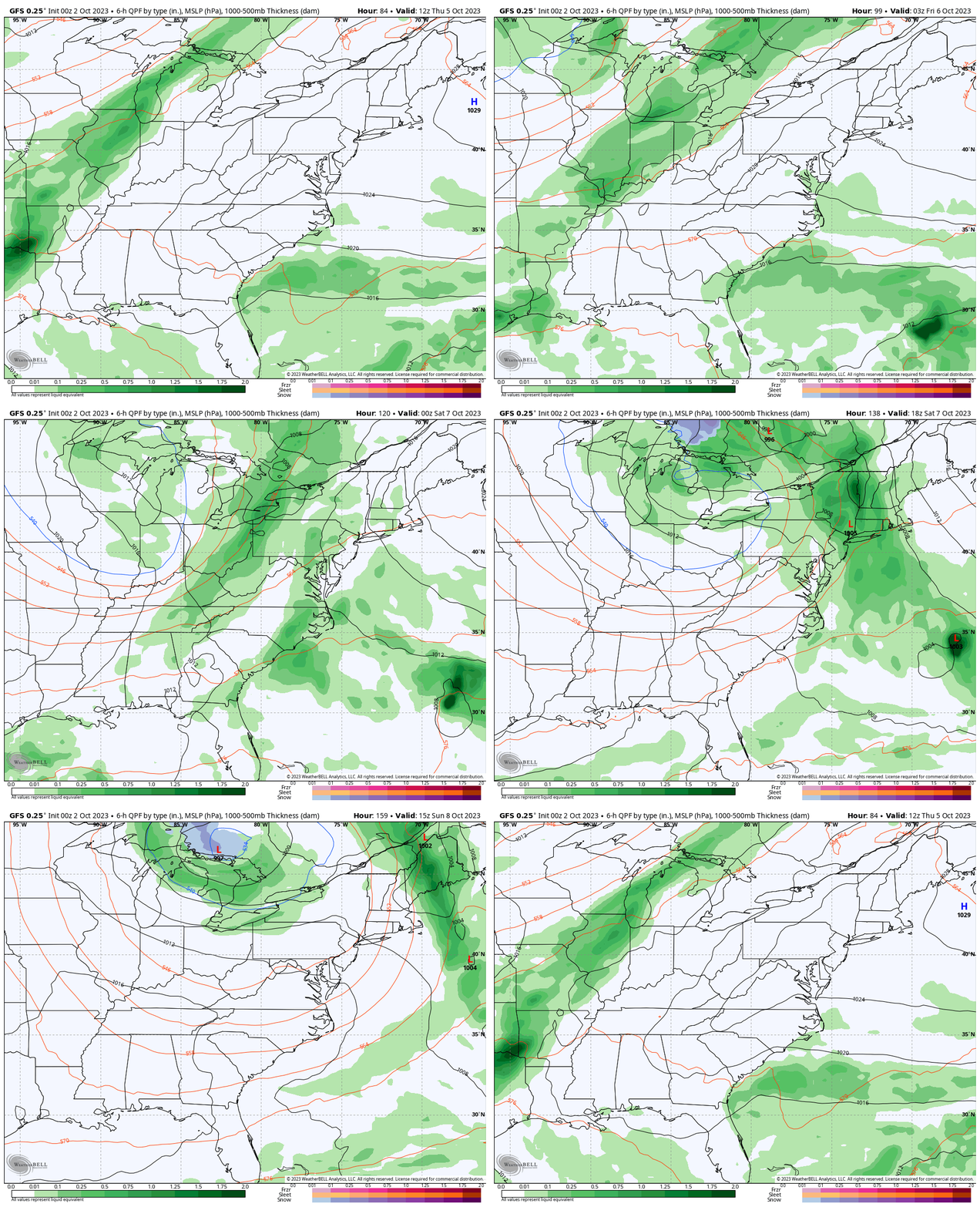
Rain Forecast Saturday Morning
The best-case scenario will have the rain moving out on Saturday morning with the cold front. This is one solution, and the optimistic one to at least dry out the rest of the weekend… but chilly winds will take over.
7 Day Forecast
More sun and afternoons in the 80s for much of this week.
The next weather system will arrive at the end of the week with showers or a thunderstorm on Friday and rain on Saturday…. At this time it may just be a morning event… improving later in the day as chilly winds take over.
Just a thought: The first inland frost could be Monday morning.
Subscribe for eMail Alerts
Weather posts straight to your inbox
Sign up and be the first to know!
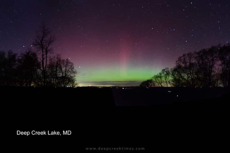
Aurora Photos From Maryland, Delaware, and Virginia
Please share your thoughts and best weather pics/videos, or just keep in touch via social media
-
Facebook: Justin Berk, Meteorologist
-
Twitter
-
Instagram
RESTATING MY MESSAGE ABOUT DYSLEXIA
I am aware there are some spelling and grammar typos and occasional other glitches. I take responsibility for my mistakes and even the computer glitches I may miss. I have made a few public statements over the years, but if you are new here, you may have missed it: I have dyslexia and found out during my second year at Cornell University. It didn’t stop me from getting my meteorology degree and being the first to get the AMS CBM in the Baltimore/Washington region. One of my professors told me that I had made it that far without knowing and to not let it be a crutch going forward. That was Mark Wysocki, and he was absolutely correct! I do miss my mistakes in my own proofreading. The autocorrect spell check on my computer sometimes does an injustice to make it worse. I also can make mistakes in forecasting. No one is perfect at predicting the future. All of the maps and information are accurate. The ‘wordy’ stuff can get sticky. There has been no editor who can check my work when I need it and have it ready to send out in a newsworthy timeline. Barbara Werner is a member of the web team that helps me maintain this site. She has taken it upon herself to edit typos when she is available. That could be AFTER you read this. I accept this and perhaps proves what you read is really from me… It’s part of my charm.
#FITF


