September 10, 2023
Sunday Morning Update
Hurricane Lee is helping to prove a valuable lesson, for anyone who will listen. The storm did erupt, as expected, to a Category 5 hurricane, then followed by a surprise deterioration. Computer guidance and forecasts experts have done a great job AND are not perfect! The ultimate lesson here is that farther out in time, the accuracy goes down even further. That is why I continue to use the word ‘suggestion’ and downplay any outlook beyond 5 days.
So any outlet that mentioned an East Coast impact or sensationalized this storm should be thinking twice now. There is a chance the storm briefly gets stronger, then will weaken as it travels north. If and where it makes landfall is still more than 5 days away and uncertain. We have a good idea most of the US coast will be protected. The rest is in this morning’s report below.
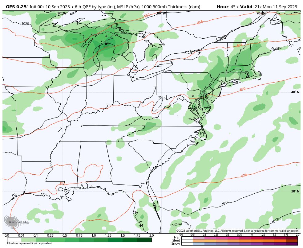
Locally we saw the repeat of showers and storms yesterday. The same is expected again today. They will not be in the same locations or times, but they will flare up. The Ravens home opener in Baltimore is worth paying attention to with over 70,000 people planning to be outside watching football. I have our local look and live radar for tailgaters below.
Let’s begin again with the Hurricane:
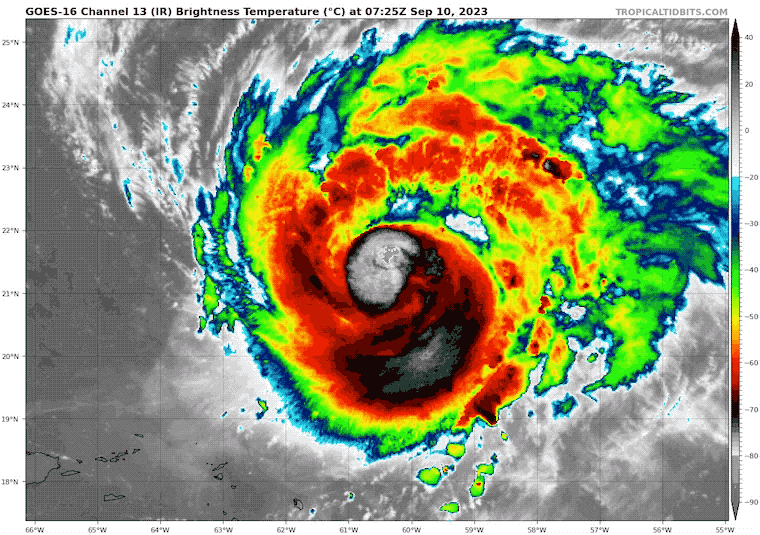
Hurricane Lee Satellite Loop
We now are looking at a Category 2 Hurricane with winds of 105 mph. It continues to feel the effects of wind shear FROM the Southwest AND dry air that eroded parts of the eye wall.
It looks ragged but is still trying to regenerate.
- Hurricane Force Winds reach 45 miles from the center.
- Tropical Storm Force Winds reach 160 miles from the center.
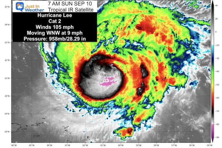
National Hurricane Center Advisory
5 AM Update
- LOCATION…21.4N 60.5W
- ABOUT 280 MI…450 KM NE OF THE NORTHERN LEEWARD ISLANDS
- MAXIMUM SUSTAINED WINDS…105 MPH…165 KM/H
- PRESENT MOVEMENT…WNW OR 300 DEGREES AT 9 MPH…15 KM/H
- MINIMUM CENTRAL PRESSURE…958 MB…28.29 INCHES
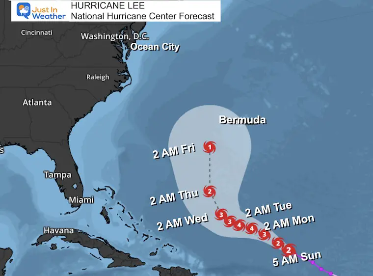
Forecast Track From The National Hurricane Center
This is expected to restrengthen to a major hurricane again in the next two days. It will slow down in forward motion, which we are already seeing. The forward speed is 9 mph, compared to 14 mph yesterday. This is part of the influence of upper-level winds which will turn the storm north.
We do see the turn to the north starting to reflect by the middle of next week in this outlook.
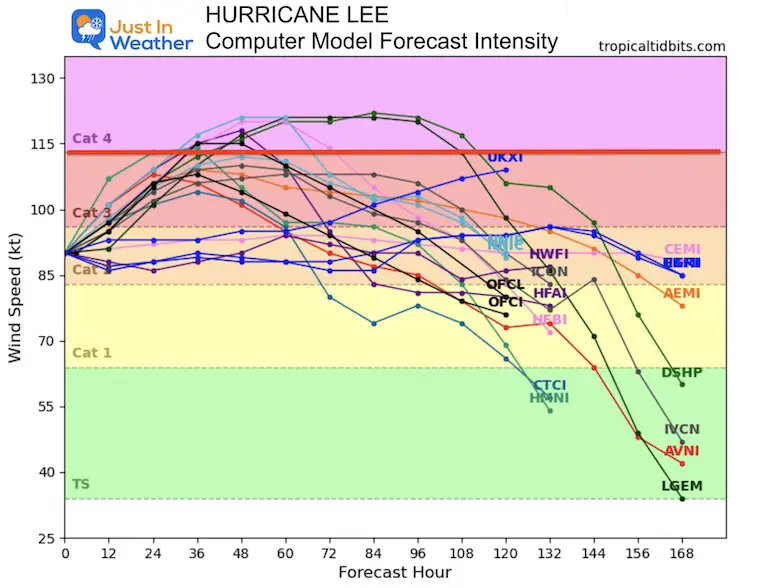
Forecast Intensity: Computer Model Guidance
We see the agreement that Lee will regain Major Hurricane Intensity (Cat 3 +), over the next two to three days, then weaken over cooler waters as it travels North.
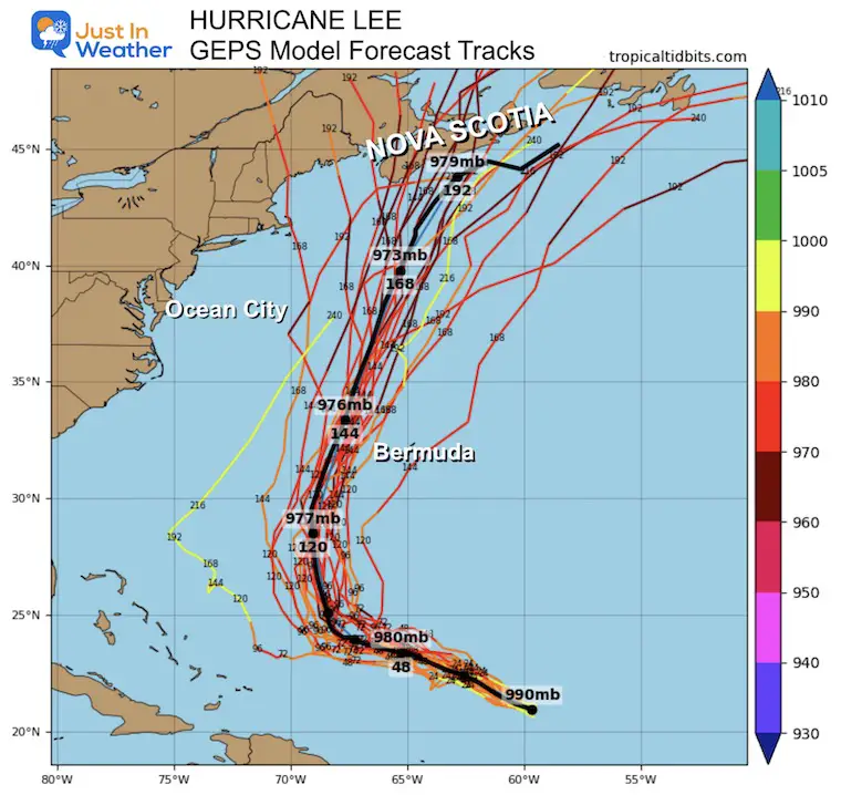
Longer Range Guidance
GEPS Member Spread
We continue to see a turn to the North AWAY from the US East Coast. This plot consensus has shifted a little farther East.
Forecast Animation:
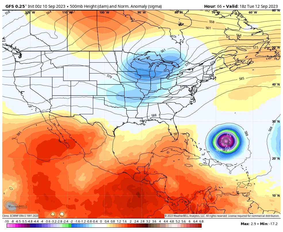
European Model: Jet Stream GFS Model
The cooling and wet pattern that will shift to the Eastern US (see more below) will be part of a trough we expect will help curve and shift Lee away from the US mainland.
This model pulls the storm away from Eastern Canada, but other models still have Nova Scotia on alert.
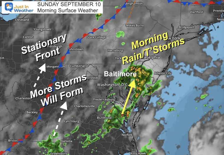
Morning Surface Weather
A stationary front remains in our region and will continue to assist in storm development.
We have had a cluster of pre-dawn rain organizing and move north along the Chesapeake Bay. This affected parts of metro Annapolis and Baltimore, with more rain on the Eastern Shore.
More showers and storms will develop this afternoon and evening… moving in the same direction from South to North.
Live Radar and Lightning Widget
Radar Forecast Simulation
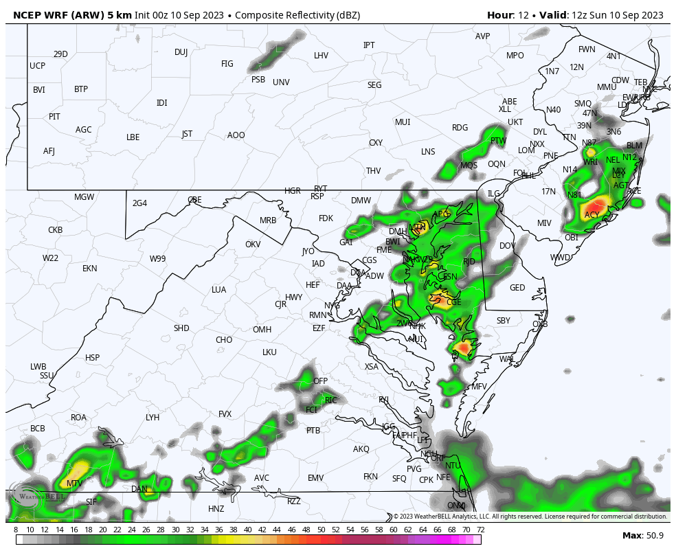
WRF Model 8 AM Sun to 8 AM Mon
I am sharing this full 24-hour loop to highlight the pattern with showers and thunderstorms. They will develop again this afternoon, but may also pulse again overnight into Monday morning.
Ravens game
The best suggestion I can make is that there will be some showers for the early tailgaters. Likely allowing for a break late morning through the start of the game. Then we will watch for showers and perhaps a thunderstorm trying to develop later in the game, or for the ride home.
This is a “suggestion” but it’s best to have some rain gear handy, and hope that it remains dry for most of the time you’re out there.
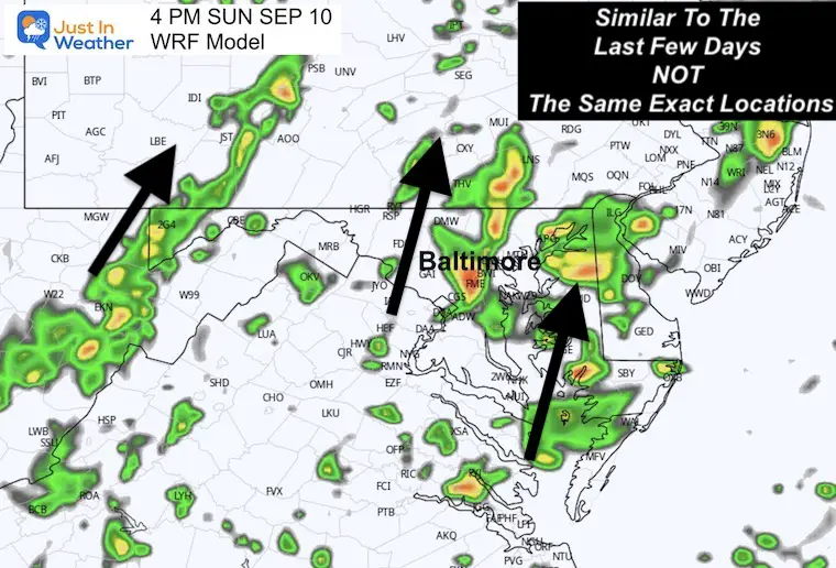
4 PM Snapshot
The suggestion here is another day with lines of afternoon storms moving South to North.
This shows a band near Baltimore. It is NOT a promise, but worth noting there is a chance for showers and storms to increase later in the game or as you depart.
Afternoon Temperatures
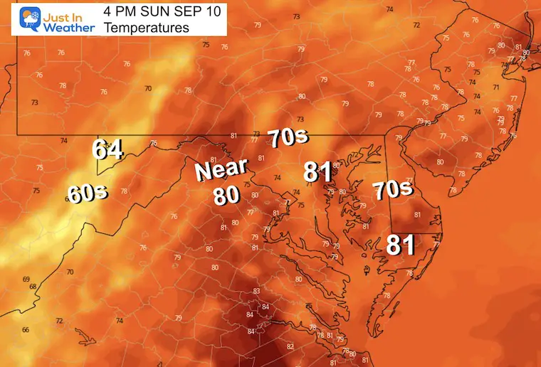
We are definitely getting into cooler air. More clouds and showers will help to hold many in the 70s. A few pockets into the lower 80s, with 60s across the mountains.
CLIMATE DATA: Baltimore
TODAY September 10
Sunrise at 6:43 AM
Sunset at 7:23 PM
Normal Low in Baltimore: 61ºF
Record 41ºF in 1956
Normal High in Baltimore: 82ºF
Record 98ºF 1983
Subscribe for eMail Alerts
Temperature Forecast
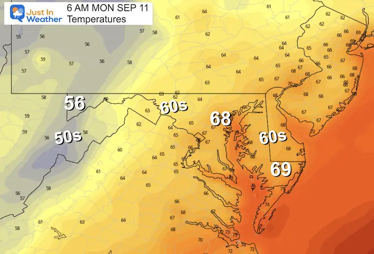
Monday Morning
Note that if you have seen rain, there may be morning fog.
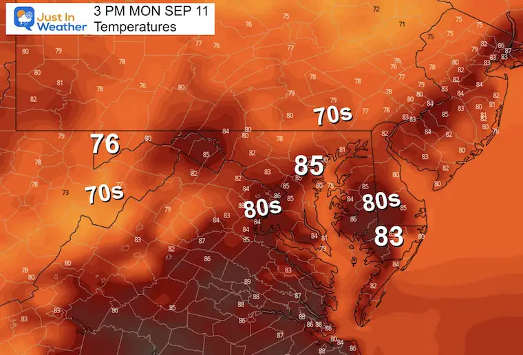
Monday Afternoon
Rain Forecast: Monday Afternoon to Friday Afternoon
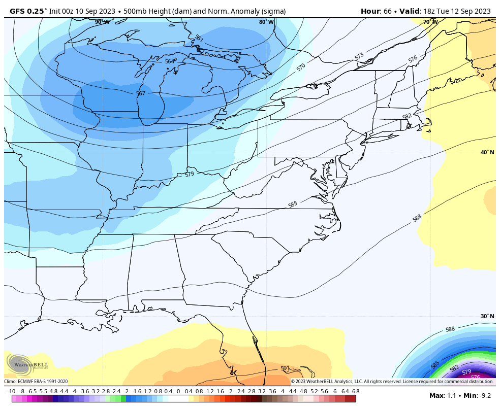
The pattern for daily storms will last into Wednesday. Then the front clears the coast… AND we can see Hurricane Lee passing well to our east. This will get steered away as a strong, cool, Canadian Fall-like air mass settles in.
Jet Stream: Tuesday to Saturday
This is the same time frame as the wider view I showed above with Hurricane Lee. We can see it here on the right edge staying well off our coast.
Locally, there will be a cooler air mass that settles to the East Coast which will make it feel like fall.
7 Day Forecast
The risk of rain will last into Wednesday. Once that front reaches the coast, it should both steer Lee away AND usher in cooler early Autumn weather.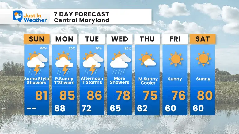
EXPLORE MORE
EARLIER IN AUGUST: Maryland Trek 10 For These Kids
I will have a follow-up and recap on our amazing week shortly.

Subscribe for eMail Alerts

Please share your thoughts and best weather pics/videos, or just keep in touch via social media
RESTATING MY MESSAGE ABOUT DYSLEXIA
I am aware there are some spelling and grammar typos and occasional other glitches. I take responsibility for my mistakes and even the computer glitches I may miss. I have made a few public statements over the years, but if you are new here, you may have missed it: I have dyslexia and found out during my second year at Cornell University. It didn’t stop me from getting my meteorology degree and being the first to get the AMS CBM in the Baltimore/Washington region. One of my professors told me that I had made it that far without knowing and to not let it be a crutch going forward. That was Mark Wysocki, and he was absolutely correct! I do miss my mistakes in my own proofreading. The autocorrect spell check on my computer sometimes does an injustice to make it worse. I also can make mistakes in forecasting. No one is perfect at predicting the future. All of the maps and information are accurate. The ‘wordy’ stuff can get sticky. There has been no editor who can check my work when I need it and have it ready to send out in a newsworthy timeline. Barbara Werner is a member of the web team that helps me maintain this site. She has taken it upon herself to edit typos when she is available. That could be AFTER you read this. I accept this and perhaps proves what you read is really from me… It’s part of my charm.
#FITF


