


May 12 Mothers Day Showers And Another Aurora Viewing Tonight May Be Better
Sunday May 12 Mother's Day Morning Report Today, we focus on the all-important Mother’s Day weather and the ongoing impact of the latest Solar Storm. We have been stuck in…
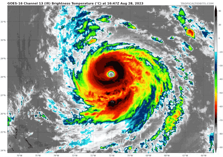
August 28, Monday Afternoon Update
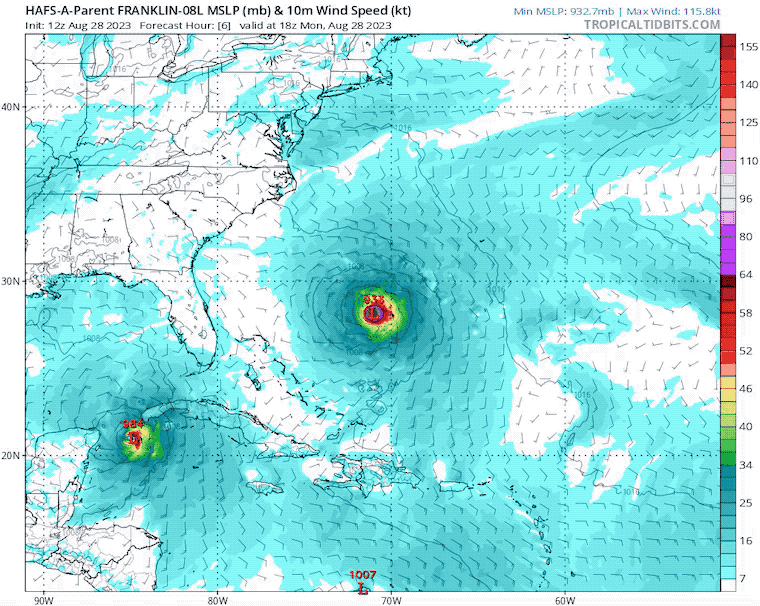
While a lot of attention has been on Idalia and the impact on Florida when it becomes a Hurricane, there is a bigger storm in the open Atlantic.
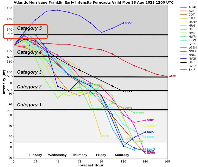
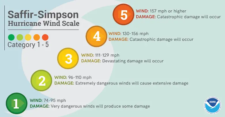
Hurricane Franklin is currently a Category 4 storm with 145 mph winds. It is currently in an environment conducive to strengthening a little more. The combination of warm water and low wind shear is what may allow this to attain the rare Category 5 status. That is when winds reach over 156 mph.
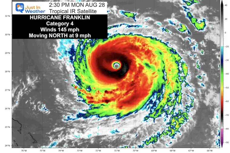
The symmetry of the storm and nearly perfect eye wall structure are signals of a very strong storm. This has created its own environment, which is why there may be a chance for it to get even stronger.
Warm water of 86ºF or higher along the path for another day. Once into cooler water, the storm will inevitably get weaker.
The Cat 5? My suggestion for if it gets that strong would be when and where.
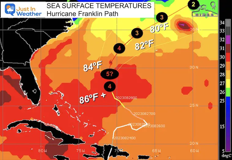
There are about 12-24 hours for potential growth, then conditions become less favorable with cooler water and upper-level wind shear.
Ranking of Categories Based On Wind Speed
There is no chance for this to hit the US directly. Instead, it will be directed to curve away from the coast into the central Atlantic.
If you look closely at the lower left side of the image, that is Tropical Storm (soon to be Hurricane) Idalia making a similar turn.
Less than 1% of tropical cyclones reach Category 5 status. The last Category 5 storms in the Atlantic:
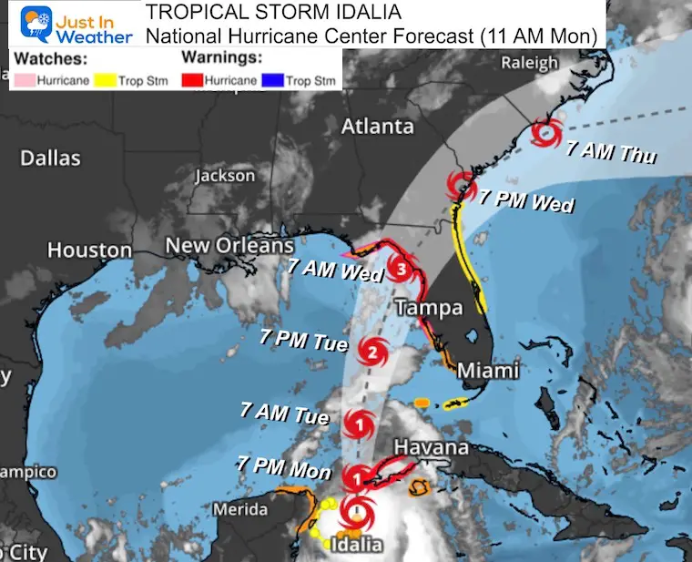
Idalia: Hurricane Warnings For Florida
I will have a follow-up and recap on our amazing week shortly.


I am aware there are some spelling and grammar typos and occasional other glitches. I take responsibility for my mistakes, and even the computer glitches I may miss. I have made a few public statements over the years, but if you are new here you may have missed it: I have dyslexia, and found out during my second year at Cornell University. It didn’t stop me from getting my meteorology degree and being the first to get the AMS CBM in the Baltimore/Washington region. One of my professors told me that I had made it that far without knowing, and to not let it be a crutch going forward. That was Mark Wysocki and he was absolutely correct! I do miss my mistakes in my own proofreading. The autocorrect spell check on my computer sometimes does an injustice to make it worse. I also can make mistakes in forecasting. No one is perfect at predicting the future. All of the maps and information are accurate. The ‘wordy’ stuff can get sticky. There has been no editor who can check my work when I need it and have it ready to send out in a newsworthy timeline. Barbara Werner is a member of the web team that helps me maintain this site. She has taken it upon herself to edit typos when she is available. That could be AFTER you read this. I accept this and perhaps proves what you read is really from me… It’s part of my charm.
#FITF