Hurricane Franklin Forecast To Be Cat 4 and Tropical Storm Idalia May Get Named Today In Gulf
Sunday Morning August 27, 2023
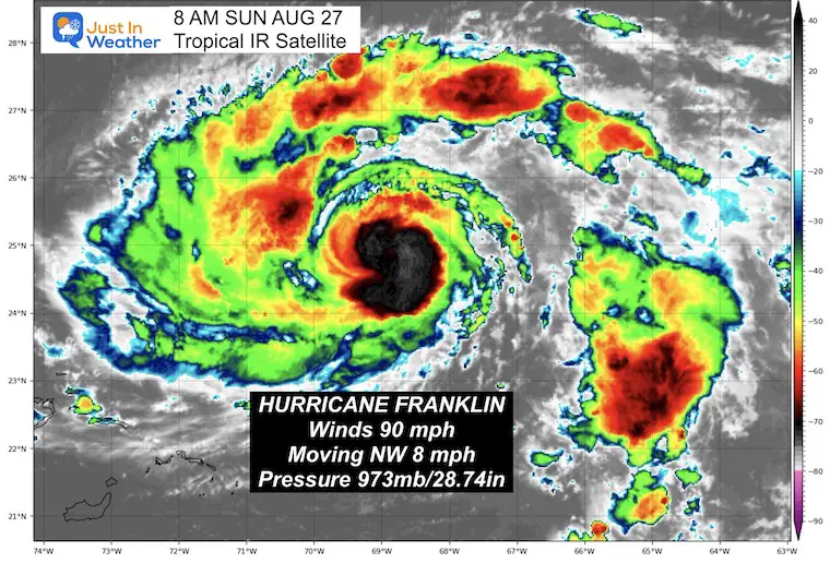
There are two tropical cyclones in the Atlantic that are of interest. Hurricane Franklin has entered the rapid development phase as expected. Winds are 90 mph and it is expected to continue to strengthen as it passes west of Bermuda.
Off the coast of Mexico, Tropical Depression Ten should get named Tropical Storm Idalia as it enters the Gulf of Mexico. This is now forecast to reach hurricane intensity and make landfall in Florida during the week.
Below is a closer look at each storm update, satellite loops, forecast animations, and the interactive Windy Widget.
Tropical Cyclone Forecast Tracks
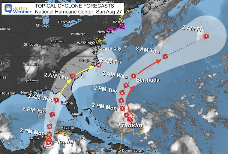
UPDATE: Idalia May Become Major Hurricane Before FL Landfall-Click here for the Monday Morning Report
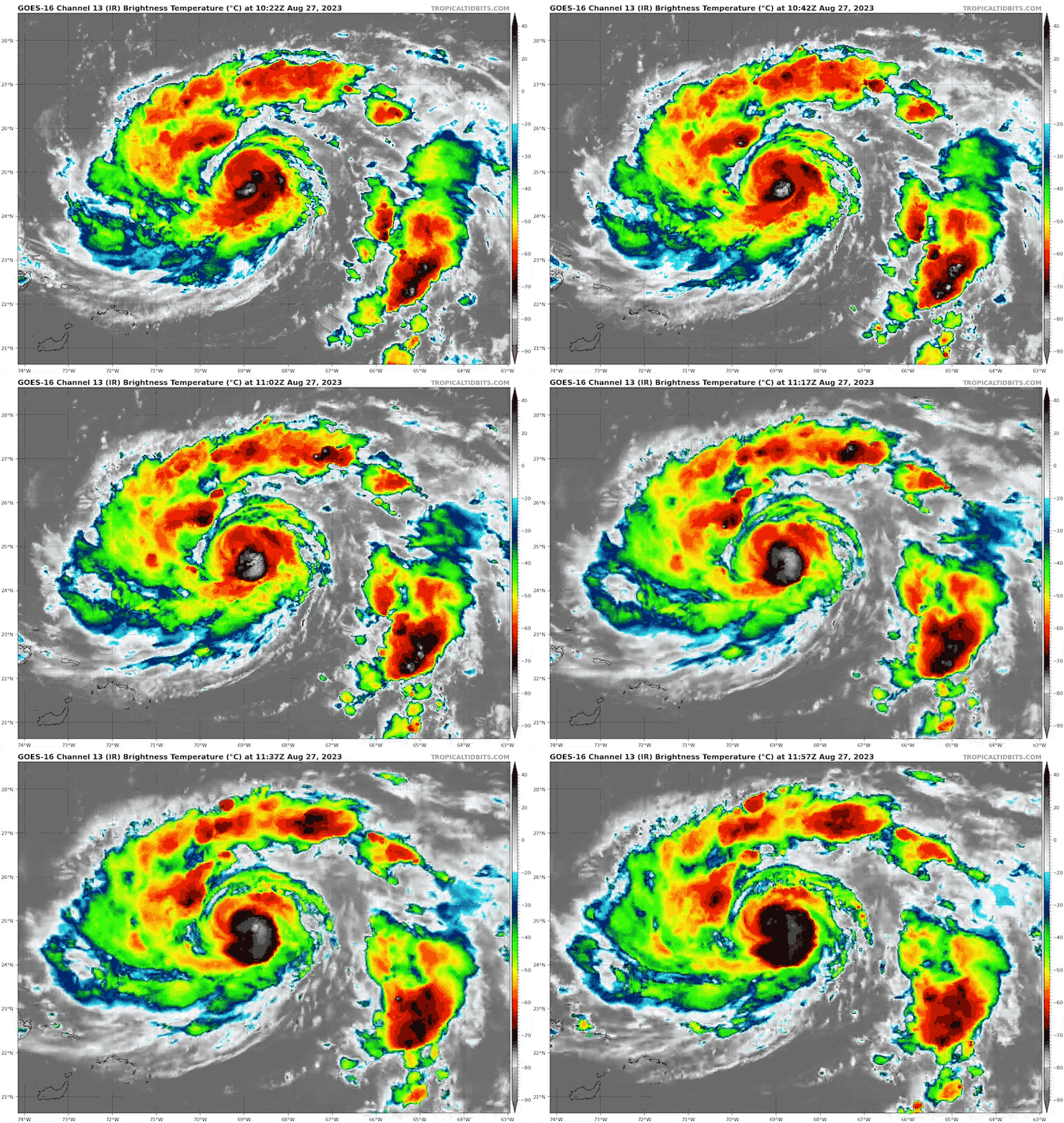
Hurricane Franklin Satellite Loop
Hurricane Force Winds Extend 25 miles from the center.
Tropical Storm Force Winds Extend 40 miles from the center.
National Hurricane Center Update: 8 AM EDT
- LOCATION…24.7N 68.7W
- ABOUT 270 MI…430 KM NE OF GRAND TURK ISLAND
- ABOUT 575 MI…925 KM SSW OF BERMUDA
- MAXIMUM SUSTAINED WINDS…90 MPH…150 KM/H
- PRESENT MOVEMENT…NW OR 320 DEGREES AT 8 MPH…13 KM/H
- MINIMUM CENTRAL PRESSURE…973 MB…28.74 INCHES
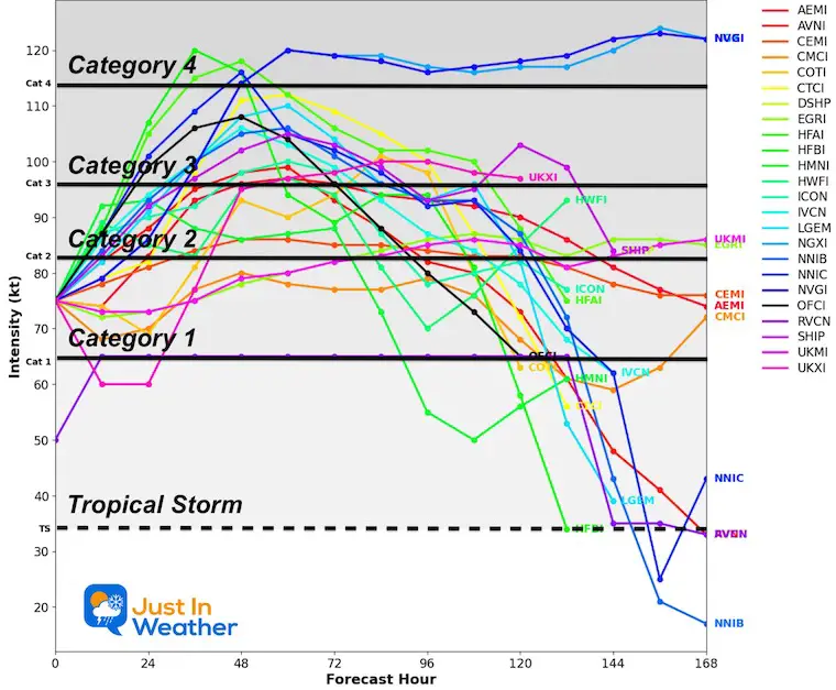
Forecast Intensity
Overwhelming support for at least Category 3, with a 20% chance to reach Category 4 briefly.
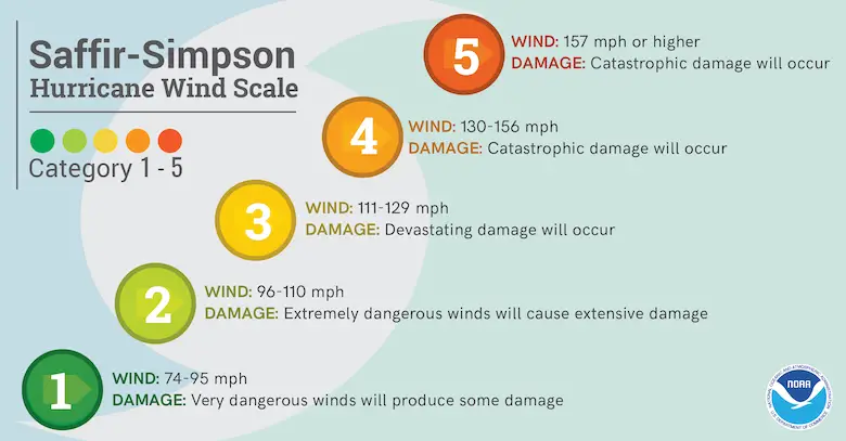
Saffir Simpson Scale
Ranking of Categories Based On Wind Speed.
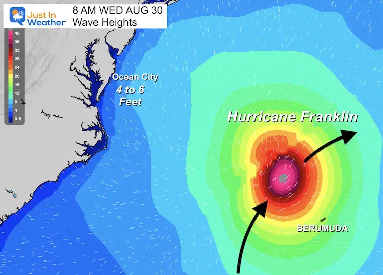
Impact: Waves In Mid-Atlantic
Ocean City MD may get 4 to 6 foot swells peaking on Wednesday morning.
There will be additional flow from the Southeast with the next system over the weekend.
Tropical Depression Ten Satellite Loop
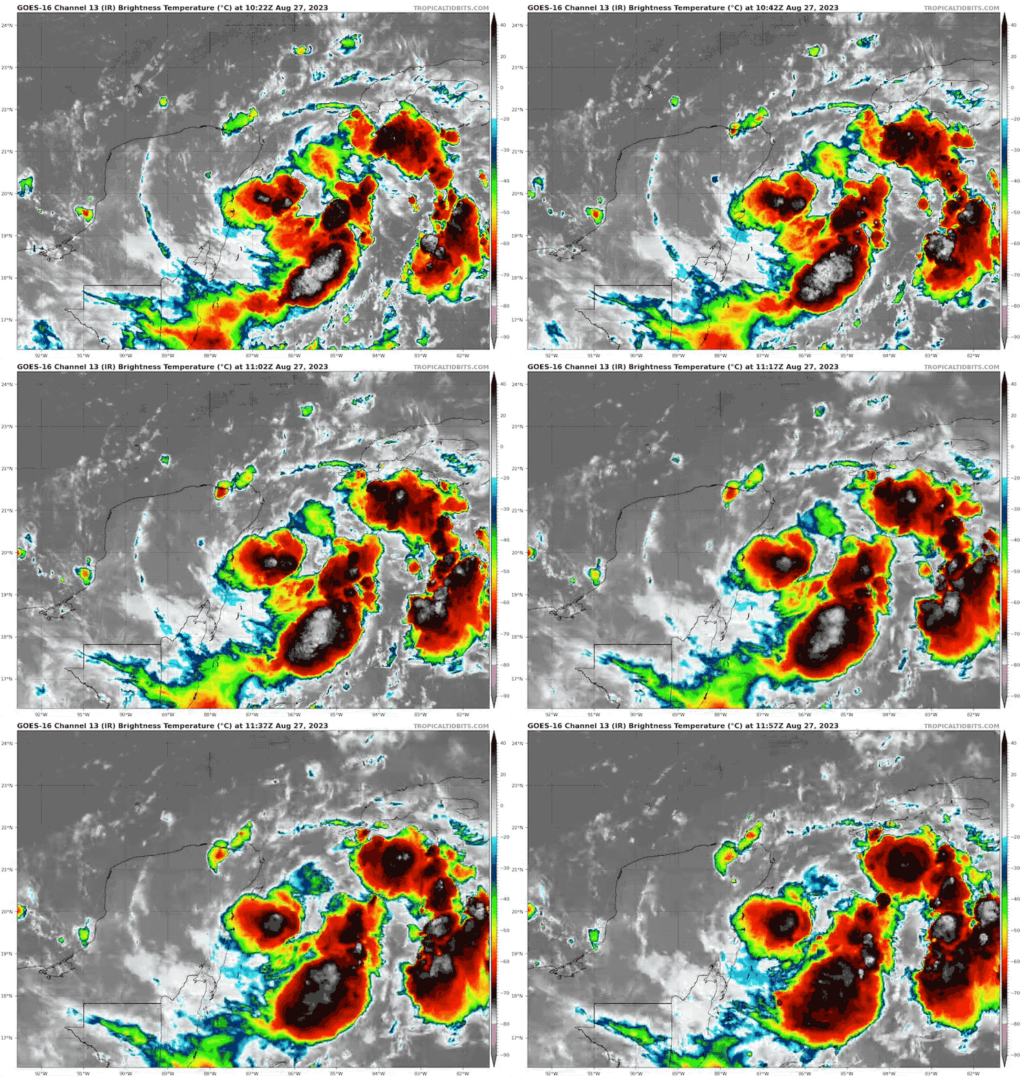
National Hurricane Center Update 8 AM EDT
- LOCATION…19.7N 86.3W
- ABOUT 70 MI…110 KM SE OF COZUMEL MEXICO
- MAXIMUM SUSTAINED WINDS…35 MPH…55 KM/H
- PRESENT MOVEMENT…SE OR 135 DEGREES AT 5 MPH…7 KM/H
- MINIMUM CENTRAL PRESSURE…1001 MB…29.56 INCHES
Live Windy Widget
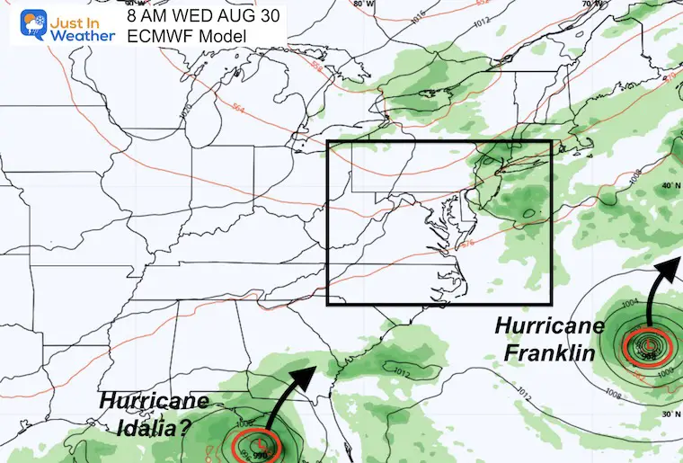
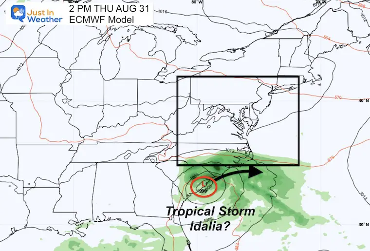
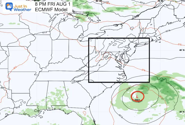
ECWMF Model Forecast
Wednesday Morning to Friday Evening
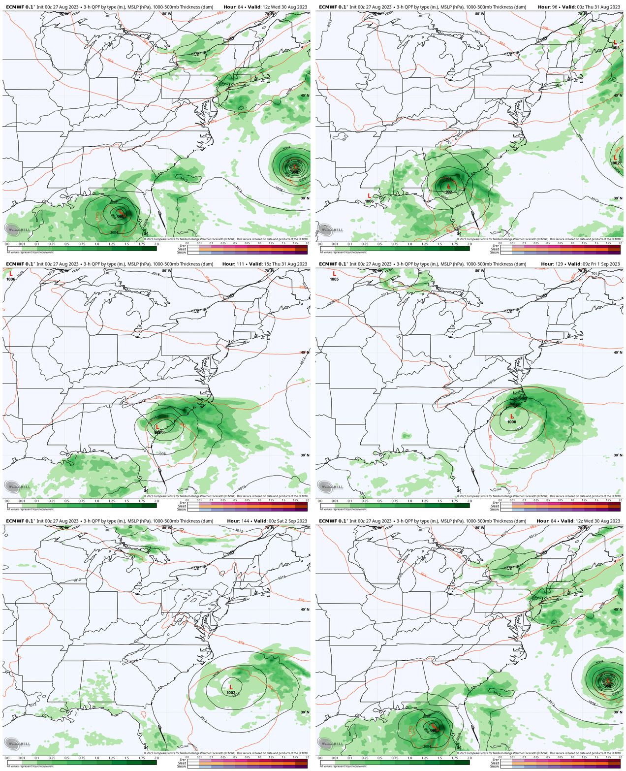
Snapshots
Wednesday
Thursday
Friday
Note:
At this time, Idalia is expected to become a Category 1 Hurricane and make landfall in Florida on Wednesday. While inland it will drop to a Tropical Storm and curve across South Carolina, then back out into the Atlantic.
The organization of this storm will confine the rain to the south, missing the Mid Atlantic.
There is a chance it may sustain or reorganize in the Atlantic off the Southeast US Coast. As it gets cut off from and directions force, it could wander aimlessly for a few days.
EARLIER THIS MONTH: Maryland Trek 10 For These Kids
I will have a follow-up and recap on our amazing week shortly.
Subscribe for eMail Alerts
Weather posts straight to your inbox
Sign up and be the first to know!
EXPLORE MORE
2023 Hurricane Season Forecast With An El Niño Watch
La Niña Has Ended. El Niño May Return By Fall
Aurora Photos From Maryland, Delaware, and Virginia
Please share your thoughts, and best weather pics/videos, or just keep in touch via social media
-
Facebook: Justin Berk, Meteorologist
-
Twitter
-
Instagram
RESTATING MY MESSAGE ABOUT DYSLEXIA
I am aware there are some spelling and grammar typos and occasional other glitches. I take responsibility for my mistakes, and even the computer glitches I may miss. I have made a few public statements over the years, but if you are new here you may have missed it: I have dyslexia, and found out during my second year at Cornell University. It didn’t stop me from getting my meteorology degree and being the first to get the AMS CBM in the Baltimore/Washington region. One of my professors told me that I had made it that far without knowing, and to not let it be a crutch going forward. That was Mark Wysocki and he was absolutely correct! I do miss my mistakes in my own proofreading. The autocorrect spell check on my computer sometimes does an injustice to make it worse. I also can make mistakes in forecasting. No one is perfect at predicting the future. All of the maps and information are accurate. The ‘wordy’ stuff can get sticky. There has been no editor who can check my work when I need it and have it ready to send out in a newsworthy timeline. Barbara Werner is a member of the web team that helps me maintain this site. She has taken it upon herself to edit typos when she is available. That could be AFTER you read this. I accept this and perhaps proves what you read is really from me… It’s part of my charm.
#FITF


