


May 9 Cooler With Rain And Severe Storm Risk Tonight South
Thursday May 9 Morning Report Today is the first day of the year with sunrise before 6 AM in Baltimore, but we won’t see it. After a high temperature of…
July 29, 2023
Saturday Mid-Day Update
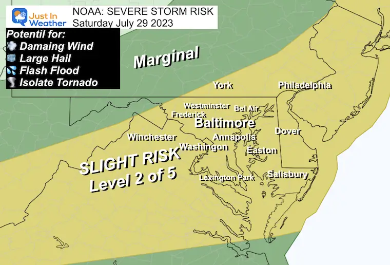
The current heat wave is going to try and end with a bang. Most usually do. When a new air mass approaches, the high temperatures, and humidity are the fuel that builds tall clouds and drops some locally heavy rain in strong to severe thunderstorms.
This afternoon a line of storms is expected to develop. Considering the eruption of severe storms last night when we had fewer supportive triggers, the cold front today should be given respect.
NOAA has already placed our region in the Slight Risk category for storms to turn severe.
The next two levels of alerts are this:
Watch: A broad area with a 4 to 6-hour window where the POTENTIAL for severe weather may develop. This is not a promise, but worth ‘watching’.
SEVERE THUNDERSTORM WATCH UNTIL 9 PM
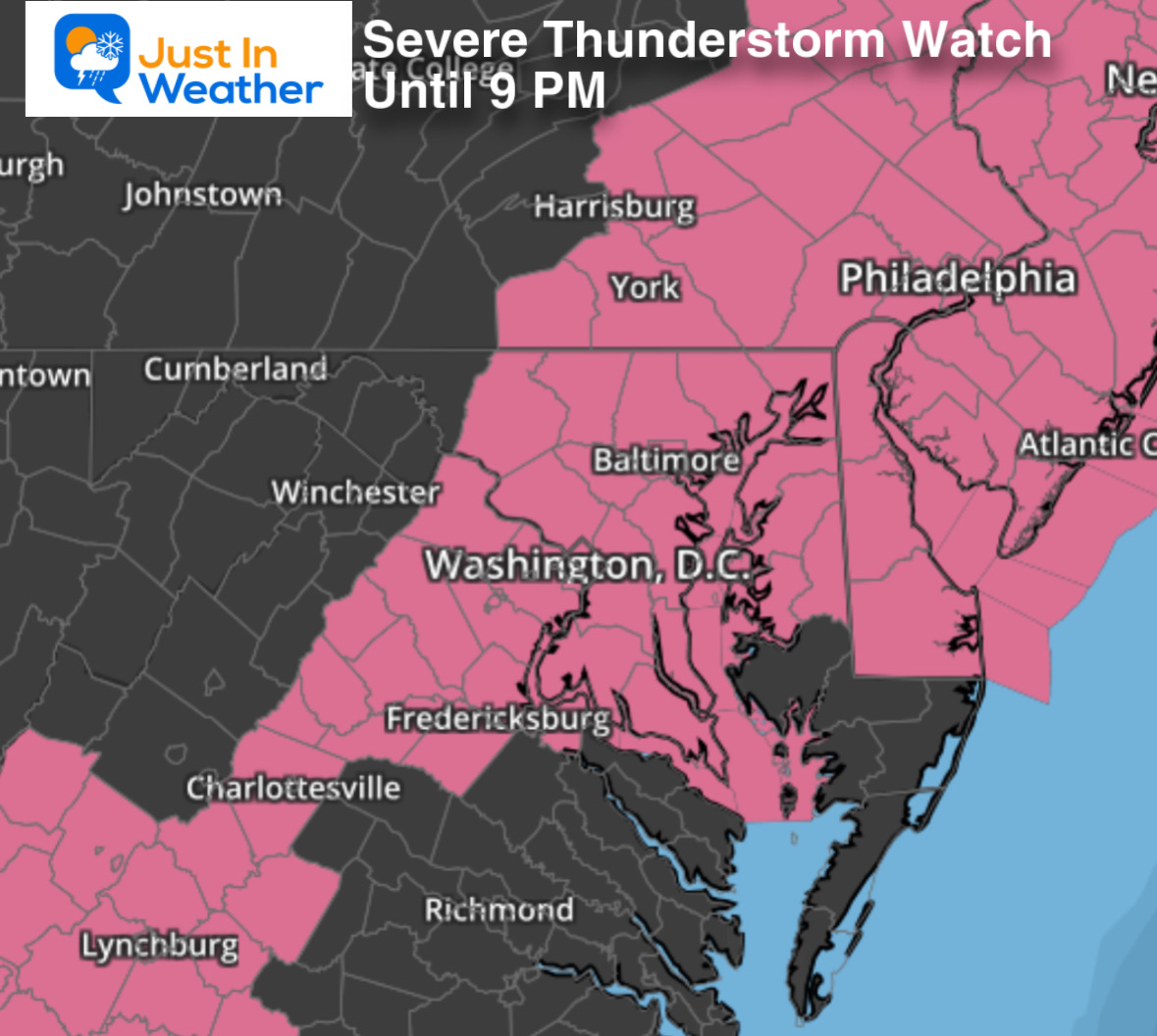
Warning: When severe weather is occurring, a storm cell is identified and plotted across a county or two with specific towns listed. This is tracking that weather in process. It may relate to high winds, large hail, flash flooding, or even a tornado.
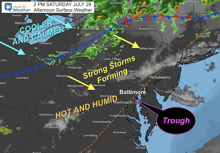
A strong cold front is the instigator of the line of storms we expect.
The trough in place is one focal point for lifting and forming storms mid-afternoon. The main line is already showing up with the cold front. This will move and build across Pennsylvania, then reach central Maryland late afternoon and evening.
A much cooler air mass should be in place as soon as Sunday morning.
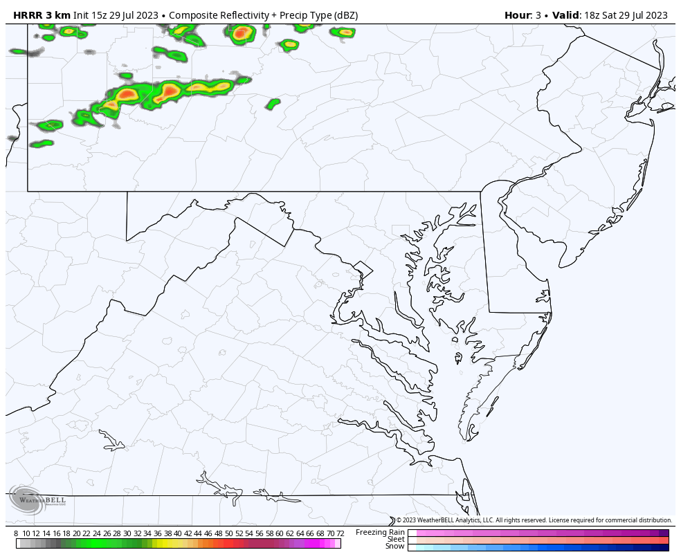
This is what is happening NOW! Compare to the forecast maps below.
Comparing the HRRR Model to the NAM 3 Km
The similarity with these models is the quick development between 4 and 5 PM.
It appears the convective temperature gets reached then with the approach of the cold front. That is the temperature needed to break through and a stable cap to allow for the free development of storms.
The development of the storm line in central Maryland near and south of Baltimore. This line looks more impressive on the NAM 3KM Model below.
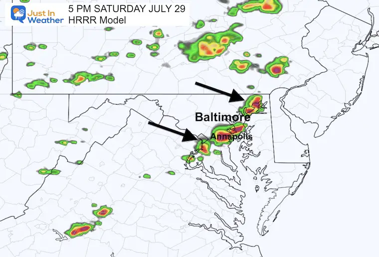
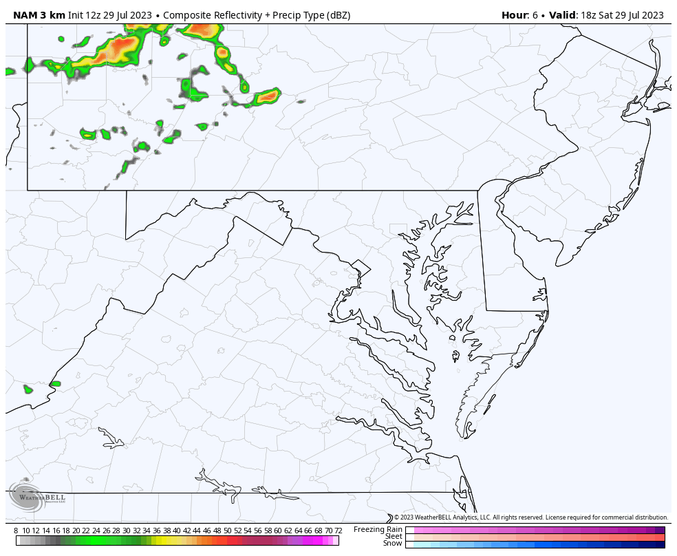
The development of that same storm line seen in the HRRR Model above is suggested here to be followed by a more prolific line northwest of Baltimore.
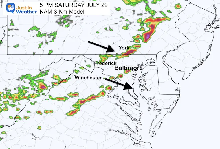
This suggests a flare-up across northern Maryland.
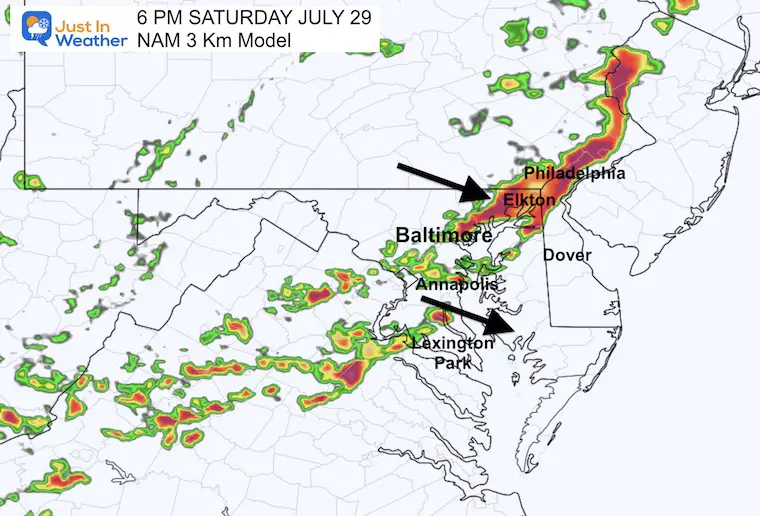
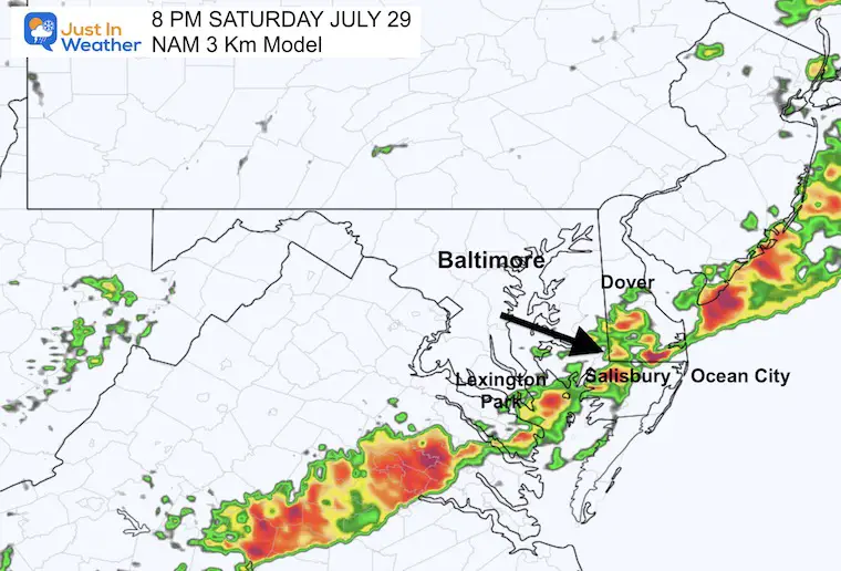
This is when the line may approach the Lower Eastern Shore and the beaches.
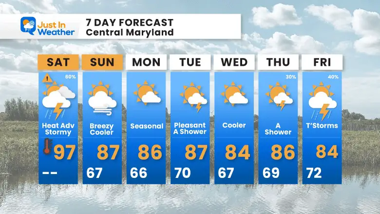
Noticeably cooler.
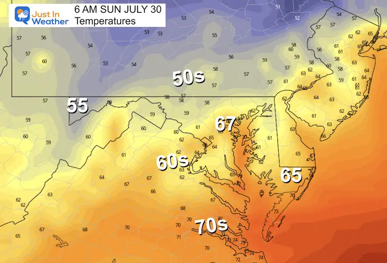
A shift in air flow brings in a cooler air mass from Canada and sets up a new pattern next week… bringing an end to the excessive heat in the east.
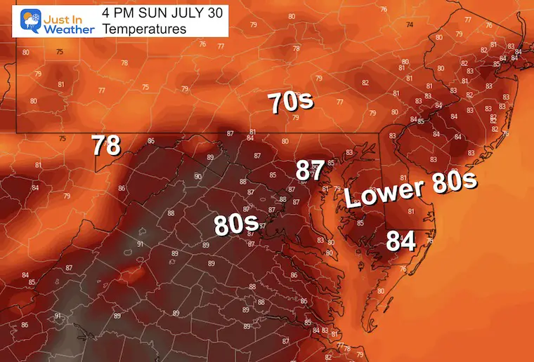
A noticeable change to the weather pattern as temps are more likely to remain in the 80s each afternoon starting tomorrow.

I am aware there are some spelling and grammar typos and occasional other glitches. I take responsibility for my mistakes, and even the computer glitches I may miss. I have made a few public statements over the years, but if you are new here you may have missed it: I have dyslexia, and found out during my second year at Cornell University. It didn’t stop me from getting my meteorology degree, and being the first to get the AMS CBM in the Baltimore/Washington region. One of my professors told me that I had made it that far without knowing, and to not let it be a crutch going forward. That was Mark Wysocki and he was absolutely correct! I do miss my mistakes in my own proofreading. The autocorrect spell check on my computer sometimes does an injustice to make it worse. I also can make mistakes in forecasting. No one is perfect predicting the future. All of the maps and information are accurate. The ‘wordy’ stuff can get sticky. There has been no editor that can check my work when I needed it and have it ready to send out in a newsworthy timeline. Barbara Werner is a member of the web team that helps me maintain this site. She has taken it upon herself to edit typos, when she is able. That could be AFTER you read this. I accept this and perhaps proves what you read is really from me… It’s part of my charm.
#FITF