July 5 High Heat Low Air Quality And Storm Risk Climbs Into The Weekend
July 5, 2023
Wednesday Morning Update
For many, we can simply call this ‘summer’ weather. The air is stagnant with building humidity. Many places will reach the 90s and the heat index will be a factor for a few more days.
With light winds, pollution levels are building, and the afternoon thundershowers will be few and far between.
We can expect temps to drop as the humidity increases over the next few days. This will increase our chance of afternoon rain and evening severe storms each day into the weekend.
Morning Surface Weather
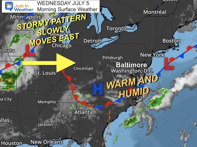
We remain in this ambiguous air mass with more humidity. This stagnant air is why the pollution levels are allowed to build up and not disperse.
Some showers and storms will develop with the heat of the day, but the chance will be about 20%, meaning most of us stay dry.
The trigger for more storms will move in closer to the weekend. So our chance for thunderstorms and even severe weather will increase from Friday through Monday.
Air Quality Maps
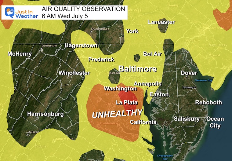
This Morning
The lowest air quality has been measured around and south of Washington, DC. Code Red levels in Prince Georges’s and Charles counties in Maryland.
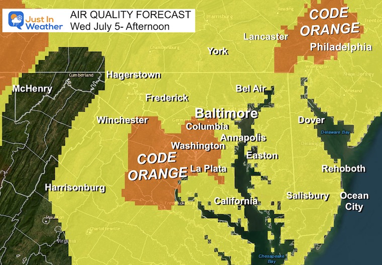
Afternoon Forecast:
Code Orange from Howard County, Maryland to metro Washington. Another cluster around metro Philadelphia.
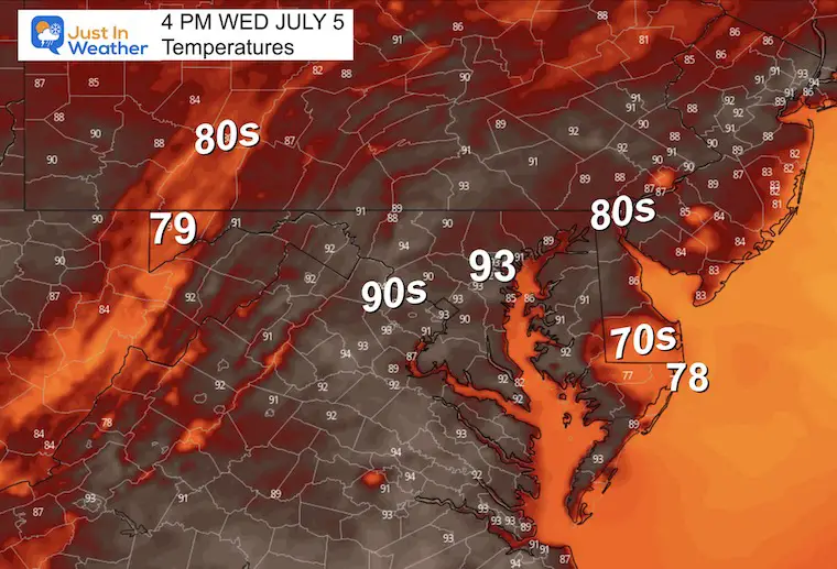
Afternoon Temperatures
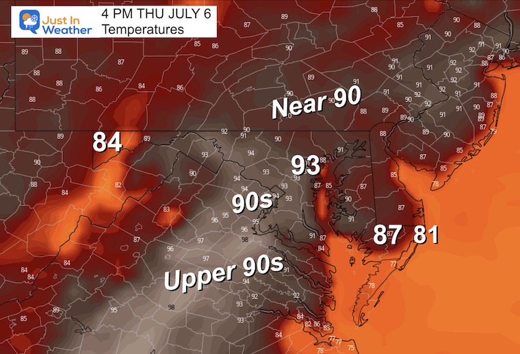
Many areas will reach into the 90s.
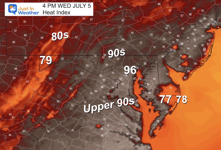
Heat Index
The humidity will become more noticeable. It will feel like the mid-90s.
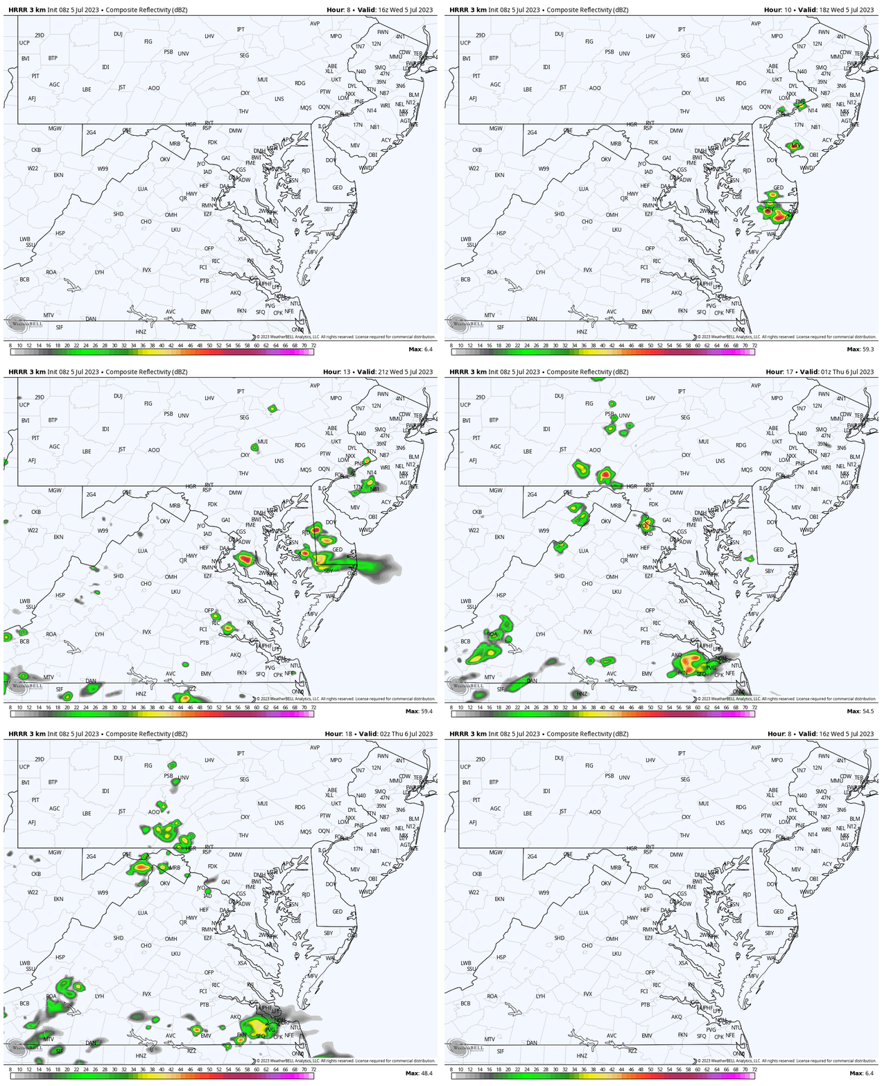
Radar Simulation Noon to 10 PM
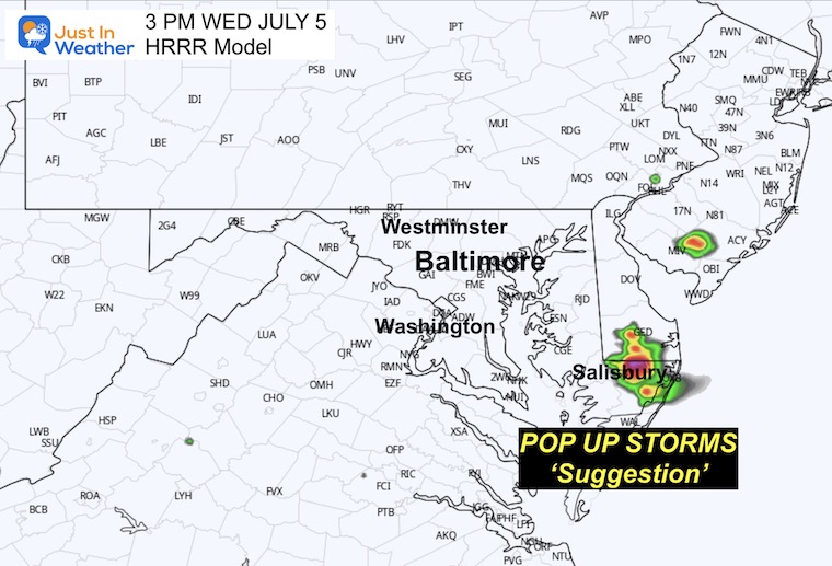
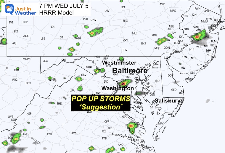
Once again we will have pop-up showers and storms. This is a suggestion and NOT perfect. However, I have seen an early afternoon cluster on Delmarva between Salisbury and central Delaware across the three short-range models… Then there may be mid to late-afternoon storms around Washington DC.
3 PM – Suggestion
7 PM – Suggestion
EXPLORE MORE
2023 Hurricane Season Forecast With An El Niño Watch
Drought Watch Updated June 15
Subscribe for eMail Alerts
Weather posts straight to your inbox
Sign up and be the first to know!
CLIMATE DATA
TODAY July 5
Normal Low in Baltimore: 67ºF
Record 55ºF in 2014
Normal High in Baltimore: 89ºF
Record 102ºF 1999
Thursday
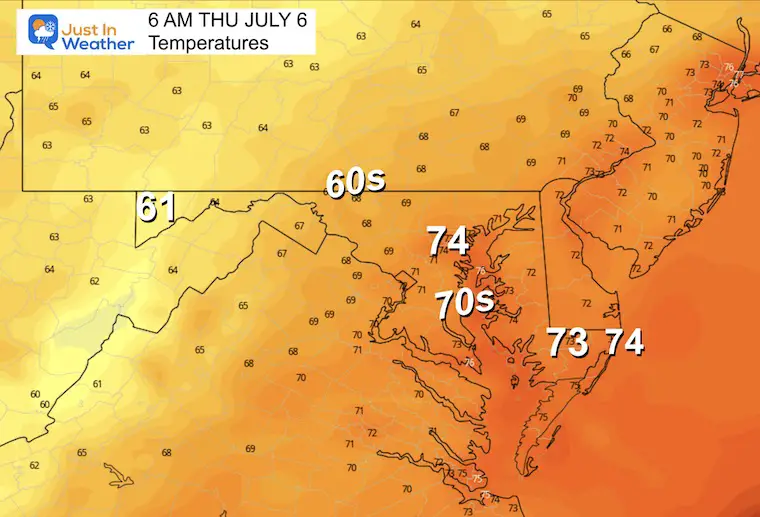
Morning Temperatures
Afternoon Temperatures
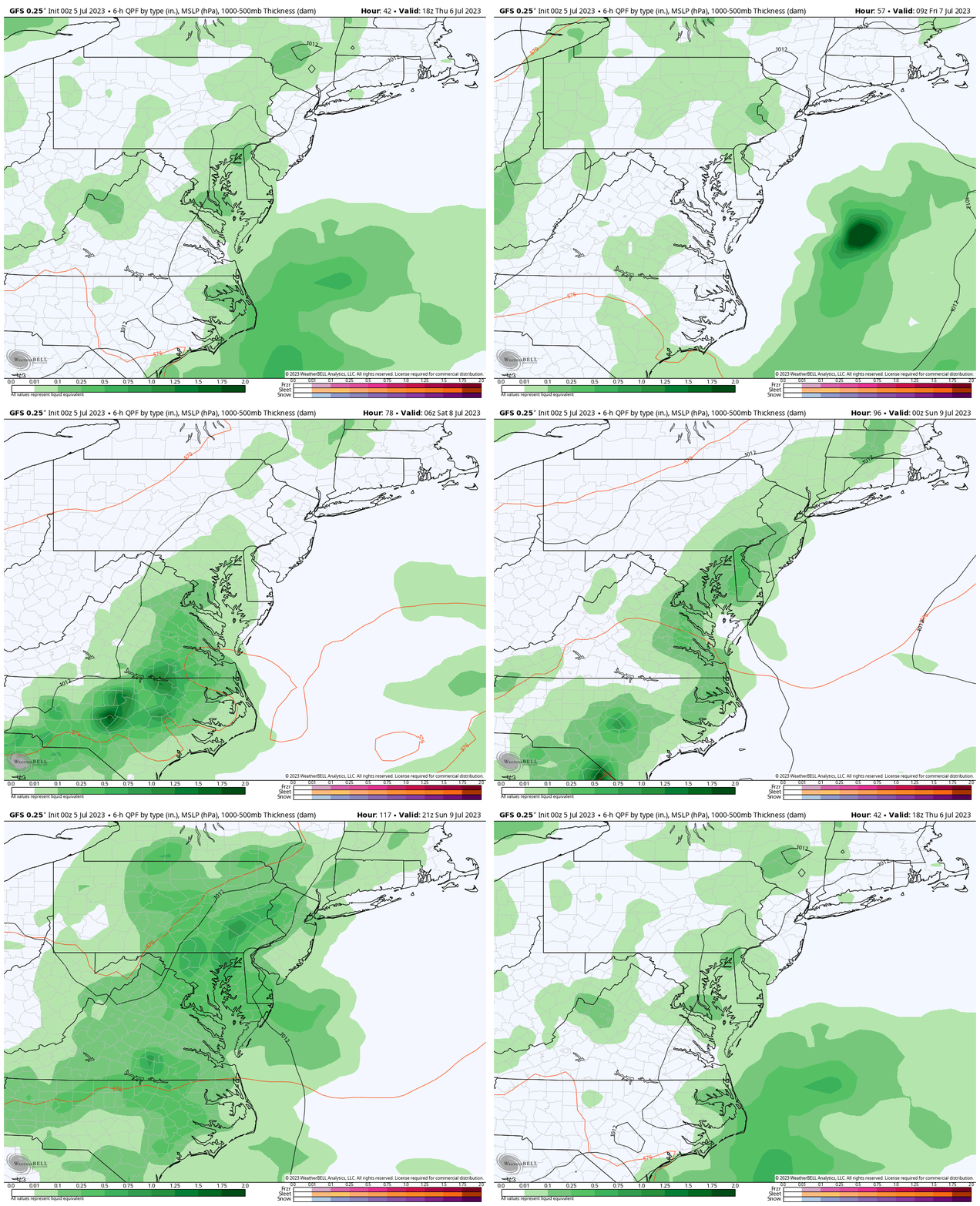
Rain and Storm Forecast Thursday Through Sunday
There will be a pulsing or flare-up of storms each afternoon and evening. The activity will increase from Friday through the weekend to become more widespread AND intense.
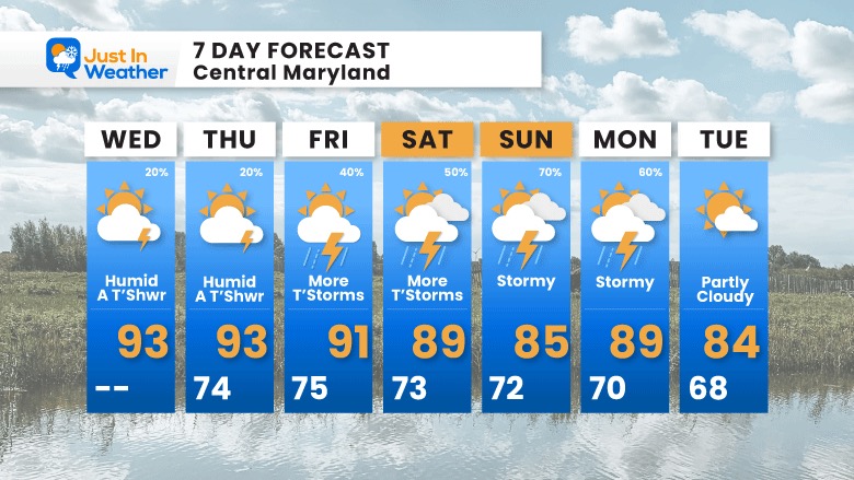
7 Day Forecast
We will trade off more humidity, slightly lower temps, and increased storm activity into the weekend. This may affect your plans and we will run the risk of storms turning severe Saturday and Sunday.
Subscribe for eMail Alerts
Weather posts straight to your inbox
Sign up and be the first to know!
EXPLORE MORE
2023 Hurricane Season Forecast With An El Niño Watch
La Niña Has Ended. El Niño May Return By Fall
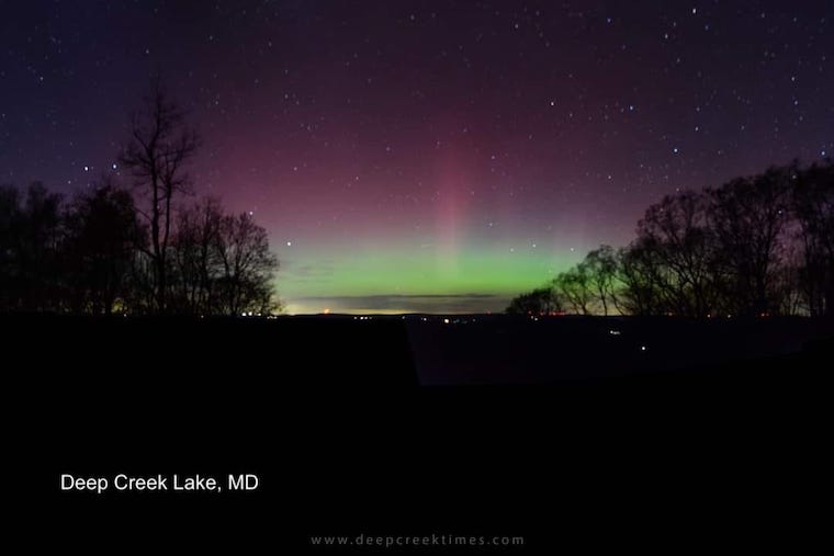
Aurora Photos From Maryland, Delaware, and Virginia
Please share your thoughts, and best weather pics/videos, or just keep in touch via social media
-
Facebook: Justin Berk, Meteorologist
-
Twitter
-
Instagram
RESTATING MY MESSAGE ABOUT DYSLEXIA
I am aware there are some spelling and grammar typos and occasional other glitches. I take responsibility for my mistakes, and even the computer glitches I may miss. I have made a few public statements over the years, but if you are new here you may have missed it: I have dyslexia, and found out during my second year at Cornell University. It didn’t stop me from getting my meteorology degree and being the first to get the AMS CBM in the Baltimore/Washington region. One of my professors told me that I had made it that far without knowing, and to not let it be a crutch going forward. That was Mark Wysocki and he was absolutely correct! I do miss my mistakes in my own proofreading. The autocorrect spell check on my computer sometimes does an injustice to make it worse. I also can make mistakes in forecasting. No one is perfect at predicting the future. All of the maps and information are accurate. The ‘wordy’ stuff can get sticky. There has been no editor that can check my work when I needed it and have it ready to send out in a newsworthy timeline. Barbara Werner is a member of the web team that helps me maintain this site. She has taken it upon herself to edit typos when she is able. That could be AFTER you read this. I accept this and perhaps proves what you read is really from me… It’s part of my charm.
#FITF


