June 27 Weather: Storm Recap And Severe Risk Today
June 27, 2023
Tuesday Morning Update
We are still in an unsettled environment. While it is warm and humid, there is less heat and the storms expected today may be less intense.
Yesterday did produce severe storms with large hail and wind damage. But it was spotty. This has left many areas still thirsty for rain and people are aggravated by changing plans with anticipation and no result.
Once again, these are scattered storms and not a promise that everyone will get hit. It is best to be aware and prepared. Today we will watch for storms between 2 PM and 8 PM. If you get in on one or a few, most will have a time span of around 30 minutes. Just have an exit plan for your event to get indoors if need be.
Before we look at today’s risk and the weekend, here is a recap of yesterday.
Monday Storm Recap
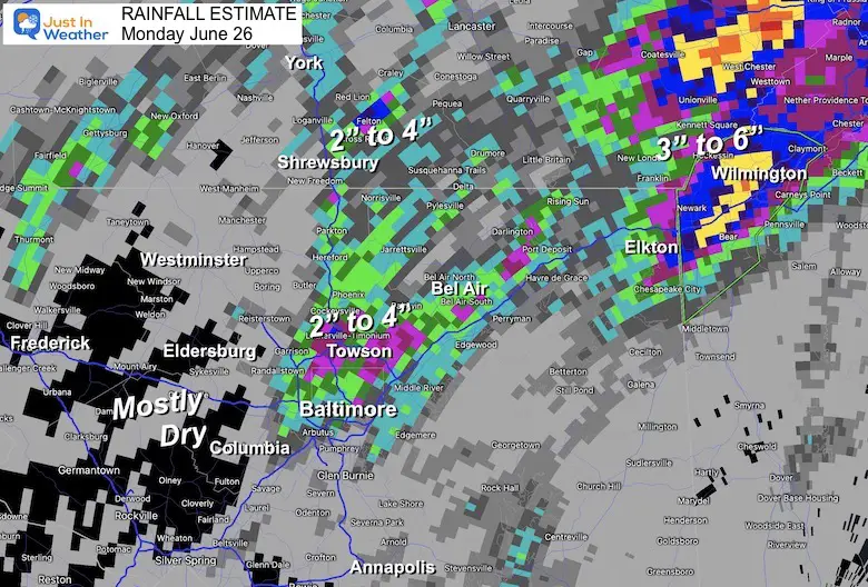
Rainfall Total
This highlights the burst of heavy rain in pockets, but some of the region missed out.
- Yes, that was between 2 to 4 inches around the north side of the Baltimore Beltway.
- The other heavy pocket was eastern Cecil County to Wilmington DE and the western suburbs of Philadelphia with 3 to 6 inches of rain!
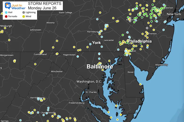
Monday Storm Reports
Many trees were downed with strong winds. That was more prominent than hail reports.
A wide spread outbreak was observed around Philadelphia.
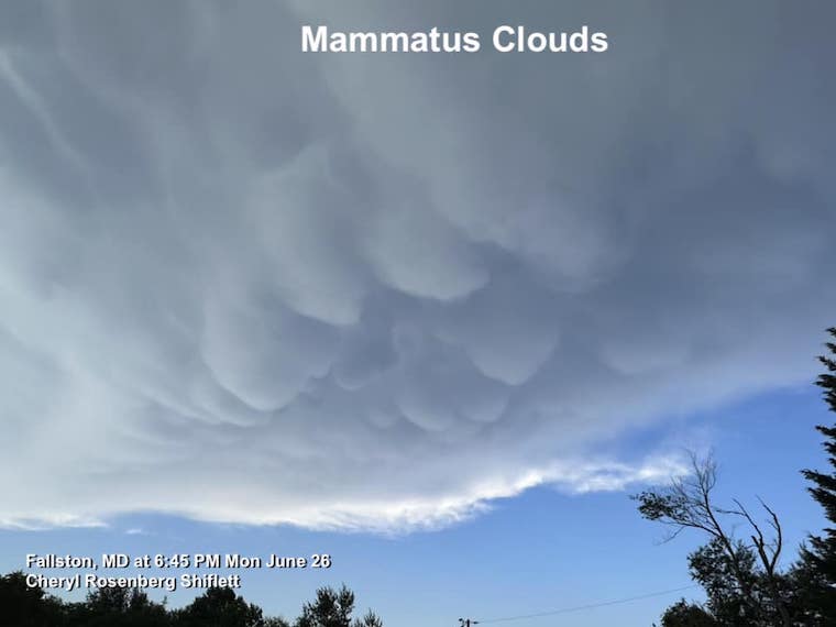
Mammatus Clouds
This was seen in Fallston, MD in Harford County. Often these pouches are on the edge of a storm that has produced large hail and is past its peak. It is colder air sinking and dominating the storm that produces these pouches. That was the case with the storm to the west in Baltimore County.
Thanks to Cheryl Rosenburg Shiflett
Large Hail
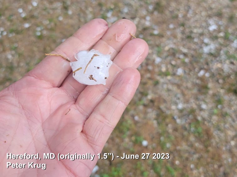
Peter Krug has the local winner. This was up to 1.5”, but melted.
This was in Hereford, Baltimore County. That cell had a history of dropping pea size hail or larger across Baltimore County.
See More on my Facebook Posts (in the comments)
My Monday Evening Request
Also here FROM MONDAY
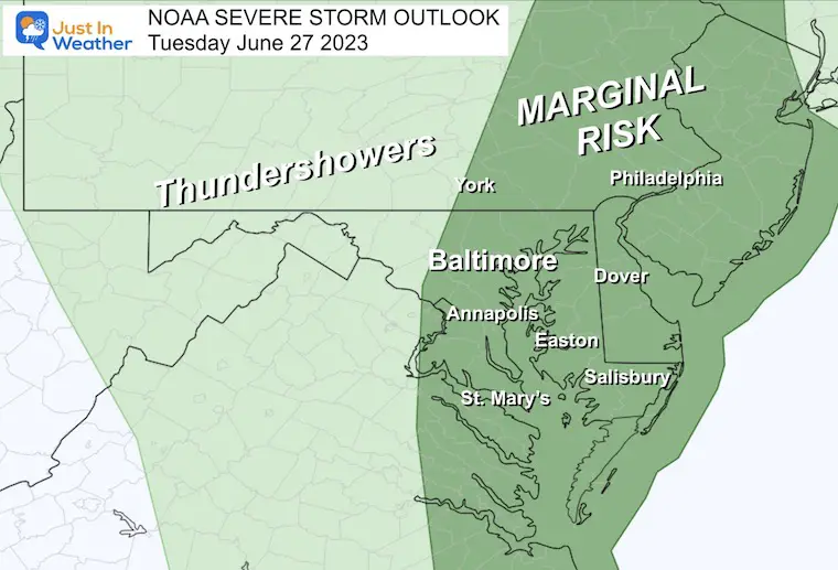
NOAA Severe Storm Risk
Marginal for thunderstorms to turn severe. This is the lowest level on the scale, but we could still see a couple of storm warnings later today.
The support is east of the mountains to the coast. This includes metro Washington, Baltimore, York, and Philadelphia. Once again visitors to Hershey Park could get in on strong storms.
Radar Simulation
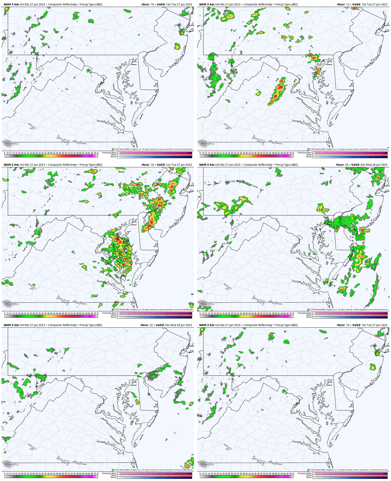
NAM 3 Km Noon to Midnight
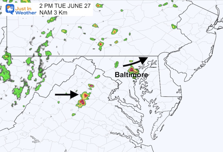
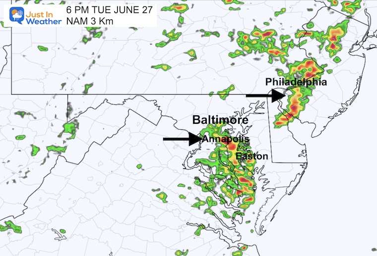
This is one model product AND not perfect. However, the suggestion is a flare up of showers and thunderstorms after 2 PM.
Snapshots
2 PM
6 PM
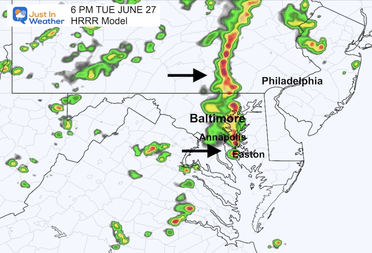
6 PM – HRRR Model
This outlook looks a lot more impressive with a solid line of storms in metro areas.
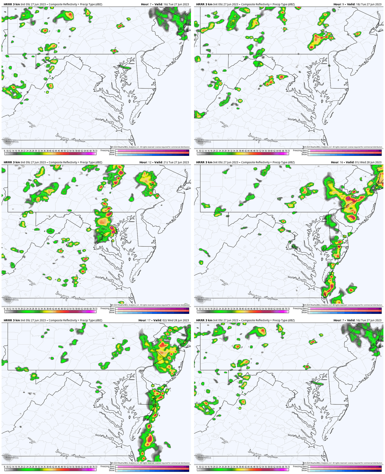
HRRR Model Simulation
12 PM to 10 PM
EXPLORE MORE
2023 Hurricane Season Forecast With An El Niño Watch
Drought Watch Updated June 15
Subscribe for eMail Alerts
Weather posts straight to your inbox
Sign up and be the first to know!
CLIMATE DATA
TODAY June 27
Normal Low in Baltimore: 66ºF
Record 50ºF in 1979
Normal High in Baltimore: 88ºF
Record 100ºF 2010
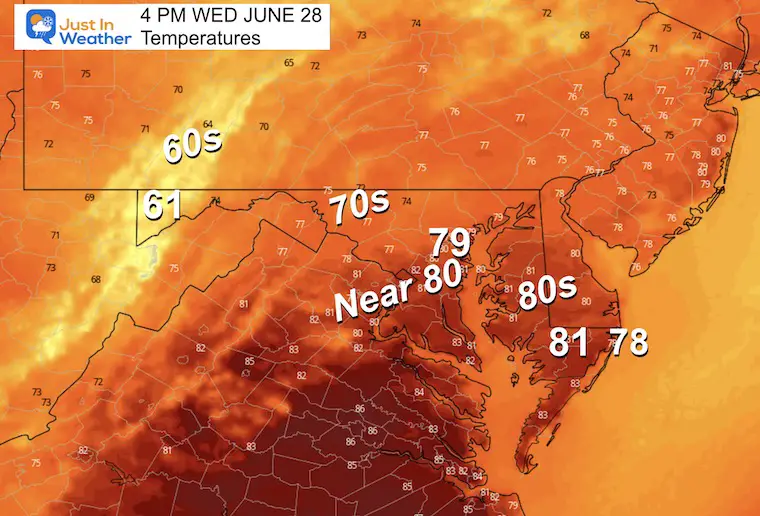
Wednesday Weather
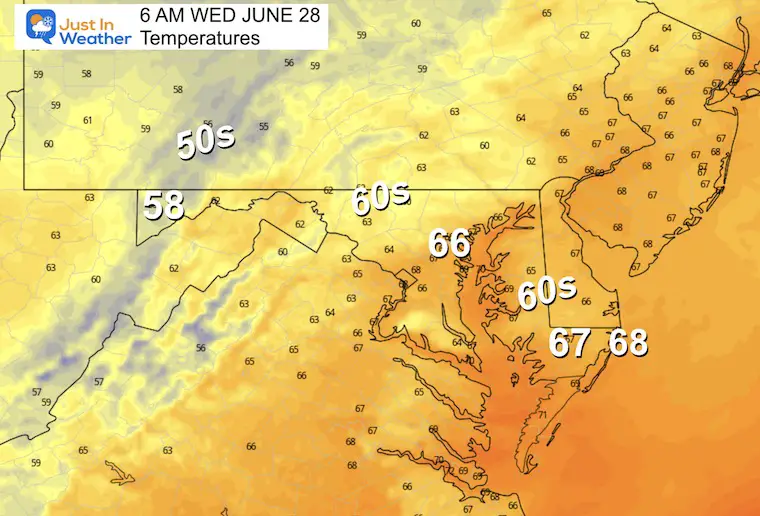
Morning Temperatures
Still warm and humid.
Afternoon Temperatures
Cooler, with a breeze and drop in humidity.
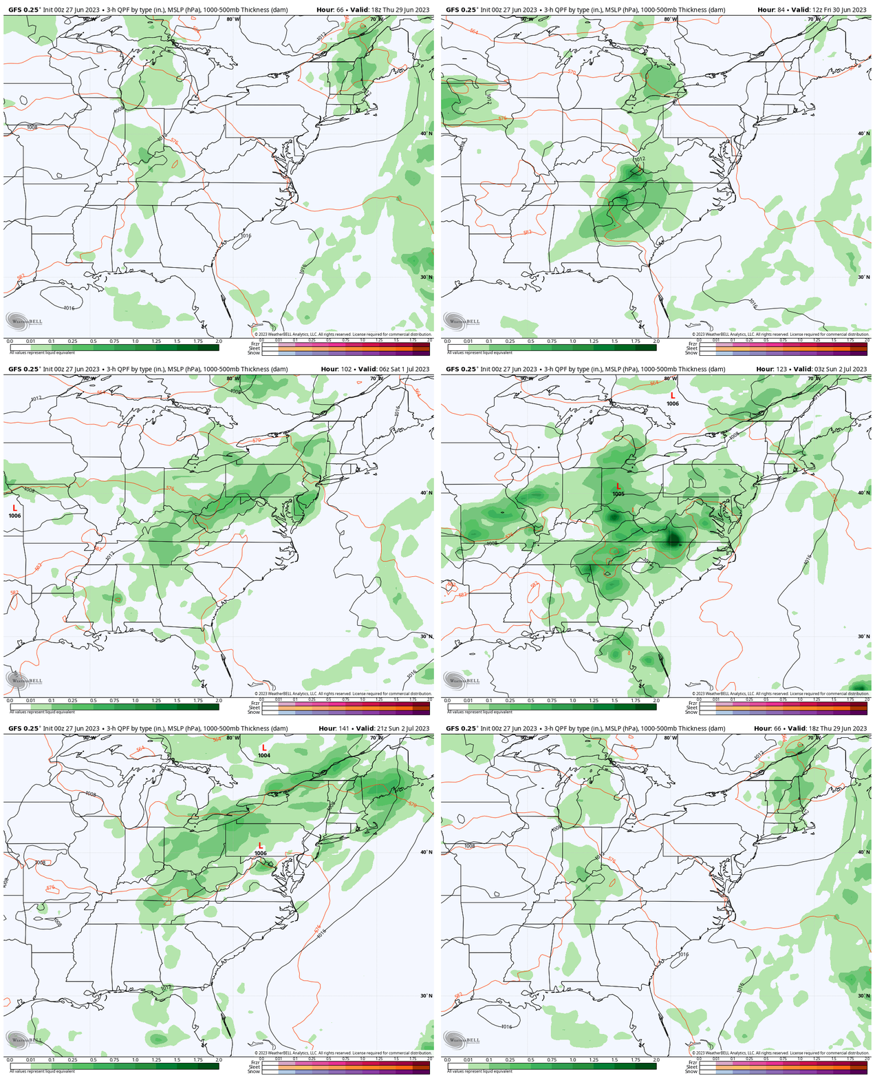
Rain Forecast Thursday to Sunday
The return of rain and storms on Friday afternoon, then more likely over the weekend. These will mainly be in the afternoon and evenings.
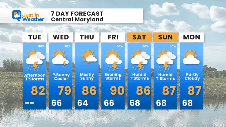
7 Day Forecast
This pattern will break for a few days. When you look at this graphic and think of your plans… YES there is a greater risk of weekend storms. However, they will be mainly later in the day. Those days will also have plenty of dry hours to be outside.
Subscribe for eMail Alerts
Weather posts straight to your inbox
Sign up and be the first to know!
EXPLORE MORE
2023 Hurricane Season Forecast With An El Niño Watch
La Niña Has Ended. El Niño May Return By Fall
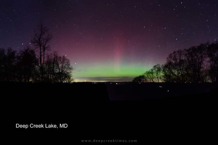
Aurora Photos From Maryland, Delaware, and Virginia
Please share your thoughts, and best weather pics/videos, or just keep in touch via social media
-
Facebook: Justin Berk, Meteorologist
-
Twitter
-
Instagram
RESTATING MY MESSAGE ABOUT DYSLEXIA
I am aware there are some spelling and grammar typos, and occasional other glitches. I take responsibility for my mistakes, and even the computer glitches I may miss. I have made a few public statements over the years, but if you are new here you may have missed it: I have dyslexia, and found out during my second year at Cornell University. It didn’t stop me from getting my meteorology degree, and being first to get the AMS CBM in the Baltimore/Washington region. One of my professors told me that I had made it that far without knowing, and to not let it be a crutch going forward. That was Mark Wysocki and he was absolutely correct! I do miss my mistakes in my own proofreading. The autocorrect spell check on my computer sometimes does an injustice to make it worse. I also can make mistakes in forecasting. No one is perfect predicting the future. All of the maps and information are accurate. The ‘wordy’ stuff can get sticky. There has been no editor that can check my work when I needed it and have it ready to send out in a newsworthy timeline. Barbara Werner is a member of the web team that helps me maintain this site. She has taken it upon herself to edit typos, when she is able. That could be AFTER you read this. I accept this and perhaps proves what you read is really from me… It’s part of my charm.
#FITF


