


January 6 Weather Some Fog And Clouds Followed By The Warm Up With Rain By The Weekend
Tuesday January 6 The storm track has shifted to the north. We are still on the edge, which is why we have areas of fog and most of the region…
June 23, 2023
Friday Morning Update
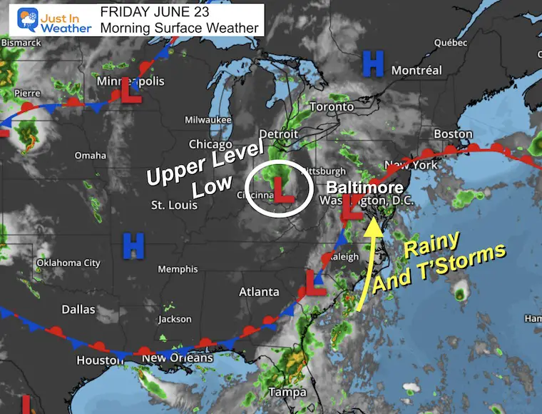
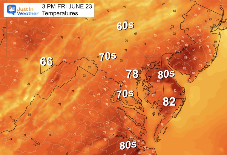
Yesterday did result in cooler temperatures, but the rain was scattered. Today we start to warm up more and will increase the wide range coverage of rain and thunderstorms. While we do not see much risk for severe weather, any storm can produce dangerous lighting or flash flooding. This is the reason to have caution any outdoor plans.
I’ve included the live radar and lightning widget below.
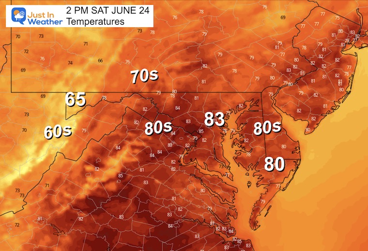
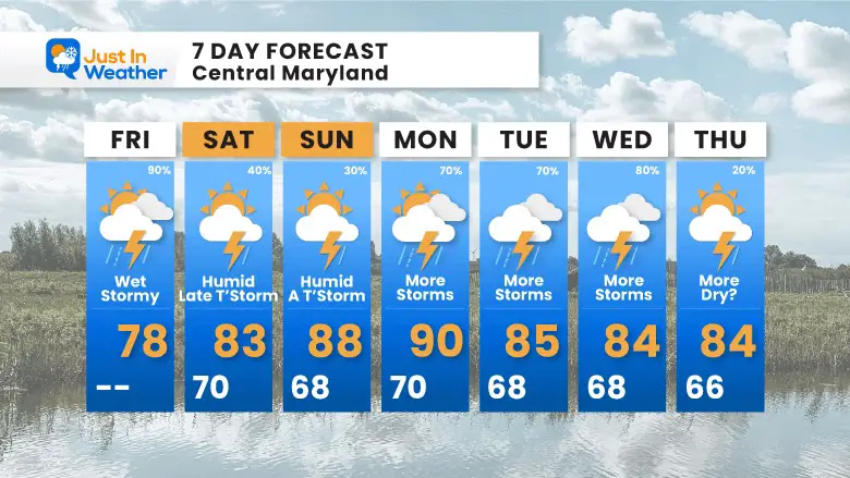
This weekend will actually be drier, with the chance of storms mainly in the afternoon or evening each day. Temps will warm up along with higher humidity. Then we bring back more rain for much of next week.
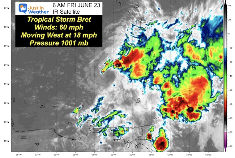
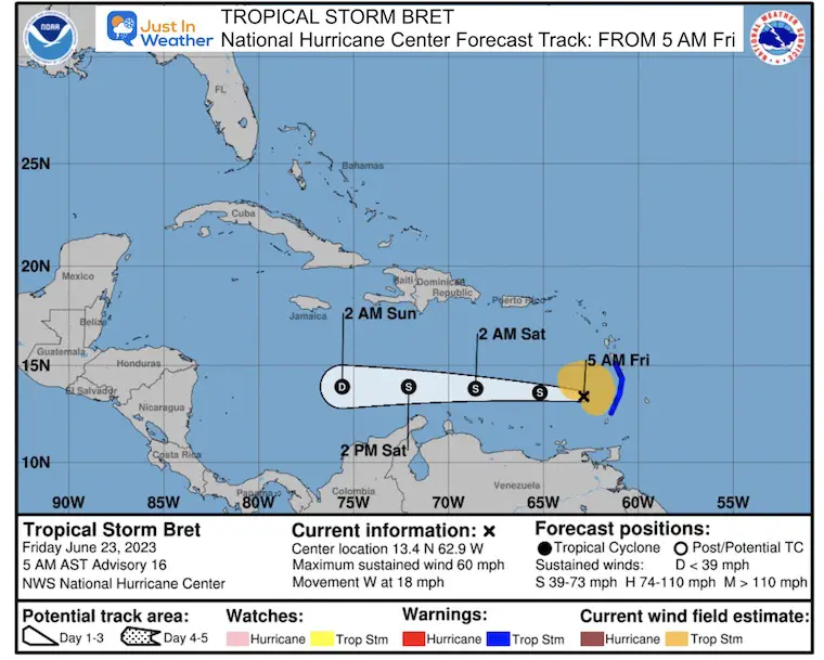
Update on Tropical Storm Bret….it is in the Eastern Caribbean, and winds have slowed a little.
The Upper Level Low in charge of our pattern is located in Southern Ohio. This is helping to pump in moisture up the East Coast from south to north. Waves of Low Pressure will enhance the rain and periods of thunderstorms today.
Use the controls to pan or zoom the map.
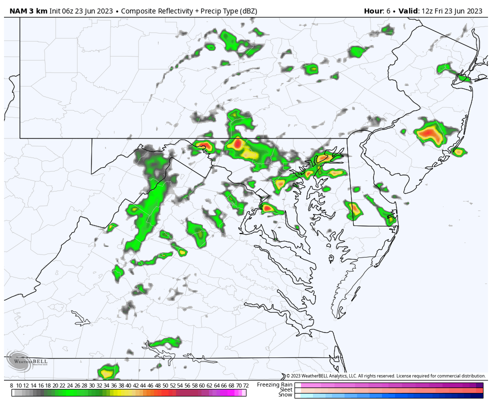
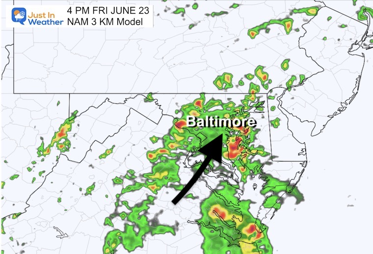
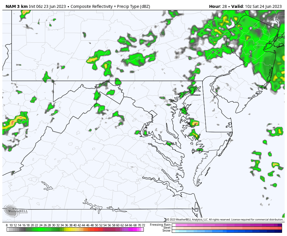
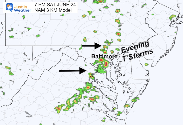
Comparing the two models there is a general agreement of the expectations, but there are subtle differences in the specific timing and location of cells.
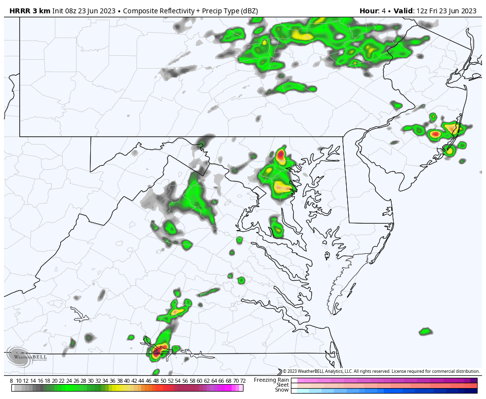
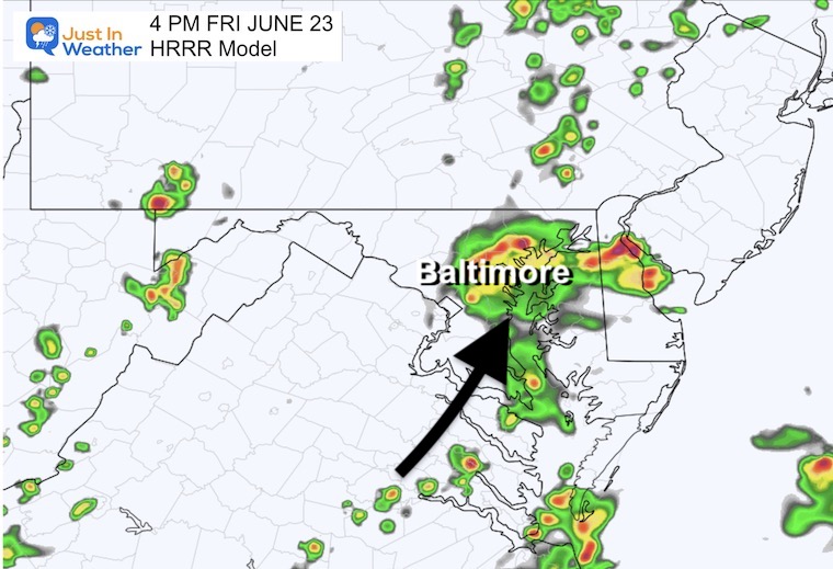
HRRR Model: A cluster poised to be over metro Baltimore, moving North.
NAM 3 Km Model: More widespread rain and storms, suggesting more rain and lasting longer.
Remaining chilly, damp, and humid.
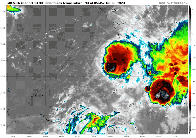
Winds have slowed to 60 mph. The wind field extends to 125 miles from the center, so it has grown larger.
5 AM Thu June 22 Update From The National Hurricane Center
It continues to move West after crossing the Windward Islands.
A Tropical Storm Warning is in effect for…
In this case, a Tropical Storm Warning means that tropical storm conditions are occurring within the warning area.
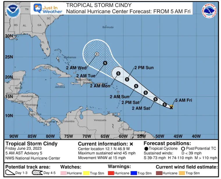
This was recently named, has 45 mph winds, and will be tracking farther north. No immediate impact, but worth watching.
Sign up and be the first to know!
Normal Low in Baltimore: 65ºF
Record 48ºF in 1992
Normal High in Baltimore: 87ºF
Record 97ºF 2010
Nearly seasonal numbers.
We may begin the day with showers, drizzle, and fog. However, much of the day will be dry. This is where the risk of rain will verify, but the graphic on your app or 7-day forecast can be deceiving.
While a spotty shower may pop up, the greater chance for storms will be in the evening.
Warmer and more humid!
My purpose for showing this animation is the broad pattern of pulsing rain each day. This will be mainly enhanced by afternoon heating to increase thunderstorms into each evening.
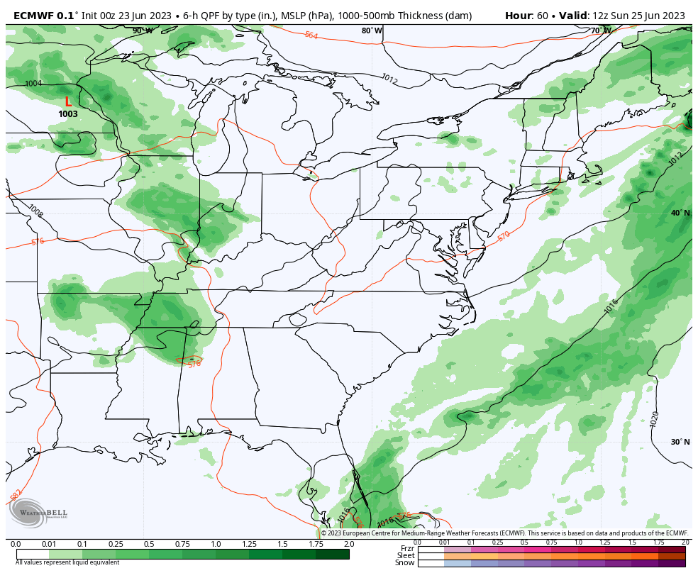
There will be more storms early next week, but the pattern is expected to break by Thursday and Friday. By that point, we could see an additional 2 to 3+ inches of much-needed rainfall. However, some individual cells could drop that much locally on any given day.
The risk of rain almost every day does NOT mean all-day washouts.
This weekend will have dry periods, with storms mainly popping up in the afternoon or evening. It will be very warm and humid. More rain will be likely during next week.
I can not suggest how to prepare for your plans. This pattern will mean mostly afternoon and evening storms, but they will be scattered. I do not trust any model to be precise with tracking the location of storm cells that far away.
Again, please just have a plan B for indoor options of your plans.
Sign up and be the first to know!

I am aware there are some spelling and grammar typos, and occasional other glitches. I take responsibility for my mistakes, and even the computer glitches I may miss. I have made a few public statements over the years, but if you are new here you may have missed it: I have dyslexia, and found out during my second year at Cornell University. It didn’t stop me from getting my meteorology degree, and being first to get the AMS CBM in the Baltimore/Washington region. One of my professors told me that I had made it that far without knowing, and to not let it be a crutch going forward. That was Mark Wysocki and he was absolutely correct! I do miss my mistakes in my own proofreading. The autocorrect spell check on my computer sometimes does an injustice to make it worse. I also can make mistakes in forecasting. No one is perfect predicting the future. All of the maps and information are accurate. The ‘wordy’ stuff can get sticky. There has been no editor that can check my work when I needed it and have it ready to send out in a newsworthy timeline. Barbara Werner is a member of the web team that helps me maintain this site. She has taken it upon herself to edit typos, when she is able. That could be AFTER you read this. I accept this and perhaps proves what you read is really from me… It’s part of my charm.
#FITF