June 16 Slight Risk For Thunderstorms To Turn Severe
June 16, 2023
Friday Morning Update
Today will bring showers and thunderstorms, with a slight risk of turning severe for some areas. We have had storms already around sunrise in the mountains, and a rogue storm in Delmarva. More will form.
This will be an unsettled day, however, it looks like the better chance of rain and heavy storms will be across Maryland and Delmarva. As for Southern Pennsylvania, lighter rain is expected, then a flare-up of storms around metro Philadelphia into Southern New Jersey in the afternoon.
The rain is important now that we have expanded the awareness of the drought in our region. Some isolated storms will produce good soakers, but most areas will be lucky to get 1/4 inch of rain.
At this point, Father’s Day Weekend will be dry and the warmest part of our weekend, then cooler next week, and the rain chances are dropping.
Morning Doppler Radar
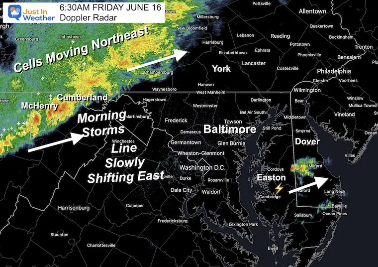
At 6:30 AM, the storms in the mountains seemed very active and are moving to the Northeast. Steady and moderate rain will move into Central Pennsylvania.
The rogue storm on Delmarva is fading… More is expected there later.
The line of storms is slowly moving to the east. See the timeline forecast below.
Morning Surface Weather
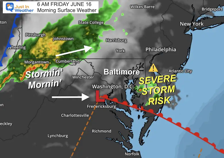
Today’s weather system is very active in the mountains with thunderstorms. These are tracking to the Northeast, and are likely to fade while crossing into the lower elevations.
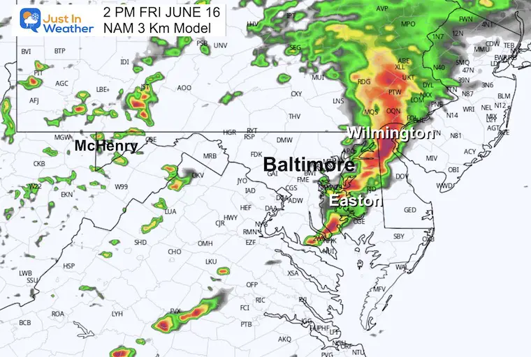
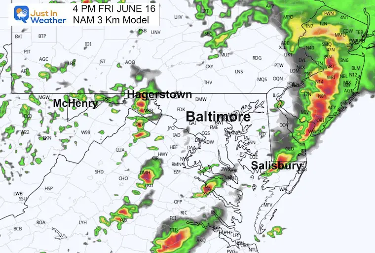
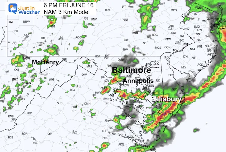
Some energy mixing with the mid-day sun will spark strong thunderstorms. There is a Slight Risk storms turn severe around The Chesapeake Bay and Delmarva with the afternoon heat. See the timeline below.
Live Radar and Lightning Widget
Compare to the Forecast Simulations Below
NOAA Severe Storm Risk
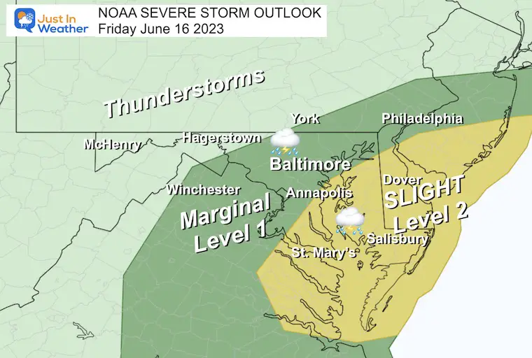
There will be thunderstorms moving through metro areas around lunchtime then building stronger in the afternoon heat as they travel east.
The Slight Risk is the higher chance for individual cells to turn severe. This includes Annapolis and across the Bay to Delmarva.
A severe storm may contain damaging wind over 58 mph, large hail over 1 inch in diameter, and an isolated tornado.
Radar Simulation
8 AM to 10 PM
UPDATE: The rain appears to be arriving 1 to 2 hours EARLIER! I will post a new report shortly.
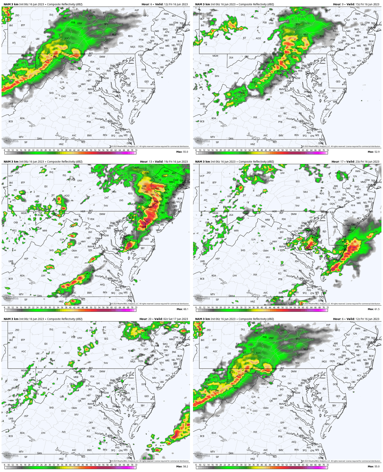
Snapshots
10 AM
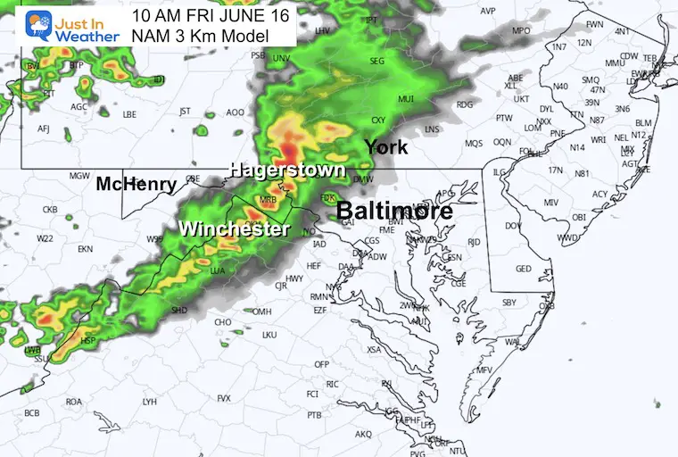
Noon
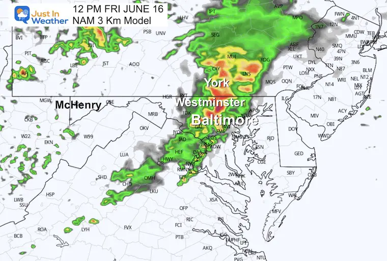
1 PM
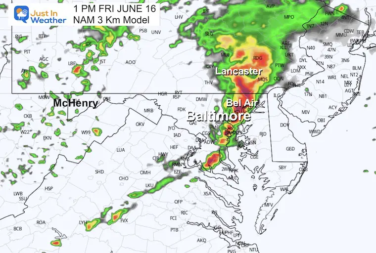
2 PM
4 PM
6 PM
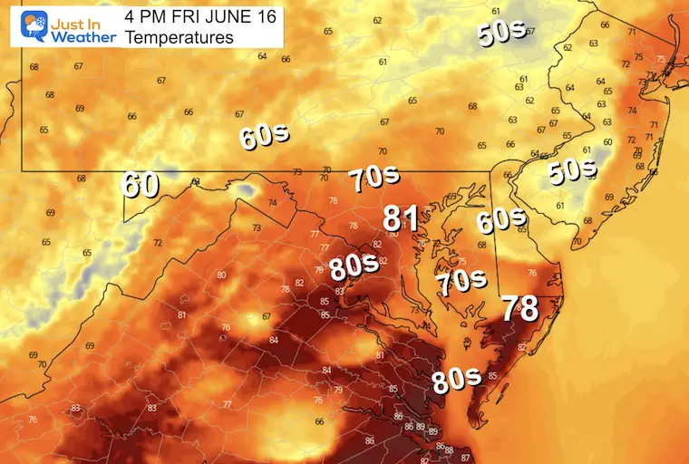
Temperatures at 4 PM
This is subjective. It will depend on any sunshine returning to boost temps into the 80s. Meanwhile, cooler 60s or even 50s around metro Philadelphia will depend on the intensity of thunderstorms.
EXPLORE MORE
Drought Watch Updated June 15
2023 Hurricane Season Forecast With An El Niño Watch
Subscribe for eMail Alerts
Weather posts straight to your inbox
Sign up and be the first to know!
CLIMATE DATA
TODAY June 16
Normal Low in Baltimore: 63ºF
Record 50ºF in 1961
Normal High in Baltimore: 85ºF
Record 99ºF 1991
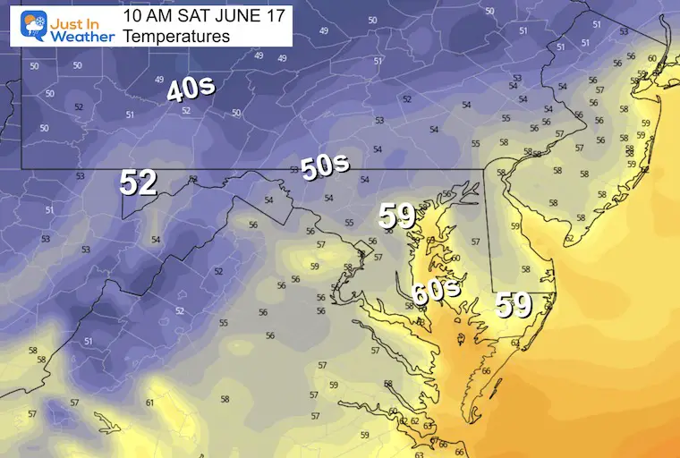
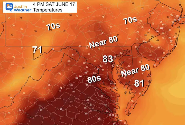
Saturday Temperatures
Morning Temperatures
Afternoon Temperatures
The high in metro areas will depend on the timing of the rain showers. Once they arrive, temps will cool back to the 70s.
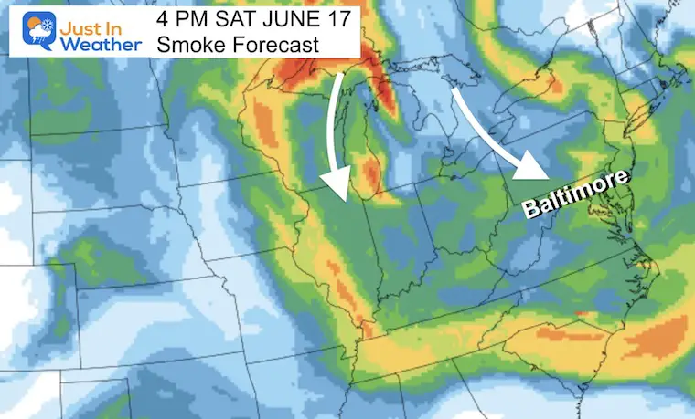
Smoke Will Return
This was the sunset photo I posted Thursday evening.
Forecast Map
The smoke will not be as bad as last week, but something that may add more haze to the sky and be a repeating pattern for much of this summer.
Father’s Day: Mostly Sunny and Warm!
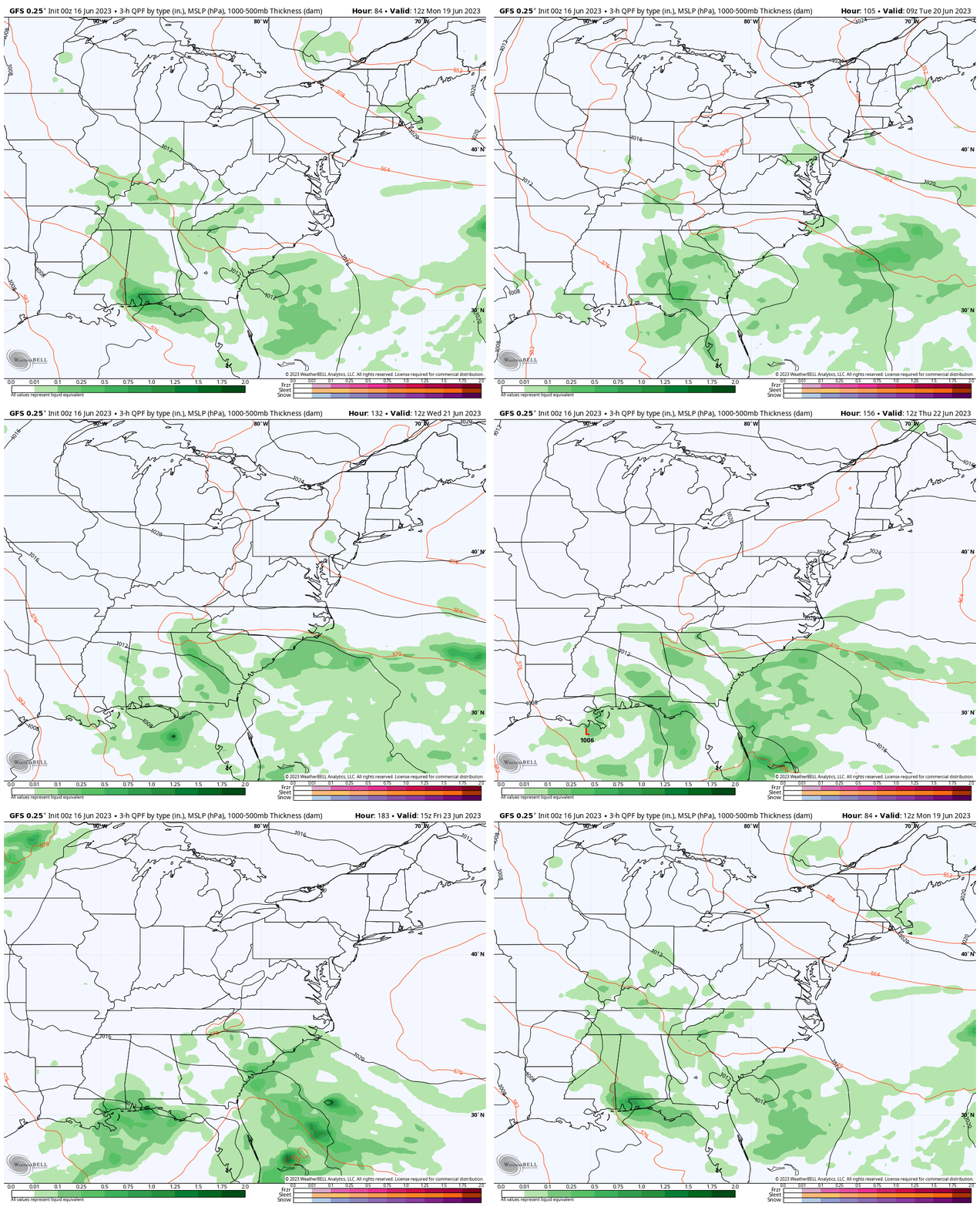
Rain Forecast: Monday to Friday
This potential rainy pattern looks less impressive for us at the last model run. This is reminding me of this past winter with expectations fading as we get closer to any storm.
At this point, I am keeping a chance for showers in for Monday afternoon and evening, then later in the week. But as we can see here the unsettled weather looks to remain in the Southeast US.
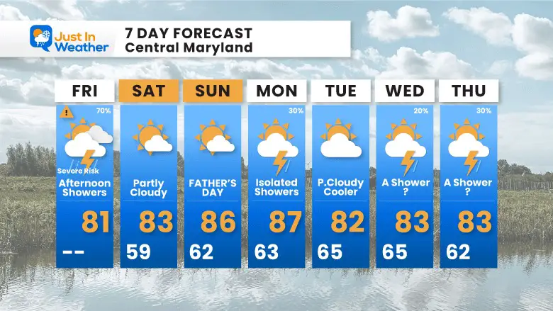
7 Day Forecast
This weekend will behave like summer, then we cool down next week. The rainy pattern keeps getting pushed back a day with the Southern storm staying south.
There is building anxiety with the drought, so we will watch this carefully for any adjustments.
Subscribe for eMail Alerts
Weather posts straight to your inbox
Sign up and be the first to know!
Also See:
La Niña Has Ended. El Niño May Return By Fall
Aurora Photos From Maryland, Delaware, and Virginia
Please share your thoughts, and best weather pics/videos, or just keep in touch via social media
-
Facebook: Justin Berk, Meteorologist
-
Twitter
-
Instagram
RESTATING MY MESSAGE ABOUT DYSLEXIA
I am aware there are some spelling and grammar typos, and occasional other glitches. I take responsibility for my mistakes, and even the computer glitches I may miss. I have made a few public statements over the years, but if you are new here you may have missed it: I have dyslexia, and found out during my second year at Cornell University. It didn’t stop me from getting my meteorology degree, and being first to get the AMS CBM in the Baltimore/Washington region. One of my professors told me that I had made it that far without knowing, and to not let it be a crutch going forward. That was Mark Wysocki and he was absolutely correct! I do miss my mistakes in my own proofreading. The autocorrect spell check on my computer sometimes does an injustice to make it worse. I also can make mistakes in forecasting. No one is perfect predicting the future. All of the maps and information are accurate. The ‘wordy’ stuff can get sticky. There has been no editor that can check my work when I needed it and have it ready to send out in a newsworthy timeline. Barbara Werner is a member of the web team that helps me maintain this site. She has taken it upon herself to edit typos, when she is able. That could be AFTER you read this. I accept this and perhaps proves what you read is really from me… It’s part of my charm.
#FITF


