


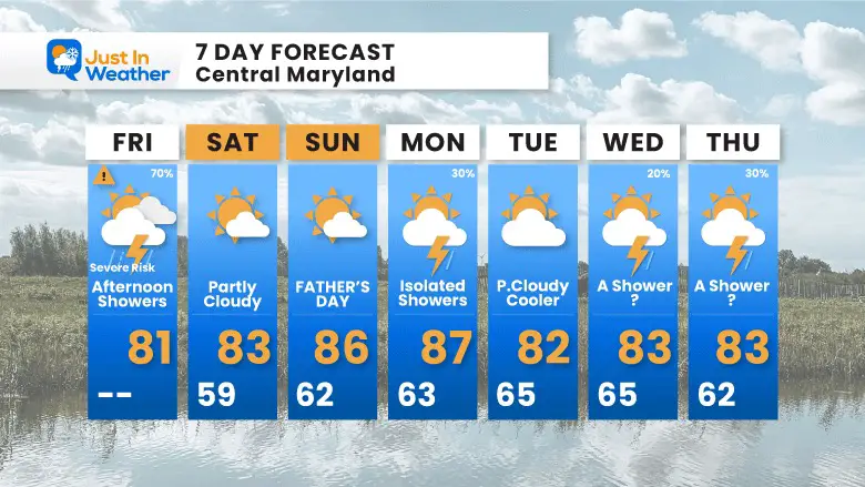
Soggy Saturday Update: Rain Timeline Through Preakness In Baltimore
Friday, May 17, 2024 As we approach another weekend, we have yet another weather system bringing us rain. This will make 16 of 20 weekends this year with some wet…
June 16, 2023
Friday Morning Update
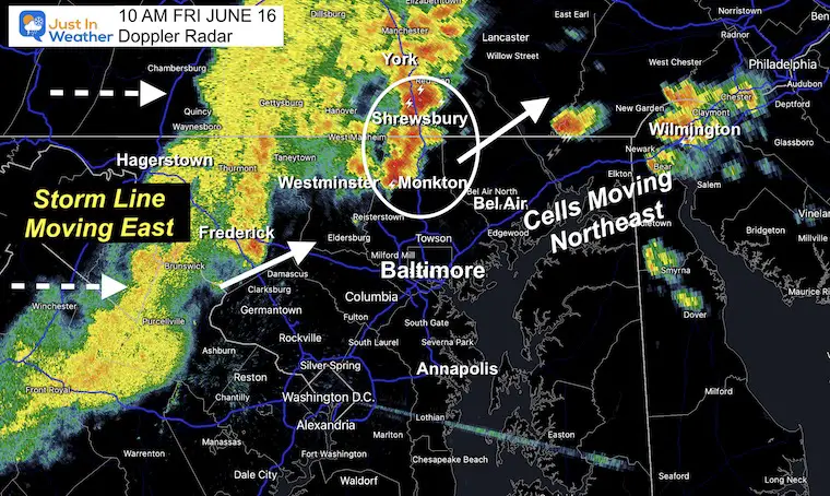
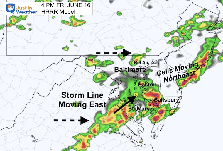
The rain we have been tracking today has arrived 1 to 2 hours sooner and is a little heavier than expected for the areas north and west of Baltimore. I wanted to show you the status at 10 AM and the new model simulation forecast maps, as they may help you with your timing.
The anticipation is for this initial line to arrive late morning to early afternoon, then redevelop in Southern Maryland and Delmarva. That may affect anyone driving to the beach for the weekend. There will be more pop-up storms this afternoon, and we still run the risk for some of these cells to turn severe. They may include flash flooding, damaging winds, large hail, or even a tornado.
There will be thunderstorms moving through metro areas around lunchtime, then building stronger in the afternoon heat as they travel east.
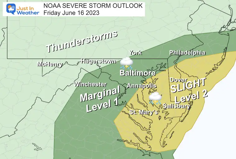
The Slight Risk is the higher chance for individual cells to turn severe. This includes Annapolis and across the Bay to Delmarva.
A severe storm may contain damaging wind over 58 mph, large hail over 1 inch in diameter, and an isolated tornado.
This is the observed rain and storm line. Compare this to the model forecast below.
There has been plenty of lightning in some of these cells, showing more energy this morning.
This was generated a few hours earlier, and we can see it already was underestimating the intensity. It was also a little slow. However, this did catch up better than the model plot I showed in my early morning report.
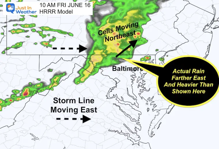
Compare to the Forecast Simulations Below
This may not match the above image depending on when you view this report. Use this to compare to the model forecast maps below.
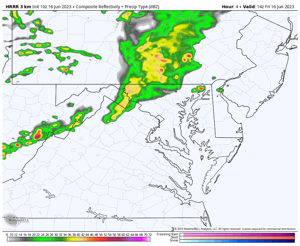
Reminder, this is the rapid update model and most recently generated. It is NOT perfect and still may underplay what we will see.
This means keep on the lookout for more storms and locally heavier than than shown here.
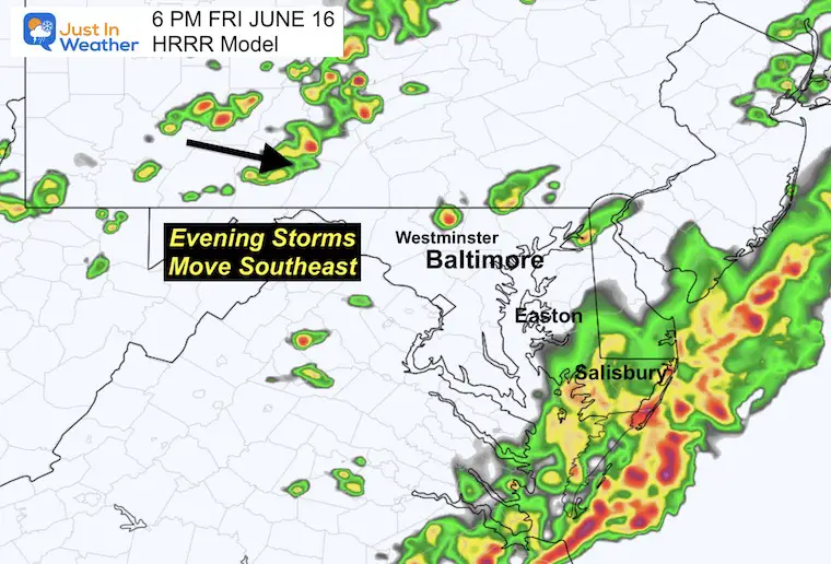
A very active afternoon. Given the recent set up, this may be close to verifying between 2 and 4 PM. Something to consider if you are traveling or have outdoor plans.
The sun may pop up after the line and ignite more storms.
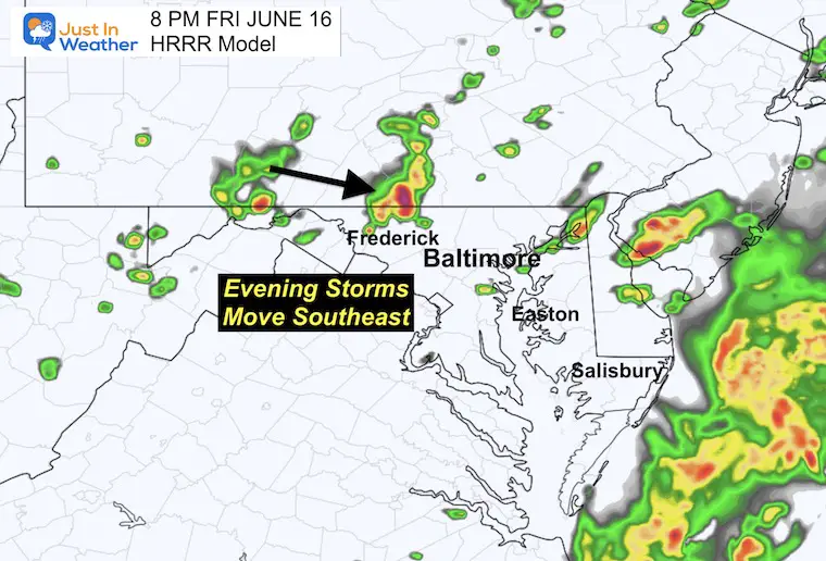
Heavy rain and storms for The Lower Eastern Shore AND beaches.
New individual cells will be forming inland.
We will need to watch for stronger storm cells through the evening to arrive from the mountains.
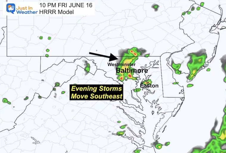
This does not PROMISE the exact locations shown. Just an idea to gauge by.
Some storms may still be possible in central Maryland through tonight.
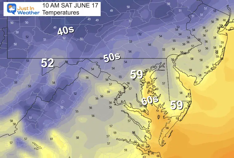
The high in metro areas will depend on the timing of the rain showers. Once they arrive, temps will cool back to the 70s.
This was the sunset photo I posted Thursday evening.
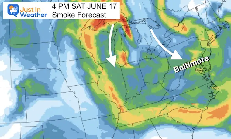
The smoke will not be as bad as last week, but something that may add more haze to the sky and be a repeating pattern for much of this summer.
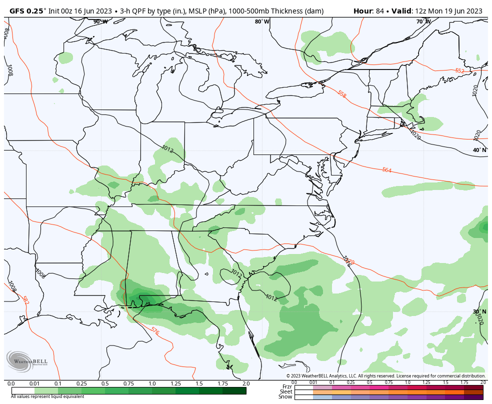
This potential rainy pattern looks less impressive for us at the last model run. This is reminding me of this past winter with expectations fading as we get closer to any storm.
At this point, I am keeping a chance for showers in for Monday afternoon and evening, then later in the week. But as we can see here the unsettled weather looks to remain in the Southeast US.
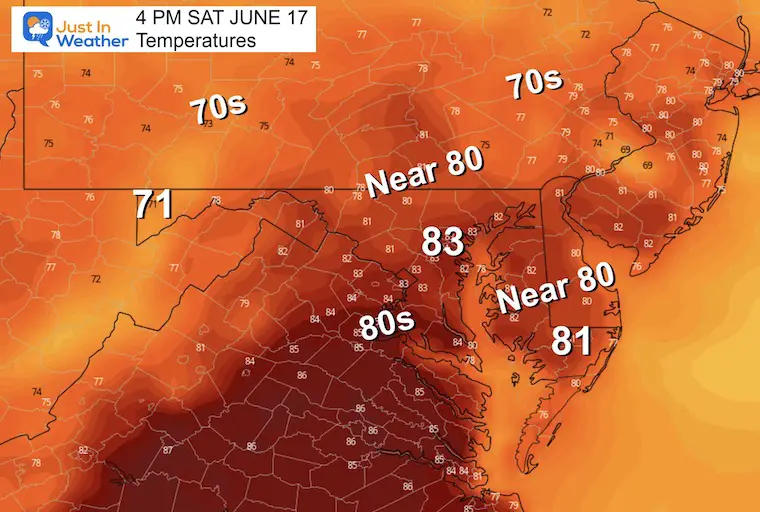
This weekend will behave like summer, then we cool down next week. The rainy pattern keeps getting pushed back a day with the Southern storm staying south.
There is building anxiety with the drought, so we will watch this carefully for any adjustments.

I am aware there are some spelling and grammar typos, and occasional other glitches. I take responsibility for my mistakes, and even the computer glitches I may miss. I have made a few public statements over the years, but if you are new here you may have missed it: I have dyslexia, and found out during my second year at Cornell University. It didn’t stop me from getting my meteorology degree, and being first to get the AMS CBM in the Baltimore/Washington region. One of my professors told me that I had made it that far without knowing, and to not let it be a crutch going forward. That was Mark Wysocki and he was absolutely correct! I do miss my mistakes in my own proofreading. The autocorrect spell check on my computer sometimes does an injustice to make it worse. I also can make mistakes in forecasting. No one is perfect predicting the future. All of the maps and information are accurate. The ‘wordy’ stuff can get sticky. There has been no editor that can check my work when I needed it and have it ready to send out in a newsworthy timeline. Barbara Werner is a member of the web team that helps me maintain this site. She has taken it upon herself to edit typos, when she is able. That could be AFTER you read this. I accept this and perhaps proves what you read is really from me… It’s part of my charm.
#FITF