June 5, 2023
Monday Morning Update
After a warm end to the weekend, cooler winds will build in this afternoon. This will keep us below average and build in more clouds this afternoon. It has been comfortable for outdoor activities, but the drought is growing with each dry day.
Not much rain is in sight. We have some isolated showers for tomorrow and more later in the week. But the region as a whole will remain dry this week. As for the heat, some of that will return by the weekend.
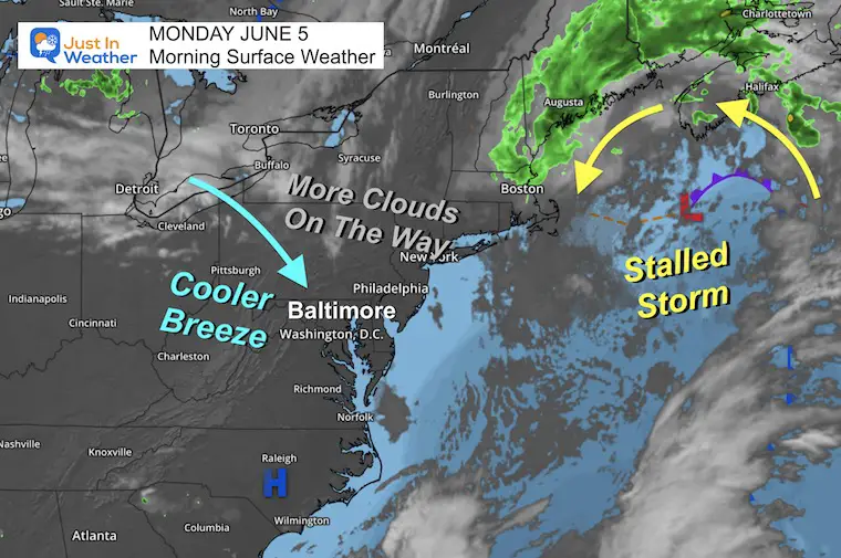
Morning Surface Weather
We continue to watch a stalled low off the coast of Maine. There is needed rain for that region, including Nova Scotia where wildfires had sent us smoke last week.
The regional air flow for us will be from the Northwest. This will bring us cooler air and increase the clouds this afternoon.
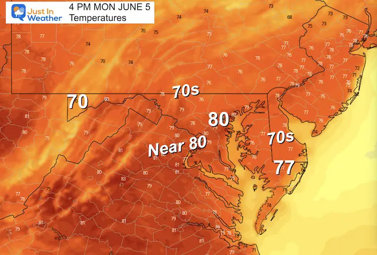
4 PM Afternoon Temperatures
It will be a cooler day thanks to the winds from the Northwest.
EXPLORE MORE
Building Drought As We Begin June
2023 Hurricane Season Forecast With An El Niño Watch
Subscribe for eMail Alerts
Weather posts straight to your inbox
Sign up and be the first to know!
CLIMATE DATA
TODAY June 5
Normal Low in Baltimore: 59ºF
Record 44ºF in 1997
Normal High in Baltimore: 81ºF
Record 101ºF 1925
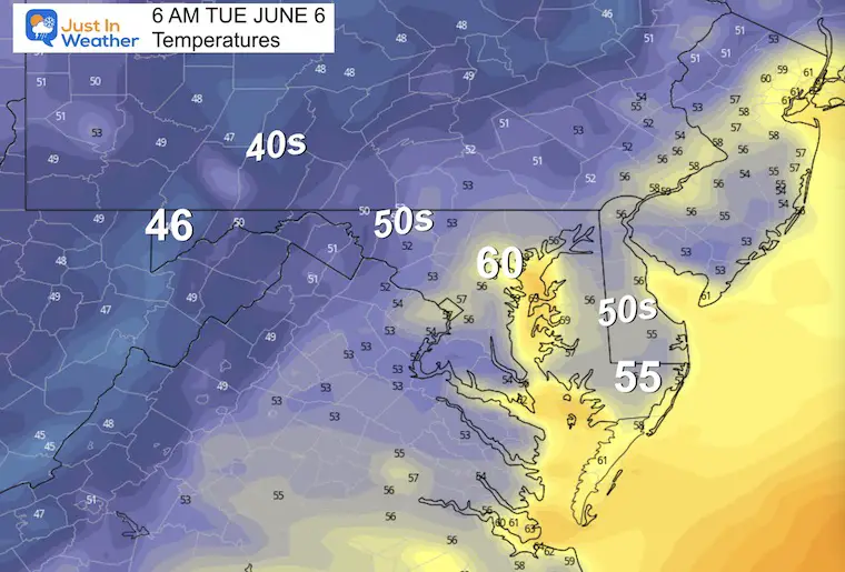
Tuesday
Morning Temperatures
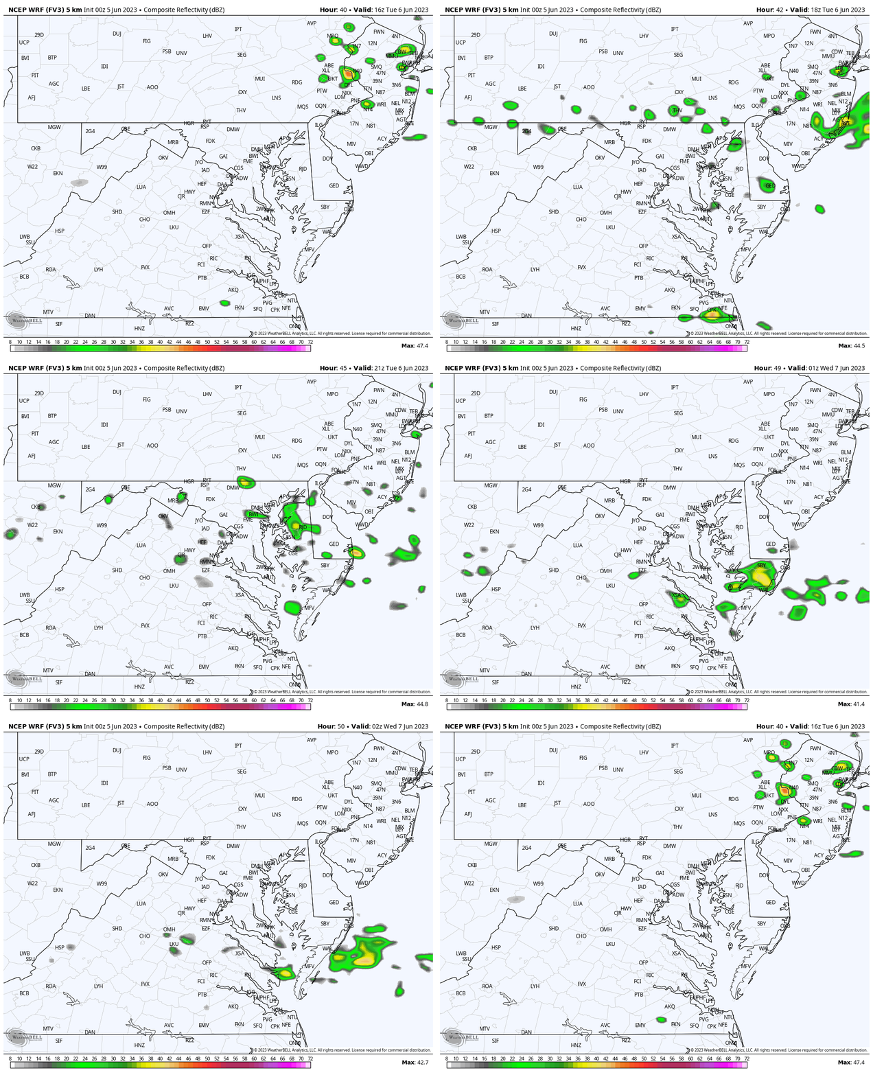
Radar Simulation: Noon to 10 PM
The slight chance for storms will build in the afternoon. The odds you get one will be about 20% and if you do it’s likely to last less than 1/2 an hour.
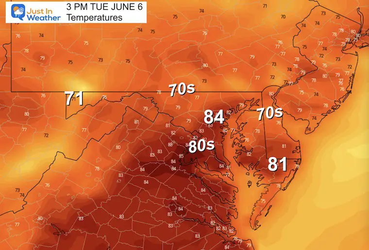
Afternoon Temperatures
LATE WEEK
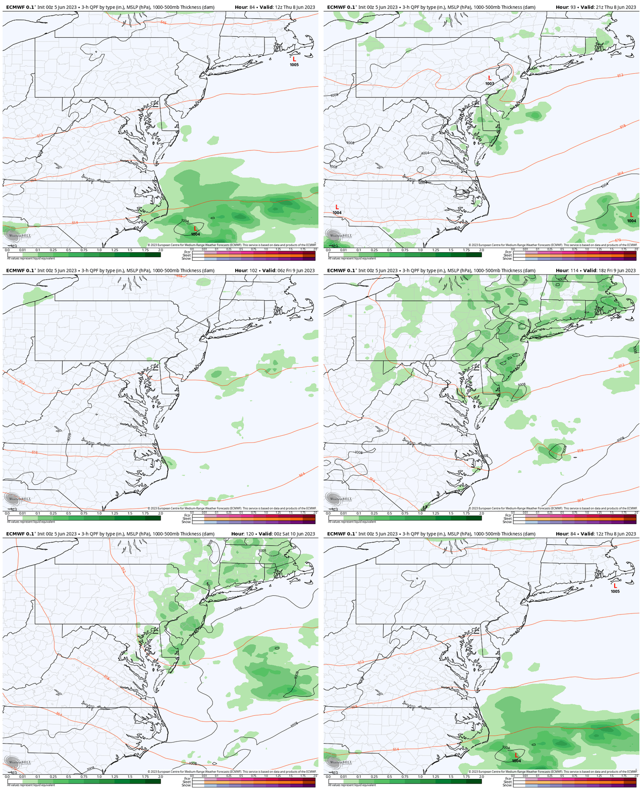
Storm Animation: Thursday to Friday
The unsettled upper air pattern will produce more showers. At this point, it looks like the focus may be more concentrated around the Chesapeake Bay to the coast. These are more scattered pop-up afternoon showers. Even local downpours will not be enough to ease the growing drought.
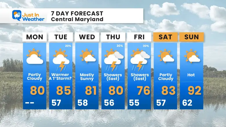
7 Day Forecast
The week ahead may not be completely dry, but the chances for rain will be low. The rain risk on Thursday and Friday may be higher, but will be concentrated near and east of the Chesapeake Bay.
Subscribe for eMail Alerts
Weather posts straight to your inbox
Sign up and be the first to know!
Also See:
La Niña Has Ended. El Niño May Return By Fall
Aurora Photos From Maryland, Delaware, and Virginia
Please share your thoughts, best weather pics/videos, or just keep in touch via social media
-
Facebook: Justin Berk, Meteorologist
-
Twitter
-
Instagram
RESTATING MY MESSAGE ABOUT DYSLEXIA
I am aware there are some spelling and grammar typos, and occasional other glitches. I take responsibility for my mistakes, and even the computer glitches I may miss. I have made a few public statements over the years, but if you are new here you may have missed it: I have dyslexia, and found out during my second year at Cornell University. It didn’t stop me from getting my meteorology degree, and being first to get the AMS CBM in the Baltimore/Washington region. One of my professors told me that I had made it that far without knowing, and to not let it be a crutch going forward. That was Mark Wysocki and he was absolutely correct! I do miss my mistakes in my own proofreading. The autocorrect spell check on my computer sometimes does an injustice to make it worse. I also can make mistakes in forecasting. No one is perfect predicting the future. All of the maps and information are accurate. The ‘wordy’ stuff can get sticky. There has been no editor that can check my work when I needed it and have it ready to send out in a newsworthy timeline. Barbara Werner is a member of the web team that helps me maintain this site. She has taken it upon herself to edit typos, when she is able. That could be AFTER you read this. I accept this and perhaps proves what you read is really from me… It’s part of my charm.
#FITF


