April 25 After A Frosty Start We Remain Chilly And Turn Rainy
April 25, 2023
Tuesday Morning Update
We start this day very chilly with frost and freeze conditions inland. Even if you are not that cold, it will feel like we turned the clock back a month as we enter an extended period of cooler temps. This will come with a sequence of storms. While it will affect another weekend, it will be beneficial to our drought.
The weather pattern we see for the next two weeks is what I expected to end our winter. This is very late and we can only say ‘what if’, on top of setting the clock back on the season.
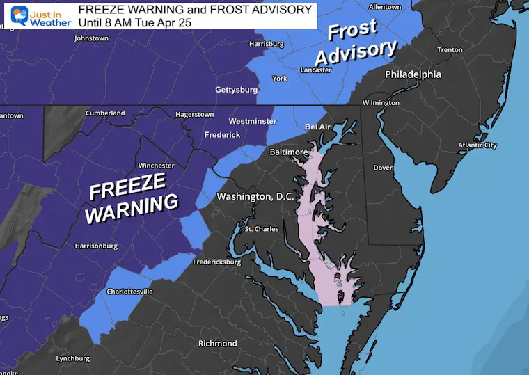
Morning Frost and Freeze Alerts
These alerts officially expire at 8 AM.
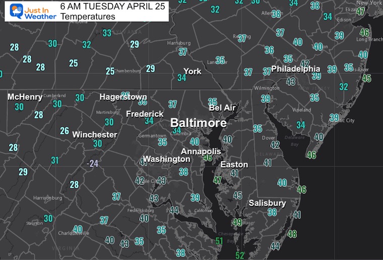
Morning Temperature Observation
Plenty of 30s inland and possible frost. The freezing temps appear to be west of Frederick and York.
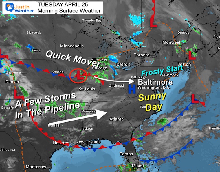
Morning Surface Weather
High Pressure is over the Mid Atlantic, meaning a sunny day with light wind. We will remain chilly. And watch the next quick moving system near Chicago set to reach us Wednesday.
Behind that will be a few more storms that reach us this weekend.
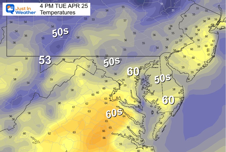
Afternoon Forecast
Subscribe for eMail Alerts
Weather posts straight to your inbox
Sign up and be the first to know!
CLIMATE DATA
TODAY April 25
Normal Low in Baltimore: 47ºF
Record 30ºF in 1956
Normal High in Baltimore: 70ºF
Record 94ºF in 1960 *Tied hottest of the month
REPORTS:
NEW:
Aurora Photos From Maryland, Delaware, and Virginia
April Heat Wave History
Winter 2023 Recap: My BUSTED Snow Outlook
La Niña Has Ended. El Niño May Return By Fall
Wednesday Temperatures
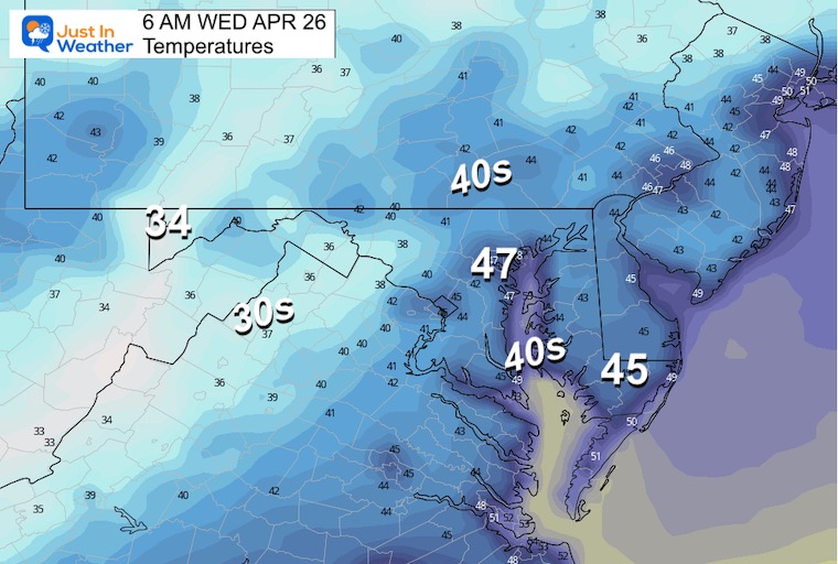
Morning
Chilly but not as cold as the past two mornings.
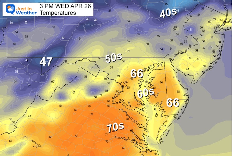
Afternoon Temperatures
Another chilly afternoon with mid 50s to near 60s. This will be limited by increasing clouds and approaching rain.
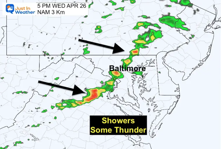
Radar Snapshot at 5 PM
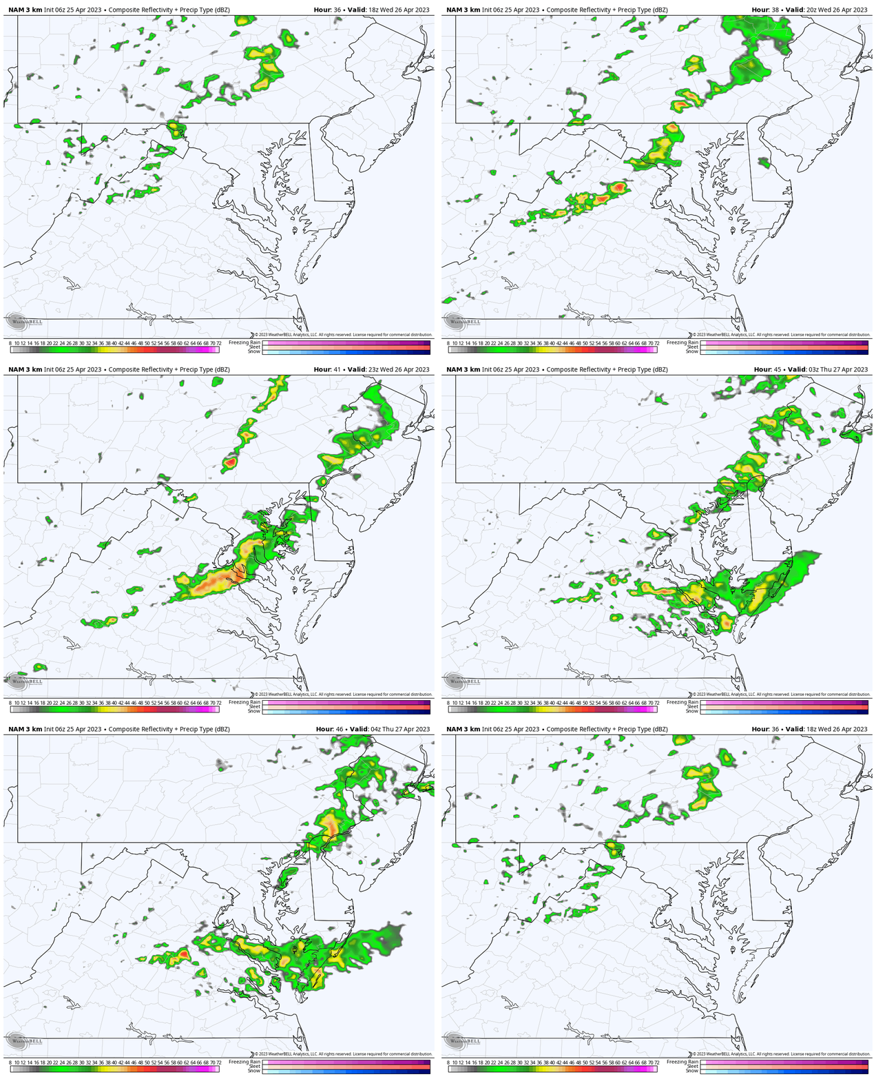
A few lines of rain may include some pockets of thunder.
Radar Simulation
2 PM to Midnight: NAM 3 Km
Storm Forecast Animation
Friday Morning To Monday Morning
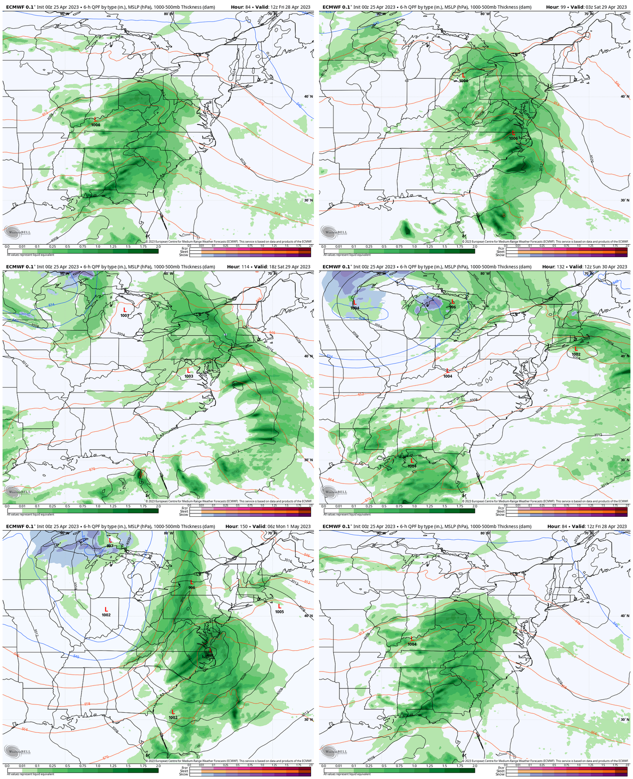
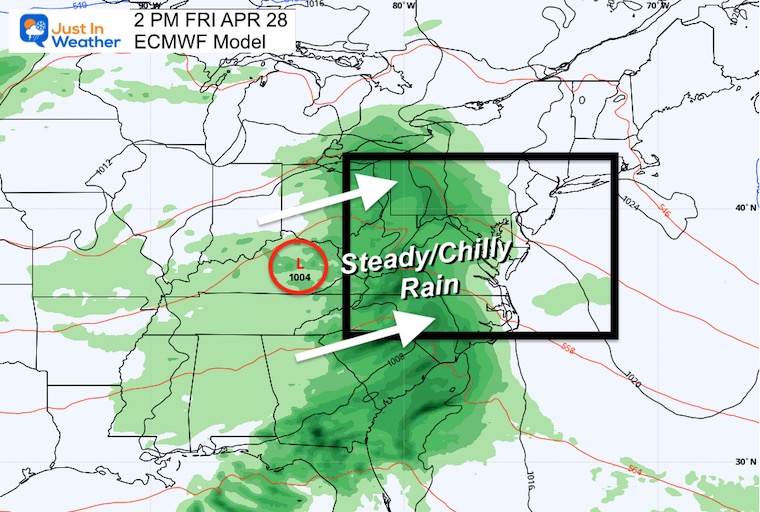
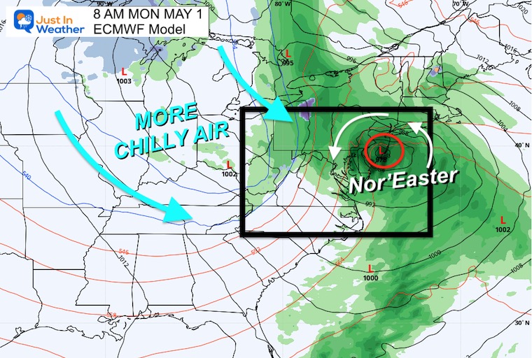
Two storms around our weekend. First arrives on Friday, the second will be later Sunday into Monday. In between there will be dry hours during the weekend. However, it will remain unsettled with a chilly and damp feel.
Friday Afternoon
This will be the start of the first of the two storms. A steady rain will arrive during the day and lock in the chilly air. Not the best start to the last weekend of April.
Monday Morning
There is still room for adjustment. However, as of now there appears to be an attempt for a coastal Nor’easter to bring a wind chipped chilly rain. Behind this storm will be a reinforcing push of chilly air.
NOAA Outlook
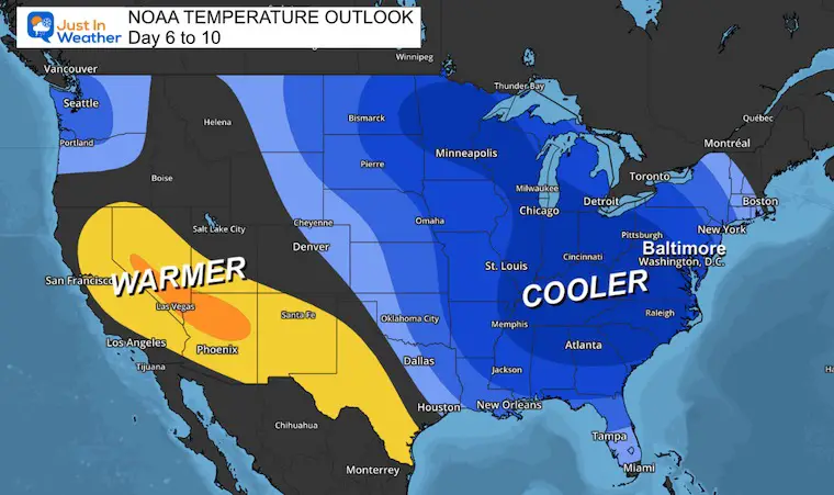
The Day 6 to 10 period will be much cooler for the Eastern US. Click here for the image to see my prior report of this pattern.
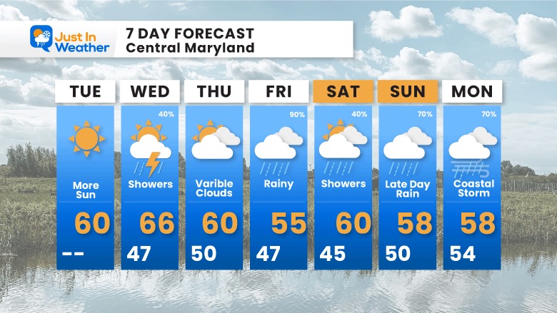
7 Day Forecast
Showers on Wednesday then we watch for the two storms this weekend. The first on Friday afternoon then second Sunday into Monday. In between our weather will remain unsettled but the weekend will not be a washout. Just chilly and damp.
Subscribe for eMail Alerts
Weather posts straight to your inbox
Sign up and be the first to know!
STEM Assemblies/In School Fields Trips Are Back
Click to see more and ‘Book’ a visit to your school
Please share your thoughts, best weather pics/videos, or just keep in touch via social media
-
Facebook: Justin Berk, Meteorologist
-
Twitter
-
Instagram
RESTATING MY MESSAGE ABOUT DYSLEXIA
I am aware there are some spelling and grammar typos, and occasional other glitches. I take responsibility for my mistakes, and even the computer glitches I may miss. I have made a few public statements over the years, but if you are new here you may have missed it: I have dyslexia, and found out during my second year at Cornell University. It didn’t stop me from getting my meteorology degree, and being first to get the AMS CBM in the Baltimore/Washington region. One of my professors told me that I had made it that far without knowing, and to not let it be a crutch going forward. That was Mark Wysocki and he was absolutely correct! I do miss my mistakes in my own proofreading. The autocorrect spell check on my computer sometimes does an injustice to make it worse. I also can make mistakes in forecasting. No one is perfect predicting the future. All of the maps and information are accurate. The ‘wordy’ stuff can get sticky. There has been no editor that can check my work when I needed it and have it ready to send out in a newsworthy timeline. Barbara Werner is a member of the web team that helps me maintain this site. She has taken it upon herself to edit typos, when she is able. That could be AFTER you read this. I accept this and perhaps proves what you read is really from me… It’s part of my charm.
#FITF


