


April 27 Weather Chilly With Showers Then Turning Up The Summer Heat
Saturday, April 27 Morning Report One day to get through before the surge of summer heat. Today, we get clouds and rain showers as a warm front approaches. But on…
April 5, 2023
Imagine having tickets to the baseball home opener, and it gets postponed one day early! That is the case for my family and many others in Baltimore waiting for the big game with the Yankees in town.
To postpone the first game of the season is already a big deal. To have it happen the day beforehand means something special is expected. By special, I mean potentially a rare, dangerous day.
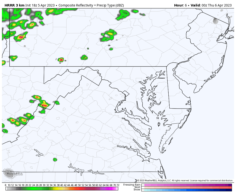
I had already anticipated a stormy day, along with many others. Below is a look at the weather forecast and simulation for why this call was made so soon.
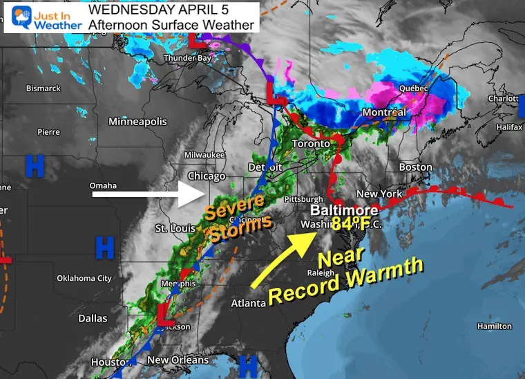
At 2:54 PM the cold front responsible for the storm outbreak can be seen along the Mississippi and Ohio River Valleys.
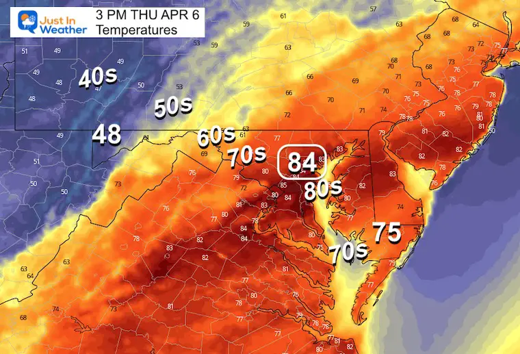
The surge of warm air has pushed into Baltimore, where temperatures just tied the record high for the date!
84ºF was observed at 3 PM along with wind gusts to 24 mph.
This record was first set on April 5, 2010.
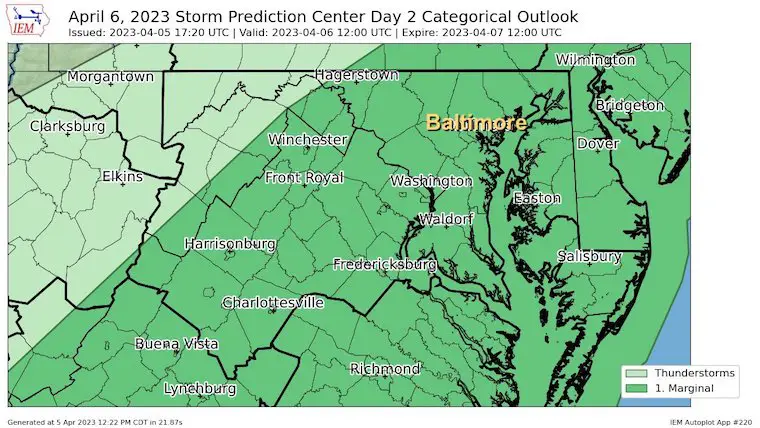
A large area has been under the Enhanced Risk for Severe Storms. There is potential for supercell storms that may contain large hail and tornadoes between Memphis, Tennessee to Cleveland, Ohio.
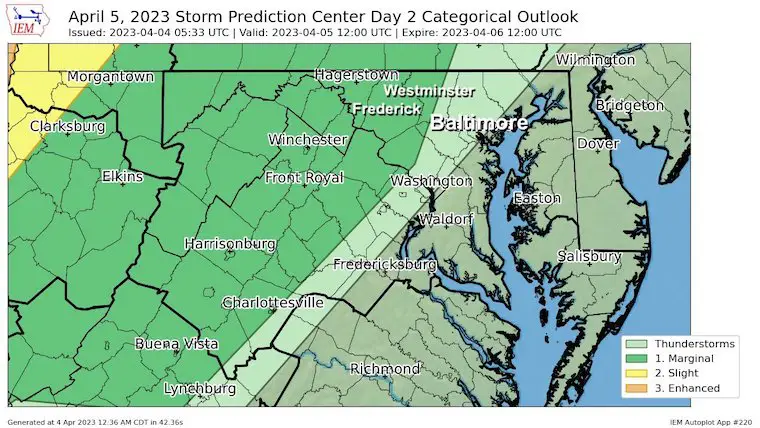
The Slight Risk has been extended to the front ridge of the mountains just west of Baltimore. This chance is very small and isolated. Tomorrow will be our day.
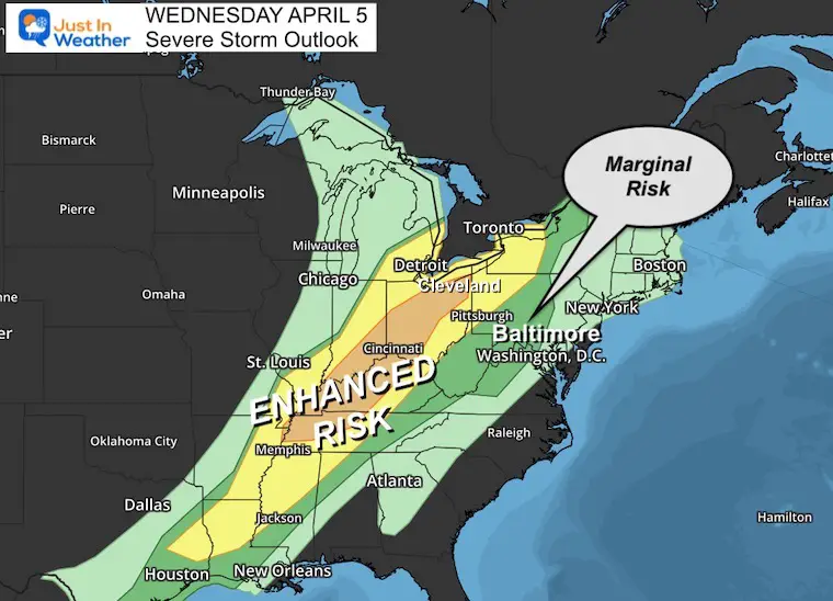
Parts of central Maryland are included, but the storms will be more likely closer to midnight.
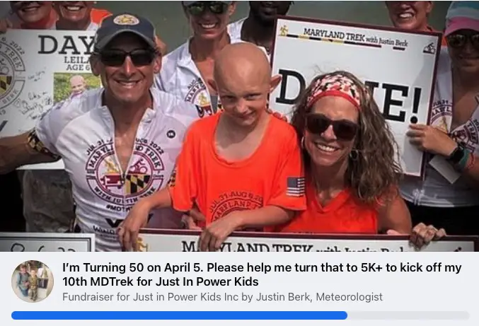
My 50th Birthday Fundraiser: Supporting Just In Power Kids and kicking off my 10th Maryland Trek. This is on Facebook and they give 100% to the cause with no fees. 100% will go to our programs.
As the cold front moves East, it will lose some energy. However, there is a combination of unseasonably warm temps AND potential wind shear with influence from the cooler Chesapeake Bay.
Marginal Risk – This may seem low, but it should not be dismissed. The outbreak may be isolated, but could still produce severe storm cells with damaging wind, large hail, and tornadoes.
See the Timeline Slider below
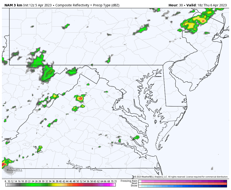
Although the shear is favorable for supercells, the shear vector and storm motions may tend to align parallel to the approaching front; this suggests a more linear storm mode. Should more discrete activity persist, there may be a more substantial hail and wind risk, perhaps even a conditional tornado threat near/east of I-95 where flow will be back due to a bay/river breeze.
While this suggests Baltimore could get a storm around 4 PM, the model error should allow for a buffer of 3 PM to 6 PM.
The line may slow down and produce a longer storm experience around the Chesapeake Bay near the Bay Bridge to the Lower Eastern Shore through evening.
I MADE THESE MAPS BEFORE THE POSTPONEMENT


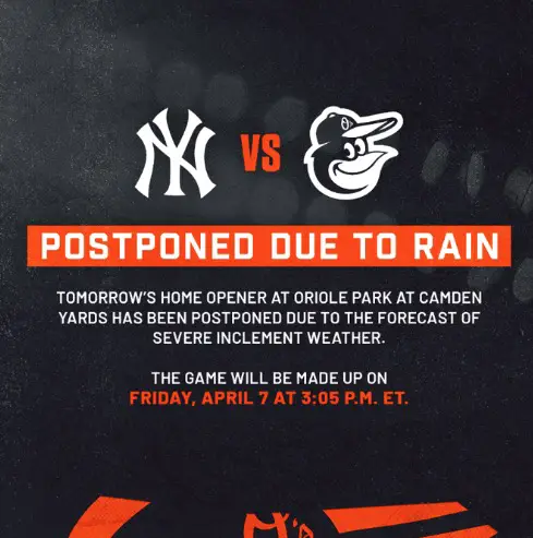
The opening game is now set for Friday afternoon. All Thursday tickets will be honored then.
After consultation with MLB, tomorrow’s Home Opener at Oriole Park at Camden Yards has been postponed due to the forecast of severe inclement weather.
The game will be made up on Friday, April 7 at 3:05 p.m. ET.
— Baltimore Orioles (@Orioles) April 5, 2023
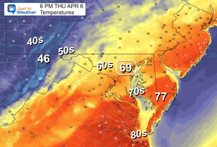
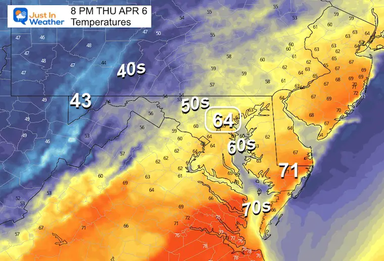
I made these temperature maps before the game was cancelled to help both my son and all of you prepare for what to expect. I want to show you them anyway in case you have other plans.
Note: We will try to make his little league game instead…
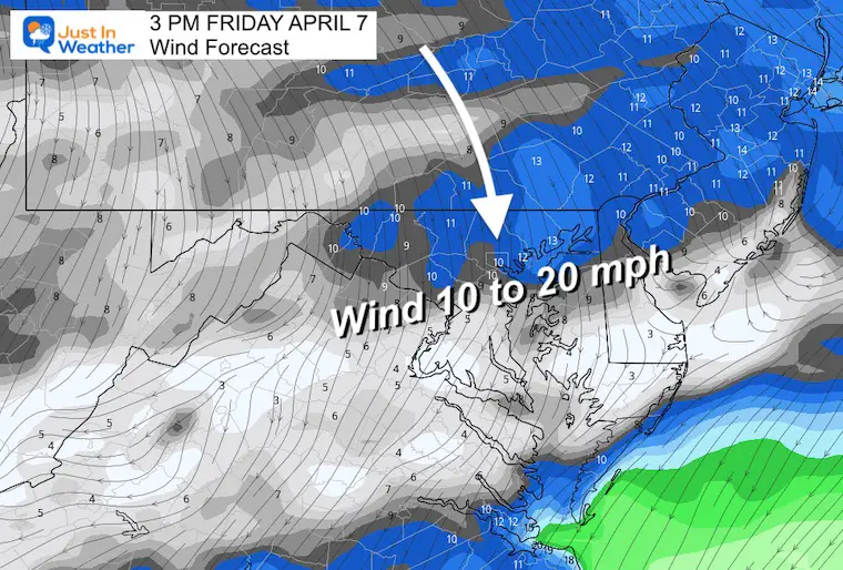
3 PM
6 PM
8 PM
This is going to be dry, but will have a much different feel. Temps will be 20 degrees cooler and there will be a cooler breeze FROM the North.
I would plan on wearing pants and hoodie or jacket.
Camden Yards = lower 60s.
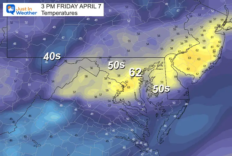
North 10 to 20 mph FROM THE NORTH. This will be ‘blowing in’ from Left Field. However, there may be some swirling around the stadium.
Click to see more and ‘Book’ a visit to your school

I am aware there are some spelling and grammar typos, and occasional other glitches. I take responsibility for my mistakes, and even the computer glitches I may miss.
I have made a few public statements over the years, but if you are new here you may have missed it:
I have dyslexia, and found out during my second year at Cornell University. It didn’t stop me from getting my meteorology degree, and being first to get the AMS CBM in the Baltimore/Washington region. One of my professors told me that I had made it that far without knowing, and to not let it be a crutch going forward. That was Mark Wysocki and he was absolutely correct!
I do miss my mistakes in my own proofreading. The autocorrect spell check on my computer sometimes does an injustice to make it worse. I also can make mistakes in forecasting. No one is perfect predicting the future.
All of the maps and information are accurate. The ‘wordy’ stuff can get sticky.
There has been no editor that can check my work when I needed it and have it ready to send out in a newsworthy timeline. Barbara Werner is a member of the web team that helps me maintain this site. She has taken it upon herself to edit typos, when she is able. That could be AFTER you read this.
I accept this and perhaps proves what you read is really from me…
It’s part of my charm.
#FITF