March 11 Storm Cranks Wind As It Pulls Away And One More To Follow
March 11, 2023
Saturday Morning
I believe we can look at the current set up with a new atmospheric memory. We changed the pattern, in part thanks to the end of La Niña (I wrote about yesterday). If we had this one month earlier, we would have been able to generate some snow and a hint of winter. However, while a few storms crank though our region, we will remain on the edge.
What we’ve been seeing is what we are likely to continue to get.
REMINDER: DAYLIGHT SAVING TIME RETURNS
- Turn your clocks FORWARD 1 Hour Tonight
- Check the BATTERIES in your smoke detectors
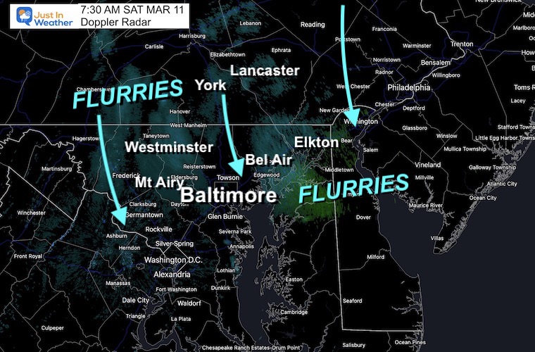
Doppler Radar Snapshot
7:30 AM
There are flurries and snow showers, but very light on radar. You may see a few flakes flying, but no impact on travel locally.
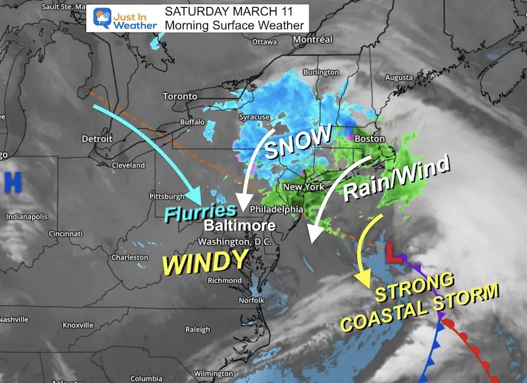
Morning Surface Weather
The Coastal Storm is doing exactly what was expected. As it pulls away, it will be bringing down some flurries or a brief snow shower this morning. It will be very strong and crank a lot of wind through the afternoon.
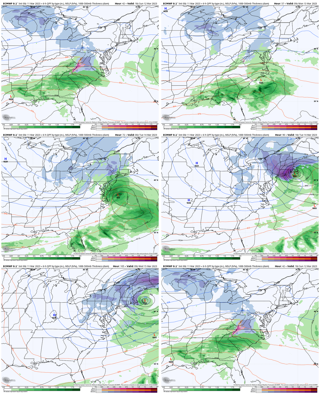
ECMWF Model
Sunday Afternoon to Wednesday Morning
This very active LATE SEASON winter pattern will continue to develop. At this point it looks like what we have seen, we will continue to see. That means some wintry mix, mostly a chilly rain, and plenty of wind. The snow winners (or losers) will be in New England with a major impact around Boston early in the week.
REPORT:
La Niña Has Ended. El Nina May Return By Fall
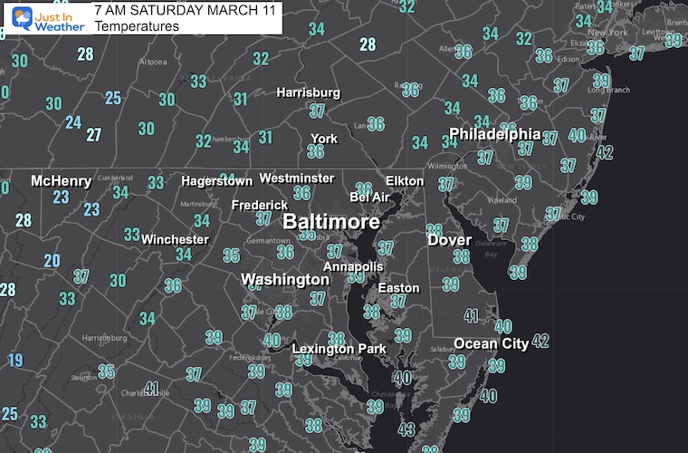
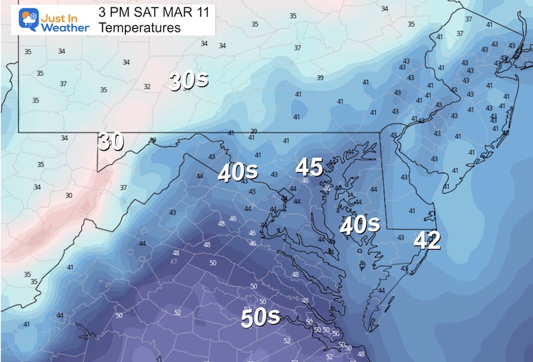
Temperature Forecast
Morning
Afternoon
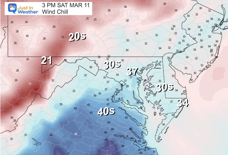
Wind Chill
It will FEEL between 5 to 10 degrees colder!
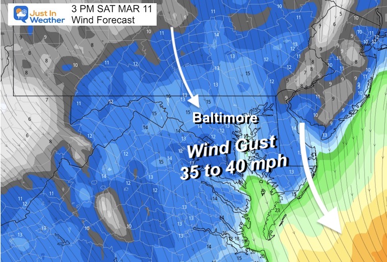
Wind Forecast
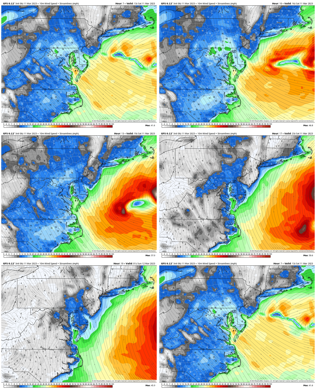
Strong winds will gust between 30 and 40 mph, thanks to that coastal storm.
Animation 8 AM to 8 PM
Subscribe for eMail Alerts
Weather posts straight to your inbox
Sign up and be the first to know!
CLIMATE DATA
TODAY March 11
Normal Low in Baltimore: 32ºF
Record 6ºF in 1960
SNOW: 6.0” in 1896
Normal High in Baltimore: 53ºF
Record 79ºF in 2021
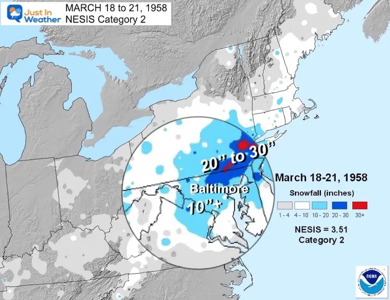
REPORT: March Snow and Extreme Weather History
March Snow and Extreme Weather History
Sunday Morning
The next system will move in with snow and a wintry mix…. For western Virginia. The late day arrival will bump into the same situation for us locally and that is NOT SUPPORTIVE for the winter part of the storm.
The same areas will get snow or a mix to start, but mostly another cold rain event.
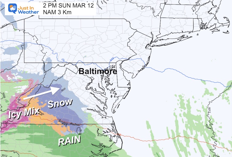
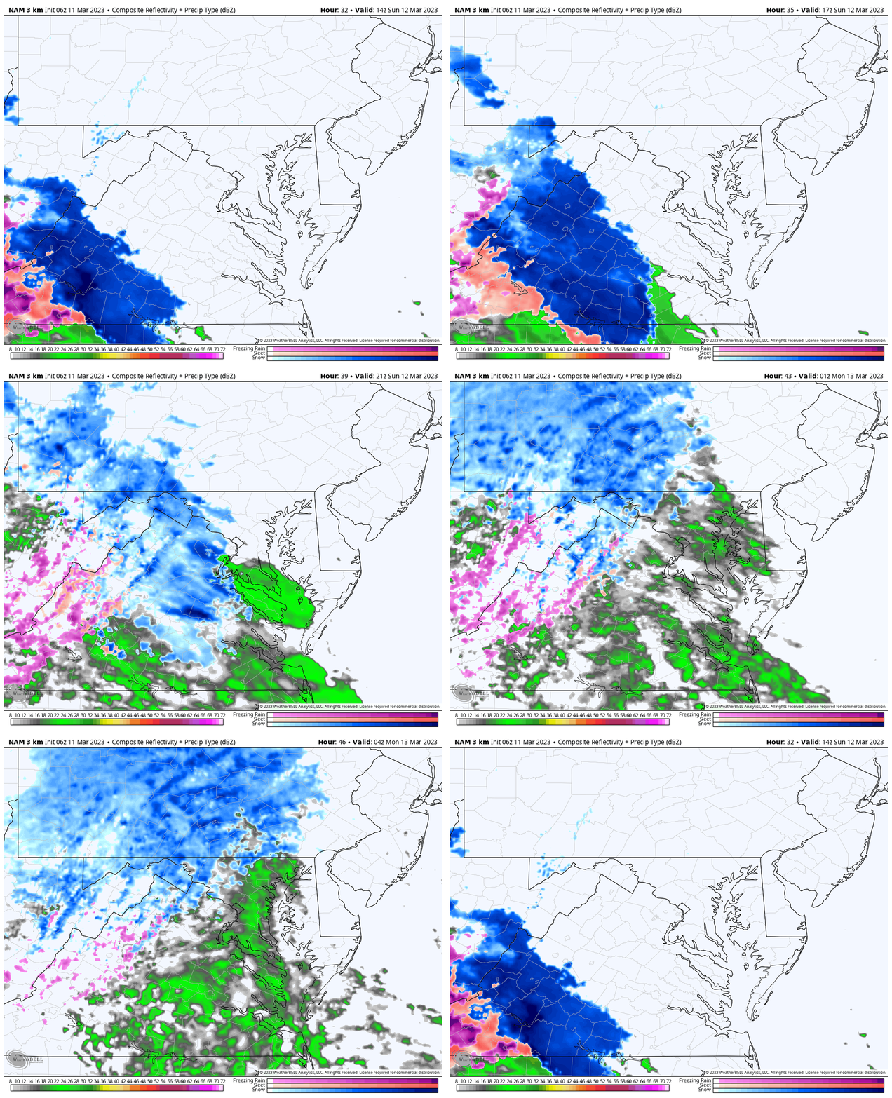
NAM 3 Km Sunday Morning To Midnight
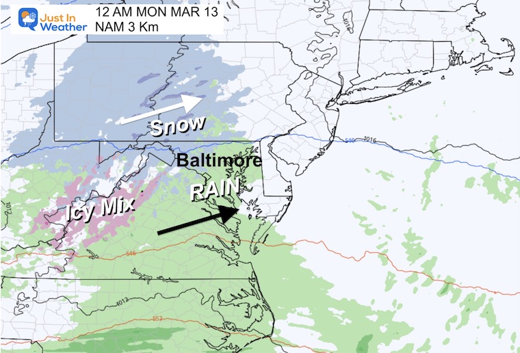
Snow and ice in Southwest Virginia may complicate travel in the mountains. By the time it reaches central Maryland, the classic ‘NORTH AND WEST’ areas may get the light snow, while a mix or cold rain will fall for most urban and Bay areas.
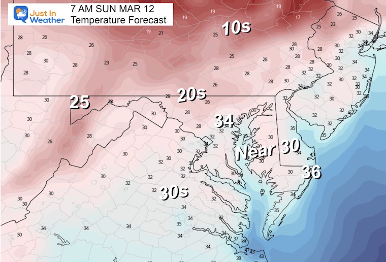
Morning Temperatures
Colder air will move in. While metro Baltimore may be ‘near’ or above freezing, many inland areas will drop into the 20s.
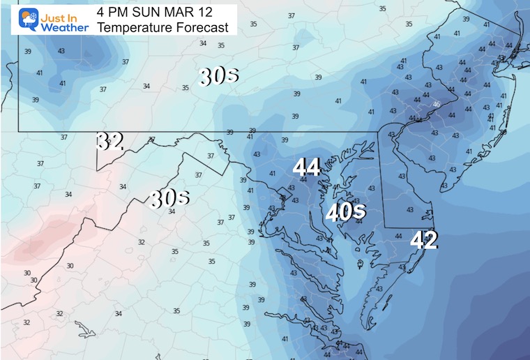
Afternoon Temperatures
Sunday Night
Snow for the typically colder inland areas, with a chilly rain for most urban and Bay areas.
Jumping To Monday: Colder Winter Storm?
Snapshot Monday
There will be another strong storm and in a good location (in normal years). This time, we are missing the cold air. If this was a month earlier, we would have had our snow. This looks like a chilly rain… and like the recent storms I expect it will depart earlier than shown here.
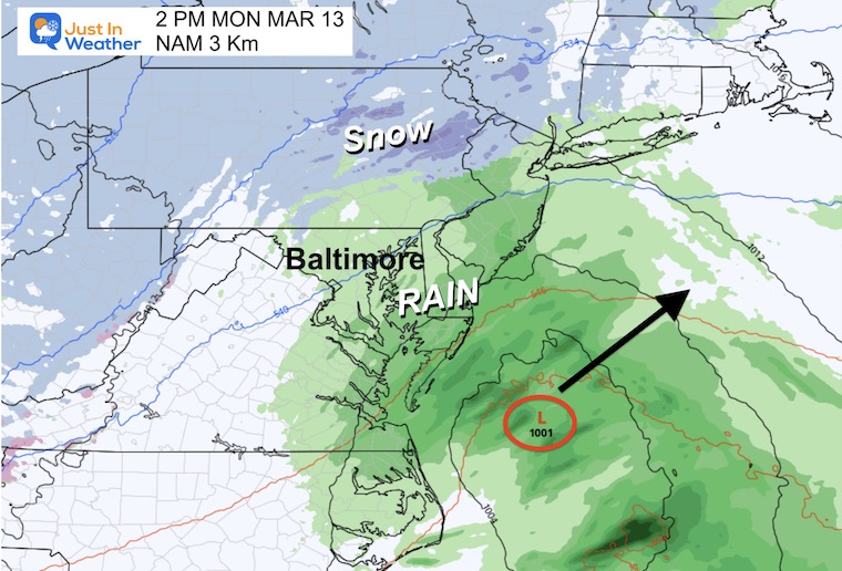
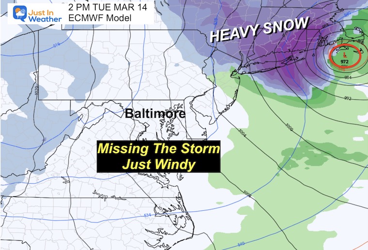
Snapshot Tuesday
The storm looks like it will crank in a hurry/bomb out. We will be on the back edge while New England gets a heavy snow and wind machine.
We will just get the wind (again).
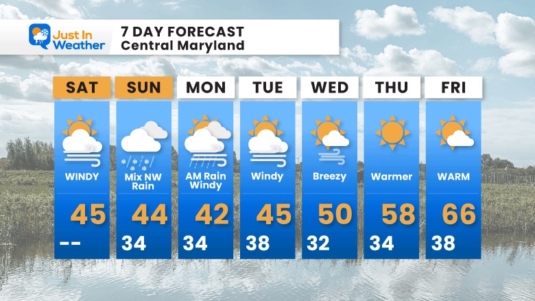
7 Day Forecast
I think this is it. Our chance for winter was with these two storms… and at this time it looks like they will crank to our north in New England. Then we break back to warming by the end of the week.
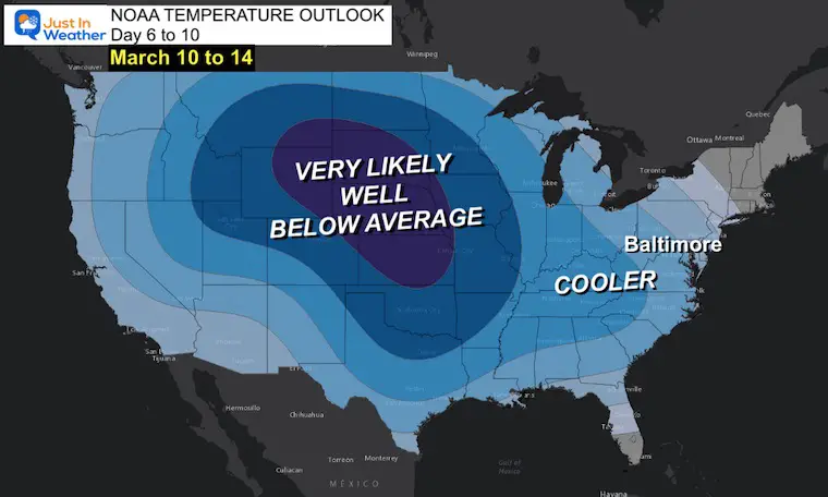
There will be more cool air to follow, but it is going to be even more challenge to get a winter event and I will remain practical.
Subscribe for eMail Alerts
Weather posts straight to your inbox
Sign up and be the first to know!
IN CASE YOU MISSED IT
My REALISTIC Expectations for the COLD OUTLOOK
Winter History: Low Snow And Late Starts
See my research based on Baltimore data since 1883.
RESTATING MY MESSAGE ABOUT DYSLEXIA
I am aware there are some spelling and grammar typos, and occasional other glitches. I take responsibility for my mistakes, and even the computer glitches I may miss.
I have made a few public statements over the years, but if you are new here you may have missed it:
I have dyslexia, and found out during my second year at Cornell University. It didn’t stop me from getting my meteorology degree, and being first to get the AMS CBM in the Baltimore/Washington region. One of my professors told me that I had made it that far without knowing, and to not let it be a crutch going forward. That was Mark Wysocki and he was absolutely correct!
I do miss my mistakes in my own proofreading. The autocorrect spell check on my computer sometimes does an injustice to make it worse. I also can make mistakes in forecasting. No one is perfect predicting the future.
All of the maps and information are accurate. The ‘wordy’ stuff can get sticky.
There has been no editor that can check my work when I needed it and have it ready to send out in a newsworthy timeline. Barbara Werner is a member of the web team that helps me maintain this site. She has taken it upon herself to edit typos, when she is able. That could be AFTER you read this.
I accept this and perhaps proves what you read is really from me…
It’s part of my charm.
#FITF
STEM Assemblies/In School Fields Trips Are Back
Click to see more and ‘Book’ a visit to your school
My Winter Outlook: Not A Typical La Niña!
I see many factors to support colder influence with multiple systems. Early and later in winter. Check it out. https://justinweather.com/2022/11/22/winter-outlook-2023-for-snow-not-typical-la-nina-plus-polar-vortex-disruption/
Also See The Winter Outlook Series:
Farmer’s Almanac Comparison
September Starts Meteorological Autumn: Weather Climate Stats For Maryland at Baltimore
Triple Dip La Niña Winter
https://justinweather.com/2022/09/09/winter-outlook-2023-la-nina-triple-dip-expectations/
CONNECTION TO WINTER?
If you want a snowy winter, this is what you might want to look for in the rest of the tropical season. https://justinweather.com/2022/08/31/record-august-for-no-named-tropical-storms-closer-look-at-snow-following/
Woolly Bear Caterpillars
https://justinweather.com/2022/10/25/winter-weather-outlook-from-the-wooly-bear-caterpillar/
Persimmon Seeds
Click to see Top 20 and MORE
Normals And Records: Maryland and Baltimore Climate History
Please share your thoughts, best weather pics/videos, or just keep in touch via social media
-
-
Facebook: Justin Berk, Meteorologist
-
Twitter: @JustinWeather
-
Instagram: justinweather
-


