February 20 Presidents Day Rain Showers Returning And Record Warm This Week
February 20, 2023
Monday Morning
The clouds have returned. Yesterday brought us breaks of sun and a high temperature of 61ºF in Baltimore before the breeze brought in some chill from the Chesapeake Bay.
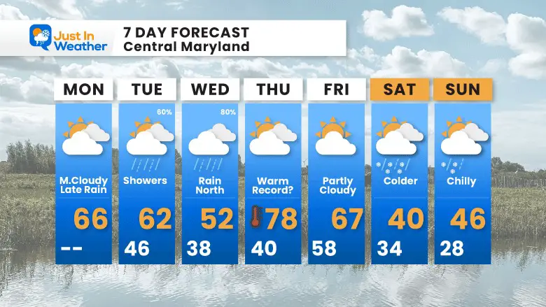
We remain mild today, even with more clouds and showers on the way. This week will be all over the place. While we will be mostly warm and get some rain, we could have brief sleet mixing in Wednesday morning, only to be watching for near record warmth on Thursday afternoon.
As for that chance of winter next weekend, I remain very skeptical.
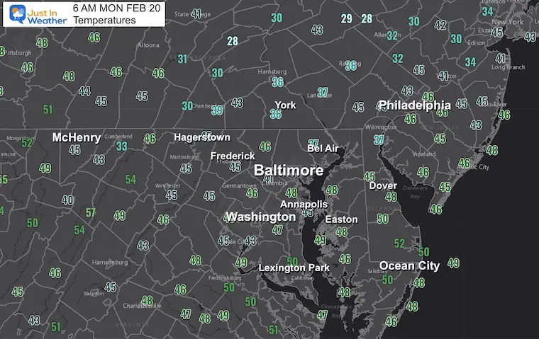
Morning Temperatures
Still mild.
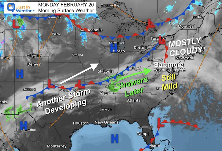
Morning Surface Weather
The cloud cover today is from a disorganized system. We remain in the mild flow that will allow our temperatures to reach the 60s again in the afternoon.
A disturbance will arrive produce some sprinkles later this afternoon, enhancing to more widespread rain showers this evening and tonight.
We will remain with the chance for rain showers for a few days as the next storm forms across the southern US. This is the storm that will bring winter back to the Northern US, and pump in near record heat for us on Thursday.
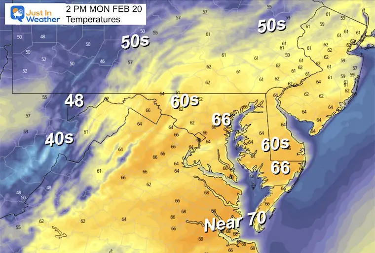
Presidents Day Afternoon
Another mild day, with many back into the lower 60s.
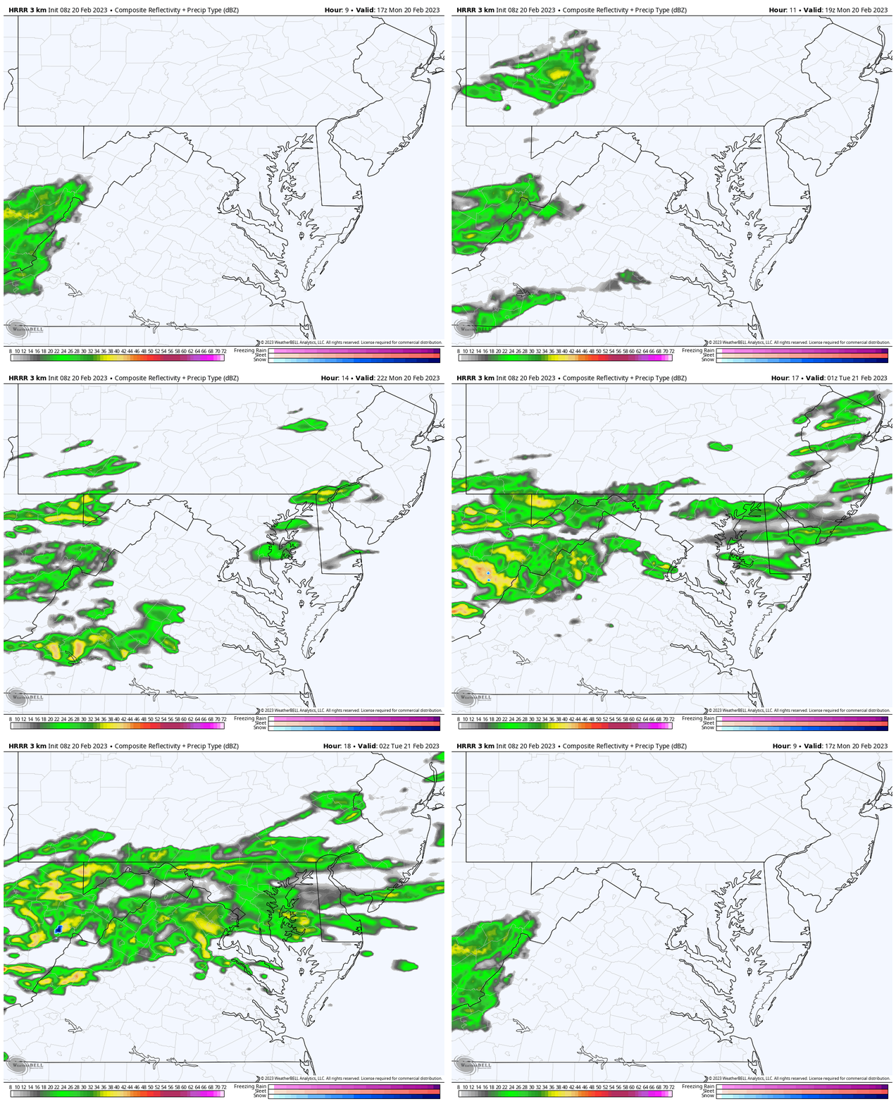
Radar Simulation Noon to 10 PM
Sprinkles may develop in the afternoon, becoming more widespread light rain through the evening and tonight.
Subscribe for eMail Alerts
Weather posts straight to your inbox
Sign up and be the first to know!
CLIMATE DATA
TODAY February 20
Normal Low in Baltimore: 28ºF
Record 1ºF in 2015
SNOW: 9.9” in 1947
Normal High in Baltimore: 48ºF
Record 76ºF 2018
Tuesday Weather
Remaining mild even with rain showers. The rain does look more likely near and NORTH of Baltimore. But the modeling has missed recent events, so I would not let your guard down for showers across any part of central Maryland.
Temperatures
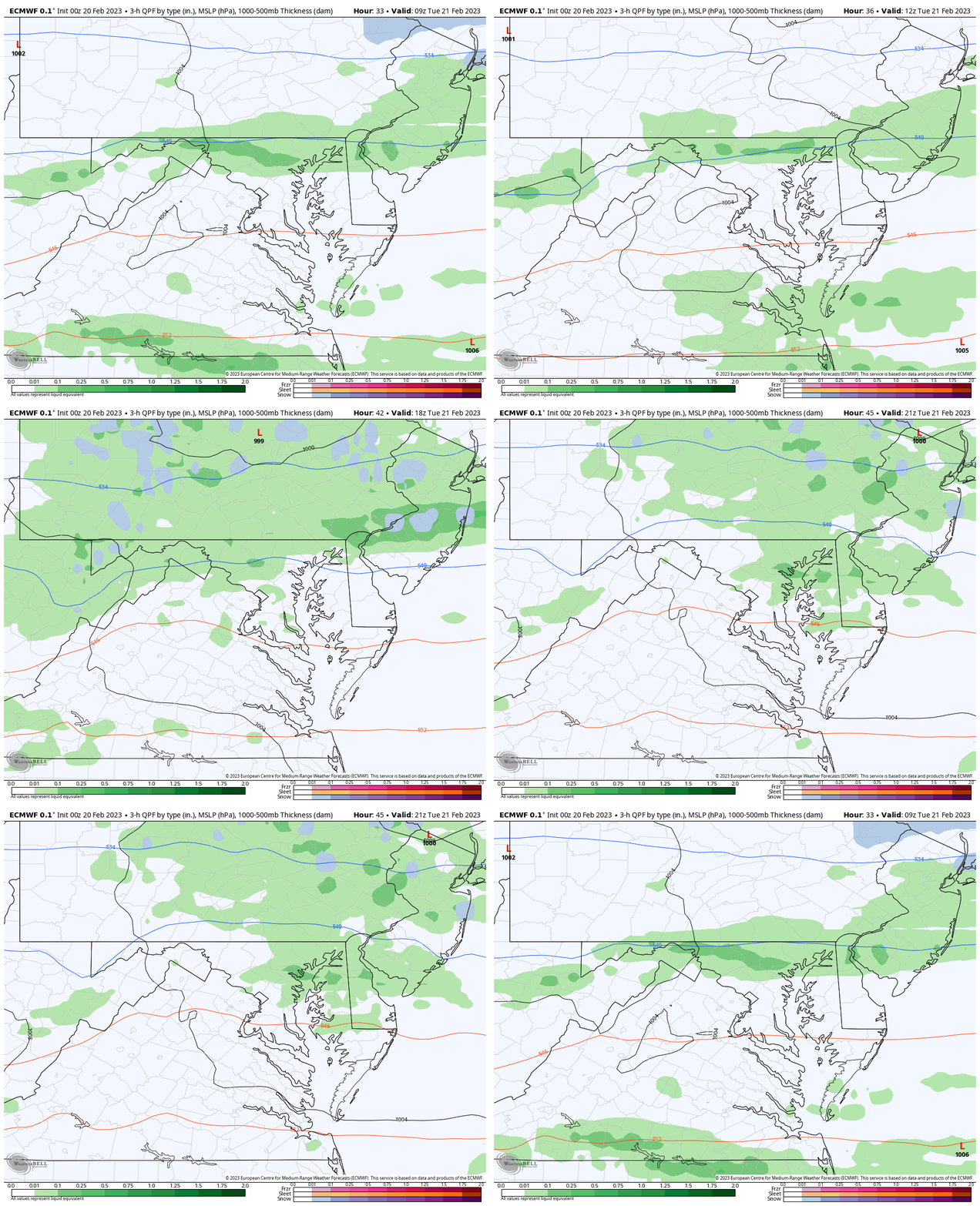
Morning
These numbers are close to normal afternoon highs.
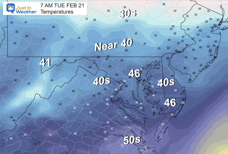
Afternoon
Mild again back into the mid 50s.
Wednesday to Thursday
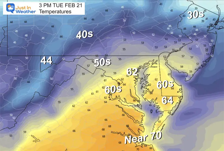
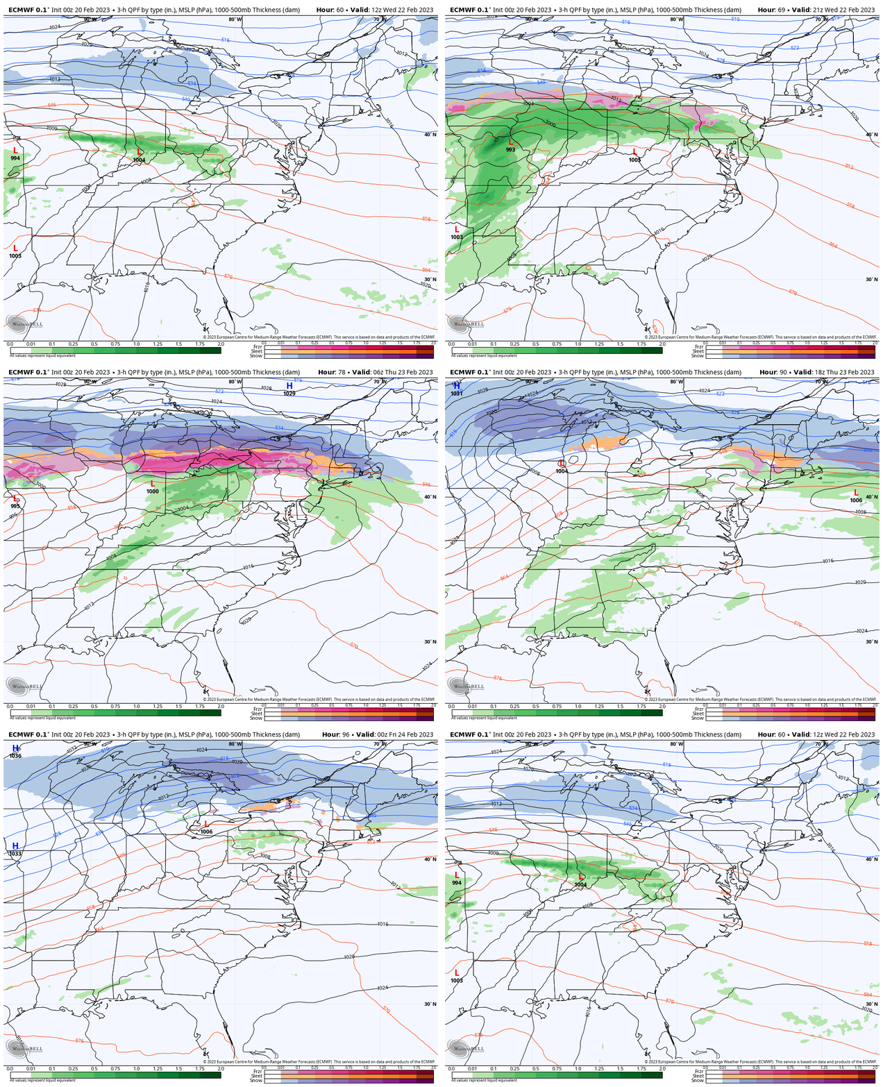
The next developing storm may bring us some sleet mixed with the rain showers as it begins on Wednesday, especially in northern Maryland to central Pennsylvania.
A robust winter storm will reach central New York to New England.
This is the storm that will change the fortune for our northern neighbors, but pump in very warm air for our region.
Thursday Afternoon
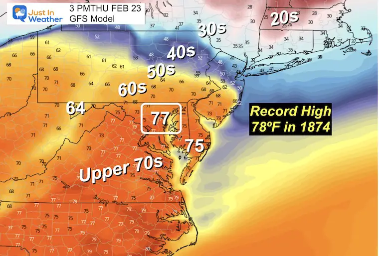
It is VERY LIKELY we will reach the mid to upper 70s. There is a chance we get a record high temperature that day, and remain in the 70s on Friday before the next abrupt change… for another colder weekend.
The big warm up will be Thursday as temperatures will approach one of the oldest records on the books.
It was 78ºF in 1874 on Feb 23. That is the mark to watch! We often end up warmer than models show.
NEXT WEEKEND
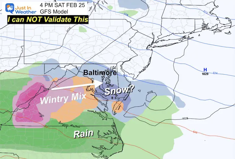
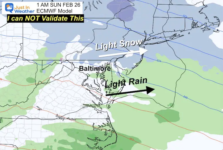
Once again we see the fading of that potential wintry system. This has been the theme all winter. If the trend holds, this system may get lost for a day or two, then creep back. I am still very suspicious about getting much out of this. So I will only show it with high skepticism.
GFS Model:
This has the more aggressive snow and mix right across the middle of our region.
ECMWF Model:
This is the more reliable product and has already shifted the event later (overnight) and farther north with only light snow.
7 Day Forecast
Most of this week will be warm. There is a small chance for some sleet at the start of the rain on Wednesday, then we jump to within reach of that long time record high on Thursday.
Next Weekend: Still only a hint, so I would not get too excited about this yet.
TRAIN DERAILMENT: TOXIN TRANSPORT
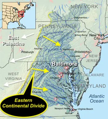
Report: Tracking Winds For Movement from the accident to the Controlled Burn Also see Videos Of Toxins in local water in East Palestine, OH.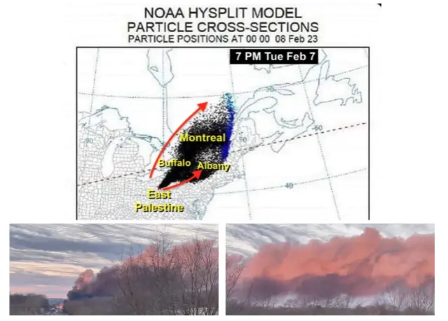
REPORT: Chesapeake Bay and Ohio Watersheds. Please click here for that report if you missed it.
Also See:
Winter History: Low Snow And Late Starts
See my research based on Baltimore data since 1883.
Subscribe for eMail Alerts
Weather posts straight to your inbox
Sign up and be the first to know!
STEM Assemblies/In School Fields Trips Are Back
Click to see more and ‘Book’ a visit to your school 
My Winter Outlook: Not A Typical La Niña!
I see many factors to support colder influence with multiple systems. Early and later in winter. Check it out. https://justinweather.com/2022/11/22/winter-outlook-2023-for-snow-not-typical-la-nina-plus-polar-vortex-disruption/
Also See The Winter Outlook Series:
Farmer’s Almanac Comparison
September Starts Meteorological Autumn: Weather Climate Stats For Maryland at Baltimore
Triple Dip La Niña Winter
https://justinweather.com/2022/09/09/winter-outlook-2023-la-nina-triple-dip-expectations/
CONNECTION TO WINTER?
If you want a snowy winter, this is what you might want to look for in the rest of the tropical season. https://justinweather.com/2022/08/31/record-august-for-no-named-tropical-storms-closer-look-at-snow-following/
Woolly Bear Caterpillars
https://justinweather.com/2022/10/25/winter-weather-outlook-from-the-wooly-bear-caterpillar/
Persimmon Seeds
Click to see Top 20 and MORE
Normals And Records: Maryland and Baltimore Climate History
Please share your thoughts, best weather pics/videos, or just keep in touch via social media
-
-
Facebook: Justin Berk, Meteorologist
-
Twitter: @JustinWeather
-
Instagram: justinweather
-


