January 21 Two Storms Ahead: Sunday Brief Mix Then Wednesday Snow More Likely
January 21 2023
Saturday Morning Report
The weather pattern is changing and the transition is slow, but it will be noticeable. I have been focused on two weather events and need to state that the first one on Sunday may bring a brief snow or mix to start mainly north and west of Baltimore. Most of central Maryland will generally see rain, but near and north of the Pennsylvania line is where there is a better chance for a start with flakes or sleet pellets.
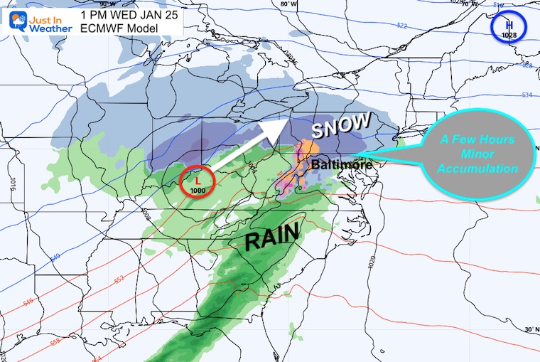
The second storm on Wednesday will be larger and have colder air in place. The timing in the morning will help as snow will try to spread in for more of central Maryland.
We have a rare late start to our season, now tied for 6th latest first measurable snow. As a consequence, I continue to exercise caution with mention of stickage or accumulation. I believe that prudent approach is best and computer model guidance will over do snow totals… So in short, it is too early to give any more than what might fall and when.
Headlines
- Today: Breezy.
- Sunday: Starting with snowy mix inland, rain near main cities and Bay.
- Wednesday: Another Storm More Likely To Start With Snow.
Climate Trivia
Latest Measurable Snow In Baltimore
- Feb 21 in 1973 (50 years ago)
- Feb 6 in 1914 (109 years ago)
- Jan 25 in 1992 ( 31 years ago)
- Jan 25 in 1901 ( 122 years ago)
- Jan 22 in 1966 (57 years ago)
- Jan 21 in 1907 (116 years ago) – TIED TODAY
Morning Temperatures
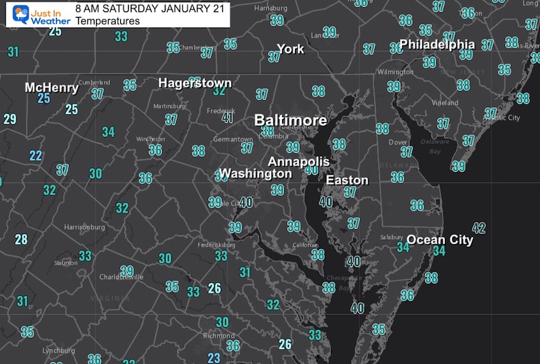
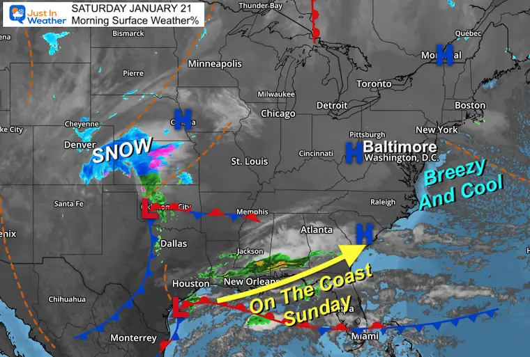
Morning Surface Weather
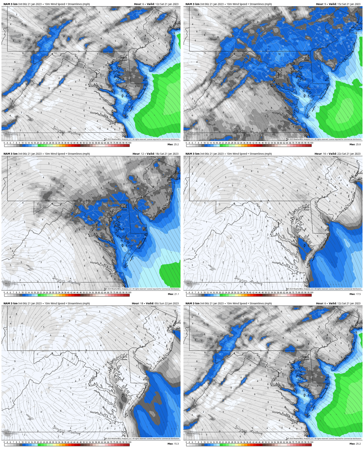
Wind Forecast: 7 AM to 7 PM
Wind gusts will increase from the North at 10 to 20 mph
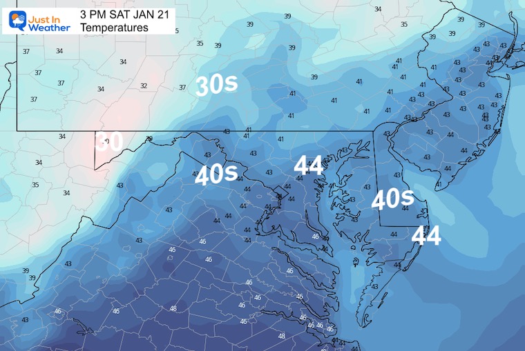
3 PM Temperatures
Subscribe for eMail Alerts
Weather posts straight to your inbox
Sign up and be the first to know!
CLIMATE DATA
TODAY January 21
Normal Low in Baltimore: 25ºF
Record -6ºF in 1985
SNOW: 5.1” 2014
Normal High in Baltimore: 43ºF
Record 66ºF 1921
Sunday
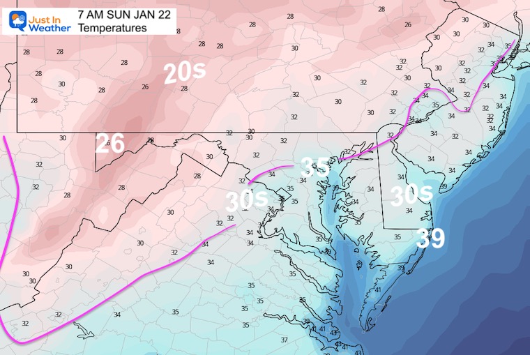
Morning Temperatures
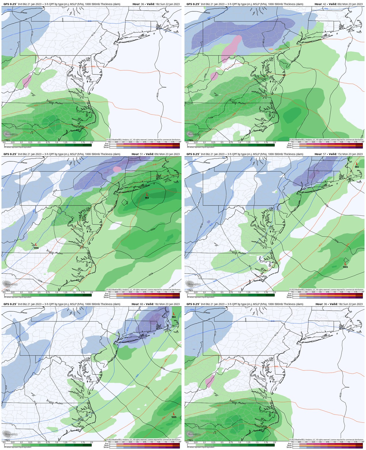
Radar Simulation: 1 PM SUN to 1 PM MON
This will be a rain event, but there is still some variability as to where the snowflakes may fall at the start, and could possibly even end with snow showers or flurries on Monday.
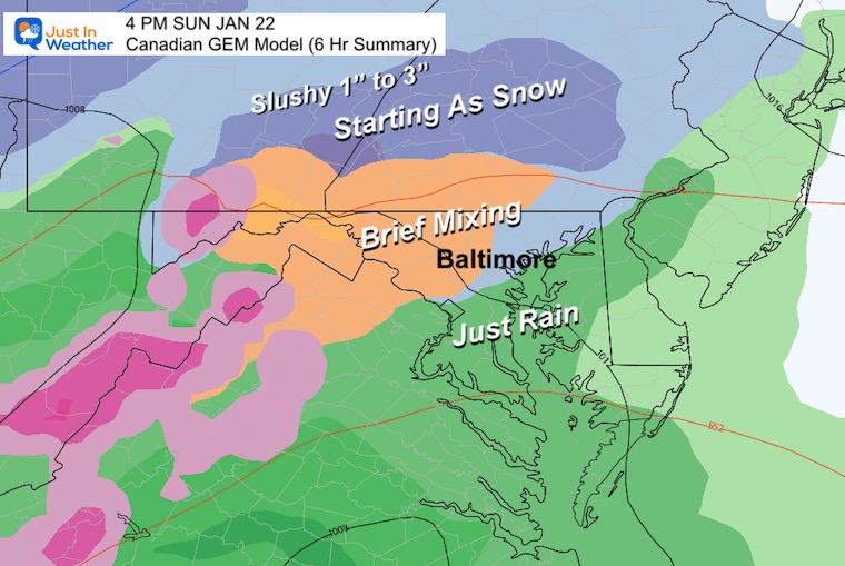
Starting Snapshots
Canadian GEM
This is the most aggressive plot with a start as snow or sleet in parts of Central Maryland and more ‘onset’ snow in southern Pennsylvania.
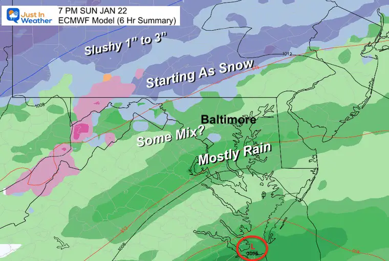
European ECMWF Model
This solution has shifted that snow/sleet to the MD/PA Line. A push of about 10 to 15 miles north of the prior plot.
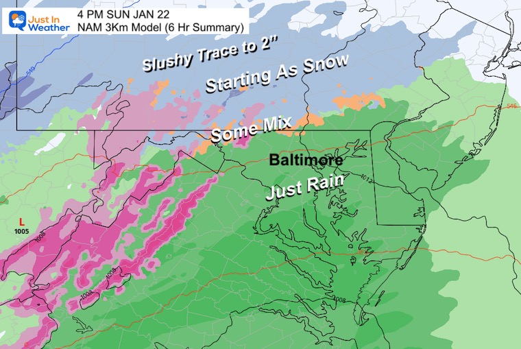
NAM 3 Km Model
This is our short range high resolution model and may take over at this point. It also shifts that snow/sleet onset to the state line.
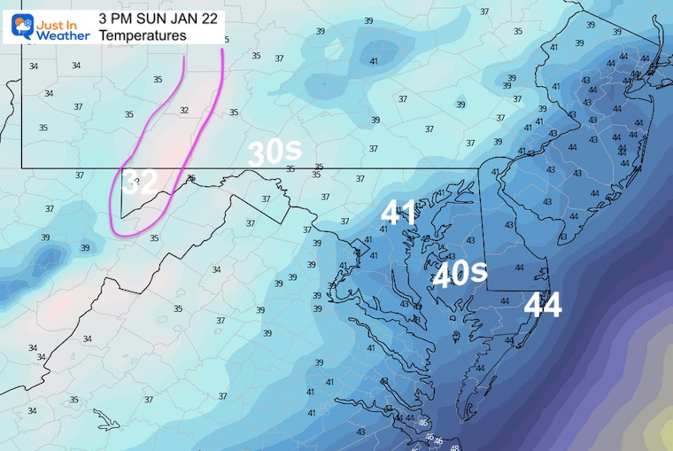
Afternoon Temperatures
I must reiterate, there is limited cold air and this was not intended to be a stickage event. We still have Wednesday.
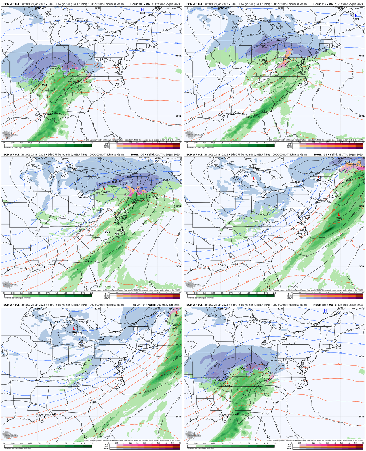
Scanning The Next Storm
The Wednesday event will interact with Strong High Pressure sending Cold Air farther south from New England. The morning timing makes this more interesting to focus on.
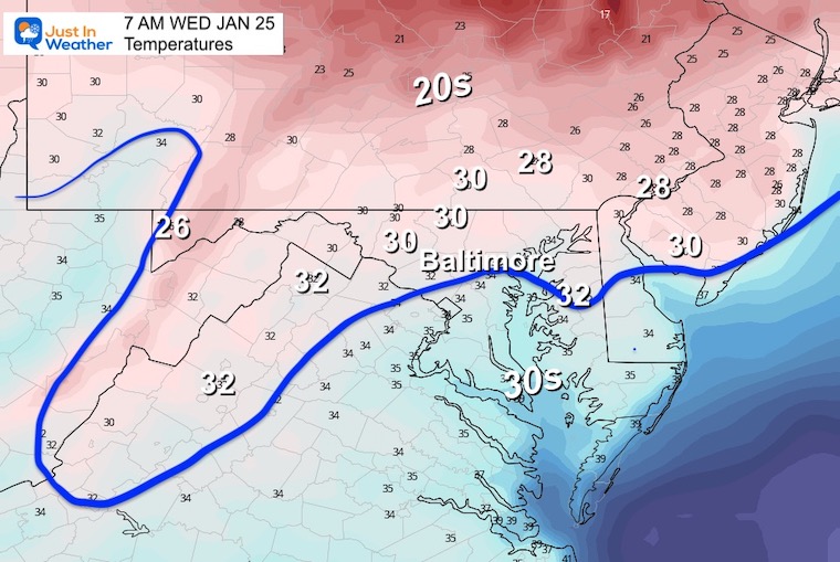
Wednesday Morning Temperatures
The freezing line to start the day will be close to Baltimore and across the Chesapeake Bay.
Snapshot: Morning
The strength of the High Pressure to our north will determine how deep the cold air may reach, which will in turn determine how much potential snow we may receive.
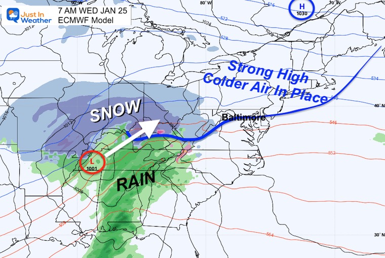
Snapshot Wednesday Afternoon
A few hours of snow opens up the potential for stickage and accumulation. I would venture to stay on the lighter side for now. More importantly, I would IGNORE any suggestions of snow totals by any model or human source. There are too many factors such as timing, warm ground, etc., to consider.
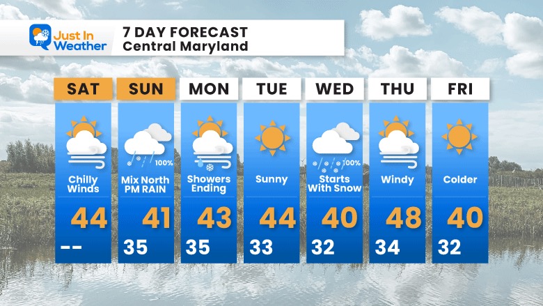
7 Day Forecast
We are in a pattern change with the storm tracks. That exception is showing up, but the truly cold arctic air is missing for now. There is colder air on the way just beyond this outlook through next weekend.
SNOWSTIX – Available Now
STEM Assemblies/In School Fields Trips Are Back
Click to see more and ‘Book’ a visit to your school
My Winter Outlook: Not A Typical La Niña!
I see many factors to support colder influence with multiple systems. Early and later in winter. Check it out.
October 27 Nor’easter Recap Still Breezy Then Next Storm Friday
Also See The Winter Outlook Series:
October 27 Nor’easter Recap Still Breezy Then Next Storm Friday
Farmer’s Almanac Comparison
September Starts Meteorological Autumn: Weather Climate Stats For Maryland at Baltimore
Triple Dip La Niña Winter
CONNECTION TO WINTER?
If you want a snowy winter, this is what you might want to look for in the rest of the tropical season. (You might be seeing a lot of commercial snow removal people out this Winter).
Rainbow Ice Cave In Mt. Rainier A Very Rare Find: Photos And Video
Wooly Bear Caterpillars
https://justinweather.com/2022/10/25/winter-weather-outlook-from-the-wooly-bear-caterpillar/
Persimmon Seeds
Click to see Top 20 and MORE
Winter Weather Folklore Top 20 And More Outlook Signals From Nature For Cold And Snow
Normals And Records: Maryland and Baltimore Climate History
Please share your thoughts, best weather pics/videos, or just keep in touch via social media
-
Facebook: Justin Berk, Meteorologist
-
Twitter: @JustinWeather
-
Instagram: justinweather


