


May 17 Clouding Up Ahead Of A Soggy Preakness Saturday Then We Warm Up
Friday May 17 Morning Report Today may end up mild, but it will bring an increase in clouds ahead of our next storm. If you are heading to the mountains,…
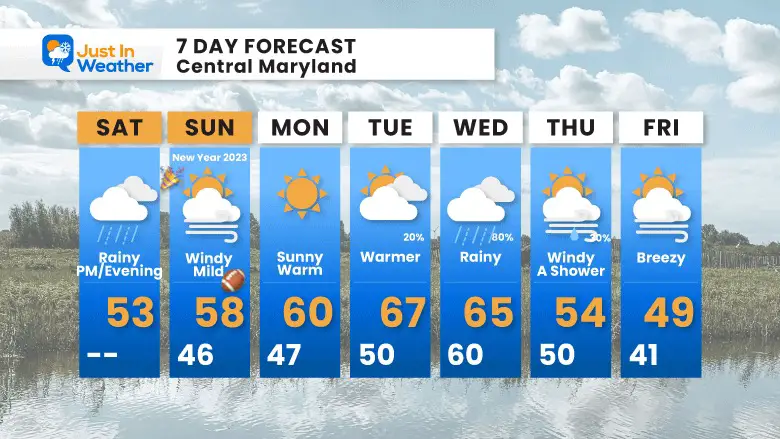
December 31 2022
Saturday Morning Report
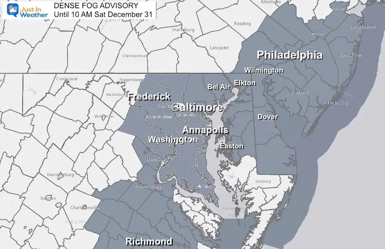
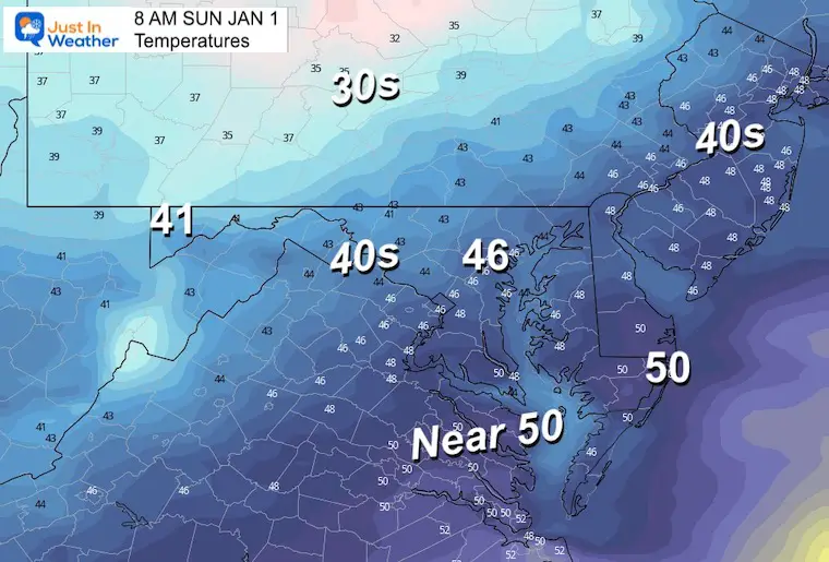
Then one foggy New Year’s Eve… There is a Dense Fog Advisory this morning as light drizzle and warmer air is moving in ahead of our next storm. It should burn off later this morning, then we will track bands of rain through the rest of the day. It may be heavy at times into the evening, then clear out close to midnight.
Below we will compare two short range models for rain timeline and intensity.
This advisory has been expanded to include all of central Maryland east of the Mountains and into Delaware. This includes I-95 between Richmond, Washington, Baltimore, and Philadelphia.
Visibility may be down under 1 mile hindering travel.
With the moisture, the air has warmed mostly to the 40s and 50s.
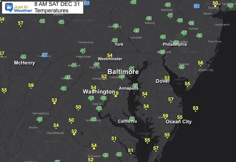
Thick fog in the Mid Atlantic this morning.
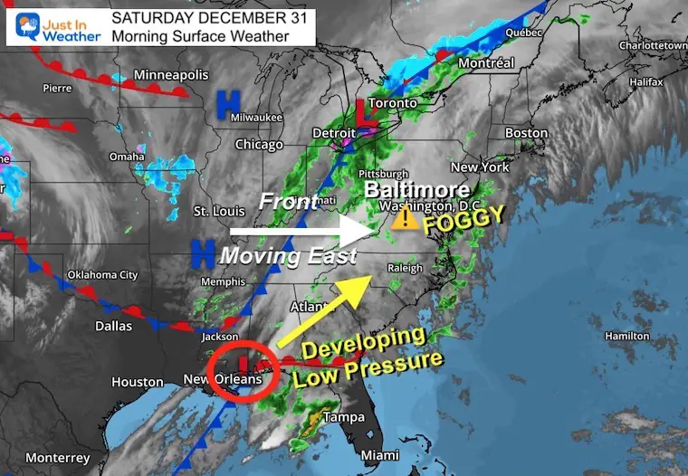
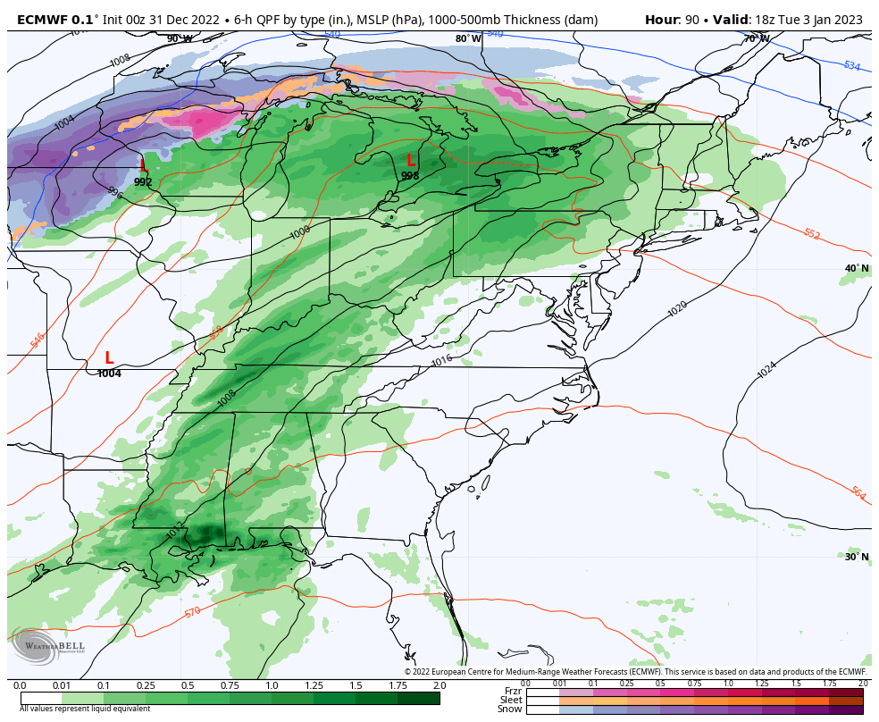
Low Pressure is trying to form near New Orleans and will ride up the east coast. That is our rain maker today, enhanced by the cold front catching up to it this evening.
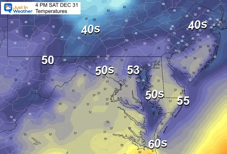
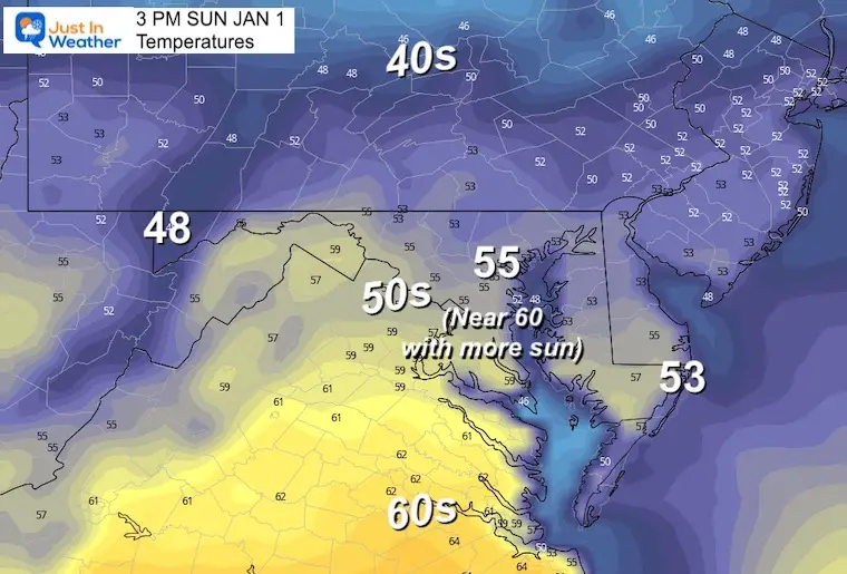
I believe we will end up warmer than this model plot, with a chance to reach the lower 60s.
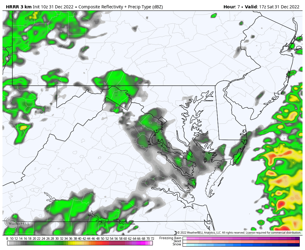
Let’s Compare the NAM 3Km and HRRR Models. There are similarities with more rain in the afternoon and evening. However, the split is in the intensity and end time. At this point, I am not sure which one has a better handle. So by showing both, I will follow up this afternoon with an update and see which one is more valid. This is as much for my research as it is for you to gain confidence for future events.
Noon to Midnight
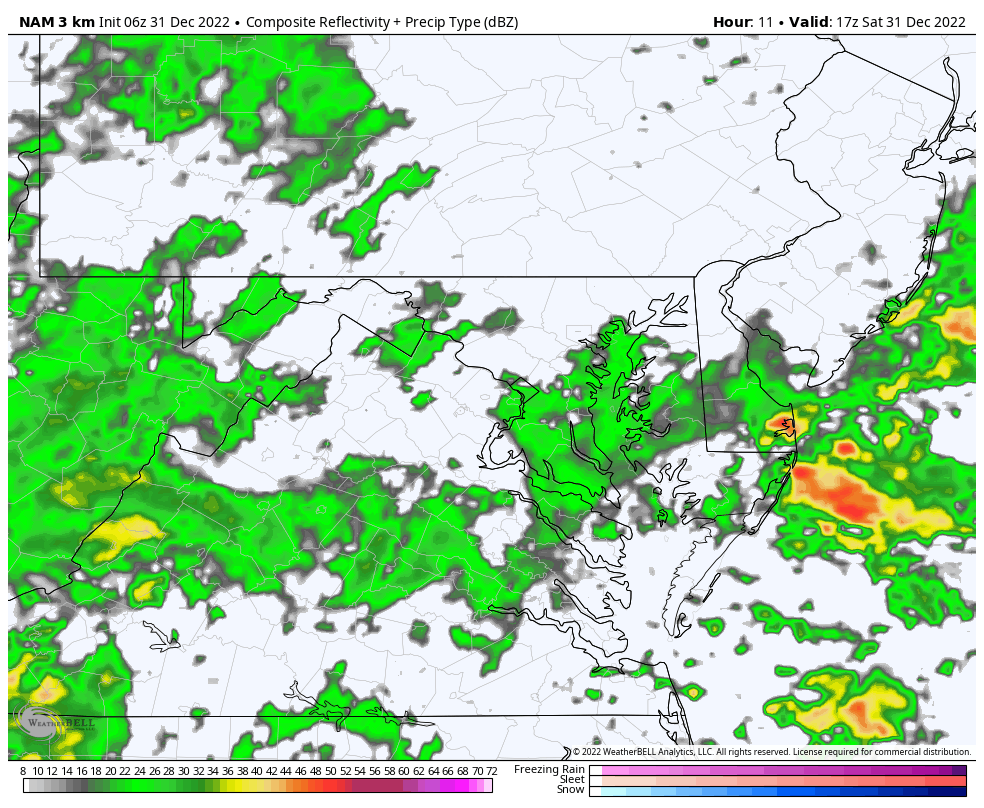
Steady rain for most of the region. Here we see heavy bands developing between Washington, Annapolis, and Baltimore.
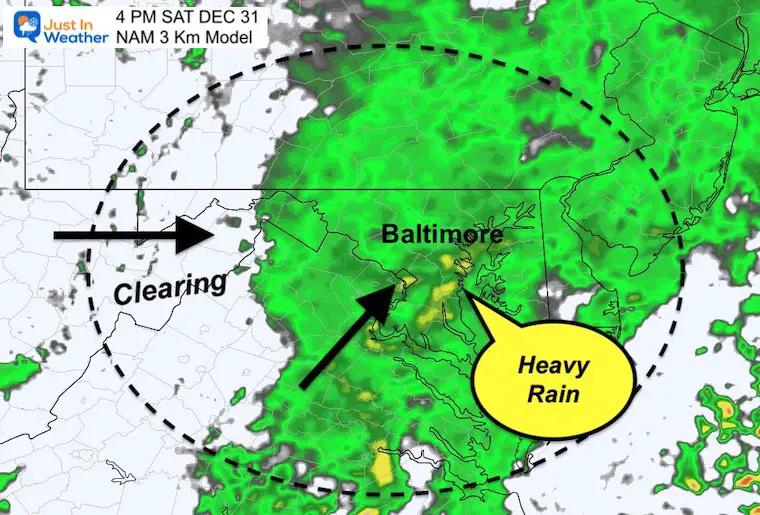
Two bands of rain: 1) Heavy showers around the Bay (Annapolis and Baltimore)
2) Rain in the mountains.
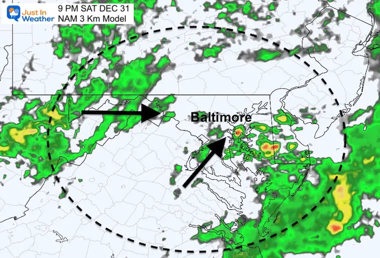
Can we dry out in time? Still some spotty showers, but this model pushed the bulk of rain away by this time.
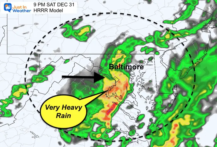
This plot is more aggressive with Low Pressure developing with intensity and heavy rain in central and southern Maryland this evening and tonight.
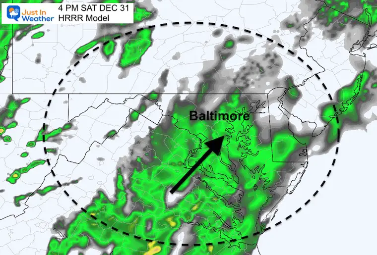
This is when steady rain is expected to move in across the region (after 2 PM). This is later than the NAM 3 Km.
Here we see that cold front more active with heavy rain and possibly some thunder across central Maryland and the Capital District into Southern Maryland.
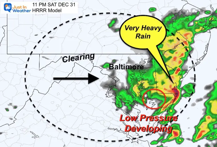
I’ve identified where this plots Low Pressure forming on the front. That enhances the heavy rain for a rough last few hours of the year for Delmarva and the beaches.
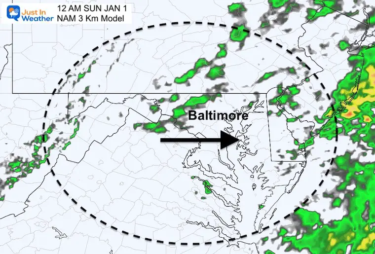
This shows the back edge of showers ending for Baltimore and Annapolis by midnight.
Normal Low in Baltimore: 27ºF
Record -1ºF in 1880
SNOW: 3.2” 1970
Normal High in Baltimore: 44ºF
Record 72ºF 1992
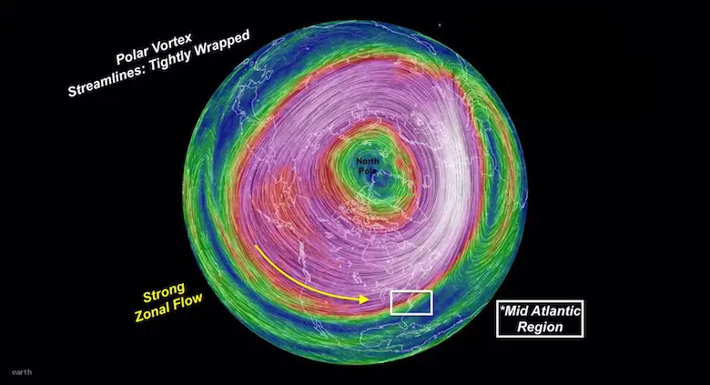
In case you missed this, I explain the stable circulation now and disruption forecast by mid January. Compare to 3 recent winters that were similar: Record warmth was followed by record snow.
If we have a run for 60ºF, it will depend on how much sun we get.
The ECMWF Model shows the next storm moving in for us on Wednesday, after surging warmer air in the 60s.
Wait for it….
The extended view into the weekend does now show a hint of some snow showers. This is NOT the coastal storm the GFS has shown yesterday, but it is trending towards something.
Yes, we will have a warm week. NO, winter is not over. Far from it. We can get some snow showers or ‘something’ organized within a warm pattern. The hint of snow next weekend is NOT the pattern change. I still see that ‘evolving’ in the middle of the month, then trending colder and more wintry for the latter half of January into February.
FITF
The focus for now is on the warm up.

December 5th Snow In Baltimore And The Start Of Faith In The Flakes FITF

Click to see more and ‘Book’ a visit to your school

I see many factors to support colder influence with multiple systems. Early and later in winter. Check it out.
Winter Outlook 2023 For Snow Not Typical La Niña Plus Polar Vortex Disruption
Atmospheric Memory Suggests Active Winter Storm Pattern Outlook
Winter Outlook 2023 From NOAA Very Different Than Farmers Almanacs
Winter Outlook 2023 Early Look At Snow From Two Farmers Almanacs
If you want a snowy winter, this is what you might want to look for in the rest of the tropical season. (You might be seeing a lot of commercial snow removal people out this Winter).
Record August For No Named Tropical Storms: Closer Look At Snow Following
Winter Weather Folklore Top 20 And More Outlook Signals From Nature For Cold And Snow
