December 30 Warming Up Today New Years Eve Rain And Very Warm Start To 2023
December 30 2022
Friday Morning Report
A good chunk of our region is starting off cold, but there are already signs of the warm up on the west end of our local maps. This will be felt by all of us by later today and set the tone for the next week.
Tomorrow will turn rainy for the last afternoon of the year, but the rain may end before midnight. Needless to day, Baltimore cancelled the events downtown, but the fireworks over The Inner Harbor will go on!
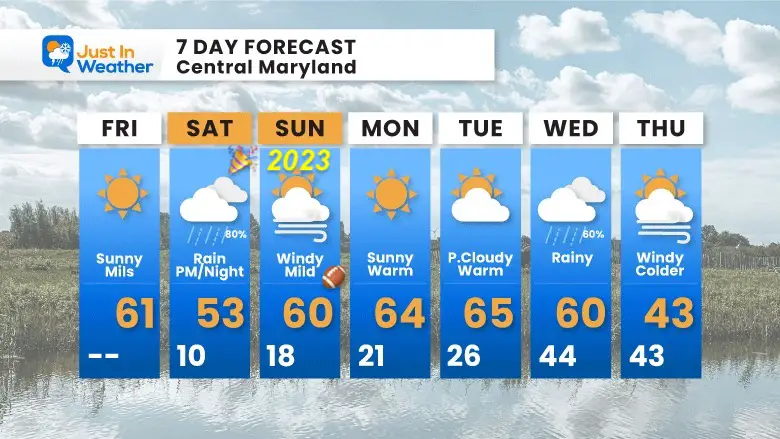
Our warming trend will build in on Sunday to start 2023 and into most of next week, however a blip is already showing up before next weekend. Models are already split on handling, so I will not push the potential winter storm yet. Just show you the comparison.
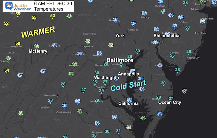
Morning Temperatures
Cold in central Maryland, but look at the warming farther west… 50s near Pittsburgh!
Headlines
- Today: Getting close to 60ºF.
- New Year’s Eve: Rainy afternoon and evening.
- 2023: Starts off very warm.
- Winter: May try to return by next weekend.
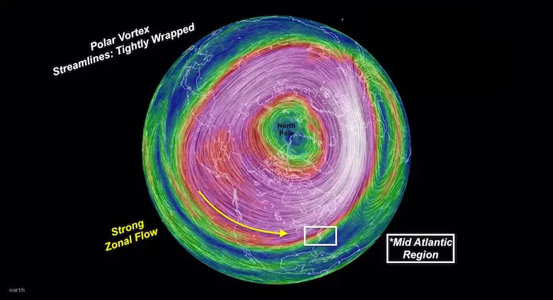
Polar Vortex Report
In case you missed this report (click here or the image), I explain the stable circulation now and disruption forecast by mid-January. Compare to 3 recent winters that were similar: After record warmth was followed by record snow.
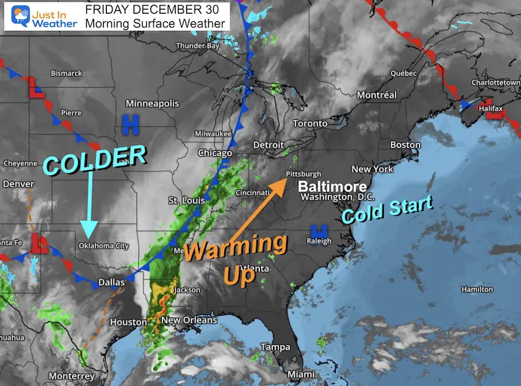
Weather Across The Nation
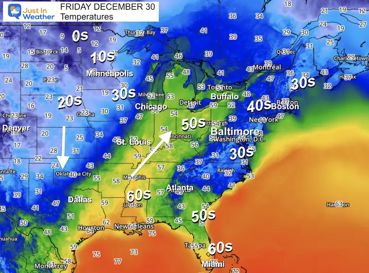
A large cold front is the dominant force for now. That is the rain event we will get tomorrow. For now, warmer air is pushing north ahead of it.
Temperatures This Morning
That warm surge is very easy to spot ahead of the cold front. It is pushing up the Mississippi River Valley. There is plenty of cold air from Canada pushing south behind it.
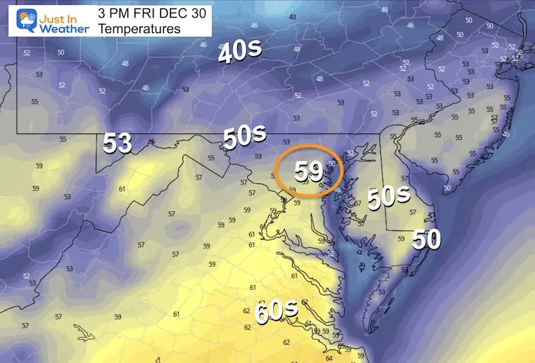
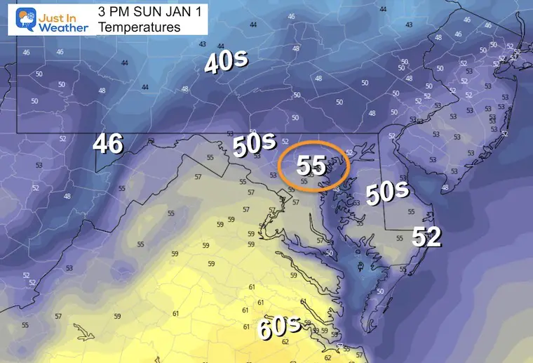
3 PM Temperatures
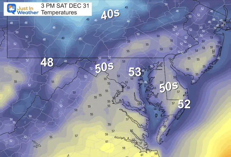
I believe we will end up warmer than this model plot, with a chance to reach the lower 60s.
Subscribe for eMail Alerts
Weather posts straight to your inbox
Sign up and be the first to know!
CLIMATE DATA
TODAY December 30
Normal Low in Baltimore: 27ºF
Record -3ºF in 1880
SNOW: 2.3” 1935
Normal High in Baltimore: 44ºF
Record 68ºF 1990
New Year’s Eve (Saturday)
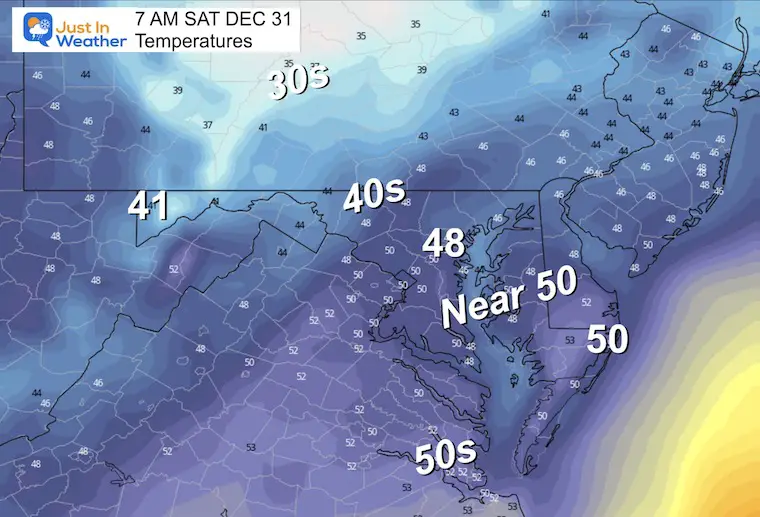
Morning
Noticeably warmer start to the day with cloud cover ahead of the rain.
Afternoon
The warming will be tampered by rain.
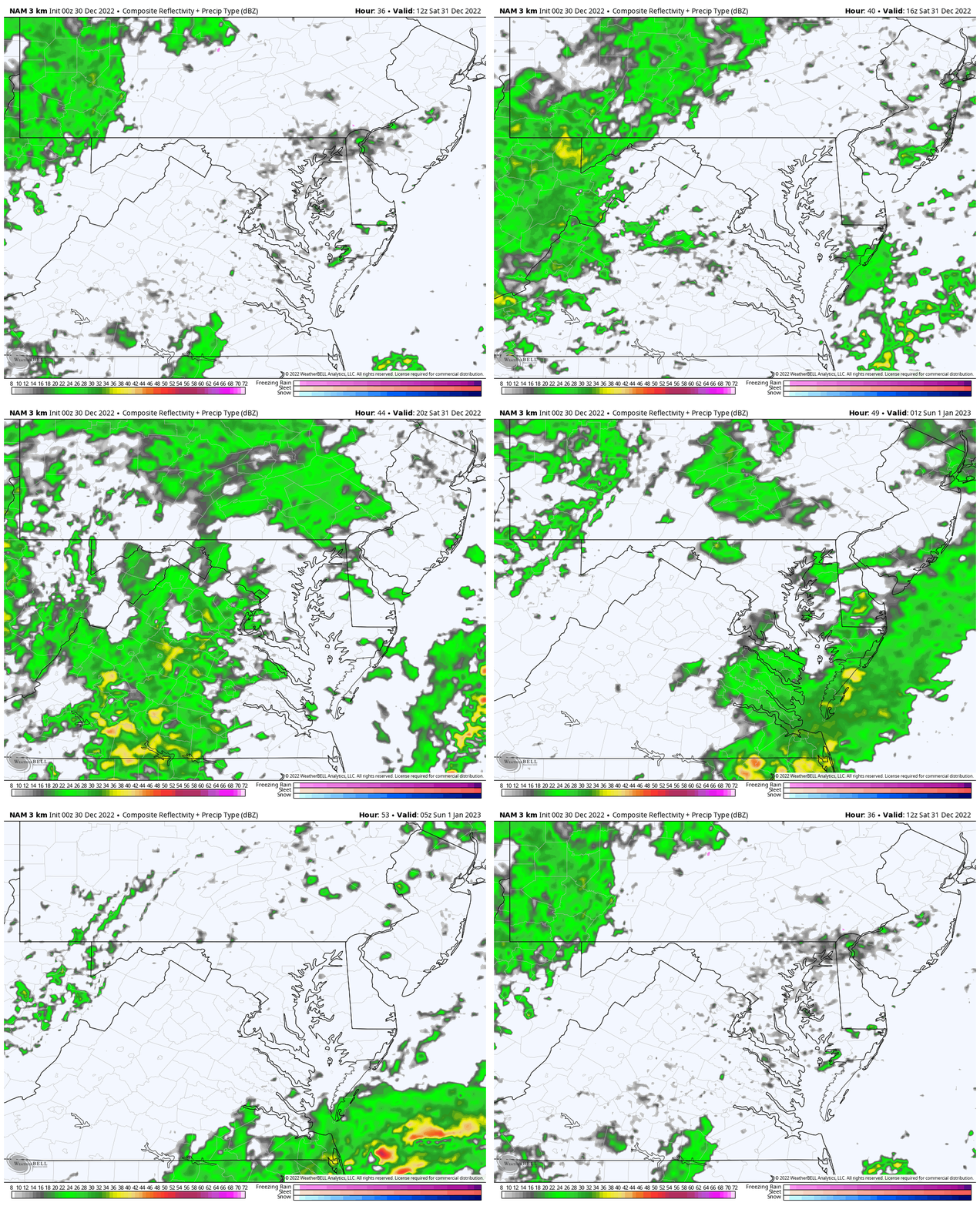
Radar Simulation
Rain showers will develop and expand in the afternoon, with steady rain in the evening. The timing is trending to speed up, which may move this out of the area by midnight. It will be followed by dry winds and a warmer air flow into next week.
New Year’s Day Afternoon
I am skipping to the high temps which may make a run above model guidance to near 60ºF.
The weather will be very nice for the Ravens Sunday Night Football Game in Baltimore.
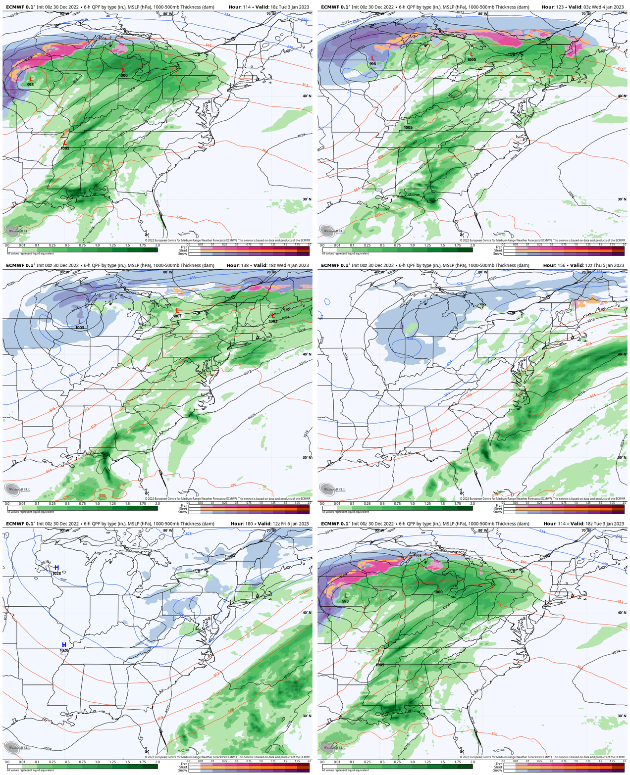
Next Storm Mid Week
The ECMWF Model shows the storm to our west on Tuesday, ushering us back with warmer air again. Then the rain moves in Wednesday, followed by cooling at the end of the week.
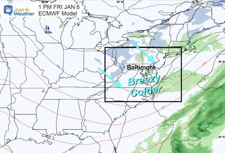
Snapshot Friday
The ECMWF Shows an Upper Level Low bringing us colder winds, but only spotty showers at best.
The GFS Model is much more aggressive, developing a coastal storm. This is the system I mentioned a few days ago that was well off the coast (and we should watch for a westward suggestion with new evaluations.) We see that here, but it is 8 days away and I still have low confidence in it.
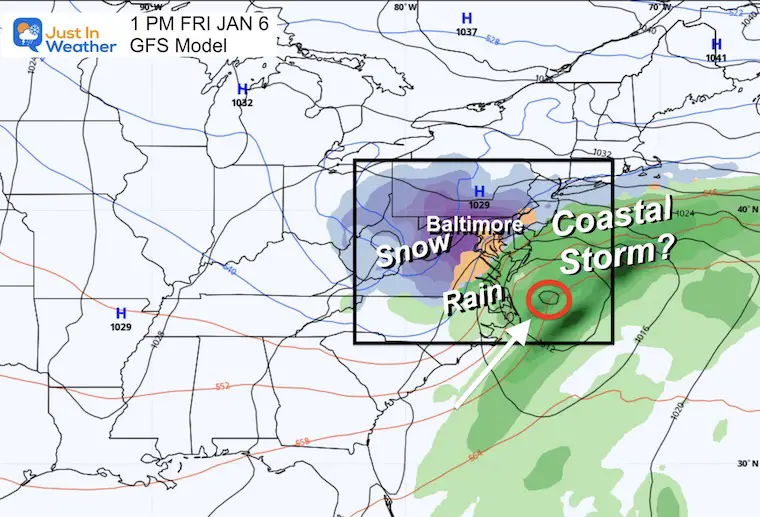
My Thoughts:
As I mentioned in my Polar Vortex report and my arctic report on the NOAA Warm Outlook, it is very likely we end up warmer to start the New Year, but we have good reason to expect a return of winter and snow by mid January.
Next weekend is obviously much sooner, and not the pattern change I mentioned. It is the blip I suggested that could be a winter event in the middle of a warm pattern. We shall see.
2023 is bound to keep us busy with an active weather start to the year.
FITF
7 Day Forecast
The focus for now is on the warm up.
Faith in the Flakes Gear
What is Faith in the Flakes?
It began with my son in 2009
October 27 Nor’easter Recap Still Breezy Then Next Storm Friday
SNOWSTIX – Available Now
STEM Assemblies/In School Fields Trips Are Back
Click to see more and ‘Book’ a visit to your school
My Winter Outlook: Not A Typical La Niña!
I see many factors to support colder influence with multiple systems. Early and later in winter. Check it out.
October 27 Nor’easter Recap Still Breezy Then Next Storm Friday
Also See The Winter Outlook Series:
October 27 Nor’easter Recap Still Breezy Then Next Storm Friday
Farmer’s Almanac Comparison
September Starts Meteorological Autumn: Weather Climate Stats For Maryland at Baltimore
Triple Dip La Niña Winter
CONNECTION TO WINTER?
If you want a snowy winter, this is what you might want to look for in the rest of the tropical season. (You might be seeing a lot of commercial snow removal people out this Winter).
Rainbow Ice Cave In Mt. Rainier A Very Rare Find: Photos And Video
Wooly Bear Caterpillars
https://justinweather.com/2022/10/25/winter-weather-outlook-from-the-wooly-bear-caterpillar/
Persimmon Seeds
Click to see Top 20 and MORE
Winter Weather Folklore Top 20 And More Outlook Signals From Nature For Cold And Snow
Normals And Records: Maryland and Baltimore Climate History
Please share your thoughts, best weather pics/videos, or just keep in touch via social media
-
Facebook: Justin Berk, Meteorologist
-
Twitter: @JustinWeather
-
Instagram: justinweather


