December 19 Colder Winds Today And Winter Storm Update
December 19 2022
Monday Morning Update
Today is the anniversary of the largest December winter storm in our region. Baltimore received 17 inches of snow on this date in 2009, with lightning early in the morning. I recall seeing that on my way to work! That kicked off our largest winter snowfall total (77 inches), which included 2 blizzards in 5 days in February 2010.
This winter has another storm, but it’s kicking off differently! The latest round of cold air gets reinforcements with gusty winds today. It will feel up to 10 degrees colder as a result. The weather will otherwise be quiet for a few days, then we track the winter storm arriving Thursday.
The quick glance for that winter storm is below. It looks like maybe a brief start with a mix, then rain ending with brief snow and flash freeze Friday. Christmas weekend will be frigid! Perhaps the coldest in a decade or so.
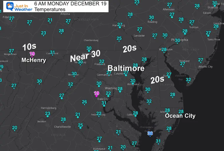
Morning Temperatures
The cold air in place is seasonal, but colder winds will hold the temps down this afternoon.
Headlines
- Today: Cold, Windy, But Dry
- The Storm: Thursday morning to Friday.
- Christmas Weekend: VERY COLD
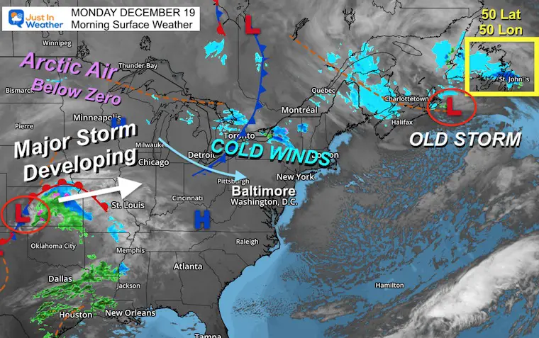
Morning Surface Weather
I am showing this wider view to highlight another feature influencing our storm.
The one reason I see the storm ahead NOT being that coastal snow maker: Newfoundland! That 50 Lat/50Lon location is where the last storm was expected to close off and stall. That would have held colder air in place longer AND prevented the next storm from closing off… to shift to the coast.
It is now expected to keep moving into the Atlantic, so the next storm gets stronger, closing off to the west and pushing warmer air up the coast instead.
In the meantime, High Pressure will build in for a few quiet days for us.
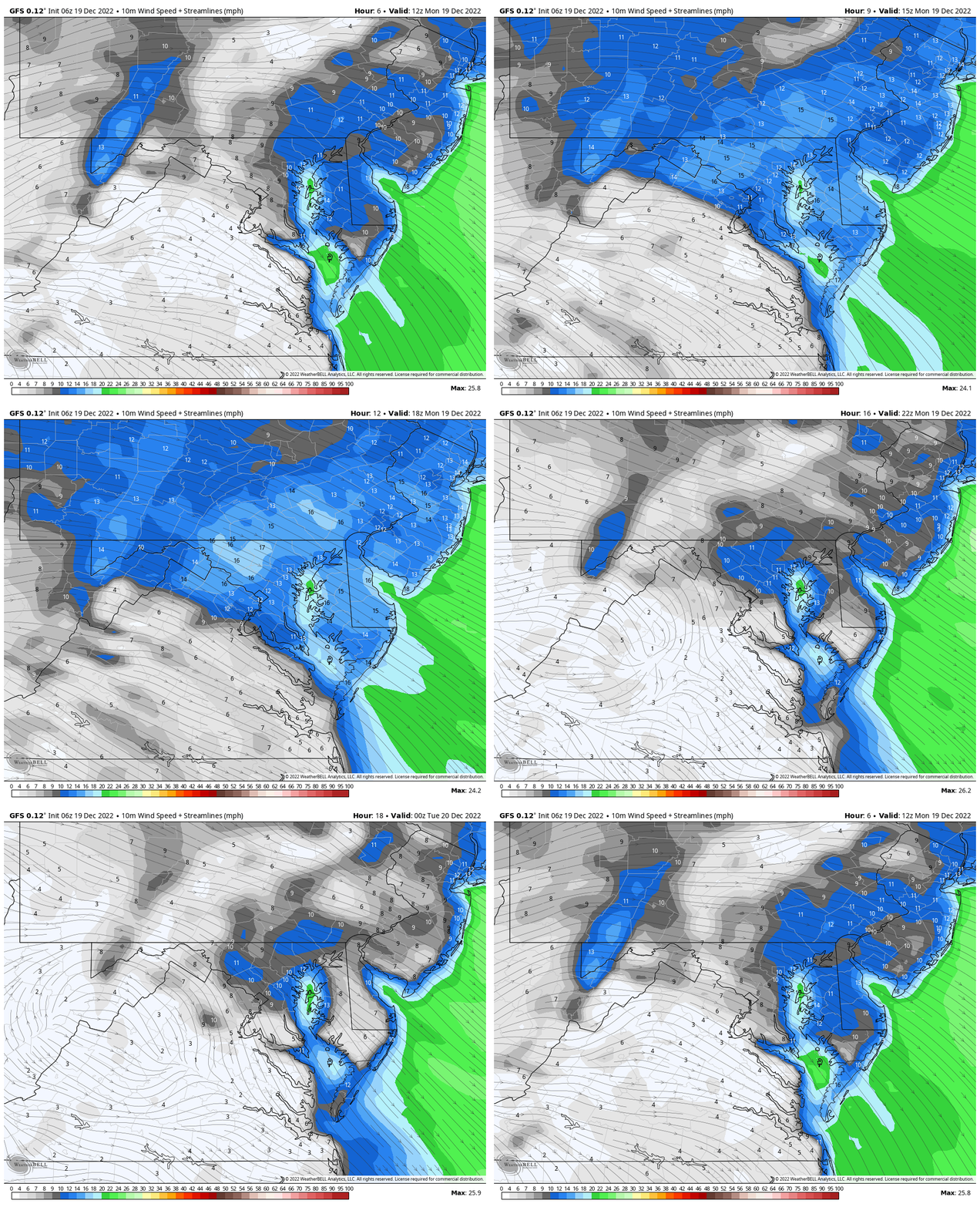
Wind Forecast
7 AM to 7 PM
Strong winds will build quickly this morning and last into the afternoon.
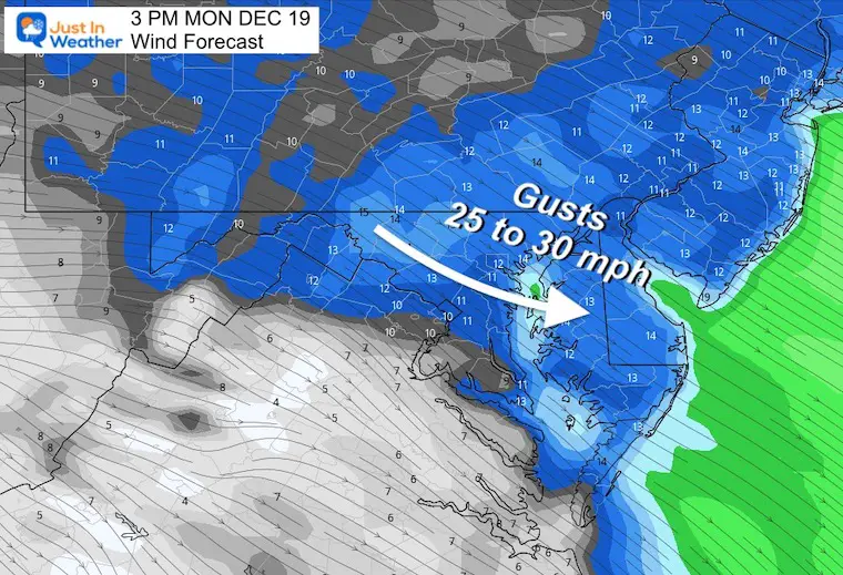
Afternoon Snapshots at 3 PM
Wind Forecast
Gusts will push up to 30 mph.
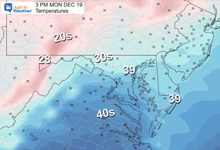
Afternoon Temperatures
Well below average. Note that 39ºF may verify warmer at the BWI location which has a tendency to run above the rest of the local region.
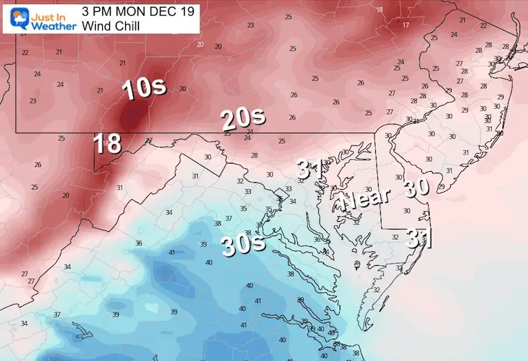
Wind Chill
It will feel up to 10 degrees colder.
Subscribe for eMail Alerts
Weather posts straight to your inbox
Sign up and be the first to know!
CLIMATE DATA
TODAY December 19
Normal Low in Baltimore: 29ºF
Record 6ºF in 1989
SNOW: 17.0” 2009 – Part of the most snow winter in Baltimore
Normal High in Baltimore: 47ºF
Record 66ºF 1931
Tuesday Temperatures
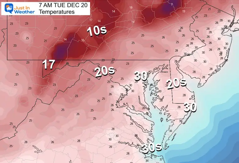
Morning
Hard freeze reaches across the Bay to the beaches.
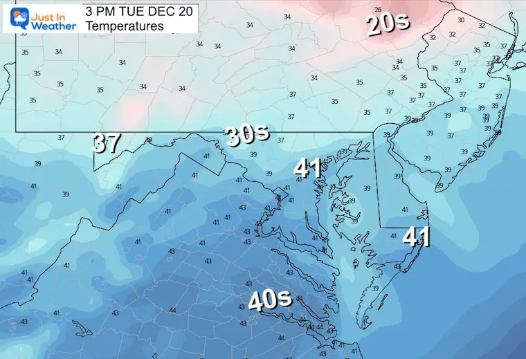
Afternoon
Just as chilly as today, but less wind.
Looking Ahead To The BIG STORM (2-Days)
Computer Model Guidance From Sunday Night
Thursday Morning
The ECMWF Model does have that wintry mix, west of the mountains. I continue to be skeptical of a few model plots based off of recent bias. If this arrives earlier (like other events), then a brief start with wintry mix may shift east.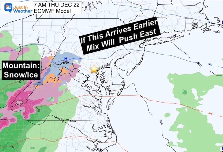
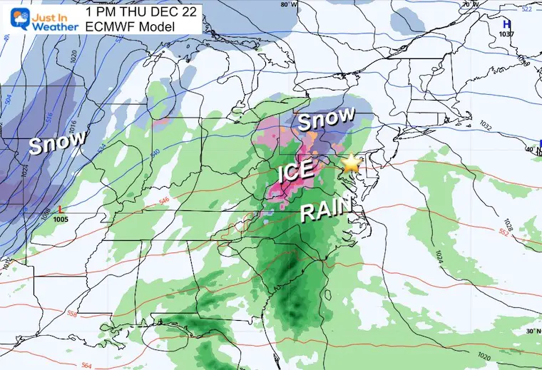
Thursday Afternoon
The later start on this models allows for some warming and rain in the cities.
The major snow impact will be in the Mid-west where blizzard conditions are likely to expand to the Great Lakes. This may have a ripple effect for plane travel around the country ahead of Christmas.
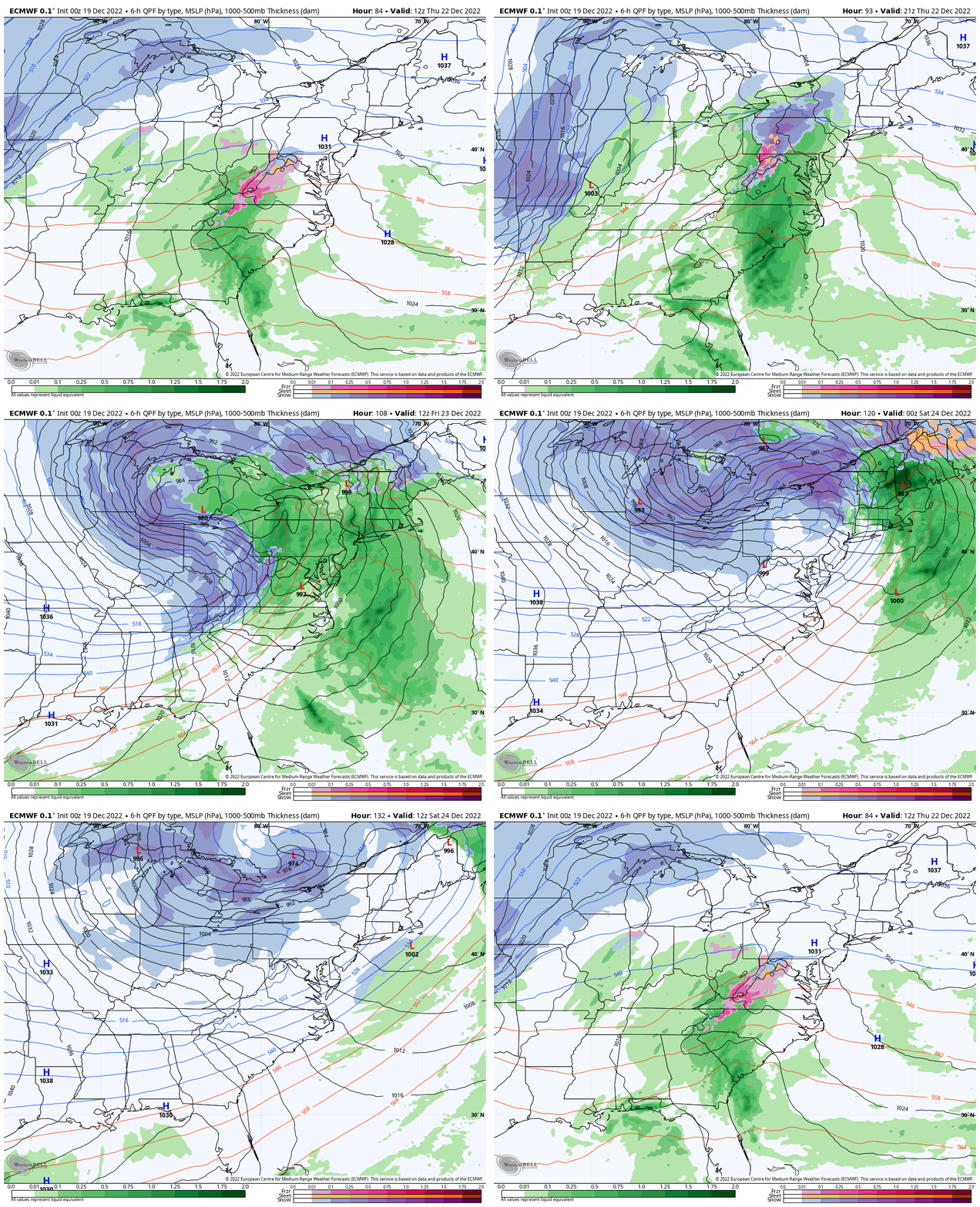
Animation ECMWF Model
7 AM Thu to 7 AM Sat
The evolution of the storm on this model has been consistent with a warming rain into Thursday night and Friday morning, then ending with a brief period of snow and flash freeze.
Again, any shift in speed and timing could expand the snow and icing risk. Still more to sort out and today will help fine tune that for us.
Key Timeframes Friday
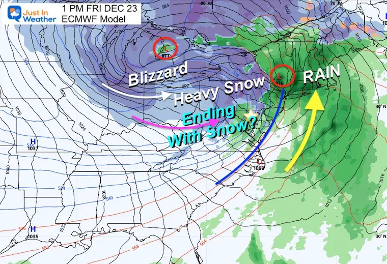
1 PM – Friday Afternoon
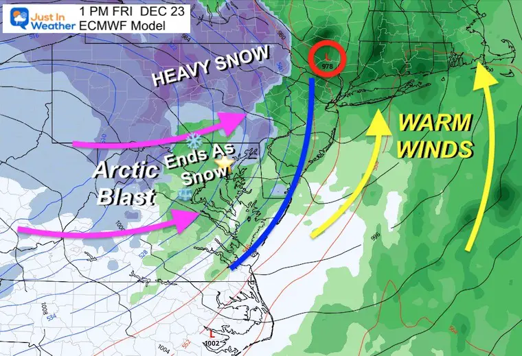
Surface Weather Forecast
The cold front location is the make or break of the snow or ice impact. It may snow with temps just above freezing, then the thermometer will crash. It will be a matter of if roads are wet when the deep freeze arrives.
Closer View
This shows the timing of the cold from to reach New Jersey by 1 PM. Colder air will be flowing in behind. The debate is how much moisture will be left over as the cold air arrives with the deep freeze.
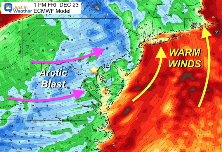
Wind Flow
The arctic front will kick up very strong winds for a few days.
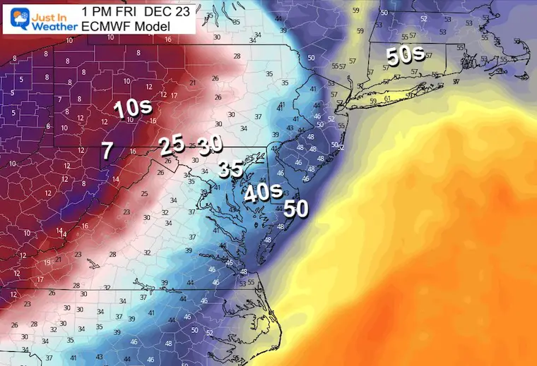
Temperatures
ARCTIC FRONT
- Ocean City = 50ºF
- Baltimore = 35ºF
- Frederick/Westminster/York = 30ºF
- McHenry, MD = 7ºF
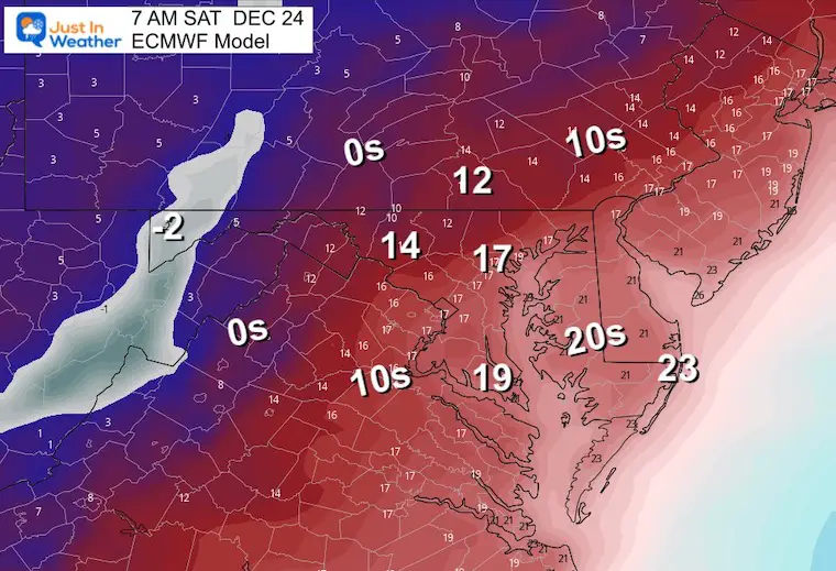
Christmas Weekend Deep Freeze
Saturday Morning- Christmas Eve Day will be FRIGID!
7 Day Forecast
Winter Solstice is Wednesday!
Thursday and Friday remain a WILD CARD. The information the models put out this morning will help us refine expectations. If there is any shift/flip or locking in on the the timing, we may see it today.
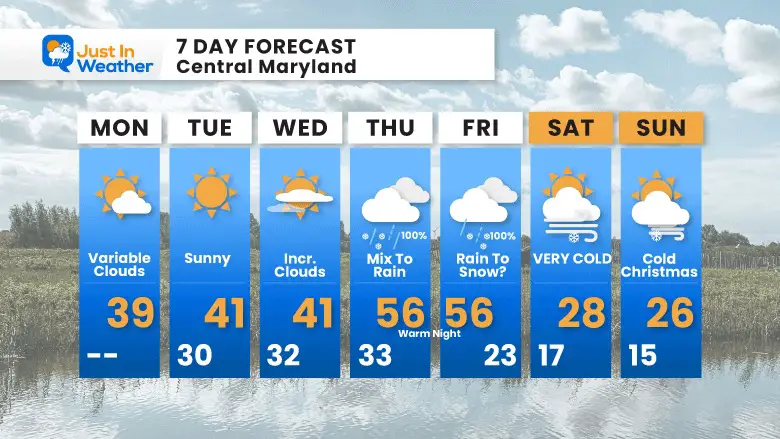
I will have a more detailed look at the storm in my afternoon report.
Faith in the Flakes Gear
What is Faith in the Flakes?
It began with my son in 2009
October 27 Nor’easter Recap Still Breezy Then Next Storm Friday
SNOWSTIX – Available Now
STEM Assemblies/In School Fields Trips Are Back
Click to see more and ‘Book’ a visit to your school
My Winter Outlook: Not A Typical La Niña!
I see many factors to support colder influence with multiple systems. Early and later in winter. Check it out.
October 27 Nor’easter Recap Still Breezy Then Next Storm Friday
Also See The Winter Outlook Series:
October 27 Nor’easter Recap Still Breezy Then Next Storm Friday
Farmer’s Almanac Comparison
September Starts Meteorological Autumn: Weather Climate Stats For Maryland at Baltimore
Triple Dip La Niña Winter
CONNECTION TO WINTER?
If you want a snowy winter, this is what you might want to look for in the rest of the tropical season. (You might be seeing a lot of commercial snow removal people out this Winter).
Rainbow Ice Cave In Mt. Rainier A Very Rare Find: Photos And Video
Wooly Bear Caterpillars
https://justinweather.com/2022/10/25/winter-weather-outlook-from-the-wooly-bear-caterpillar/
Persimmon Seeds
Click to see Top 20 and MORE
Winter Weather Folklore Top 20 And More Outlook Signals From Nature For Cold And Snow
Normals And Records: Maryland and Baltimore Climate History
Please share your thoughts, best weather pics/videos, or just keep in touch via social media
-
Facebook: Justin Berk, Meteorologist
-
Twitter: @JustinWeather
-
Instagram: justinweather


