December 18 Colder Winds Today And Holiday Winter Storm Arrives Thursday
December 18 2022
Sunday Morning Update
Cold air will be felt today with gusty winds, but the mother load of arctic air is set to arrive Christmas weekend. This may be the coldest in 5 years for many areas. In between, there will be a major winter storm affecting a large area on Thursday and Friday. My latest thoughts on the mix for The Mid Atlantic. I have been doubting all snow, but it may start and end that way for many.
We are in Holiday Week: Hanukkah begins tonight and Christmas is next weekend. A lot of weather will happen in between.
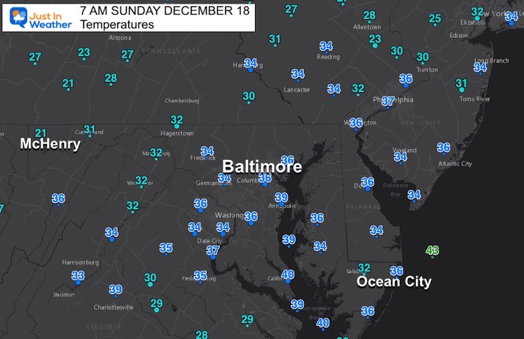
Morning Temperatures
The cold air in place is seasonal, but colder winds will hold the temps down this afternoon.
Headlines
- Today: Cold winds, maybe a flurry later
- The Storm: Thursday morning to Friday.
- Christmas Weekend: VERY COLD
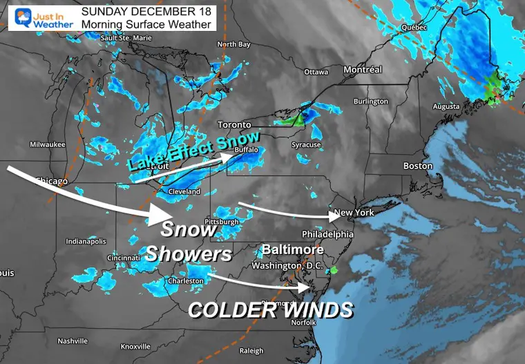
Morning Surface Weather
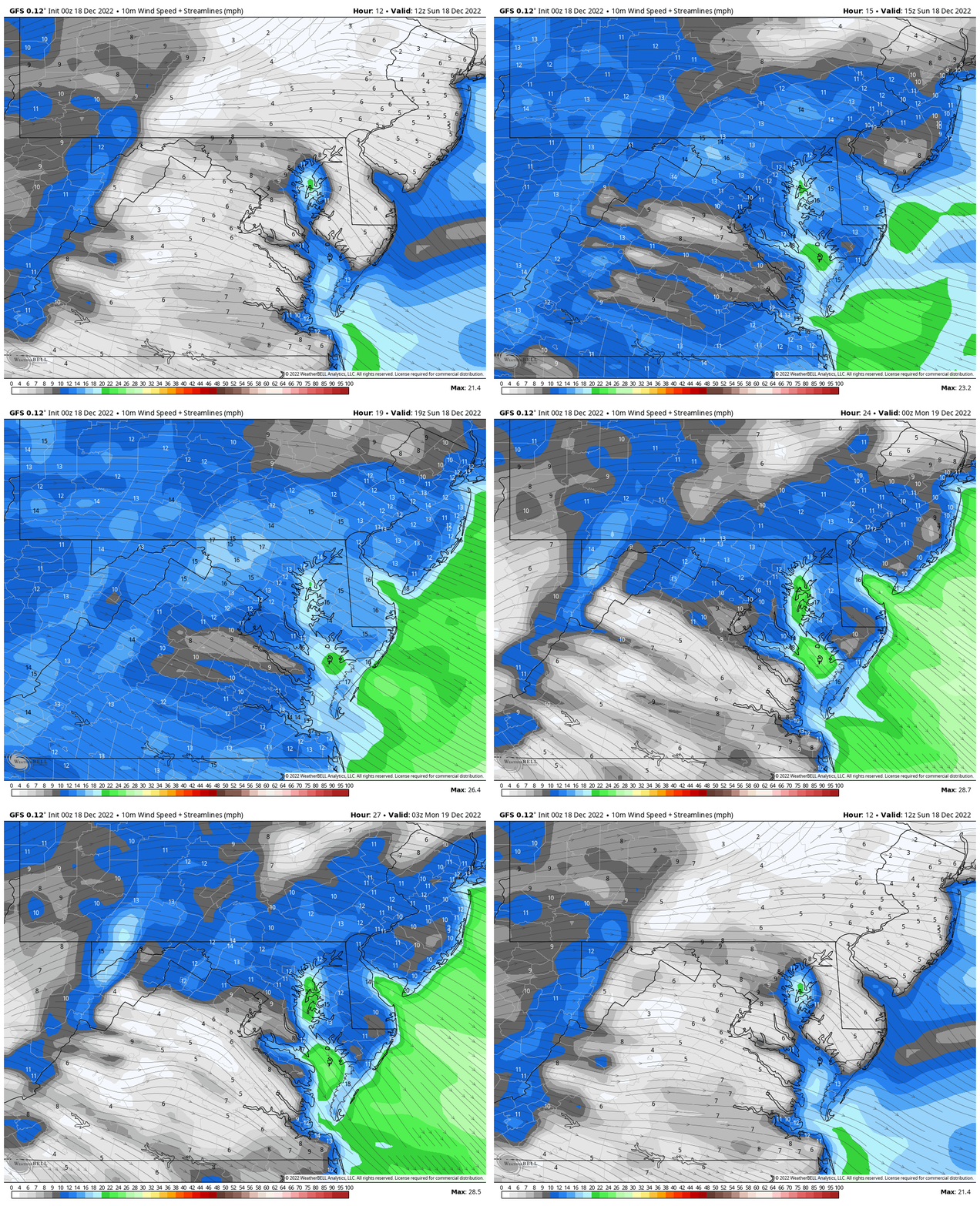
Wind Forecast
A colder push of air will increase this afternoon.
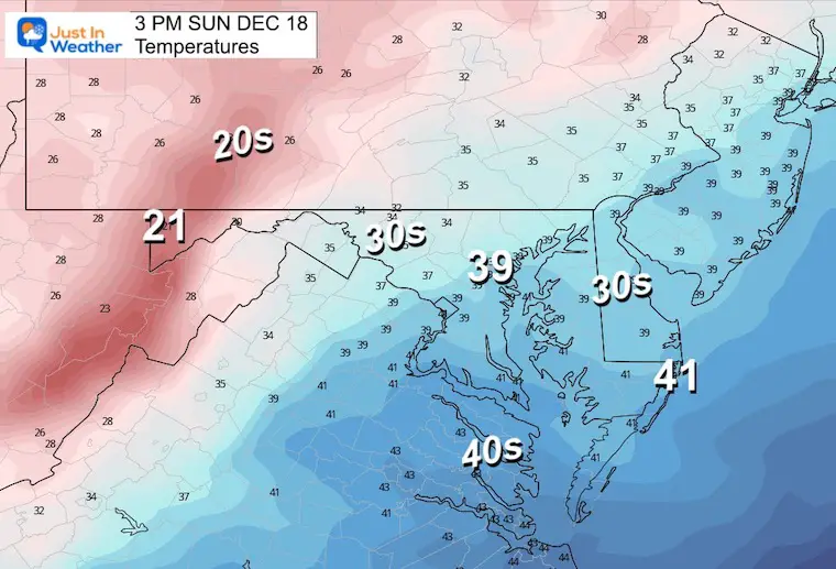
Afternoon Temperatures
Seasonably cold temperatures.
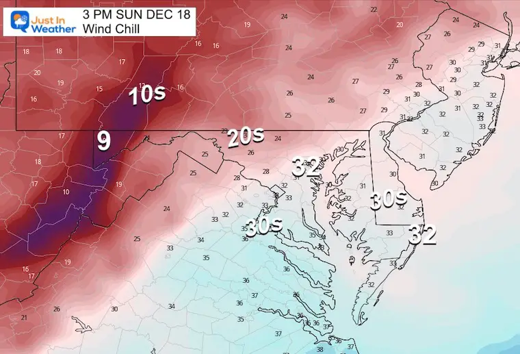
Wind Chill
It will feel up to 10 degrees colder.
Subscribe for eMail Alerts
Weather posts straight to your inbox
Sign up and be the first to know!
CLIMATE DATA
TODAY December 18
Normal Low in Baltimore: 29ºF
Record 7ºF in 1919
SNOW: 4.0” 1916
Normal High in Baltimore: 47ºF
Record 72ºF 2006
Monday Temperatures
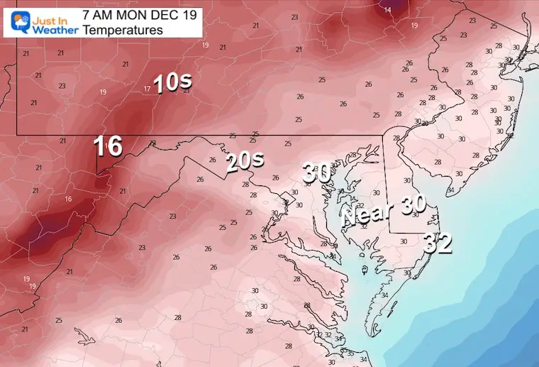
Morning
Freezing temps should reach the beaches. Teens in the mountains with a fresh blanket of snow.
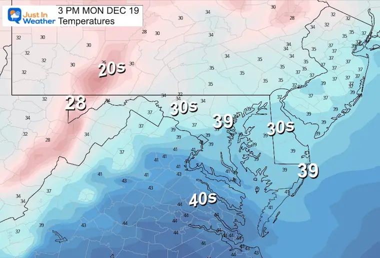
Afternoon
Many areas may remain in the upper 30s or colder.
Looking Ahead To The BIG STORM (2-Days)
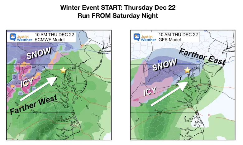
Computer Model Guidance From Saturday Night
THURSDAY MORNING
The European ECMWF and American GFS Models are in a little better agreement
The ECMWF (right) is still warmer, and brings the start as rain with inland snow/ice. The GFS (left) is colder for us with a snow or mix closer to Baltimore for the arrival. I am partial to this notion based on systems tending to arrive a few hours earlier than models have been showing.
FRIDAY – Different Ending Times
The ECMWF (left) shows the cold air catching up to the moisture and ending with a period of snow.. even in metro areas. I support this solution due to the faster speed.
The GFS (right) does also show some change over but is nearly 12 hours later. It seems too slow.
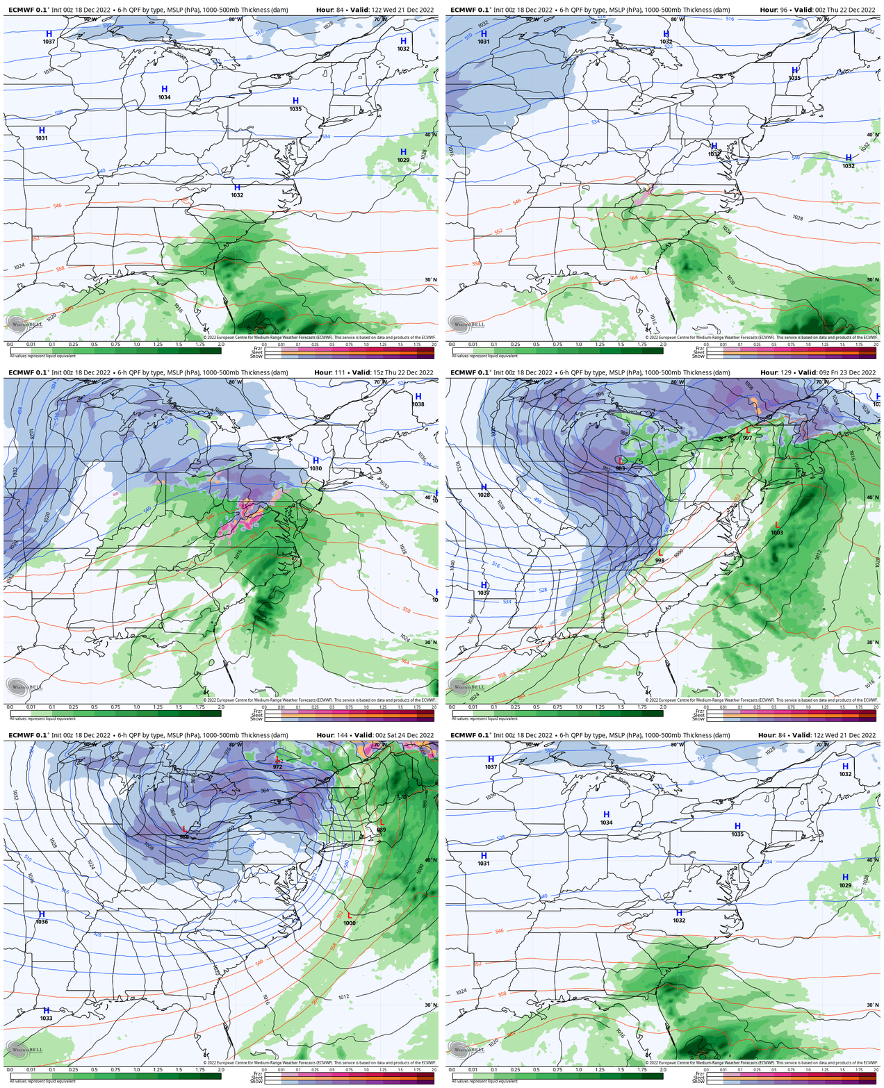
Animation ECMWF Model
7 AM Wed to 7 PM Friday
The evolution of the storm on this model has been more consistent. I still have some questions, but this does seem like the more likely set up. Notice how widespread the impact will be: Snow and ice will affect Chicago, the Great Lakes, and New England Thursday Night. This becomes an east coast concern for flash freeze on Friday.
Key Timeframes
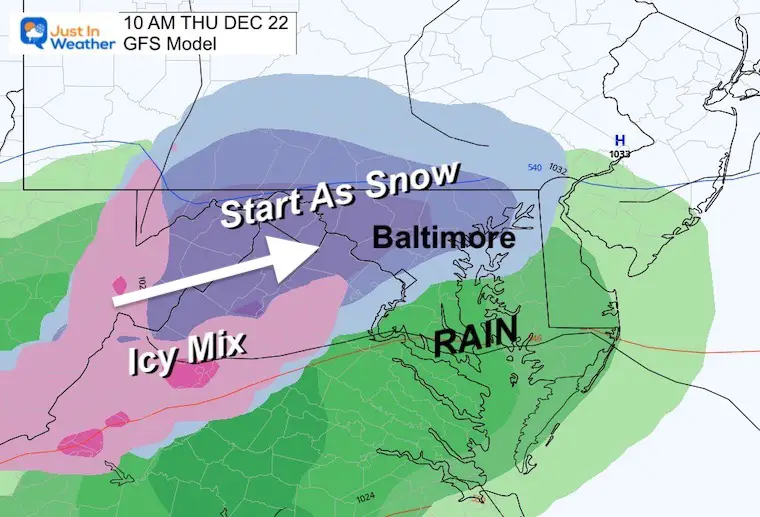
Starting Thursday Morning
I am leaning towards the GFS solution because of the earlier arrive to catch up to colder air in place. This is NOT a promise for now, but what I am looking for the Euro to catch up to. So we could have a snow or mix start in central Maryland.
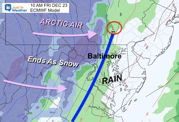
Ending Friday
The Euro is faster, allowing the cold air to catch up and bring a few hours of snow early in the day. This would fit prior storms moving faster… but also introduce flash freezing and some accumulation.
Temperatures
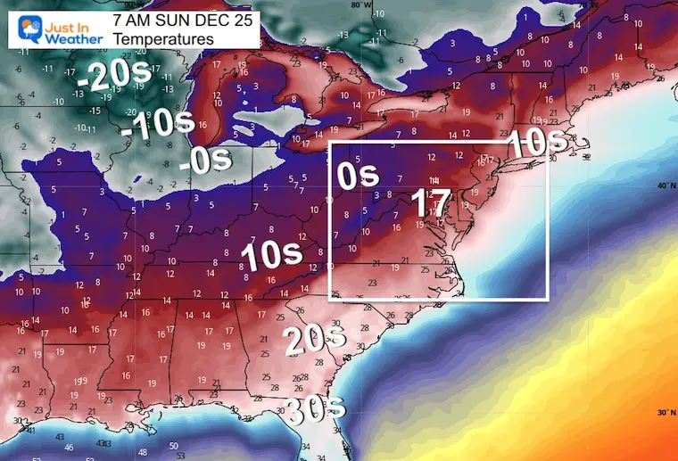
This is going to be a major arctic outbreak. Watch the animation from Thursday Morning to Christmas Morning.
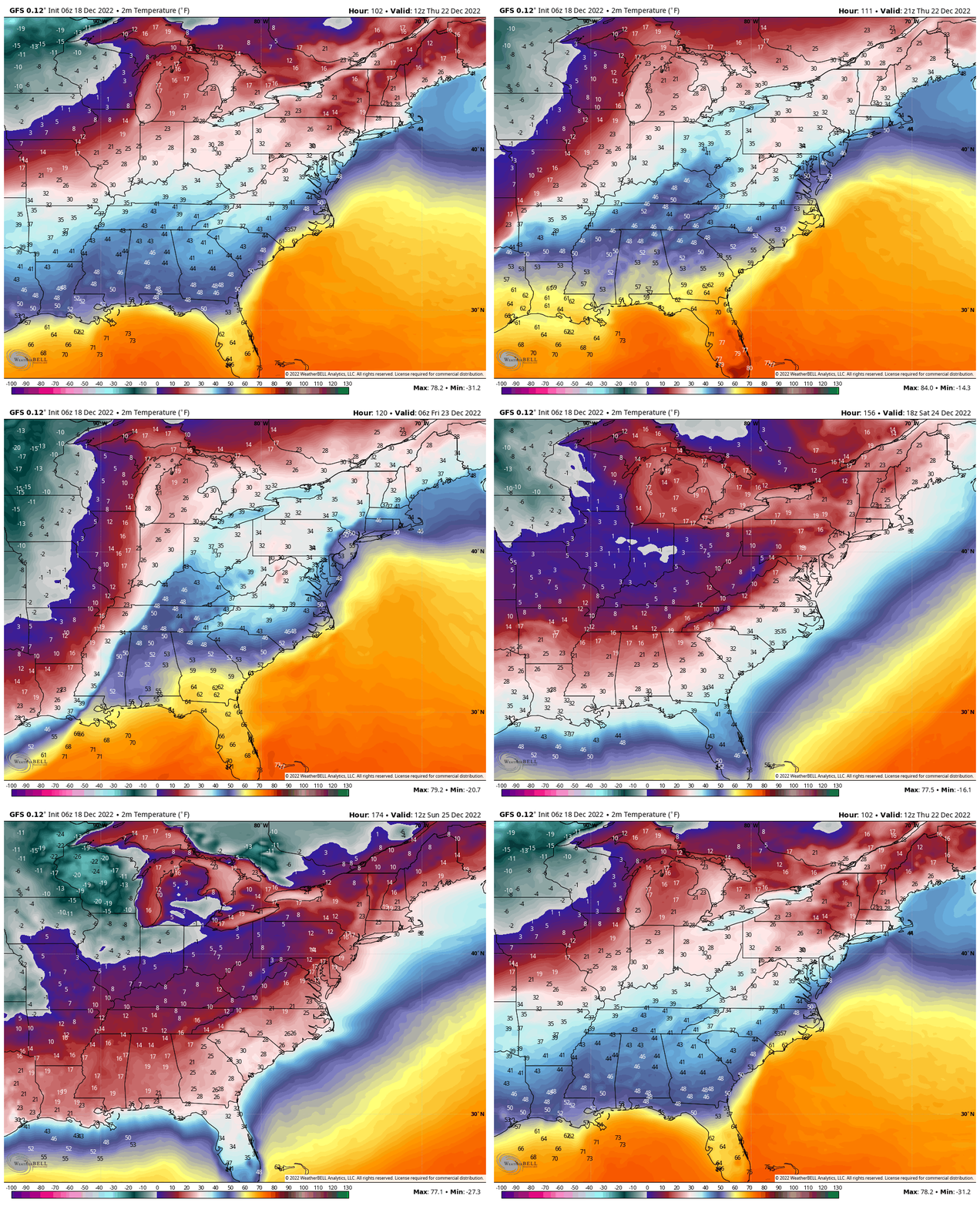
Christmas Morning Deep Freeze
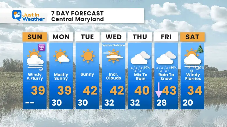
7 Day Forecast
Winter Solstice is Wednesday!
Thursday and Friday remain a WILD CARD. I would not endorse anyone locking in on a promise now. Definitely do not consider a promise for totals. Just consider a possible impact on Thursday to Friday for travel.
Faith in the Flakes Gear
What is Faith in the Flakes?
It began with my son in 2009
October 27 Nor’easter Recap Still Breezy Then Next Storm Friday
SNOWSTIX – Available Now
STEM Assemblies/In School Fields Trips Are Back
Click to see more and ‘Book’ a visit to your school
My Winter Outlook: Not A Typical La Niña!
I see many factors to support colder influence with multiple systems. Early and later in winter. Check it out.
October 27 Nor’easter Recap Still Breezy Then Next Storm Friday
Also See The Winter Outlook Series:
October 27 Nor’easter Recap Still Breezy Then Next Storm Friday
Farmer’s Almanac Comparison
September Starts Meteorological Autumn: Weather Climate Stats For Maryland at Baltimore
Triple Dip La Niña Winter
CONNECTION TO WINTER?
If you want a snowy winter, this is what you might want to look for in the rest of the tropical season. (You might be seeing a lot of commercial snow removal people out this Winter).
Rainbow Ice Cave In Mt. Rainier A Very Rare Find: Photos And Video
Wooly Bear Caterpillars
https://justinweather.com/2022/10/25/winter-weather-outlook-from-the-wooly-bear-caterpillar/
Persimmon Seeds
Click to see Top 20 and MORE
Winter Weather Folklore Top 20 And More Outlook Signals From Nature For Cold And Snow
Normals And Records: Maryland and Baltimore Climate History
Please share your thoughts, best weather pics/videos, or just keep in touch via social media
-
Facebook: Justin Berk, Meteorologist
-
Twitter: @JustinWeather
-
Instagram: justinweather


