Tuesday Afternoon Update: GFS Model Trending Colder For The Weekend Event
December 6 2022
Tuesday Afternoon Update
As you read the following, please note this is just one model update to follow in the series of reports for signals of winter weather. This is NOT a forecast and definitely not a promise. However, what we see is that the American GFS Model (which has been the warmest of our three main model guidance packages) is now showing a colder intrusion and some nearby snow going into the weekend.
Tuesday Afternoon Surface Weather
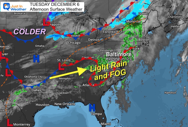
We are in a wet pattern. Today we have periods of rain and fog with cool air stuck in the interior Mid-Atlantic. The colder air is locked in place, and so is the storm track.
GFS Model Simulation: Tuesday Through Saturday
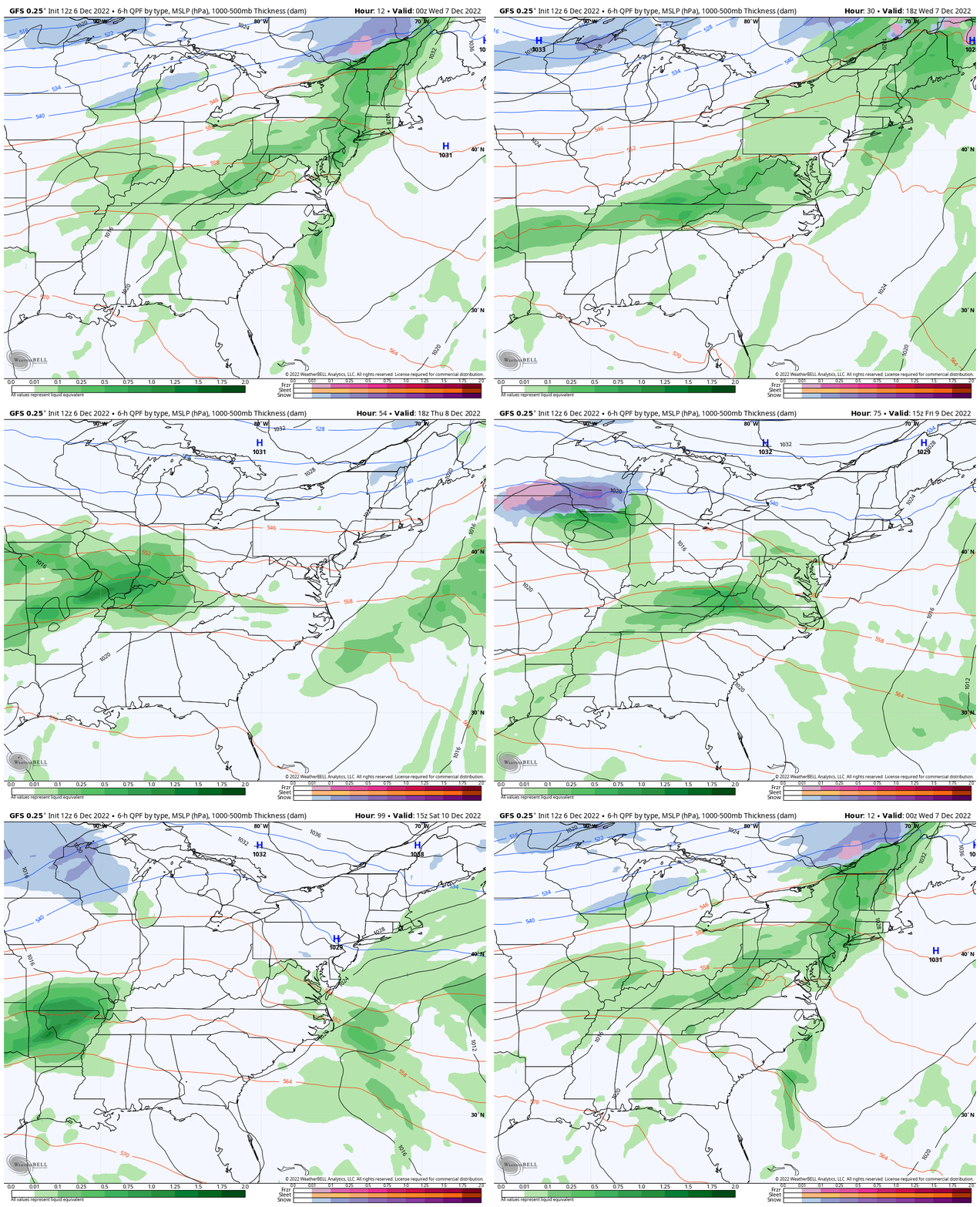
We will remain with clouds and showers much of the week, and the final wave will try to bring in colder air. We can see a hint of that with snow (blue) showing up overnight Friday into Saturday morning around the Maryland and Pennsylvania line.
Wednesday: Showers
Thursday: Maybe a dry break
Friday: Rain returns
Friday Night-Saturday: Rain with snow mix INLAND!
Reminder:
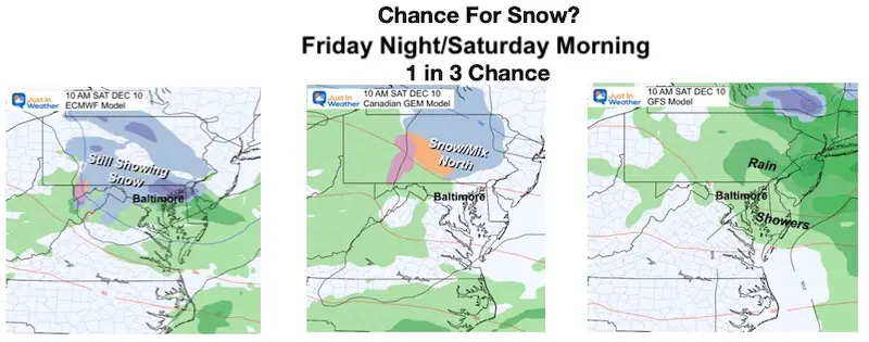
I showed this comparison the morning of the European, Canadian, and GFS Model. Here we even saw the Canadian Model back off a little, and the European was the only one still showing some nearby snow. The GFS Model (on the right) remained warm for a few runs and kept just rain as a risk for central Maryland.
NEW GFS: Friday 7 AM to Saturday 1 PM
See the time stamps below.
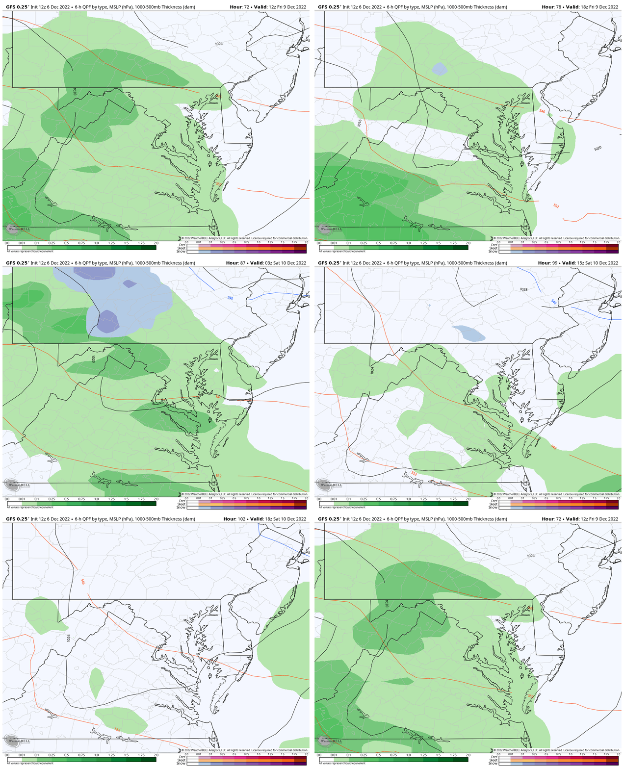
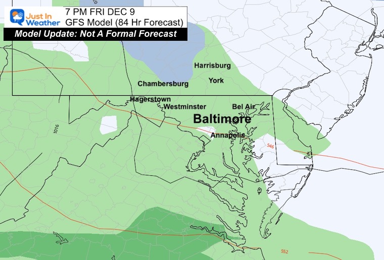
Friday Evening
Light rain over much of the area, with a hint of snow mixing in near I-81 north and west of Chambersburg to Harrisburg PA.
EARLY Saturday Morning
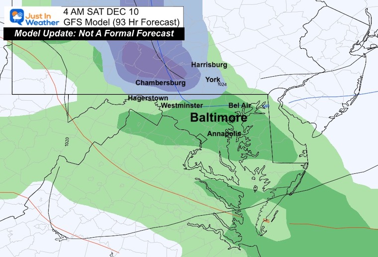
4 AM – The signal for snow within 10 miles of the Maryland and Pennsylvania line up into central Pennsylvania.
This may include northern Baltimore, Carroll, Frederick, and Washington Counties in Maryland. If you are near Baltimore, Annapolis, or Washington, this still looks like a rain event for you.
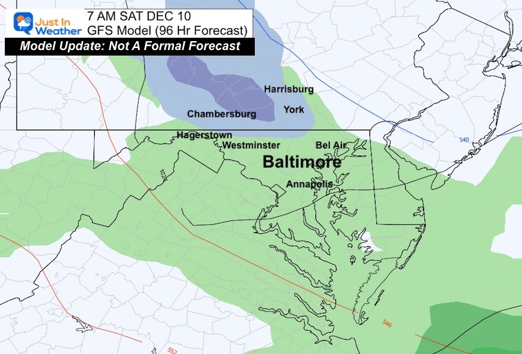
7 AM – If snow will fall in this area it will continue for a few hours.
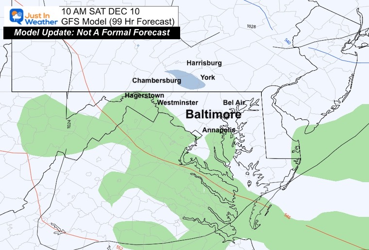
10 AM – The energy will not last long as the precipitation fades to showers and ends during the morning.
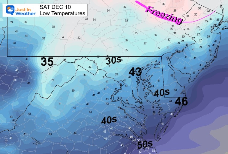
Low Temperatures
If we follow this GFS Model solution, then we also must consider that the surface air temperatures will remain above freezing. Also, the ground is likely still too warm, so stickage will be limited.
Notes:
This is just an inside look at the latest model update. It is NOT a forecast, nor should it be. However, if the European Model (we will see later) still holds cold, then we know that is likely the way we should look at this event. It also leads more value to the European Model with the mid to long range for future events.
I do not believe in snow forecast beyond 72 hours, should there be any impact stickage and accumulation.
I will follow up with the Canadian and European Model updates later.
Subscribe to my Newsletter
Weather posts straight to your inbox
Sign up and be the first to know!
NEW REPORTS
Comparing The Snow In Decembers With Similar Patterns
NEW Faith In The Flakes Gear
My Winter Outlook: Not A Typical La Niña!
I see many factors to support colder influence with multiple systems. Early and later in winter. Check it out.
October 27 Nor’easter Recap Still Breezy Then Next Storm Friday
Also See The Winter Outlook Series:
October 27 Nor’easter Recap Still Breezy Then Next Storm Friday
Farmer’s Almanac Comparison
September Starts Meteorological Autumn: Weather Climate Stats For Maryland at Baltimore
Triple Dip La Niña Winter
CONNECTION TO WINTER?
If you want a snowy winter, this is what you might want to look for in the rest of the tropical season. (You might be seeing a lot of commercial snow removal people out this Winter).
Rainbow Ice Cave In Mt. Rainier A Very Rare Find: Photos And Video
Wooly Bear Caterpillars
https://justinweather.com/2022/10/25/winter-weather-outlook-from-the-wooly-bear-caterpillar/
Persimmon Seeds
Click to see Top 20 and MORE
Winter Weather Folklore Top 20 And More Outlook Signals From Nature For Cold And Snow
Faith in the Flakes Gear
SNOWSTIX – Available Now
Normals And Records: Maryland and Baltimore Climate History
STEM Assemblies/In School Fields Trips Are Back
Click to see more and ‘Book’ a visit to your school
Please share your thoughts, best weather pics/videos, or just keep in touch via social media
-
Facebook: Justin Berk, Meteorologist
-
Twitter: @JustinWeather
-
Instagram: justinweather


