


May 11 Aurora Viewing Forecast Weather And More Photos
Saturday May 11, 2024 The display of Northern Lights last night was historic. As the name implies, this is more common in the Northern Latitudes. On rare occasions we can…
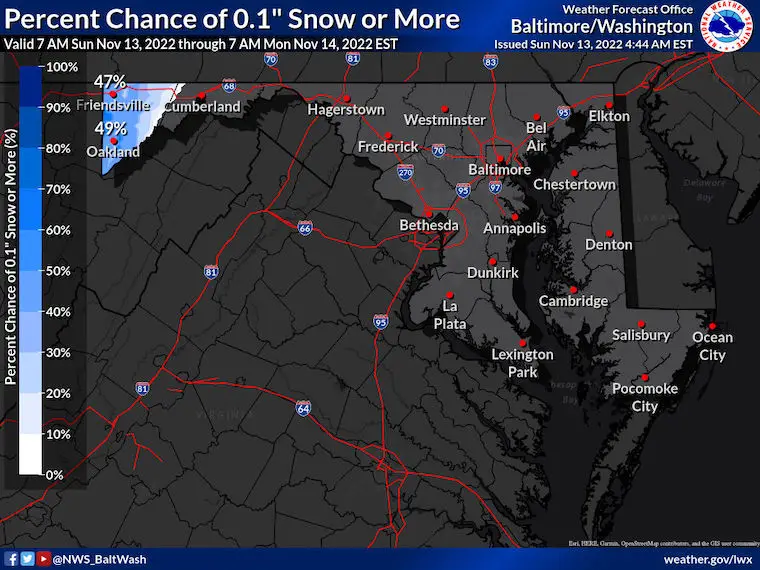
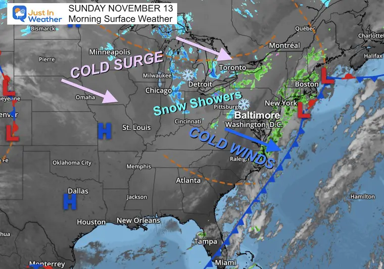
November 13 2022
Sunday Morning Update
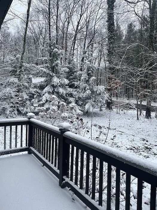
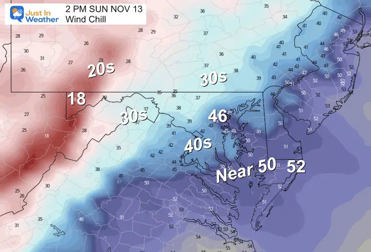
The cold air had finally arrived with strong winds and possibly a challenge for the Bay Bridge Run. The steady winds of 20 mph will gust to 30 mph and keep our temperatures cold. It has already brought snow to the mountains of Western Maryland and West Virginia. See photos and live cam below.
Is more on the way?
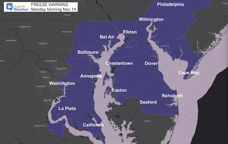
Well, first a Freeze Warning for metro areas west of the Bay through Delaware, then we watch the next system on Tuesday evening.
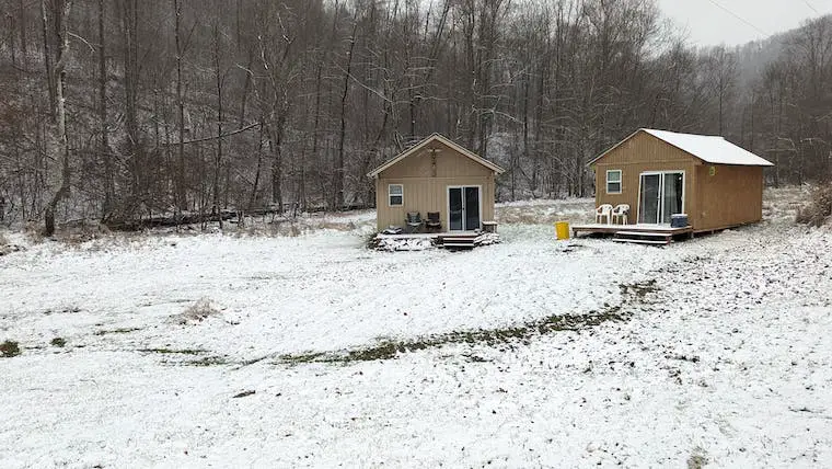
This is a fresh 1 inch on the ground in Garrett County, MD near Deep Creek Lake. Kristin Skeweris sent this while it was still snowing. See the Web Cam Below.
This webcam is positioned at The Greene Turtle Deep Creek Lake and shows Wisp Resort, including a zoomed-in view of Squirrel Cage, The Face, the terrain park, Boulder, the mountain coaster, the tubing park and a shot of McHenry Cove at Deep Creek Lake!
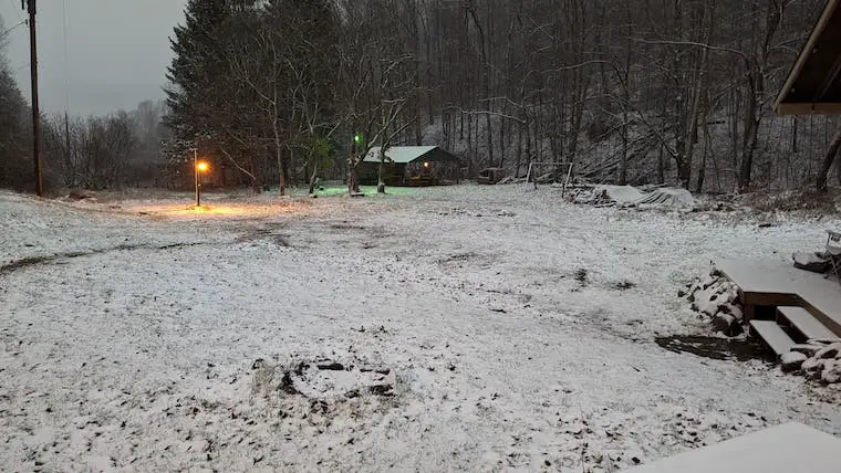
About 30 miles away from Deep Creek Lake. Also about 1 inch on the ground and still falling…
This has already over produced, and an additional coating to 1 inch is possible this morning.
With the cold front off the coast, and High Pressure dominating most of the Nation with a fresh Canadian Air Mass, the Lake Effect Snow Machine is open for business….
The winds will be brisk today, then settle down tonight.
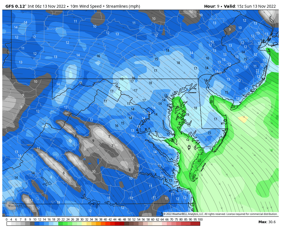
Peak wind gusts up to 30 mph.
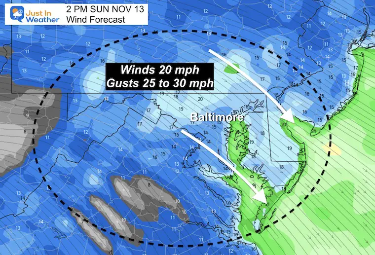
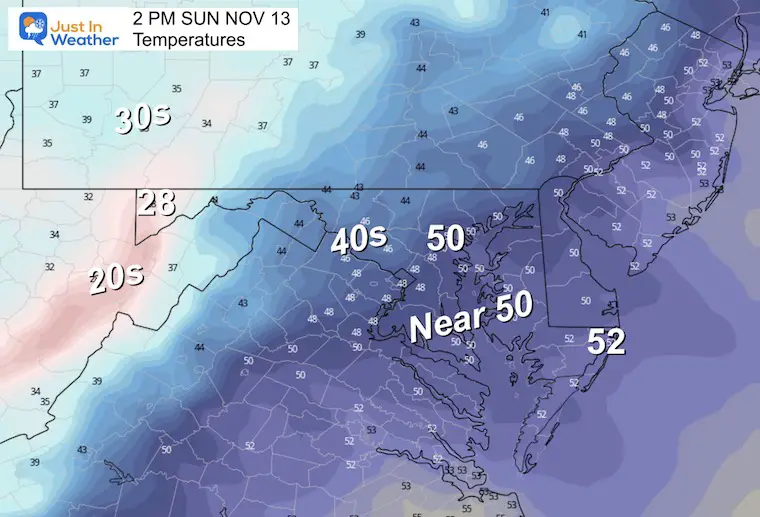
It will definitely feel colder with the winds today.
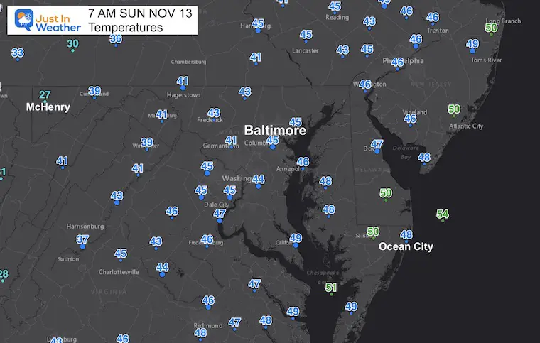
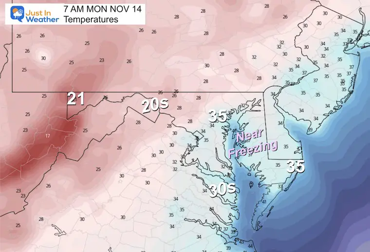
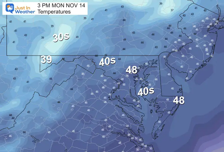
With the wind calming overnight, temps will tank to near 32ºF for the urban areas on the Western Shore of the Bay across through much of Delaware.
Normal Low in Baltimore: 37ºF
Record 22ºF in 2019
SNOW: 3” 1904
Normal High in Baltimore: 58ºF
Record 77ºF 1955
Much of the region will stay in the 40s!
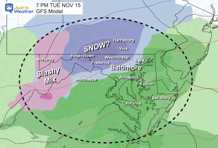
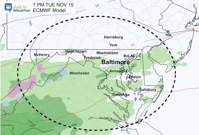
I’ve highlighted the potential for where snowflakes may fly. This is NOT a promise of stickage. The ground needs to chill sufficiently and early season events are a challenge to note when and where the snow may lay and stay.
There is hope for it to fall nearby. FITF
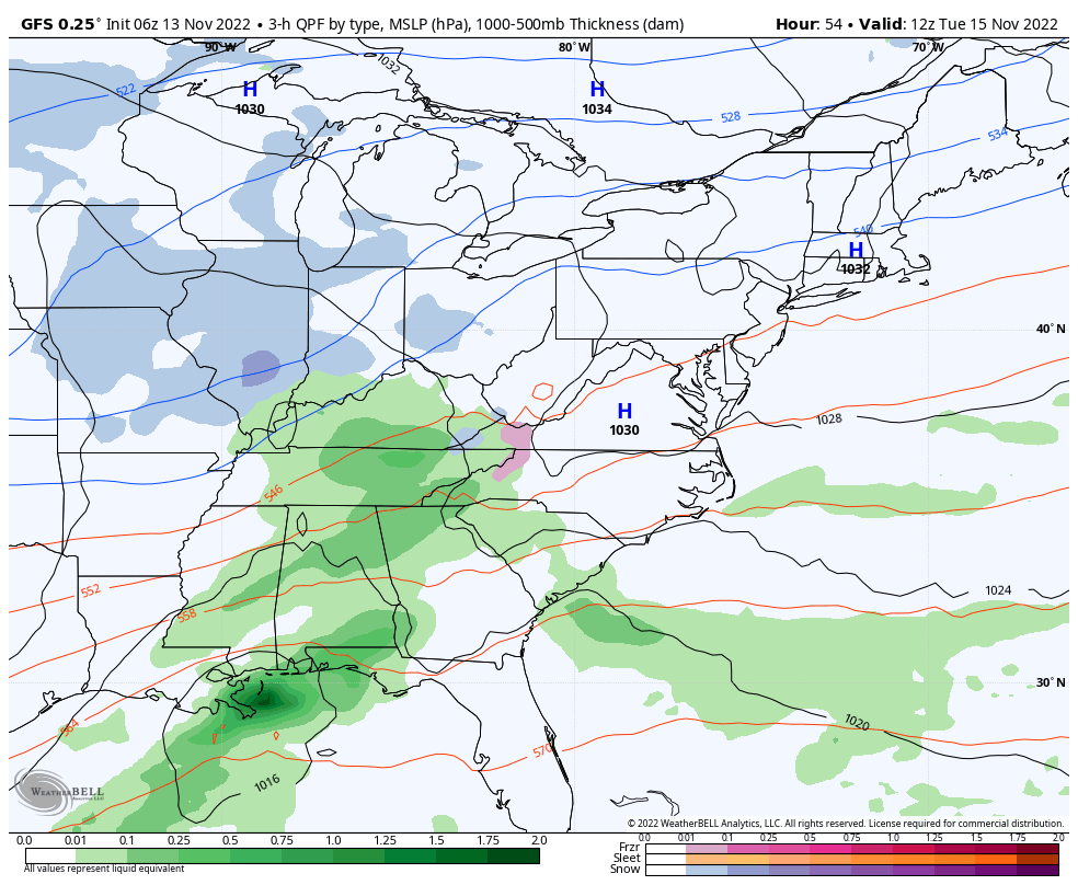
This has a slower solution, bringing in precipitation about 6 hours later and a little bit warmer.
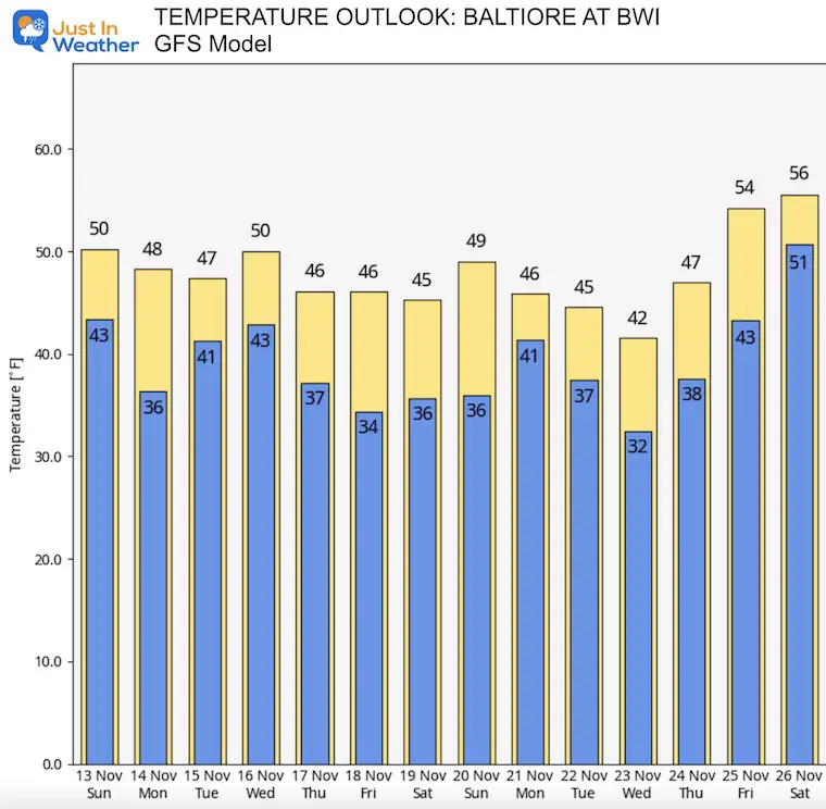
Just a look at the GFS for now. I am short on time to put a full 7-Day forecast together. I hope to have that in my report tonight.
Cold Air here to stay through Thanksgiving
The Big Cool Down Into Mid November: NOAA Outlook Does This For First Time
Click to see more and ‘Book’ a visit to your school

Winter Outlook 2023 From NOAA Very Different Than Farmers Almanacs
Winter Outlook 2023 Early Look At Snow From Two Farmers Almanacs
If you want a snowy winter, this is what you might want to look for in the rest of the tropical season. (You might be seeing a lot of commercial snow removal people out this Winter).
Record August For No Named Tropical Storms: Closer Look At Snow Following
Winter Weather Folklore Top 20 And More Outlook Signals From Nature For Cold And Snow


