


May 4 Chilly And Wet Weekend: Live Radar
Saturday May 4 Morning Report May the 4th Be With You! There is a definite change in the Force we all will notice this morning. A band of rain has…
Saturday November 5 2022
The unseasonably warm weather we have here on the East Coast of the US has a tradeoff. While we have missed out the the severe storms that have hit the southern Plains, strong winds ahead of that storm system are what has been pumping in late summer weather.
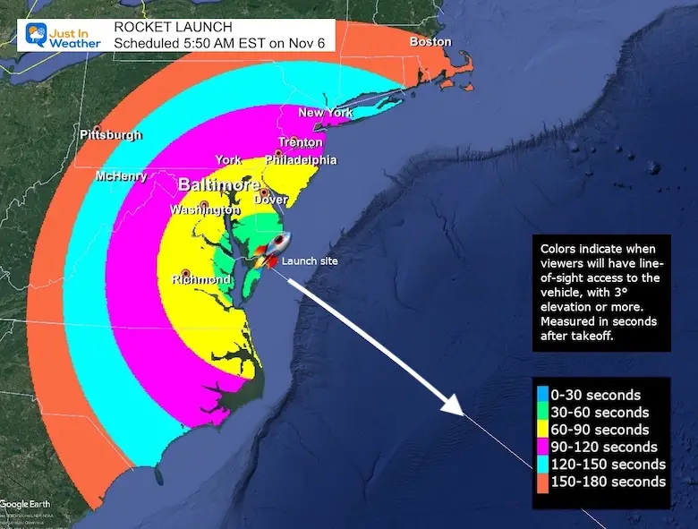
As much as I would like to be saying, “Ride Sally Ride”, the SS Sally Ride mission on Sunday Morning has some hurdles.
When I first intended to write this weather update, I expected it would suggest that some places will simply not see the rocket launch due to clouds and rain. But since The Wallops Island facility is to our Southeast and away from the rain, it would be great to think the scheduled event would still happen. Upon digging a little deeper, the weather conditions have other elements that may hinder the rocket launch on time.
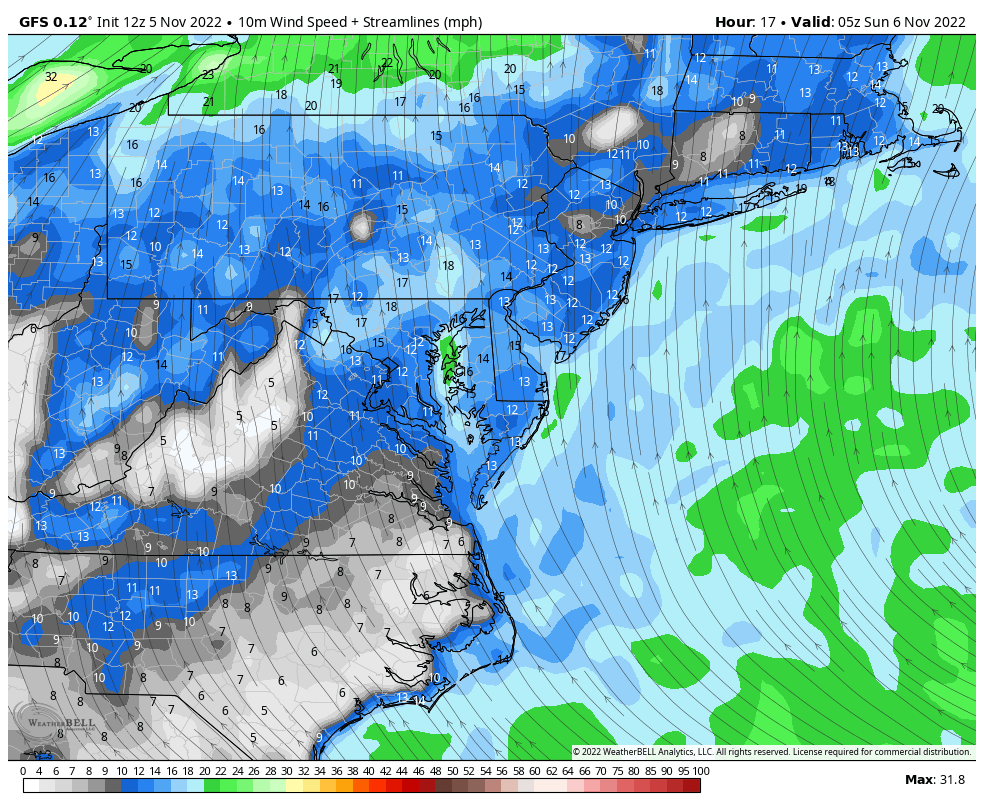
A strong cold front is draped from the Great Lakes, down the Ohio Valley to the Gulf Coast. Strong winds ahead of this system are from the South. That is what has increased out temps to the 70s, but also the cloud cover inland.
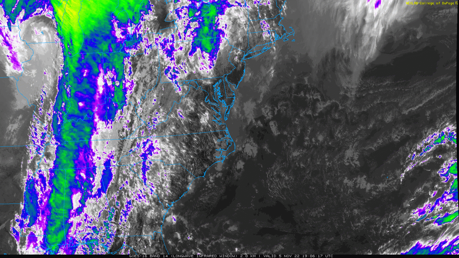
The clouds that had built inland during the day are from the same force that has helped develop fog along the coast overnight and into the early morning.
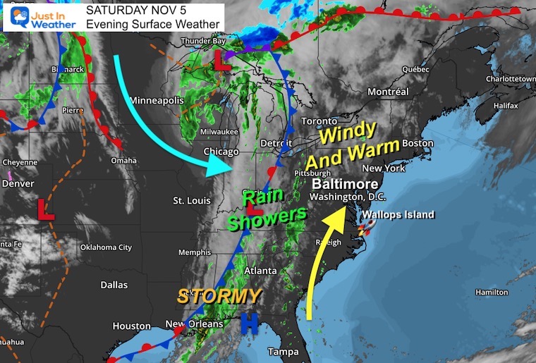
A solid line of clouds will continue to spread in from the west. There is more clearing by the coast this evening, however that may not last until morning.
Let’a look at these separately.
IF THE LAUNCH HAPPENS…
Here is where rain is expected to be falling… Inland! So if you are near I-95 from around Baltimore and inland to the west and north, this is not the event for you to walk up for… Unless you want to watch online.
See the Rocket Launch info here
Rainy Forecast Sunday Morning
The ECMWF Model shows the rain moving in close to Washington, Baltimore, York PA, and westward before sunrise.
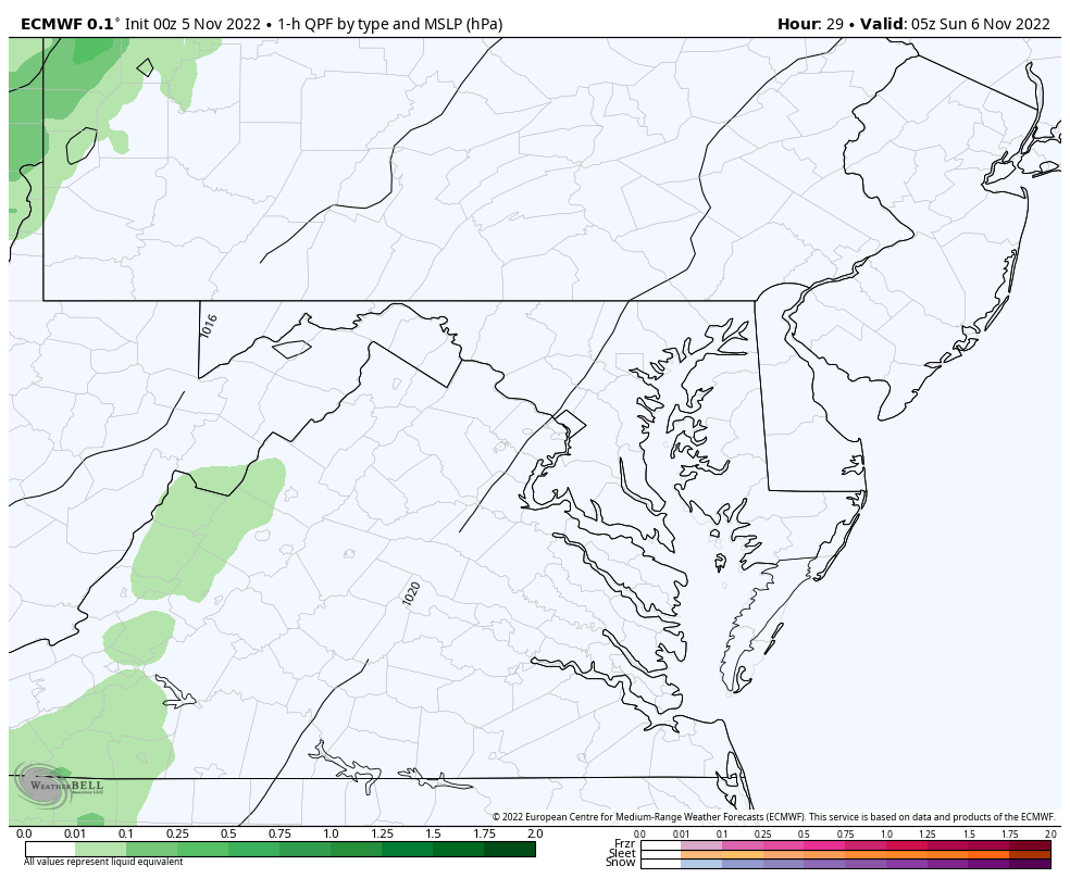
6 AM to Noon Sunday


I’ve curtailed the NASA restriction list for what is relevant now.
A complete list of weather restrictions can be found here from NASA.
https://www.nasa.gov/content/artemis-i-weather-criteria
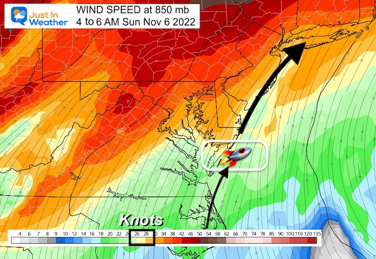
Perhaps just below the criteria of 40 knots.
Do not launch through precipitation.
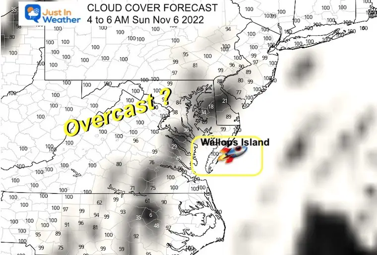
*It should not be raining at Wallops Island in the morning.
Gusty winds may actually begin to ease close to or shortly after launch time.
Surface winds may gust over 30 mph until early morning.
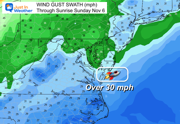
Winds forecast to be 25 to 35 knots.
Do not launch through a cloud layer that is within 5 nautical miles, greater than 4,500 feet thick, and extends into freezing temperatures, unless specific criteria related to radar reflectivity and cloud altitude can be met.
Do not launch if the flight path is within 3 nautical miles of a thunderstorm debris cloud for 3 hours, unless temperature, surface electric field, and radar reflectivity criteria can be met.
Do not launch if the flight path is within 5 nautical miles of disturbed weather clouds that extend into freezing temperatures and contain moderate or greater precipitation.
Do not launch if the flight path is within 10 nautical miles of cumulus clouds with certain distance and height criteria. There are additional caveats that could be met for clouds not reaching 23 degrees Fahrenheit.
Do not launch through cumulus clouds formed as the result of or directly attached to a smoke plume, unless more than 60 minutes passed since detachment from the smoke plume.
Do not launch for 15 minutes if field mill instrument readings within 5 nautical miles of the launch pad equal or exceed +/- 1,500 volts per meter, or +/- 1,000 volts per meter, unless specific caveats related to clouds within 10 nautical miles of the flight path can be met.
Antares Rocket Photos Reaching Launchpad: Sunday Morning NASA Launch Mission Update
Meteor Sighting Friday Night November 4: Video From Baltimore County And Map Where It Tracked
Total Lunar Eclipse Part Of November Highlights: Weather The Sun Plus A Rocket Launch
Click to see more and ‘Book’ a visit to your school


Winter Outlook 2023 From NOAA Very Different Than Farmers Almanacs
Winter Outlook 2023 Early Look At Snow From Two Farmers Almanacs
If you want a snowy winter, this is what you might want to look for in the rest of the tropical season. (You might be seeing a lot of commercial snow removal people out this Winter).
Record August For No Named Tropical Storms: Closer Look At Snow Following
Winter Weather Folklore Top 20 And More Outlook Signals From Nature For Cold And Snow

