September 30 Remaining Cool As Rain From Ian Arrives Friday
September 30, 2022
Friday Morning Update
Hurricane Ian is stronger AND larger this morning. Winds around the eye are 85 mph and it will make landfall near Charleston, SC early this afternoon. Tropical Storm Force Winds extend 485 miles away… and may reach Ocean City.
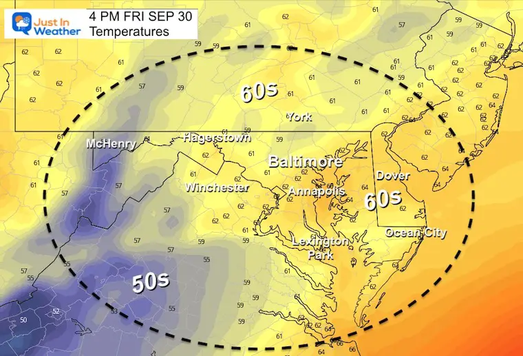
Winds locally will be like a Nor’easter and restrictions are in place on the Bay Bridge. It will be a chilly wind and some may stay in the 50s for a few days.
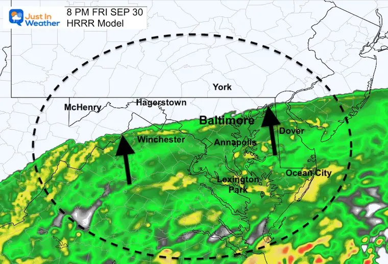
Rain will spread in slowly to southern Maryland this morning, then into Annapolis to Baltimore between afternoon and evening.
The heaviest reign will be through Saturday morning, but showers will last through Tuesday. See the forecast highlights below.
Satellite Snapshot

Sunset Last Night: That was from Ian’s Clouds here.
Even better images than mine were in the comments
How about that #sunset this evening.
Yes, clouds from #HurricaneIan pic.twitter.com/03fPTDSJQk— Justin Berk (@JustinWeather) September 29, 2022
Morning Surface Weather
Our set up includes strong High Pressure to the North and Ian to the south. This is a Category 1 Hurricane with 85 mph winds this morning. Landfall today will then bring it inland and spread rain our way for a few days.
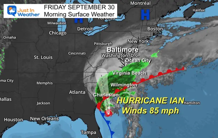
Hurricane Ian Morning Update:
Click for full report
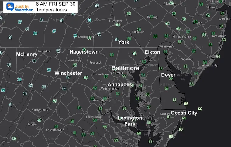
Morning Temperatures
Rain Forecast Animation: 8 AM to Midnight
Forecast Snapshots
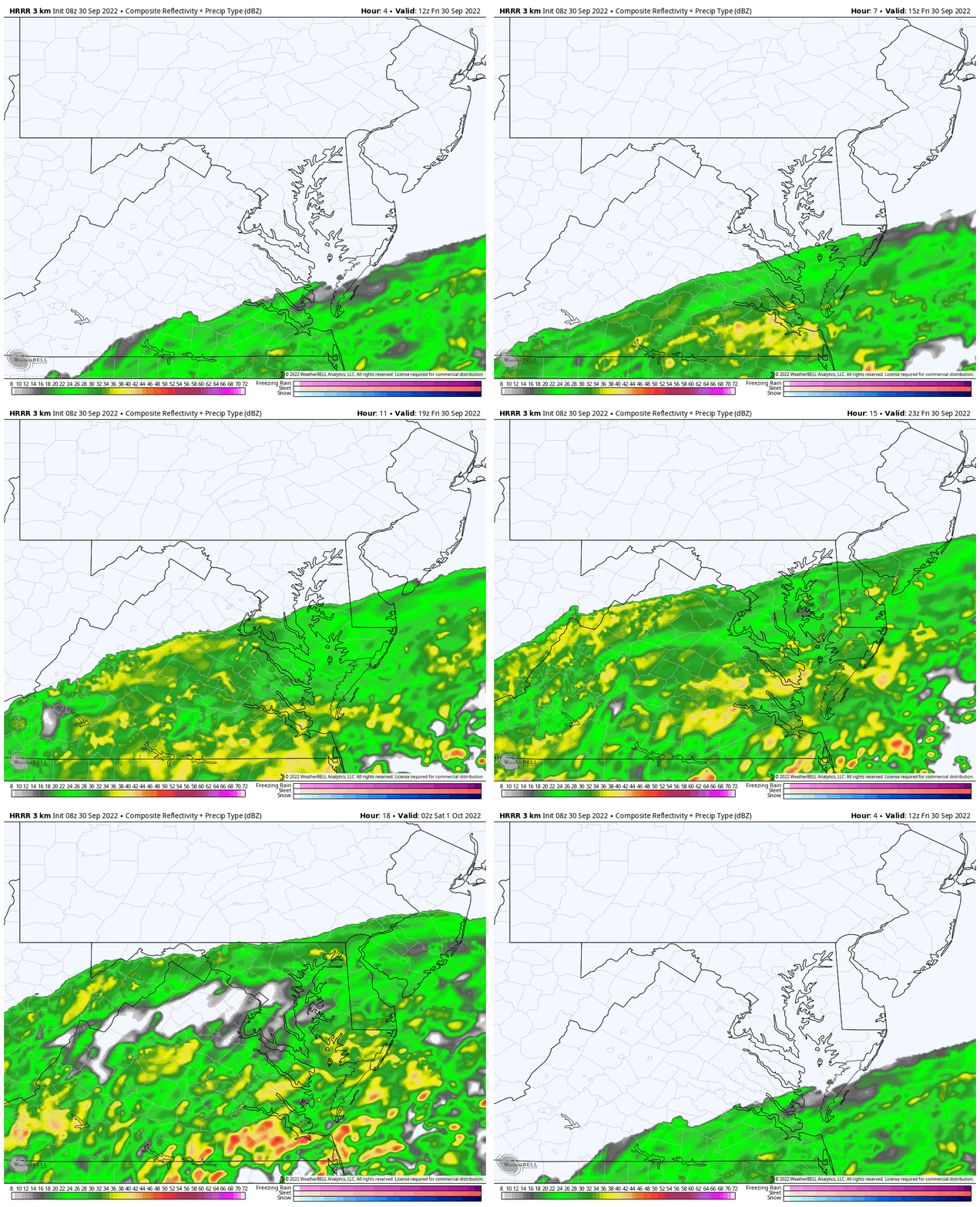
8 AM
Rain will reach Southern Maryland and Ocean City.
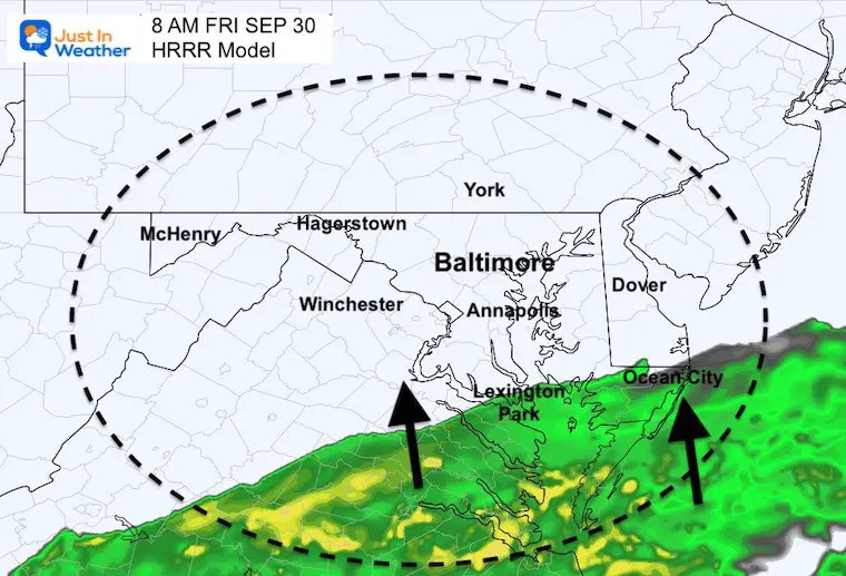
4 PM
It may take all day to reach Easton and Annapolis… The Bay Bridge will get wet by the afternoon commute.
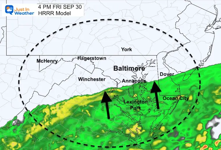
Wind
This will be like a Nor’easter. Winds may reach Tropical Storm Force gusts in Ocean City.
Wind Restrictions on the Bay Bridge.
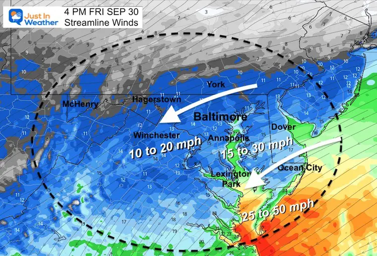
Temperatures – Remaining chilly
8 PM
Rain should reach metro Baltimore this evening and continue expanding north tonight.
CLIMATE DATA
TODAY September 30
Normal Low in Baltimore: 54ºF
Record 39ºF in 1988
Normal High in Baltimore: 74ºF
Record 92ºF 1986
Weather posts straight to your inbox
Sign up and be the first to know!
Saturday
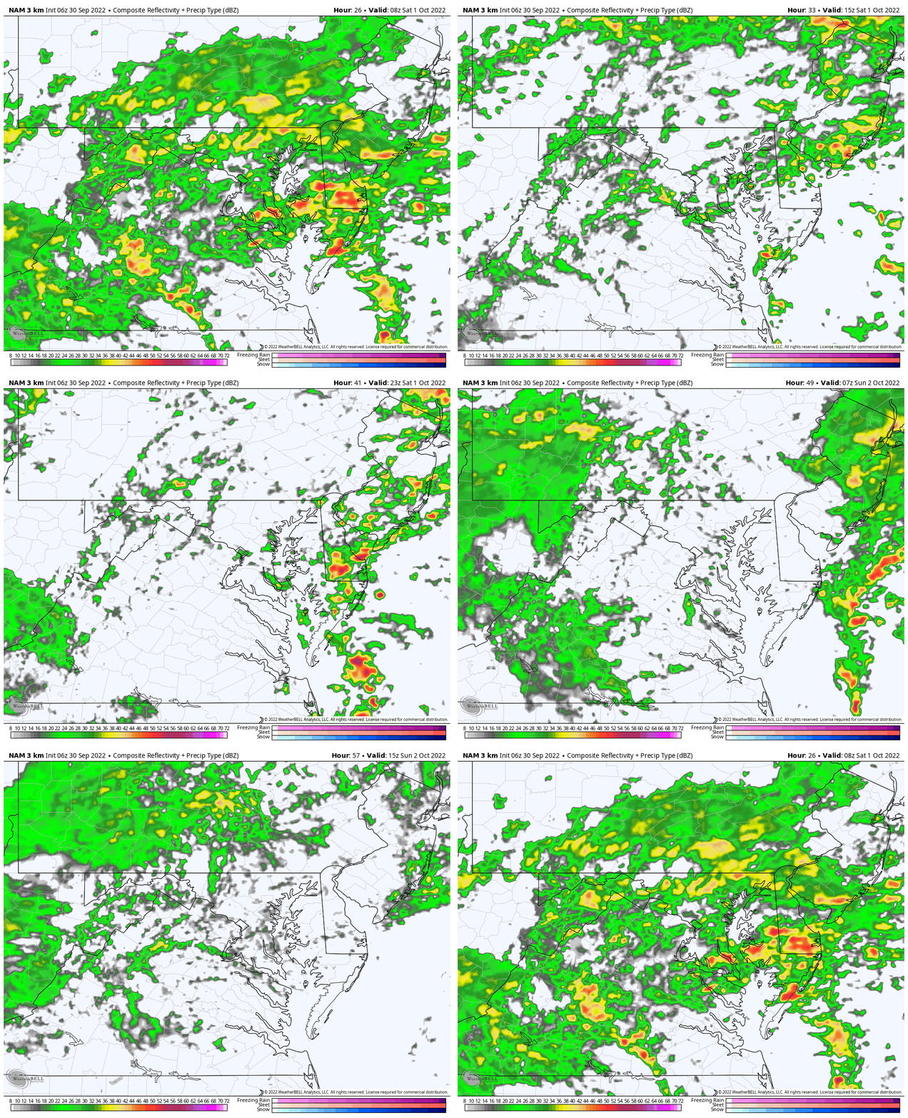
Rain Forecast 4 AM Sat to 2 PM Sun
Rain and downpours will taper to showers.. but hit and miss all weekend.
Temperatures
Morning
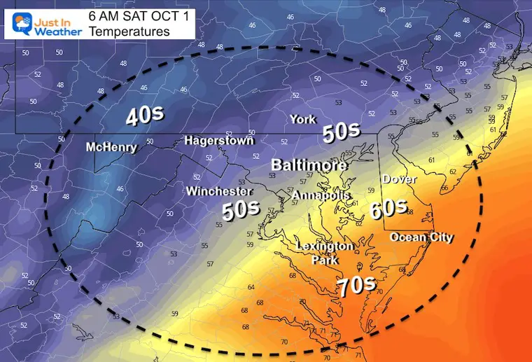
Afternoon
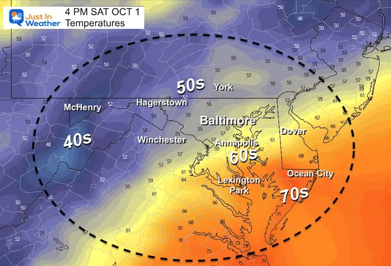
Many areas in central Maryland remain in the 50s all day.
Long Range Forecast For Ian
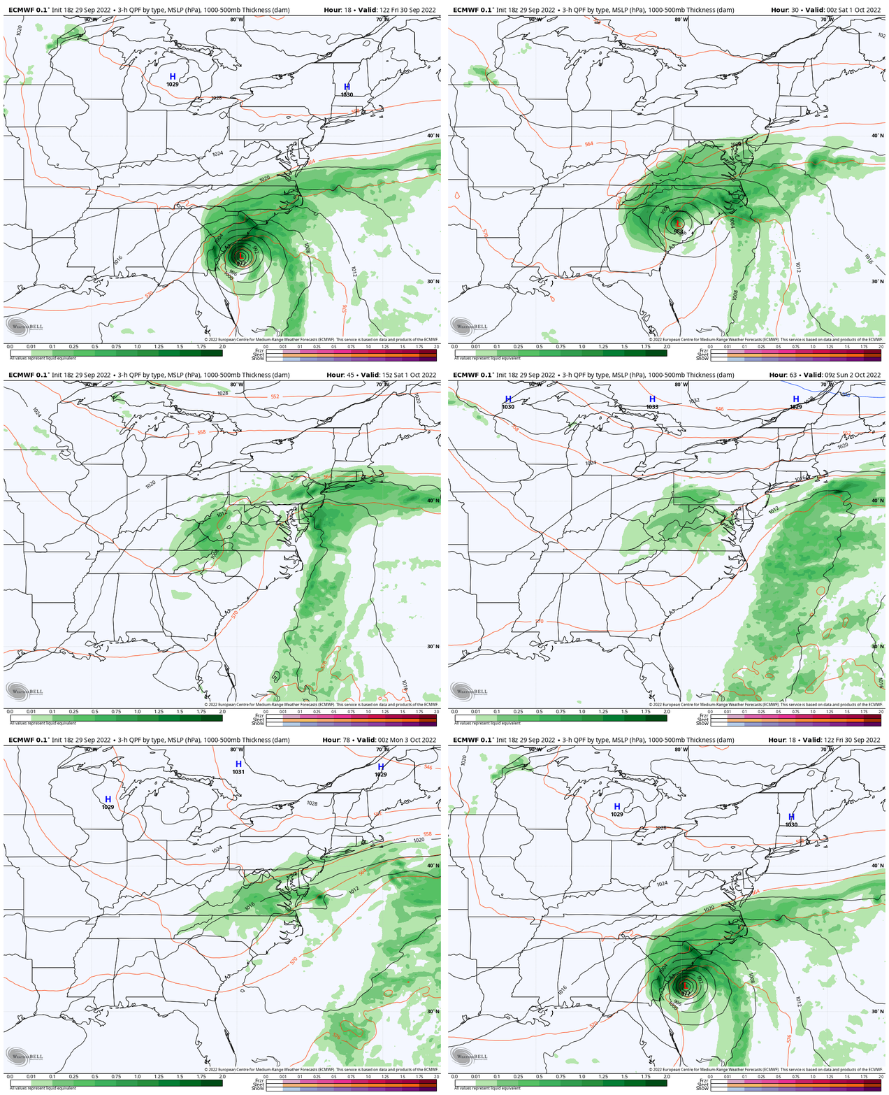
ECMWF Model: Friday Morning to Tuesday Afternoon
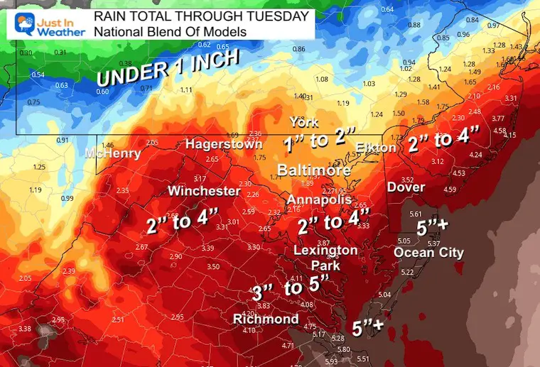
Rainfall Potential: National Blend Of Models
The heaviest rain will be Southern Maryland to Ocean City and Delaware Beaches where over 5 inches may fall.
Central Maryland will range from over 1 inch to the north to 4 inches south of Annapolis.
Much less father north and west into PA.
7 Day Forecast
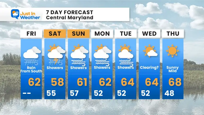
Rain showers and chilly winds will continue until early next week.
Weather posts straight to your inbox
Sign up and be the first to know!
PATTERN CHANGER?
CONNECTION TO WINTER?
If you want a snowy winter, this is what you might want to look for in the rest of the tropical season.
Rainbow Ice Cave In Mt. Rainier A Very Rare Find: Photos And Video
Hurricane Season Forecast: June 1 Through November 30
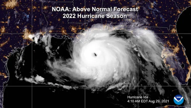
NOAA 2022 Hurricane Forecast- Above Normal Again
Related Posts
NOAA Study: Reducing Air Pollution INCREASED Tropical Storms
Atlantic Tropical History: Maps of Origin Regions Every 10 Days
Please share your thoughts, best weather pics/videos, or just keep in touch via social media
-
Facebook: Justin Berk, Meteorologist
-
Twitter: @JustinWeather
-
Instagram: justinweather
STEM Assemblies/In School Fields Trips Are Back
Click to see more and ‘Book’ a visit to your school


